First of two parts.
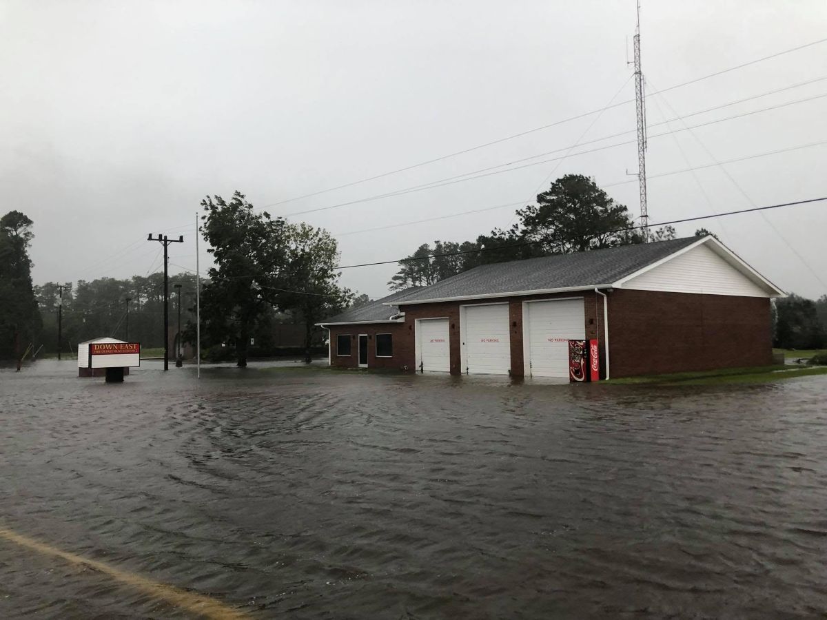
At this time eight years ago, the state was still reeling from the destruction Hurricane Florence unleashed on the coast.
Supporter Spotlight

The tropical storm was a Category 1 on the Saffir-Simpson Hurricane Wind Scale when it made landfall at Wrightsville Beach Sept. 14, 2018, and, as it crawled up the coast in the days that followed, left behind catastrophic damage with record rainfall and storm surge.
The 13 unincorporated communities making up Down East Carteret County were particularly hard hit, and the world outside of the isolated area took notice of the challenges residents of the low-lying properties face as sea levels rise and storms become more intense and last longer.
The attention and interest from researchers, state and federal agencies, educators and nonprofits in the aftermath led to the creation of the Down East Resilience Network, a project of the Core Sound Waterfowl Museum and Heritage Center on Harkers Island, which experienced extensive damage because of the storm. The group has been working in recent years to understand the changes and challenges these low-lying communities face. The network held its first gathering in 2023 to commemorate the fifth anniversary dubbed “Florence@5.”
There have been a few meetings since, most recently Sept. 14-16 for “Florence@8” at the museum. The three-day gathering to reflect on the past eight years was also a vehicle to share ongoing research, lessons learned since the costly storm and approaches toward resilience.
“I am always overwhelmed by the members of the Network’s commitment to Down East, especially with all the other small communities in Eastern NC who need the investment of resources just like we do,” said Karen Willis Amspacher, the museum’s executive director and network coordinator.
Supporter Spotlight

The three-day workshop began with an open house and program on “Resilience in the Classrooms Across North Carolina,” which highlighted “Ready, Set, Resilience,” a nature-based curriculum for middle-schoolers, and “Tide Talk,” ready-to-use lesson plans on how flooding impacts schools and students Down East.
Gian Tavares, who in early June became director of the State Resilience Office at the North Carolina Department of Environmental Quality, told the couple of dozen in attendance when the workshop resumed the following day that resilience in North Carolina had been his focus for most of his professional life.
Tavares explained that before joining NCDEQ, he was with the American Flood Coalition, the Federal Emergency Management Agency, and the Cybersecurity and Infrastructure Security Agency. He said that he was a “disaster management person at heart.”
He said his career taught him the importance of understanding what long-term resilience looks like and how to incorporate that into preparing for the next disaster.
“How do we make sure that that communities are thriving going into these future conditions?” he asked attendees. How do residents make sure they’re prepared for the next storm, or chronic flooding, he asked, noting that the ditches on the sides of the road through Down East Carteret County are constantly filled with stormwater. “That’s something that we have to live with now, right? How do we make sure that these communities really get through the day to day and thrive?”
After Tavares spoke, scientists gave brief presentations on research about or related to coastal North Carolina and its residents.
Down East Vulnerability Assessment
Coastal research scientist Dr. Katie McDowell Peek with Western Carolina University’s Program for the Study of Developed Shorelines broke down the program’s recent report analyzing public infrastructure Down East and the adjacent communities of Merrimon and South River.
Researchers assessed the vulnerability of 67 buildings, 148 state-maintained roads or segments totaling about 125 miles, and 14 road bridges. Vulnerability is considered the extent to which a resource is susceptible to harm from natural hazards, which are, in this case, coastal flooding, erosion, shoreline proximity, sea level rise, and storm surge.
Looking at the big picture, coastal hazards exposure was deemed “very high” or “high” for a third of infrastructure that was assessed, mostly structures in Davis, Merrimon, Otway, Sea Level, Smyrna, Stacy, Straits and Williston. Of the remaining two-thirds, 36% have “moderate exposure” and 28% have “low exposure,” according to the analysis. Only about 2% have a “minimal” risk exposure, primarily those on Harkers Island and in Atlantic.
Around 75 miles of the 125 miles of state-maintained roads analyzed for exposure were found to be “very high” or “high,” Peek said. And all bridges have “very high” exposure because of their location and purpose.
Sunny Day Flooding Project
The Sunny Day Flooding Project has been monitoring flooding in coastal communities for several years.
Dr. Katherine Anarde, assistant professor with North Carolina State University’s Civil, Construction and Environmental Engineering program, said the work was prompted by the question of how often flooding occurs where people live as compared to estimated information from tide gauges in the region and began collecting data in 2023.
Flooding is measured at Rodanthe, as well as at two sites in New Bern, four sites Down East, one on Beaufort’s Front Street, and at three places in Carolina Beach.
Anarde said the findings so far suggest a discrepancy between what the tide gauges are measuring and what is being experienced on land, or that flooding is being either grossly overpredicted or underpredicted for where people live. The plan is to continue to track flooding to illustrate how things are changing.
Currently, the project is working with Carteret County education system’s leadership, or the people who decide when to send students home from school because of flooded roads, on installing additional flood-monitoring sensors Down East.
Another facet of the project is research by University of North Carolina Chapel Hill doctoral student James Collins and N.C. State doctoral student Ryan McCune.
The two interviewed residents about their experiences living Down East. Collins explained that they “heard again and again that this chronic flooding is quote ‘the price of paradise.’” Though residents were affected by flooding, they were determined to stay and had adjusted aspects of their life to be able to do so.
The two explored how residents live with flooding and published the results in August. “Applying ‘the price of paradise,’ we organized first the impacts that we heard about that residents were already navigating into an acronym ‘PRICE,’ which stands for Property, Roads, other Infrastructure, Children, especially getting kids to and from schools, as well as other Emerging areas like small businesses” and emergency response, Collins said. Those interviewed were aware of the chronic coastal flooding. Regardless, more than 75% said they wanted to stay.
“Respondents expressed reasoning and beliefs that supported flooding tolerance, including normalizing flooding, bargaining between drawbacks and benefits, reframing flooding positively, and dismissing flooding issue,” the study states.
Looking ahead for the team, workshops are planned for November, January and March to better understand what communities want now and the future.
On-site wastewater, state money
Vic D’Amato is the Viable Utilities Unit supervisor at the North Carolina Department of Environmental Quality. He explained how on-site wastewater systems rely on unsaturated soil beneath the drain field to act as a biological filter for the effluent that is discharged from the septic tank before it reaches ground and surface waters. As sea levels rise, so does groundwater, and it starts to infiltrate the zone of unsaturated soil.
“That’s ultimately the issue,” D’Amato said. The unsaturated zone is necessary for a septic system to function, and as the distance beneath the drainfield and groundwater shortens, treatment is compromised.
DEQ’s Division of Water Infrastructure has state and federal funding for water and wastewater infrastructure, such as the drinking and clean water state revolving funds, reserve programs and viable utility reserve.
The Clean Water State Revolving Septic Funding Pilot Project has awarded repayable loans with principal forgiveness for programs targeting low-income homeowners in the amount of $500,000 each to Nags Head and Washington Park, $250,000 each to Beaufort and Pitt counties, and $750,000 to Hyde County.
The Closing America’s Wastewater Access Gap is a federal technical assistance program that many eastern North Carolina communities are participating in, including unincorporated North River, also in eastern Carteret County. D’Amato said that the state was working with residents on a community-informed solution to address on-site wastewater shortcomings and challenges. Dare County is working to determine where systems are most at risk and solutions like upgrading on-site systems, clustering, which means to treat wastewater from multiple units together, and sewer connection.
D’Amato added that, in the future, the hope is to make the pilot program a recurring one and elevate the on-site wastewater issues to policymakers.
Community-led resiliency planning
N.C. State Goodnight Distinguished professor and Coastal Resilience and Sustainability Initiative Director Erin Seekamp said that she is part of a research effort to learn what Outer Banks residents think about large-scale adaptations, like a bridge or levee, that cause an area to change.
“We really started to think about some of these larger questions about hazards and people, and thinking about them in connected ways. And so, adaptations do transform the natural geomorphic processes, but what we wanted to know is how do they actually decrease flood risks,” she said, adding that adaptations transform the community’s relationship with the barrier islands, which can affect residents’ sense of place.
The group of researchers worked with the community to envision types of adaptations that could bolster resilience from Rodanthe to Ocracoke and to consider how it affects their connection and the next generation’s connections to the Outer Banks.
Residents were asked to choose one of four types of adaptation options they wanted to see modeled under different storm scenarios along a stretch between Rodanthe to Ocracoke: raising marsh elevation; raised road and bulkheads on the soundside; a triple-scale nourishment and oceanfront property purchase option; and bridge around the hotspot and dune breach.
A little more than half of those surveyed selected the bridge, because that method was most familiar to them.
After residents looked at the results of the simulation to visualize long-term adaptation, “almost 50% felt that their community was more resilient when looking at the current models. It helped them somewhat to visualize those different outcomes into the future, but not a lot happening in terms of changing their storm expectations,” Seekamp said.
The visualizations didn’t change the residents’ views on relocating, illustrating how connected people are to place. That they live with flooding, and will continue to live with flooding, she said.
Researchers were also curious if residents would encourage their children to stay or leave the area. Before the viewing the modeling scenarios, about a third said they would encourage their children to consider living elsewhere, but after viewing the model projections, perceptions changed. Those surveyed acknowledged that some adaptations could reduce the duration of the flooding and the extent of that flooding.
Seekamp said that while it’s hard to get people to think outside of the box about feasible solutions, instead of what they’re used to – a bridge versus the other options — that needs to change. “We just know people are so strongly connected to place. It’s important to recognize that people feel that strongly, and so to keep thinking about what possible solutions can help people stay, and for how long? And will the next generation stay?”
Seekamp mentioned during her talk a research fair planned for Oct. 3. She told Coastal Review Tuesday that the fair, which had been canceled because of a nor’easter that saturated the coast that weekend, was rescheduled for Nov. 21.
Groundwater monitoring
Don Barber, associate professor in Environmental Studies and Geology at Bryn Mawr College in Pennsylvania, said he is currently involved in work that includes shallow groundwater monitoring wells to record water levels, temperature and salinity at three sites in Davis, one of the low-lying communities Down East. Barber said there is a website showing the most recent week of water levels.
“Landward movement of saltwater underground is increasingly common along low-elevation coastlines,” the website states. This site features three shallow wells in Davis, NC that monitor water level, temperature, and conductivity (a proxy for salinity). The well loggers show real-time fluctuations in water table height and shallow groundwater salinity caused by tides and precipitation.”