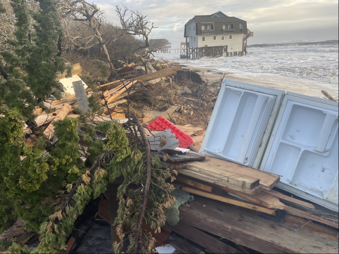
Meteorologists expect the nor’easter that has caused ocean overwash, flooding and road damage to low-lying coastal areas this week to persist through Friday and ease up over the weekend.
Outer Banks residents are dealing with transportation complications because of damage to its primary highway, N.C. 12, caused by ocean overwash, and the temporary suspension of all ferry routes except for Southport-Fort Fisher early Friday because of high winds and tides.
Supporter Spotlight

North Carolina Department of Transportation reminded the public through a press release and social media early Friday that a section of N.C. 12 between the Marc Basnight Bridge and Rodanthe remains closed because of damage and ocean overwash.
NCDOT’s ferry division said in a social media post that “Our early autumn nor’easter is causing service interruptions throughout most of the system today due to high winds and tidal conditions. We will resume operations at each location as soon as it becomes safe to do so.”
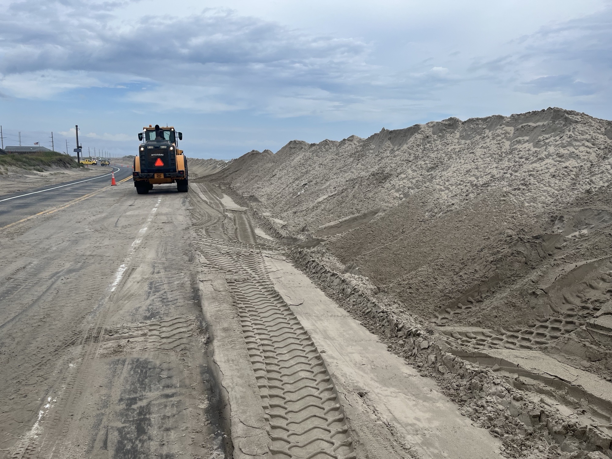
NCDOT officials closed the estimated 500 feet of damaged pavement on N.C. 12 near the Pea Island Visitor Center early Thursday morning after extreme tides broke through protective sand dunes and covered, then undermined, the roadway.
“The road is currently covered in 4′ of water in some areas, as well as deep sand. At this point, it is impossible to assess the extent of any road damage, but once we do, we will have a better idea of repair/reopening options,” NCDOT said mid-morning Friday.
Supporter Spotlight

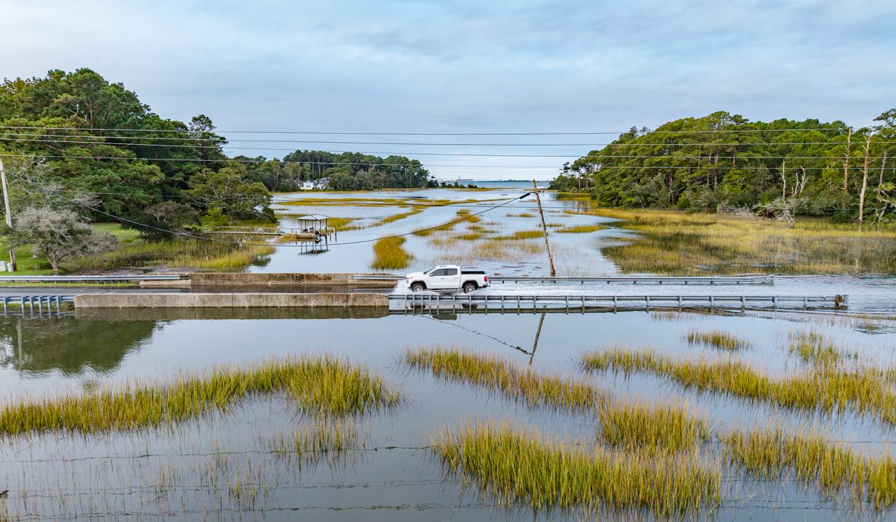
NCDOT also closed on Friday morning a section of N.C. 12 on Ocracoke Island between the National Park Service Pony Pens and the ferry terminal due to severe overwash. Additionally, there is sand and water in several places, and 1 to 6 inches of of soundside flooding in Hatteras Village between Eagle Pass and the Hatteras ferry terminal.
Officials with the Cape Hatteras National Seashore closed its off-road vehicle ramps until hazardous driving conditions are no longer a threat.
Cape Lookout National Seashore officials said Friday that north winds and higher tides have caused the road leading to the Harkers Island Visitor Center to experience some flooding but are expected to recede as the tide goes down.
Carteret County Emergency Services reported Thursday evening water on roadways in Down East communities, including Davis, Williston and Stacy.
Friday into the weekend
The National Weather Service forecasters with the Newport/Morehead City office warned at the 8 a.m. Friday briefing that “Coastal impacts, dangerous marine conditions, and moderate to strong winds are ongoing, and confidence is high on the extent of coastal and marine impacts.”
“Minor ocean overwash and dangerous surf conditions are likely to continue into the weekend along the Outer Banks,” with greatest impacts are expected along the oceanside areas of Hatteras and Ocracoke islands and minor impacts likely for the North of Oregon Inlet, and areas adjacent to the southern Pamlico Sound and Neuse Rivers.
The Outer Banks, especially from Cape Lookout north through Duck, will likely experience through today northeast wind gusts between 40 and 50 mph, and the possibility of isolated power outages and tree damage.
A coastal flood warning remains in effect for oceanside areas from Oregon Inlet to Ocracoke. Coastal flood advisories are also in effect for oceanside areas from Duck to Oregon Inlet, and for areas adjacent to the southern Pamlico Sound and Neuse River.
Ocean overwash will continue to inundate portions of N.C. 12 on Hatteras and Ocracoke islands through Friday.
Meteorologists are “carefully watching another HIGH TIDE this evening which may bring similar impacts to what we saw with this morning’s high tide. While the wave heights may be decreasing, we are more vulnerable due to the prolonged duration of the event and being without protection (dunes),” they said Friday morning.