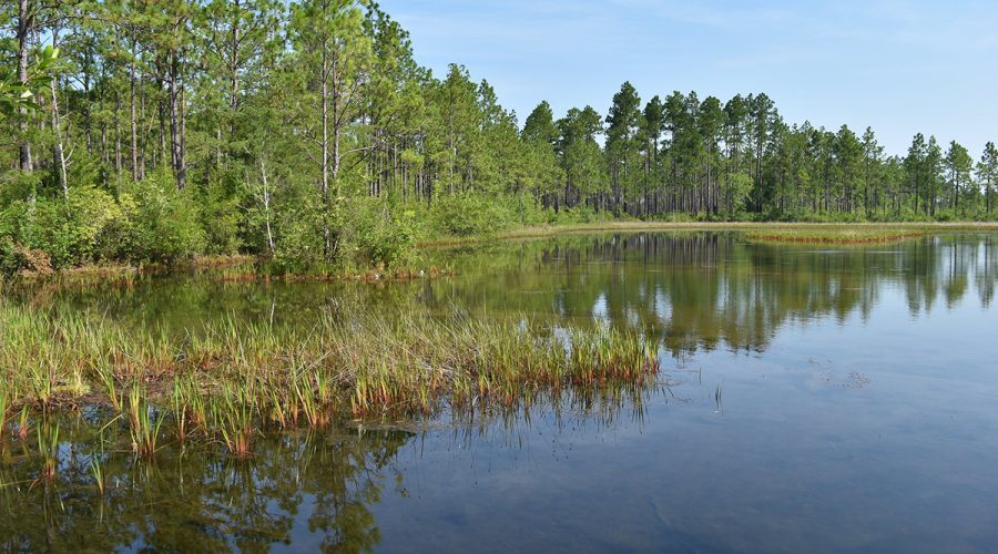
The public may provide feedback on draft plans for the Lumber and Tar-Pamlico river basin action strategies during a July 20 virtual information session.
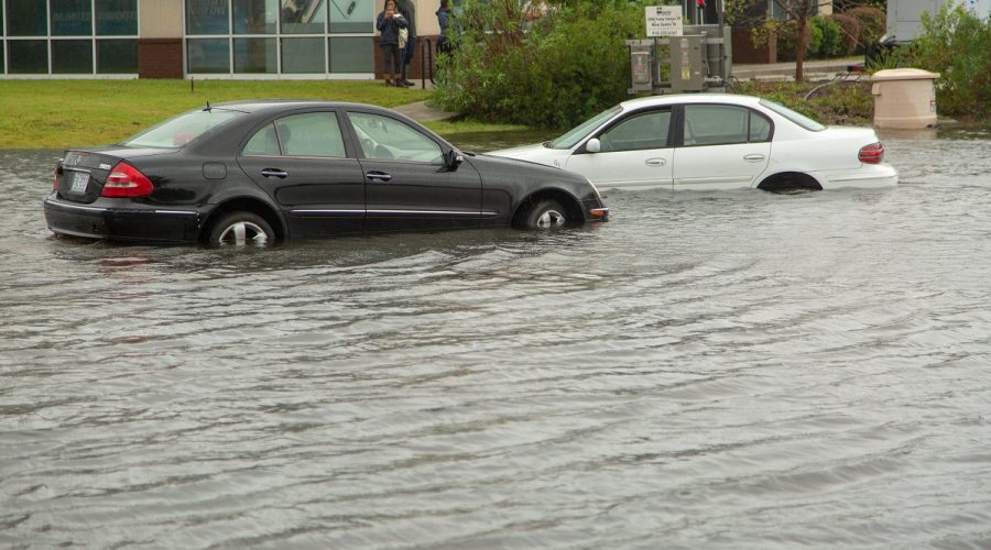
flood

Stein signs budget with safe water provisions, new ferry tolls
Gov. Josh Stein signed the $34.4 billion spending plan featuring coastal environmental spending and policy provisions, and new tolls on state ferries that have long been free to ride.
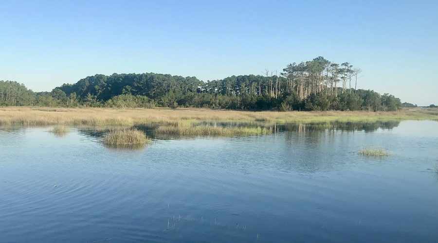
Scientific data: Understanding rising sea levels for anglers
Dr. Shintaro Bunya, a scientist at the University of North Carolina Chapel Hill Center for Natural Hazards Resilience, works with government agencies and communities to help them better understand and prepare for coastal flood risks, and here he does the same for anglers.
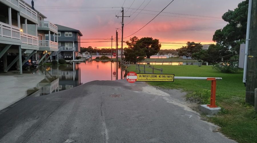
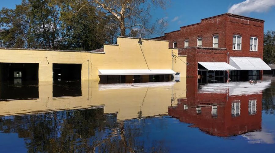
Sunny day flooding not as paradoxical as it may sound
While seemingly counterintuitive, king tides are not a new phenomenon but do represent a chronic and increasingly difficult challenge for coastal communities, but ordinary people can help by contributing to the science.
NCDOT to host meetings on plans to improve NC 12 access
The meetings in Hatteras, Rodanthe and Nags Head are an opportunity for the public to hear from transportation officials possible solutions for a vulnerable stretch of N.C. 12 in Dare County.
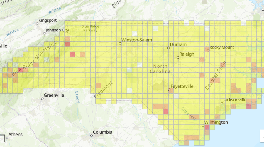
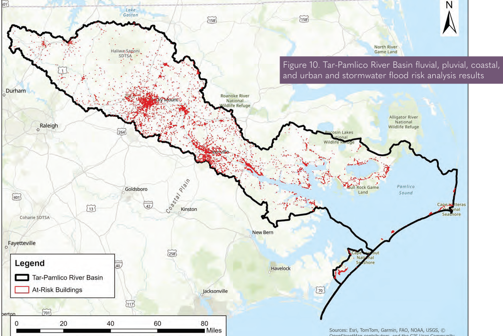
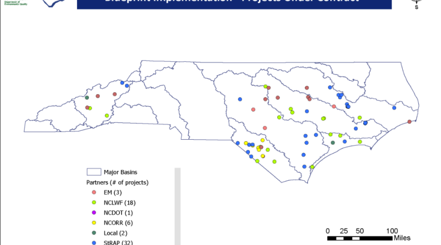
Mapping upgrades go live in online flood blueprint tool
The North Carolina Department of Environmental Quality’s online tool designed to help local governments, agencies and nongovernmental partners plan and prioritize flood resilience actions now includes new maps for five river basins in Eastern North Carolina.
Federal judge orders FEMA to restore BRIC program
The same federal judge who ruled late last year that the Trump administration unlawfully axed FEMA’s Building Resilient Infrastructure and Communities program has ordered the agency to reinstate the program and release funds awarded to previously approved projects.
NCDEQ to host online session on flood mitigation Blueprint
The N.C. Department of Environmental Quality Flood Resiliency Blueprint program is scheduled to host an online public information session March 25.

Amid record growth, groups protect tracts from development
Population growth on the North Carolina coast has ramped up pressure on conservation groups to acquire and set aside land, such as the more than 2,000 acres in coastal counties recently protected from development, areas with natural landscape features that reduce flood risk, improve water quality and provide vital habitat.
Despite judge’s order, communities in 20 states still waiting
Coastal communities in line for announced federal storm resilience funding, which the administration pulled last year and that a judge last month ordered immediately and, permanently restored, are still wondering when the money will come.

NCDEQ’s staffing cut by more than 30% over 14 years: Report
As North Carolina’s population has grown and the factory farming industry expanded, the state’s environmental agency staff has been slashed by almost a third in less than 15 years.
Climate change compounds challenge to stabilize beaches
Stabilizing Outer Banks beaches is becoming more challenging with the quickly evolving and often unpredictable consequences of a changing climate: Sea levels are increasing faster than projected, storms are intensifying, rainfall is heavier.
Public hearing Tuesday on proposed ‘WOTUS’ definition
A hearing is set for next week on the proposed definition rolled out last month for “Waters of the United States,” which outlines the waterbodies eligible for protection under the federal Clean Water Act, that conservationists warn will leave millions of acres of nontidal wetlands vulnerable to pollution, harm fish habitat and worsen flooding.
UNCW center awarded grant for flood planning, resilience
The Endowment, established from New Hanover County’s sell of New Hanover Regional Medical Center to Novant Health in 2020, has awarded a $500,000 grant to UNCW’s Center for Marine Science to help enhance flood safety and resilience efforts in the county.

Appeals period to begin for Jacksonville’s revised flood maps
Jacksonville recently hosted an informational open house on the proposed updated flood studies and revisions to the 2016 flood insurance rate maps that the city appealed.
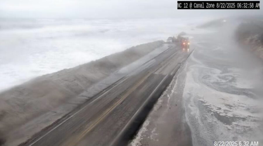
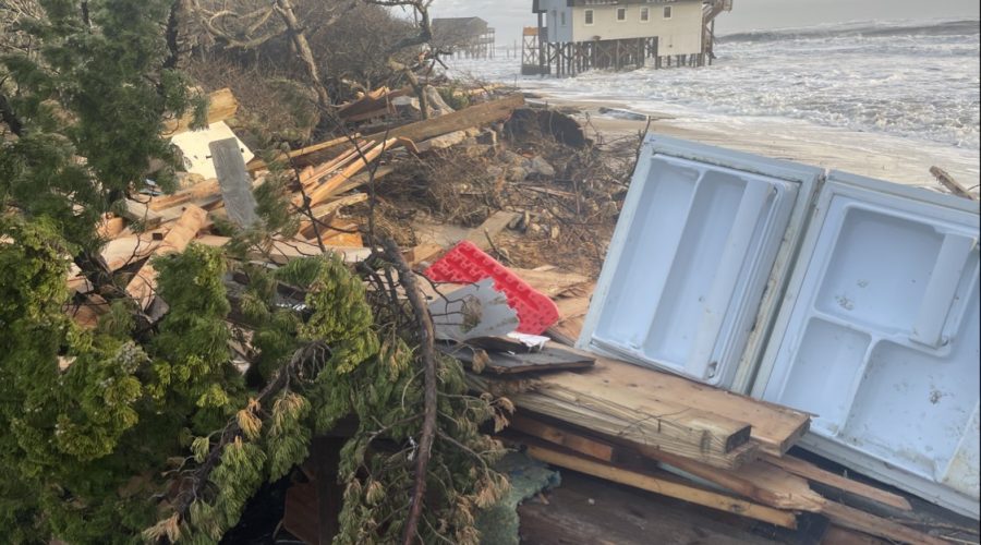
Flooding keeps NC 12 closed to traffic as Erin heads out to sea
State transportation crews were clearing N.C. Highway 12 and rebuilding dunes in the wake of Hurricane Erin’s pass offshore, as flooding conditions continued and the road remained closed Friday morning.