In the last six years the Atlantic Ocean has demolished nearly three dozen privately owned oceanfront homes in Buxton and Rodanthe.
These collapsed houses represent a broader coastal management challenge, even pushing the commission that makes coastal development rules to reconsider a decadeslong ban on hardened structures built for erosion control, Dr. Reide Corbett said during a recent talk at Core Sound Waterfowl Museum and Heritage Center on Harkers Island.
Supporter Spotlight

A coastal oceanographer and geochemist, Corbett, as of July 16, is the new interim dean of the Thomas Harriot College of Arts and Sciences on East Carolina University’s main campus. He spent the last 14 years as head of the Coastal Studies Institute, or CSI, in Wanchese, led by ECU. His talk was one of five in the “Water/Ways” speaker series last month organized to complement the Smithsonian traveling exhibit with the same name that was on display at the time.
“There’s no doubt that we are seeing changes along our shoreline,” and because there’s not just one thing driving coastal change, there’s not one simple solution, Corbett said early in the presentation.
“I’ll go ahead and put quotes around ‘solution’ now because I might not do it throughout the entire talk, because a solution to many of these challenges we face is likely only temporary. It’s not going to solve the problem. The process that is driving many of these changes won’t be solved by one thing.”
The process
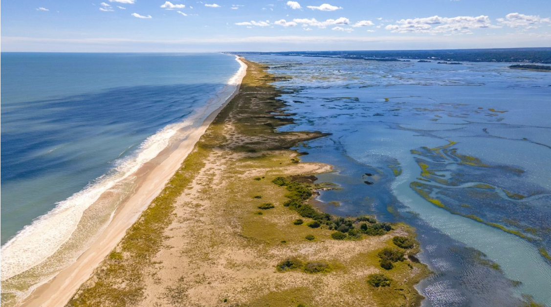
North Carolina’s coast is protected by low-lying sand deposits called barrier islands. These mobile landforms that separate the mainland from the ocean are in constant but slow motion toward the mainland. This natural process is how these islands maintain elevation and width.
This is nothing new, “barrier islands have always changed,” Corbett said, but now these mobile landforms are developed. “For better or worse, it is where we are. These coastlines have been changing since there were coastlines. The difference is we have a lot of infrastructure today in the same areas where these coastlines are changing.”
Supporter Spotlight

The natural process of erosion on the oceanside and growth on the sound side of the island is being exacerbated by increasing sea levels, development associated with population growth, and storm impacts.
The National Oceanographic Atmospheric Administration reported a few years ago that sea level is expected to rise 1 to 1.5 feet by 2050. “To put that in perspective, it took the last almost 100 years for sea levels to change 1 foot in coastal North Carolina,” Corbett said. “And from roughly 2000 to 2050, we’ll expect at least an additional 1-to 1.5-foot rise.”
That is a significant amount, and “When you look at what sea level is doing based on tide gauges up and down our coast, we are right on track to meet that if not surpass that” projection that he said has a 95% chance of happening.
To illustrate, when a house on the Outer Banks gets taken by the ocean, Corbett said the “narrative is ‘often why did people build here? Why would they put their house right there? It’s so vulnerable,’” but when the houses were built in Buxton, for example, in the 1970s and 1980s, there was 100 to 300 feet of beach, or a few dunes, in front at the time. Now, the ocean is on their doorstep.
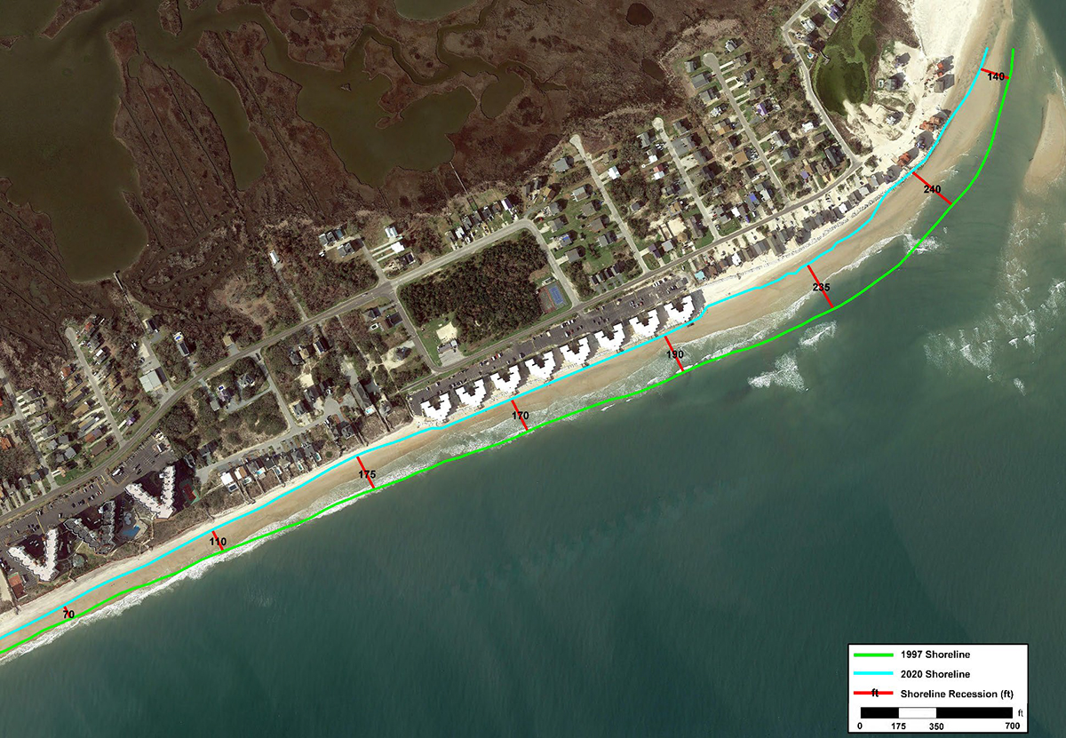
It’s because these shorelines have been eroding for decades, some at 5, 10 or 15 feet per year every year. Then put a storm on top of that, or this past fall, three storms “one after another after another without any time for recovery, and what you end up doing is deflating the beach, dropping the elevation of that beach, removing significant amount of sand because of the energy in the system.”
There has been roughly a 1-foot rise in sea level since 1975 at this location, and erosion has continued anywhere from 4 to 8 feet per year there. “You put those two things together and this is what you have,” he said.
As Corbett said early in the program, “there’s not going to be a single simple solution for any community” and what may work for one won’t necessarily work for another.
Community questions
Communities need to ask themselves what they are trying to protect. “Is it an individual home? Is it a way of life? Is it an economy? Where are we acting? Where is it most vulnerable? What are we trying to protect? And where is that? You can ask ‘why are we trying to protect that?’ as well if you like. How far are we looking out into the future? Because I think that’s important to consider when acting on a potential solution.”
What can a community do once it decides on a path forward? There area a handful of options, starting with nothing, which Corbett said isn’t really a response. Some areas can be protected. For example, a living shoreline in an estuary could protect infrastructure. Accommodate the change and that might look like houses being raised or a bridge around a very vulnerable location or leave. “Nobody likes to hear the word ‘retreat’ because it seems like you’re giving up. And I don’t disagree with that,” he said, but the idea is to move out of those most vulnerable locations.
Corbett said that hardened structures are “being pointed to a lot today as a way of protection, a solution to the problem. And I think it’s important to recognize the tradeoffs.”
In North Carolina, hardened structures have not been used to control erosion in decades, because of a policy in the 1980s and then a law in the early 2000s.
Corbett noted on the presentation slide that the state law “prohibits the construction of a permanent erosion control structure in an ocean shoreline, including breakwater, bulkhead, groin, jetty, revetment, seawall or any similar structure. This ban was based on extensive studies and technical data documenting the detrimental impacts of erosion control structures, including 150 years of documented negative impacts of shoreline stabilization on the barrier islands of New Jersey.”
The different kinds of hardened structures come with their own sets of problems. A vertical structure like a seawall might protect what’s behind it but will lead to higher erosion rates on either side of the structure and a total loss of recreation beach in front of it, Corbett said.
The houses actively crumbling have pressed the Coastal Resources Commission to consider potential changes to its laws on hardened structures and charged its science panel, on which he serves, in February to draft a report on the various types of hardened structures for oceanfront and the advantages and disadvantages of each type. The report was first presented during the commission’s June meeting.
The North Carolina Department of Environmental Quality’s Division of Coastal Management, which carries out the development rules established by the commission, announced that the commission is to hear an update on the report during the Aug. 26-27 meeting in Manteo.
But with all those responses, “I think it’s important to recognize that the processes aren’t changing,” Corbett said.
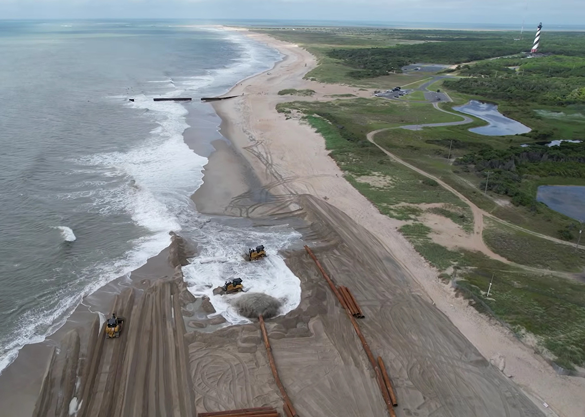
Buxton has three terminal groins that were built in the 1960s that have deteriorated, and the narrative suggests that the deterioration and large holes in the structure farthest south has led to significant erosion.
“My argument is, it’s not just that. It’s an erosional system. There’s a lot of data to show that even with these groins, there’s a reason we moved the lighthouse,” said Corbett, referring to the Cape Hatteras Light, which was moved in 1999 a distance of 2,900 feet from where it was built in 1870 because of its proximity to the waves. “It wasn’t a stable system. And those groins have been there since the late ’60s. And so, this is an eroding system. And it’s been eroding regardless of whether those groins were there or not. And it will continue to erode whether we rebuild those groins or not.”
Nourishment does protect but is a temporary solution. It’s not changing the process causing the erosion.
Beach nourishment is when sand is taken from a borrow area and pumped onto the beach. The amount of time the new sand lasts on the shoreline is no longer projected to be seven years. Now the project planners are calculating for five years. But that’s not long enough either. The sand from a 2022 beach nourishment in Buxton only lasted two years until more was needed.
Corbett’s hypothesis is that nourishment projects are causing the shoreface to steepen 15 to 20 feet from the shoreline. He said he was considering looking further into this untested theory to see if the nourishment areas are becoming more vulnerable.
Data available on coastsat.space, which uses satellite imagery to map ocean shorelines, shows how the beach is changing and responding to a beach nourishment project.
For south Nags Head, the first nourishment project was in late 2011 or 2012, and data shows that after nourishment, the erosion rate became significantly faster.
“You place a lot of sand on the beach, it’s unnatural. Yes, it provides a wider beach, but you also increase that erosion rate,” Corbett said. “I’m not saying this isn’t protecting infrastructure” but it doesn’t stop the process.
“Nourishment is a Band-Aid for that real physical process of erosion. It hasn’t slowed the process. It is a temporary solution that has to continue. You don’t do a single nourishment, you develop a nourishment program,” he said. “It’s $20 million today. It’s $20 million in five years.”
Ultimately, Corbett said communities need to decide what they want to protect and if they’re willing to accept the tradeoff.