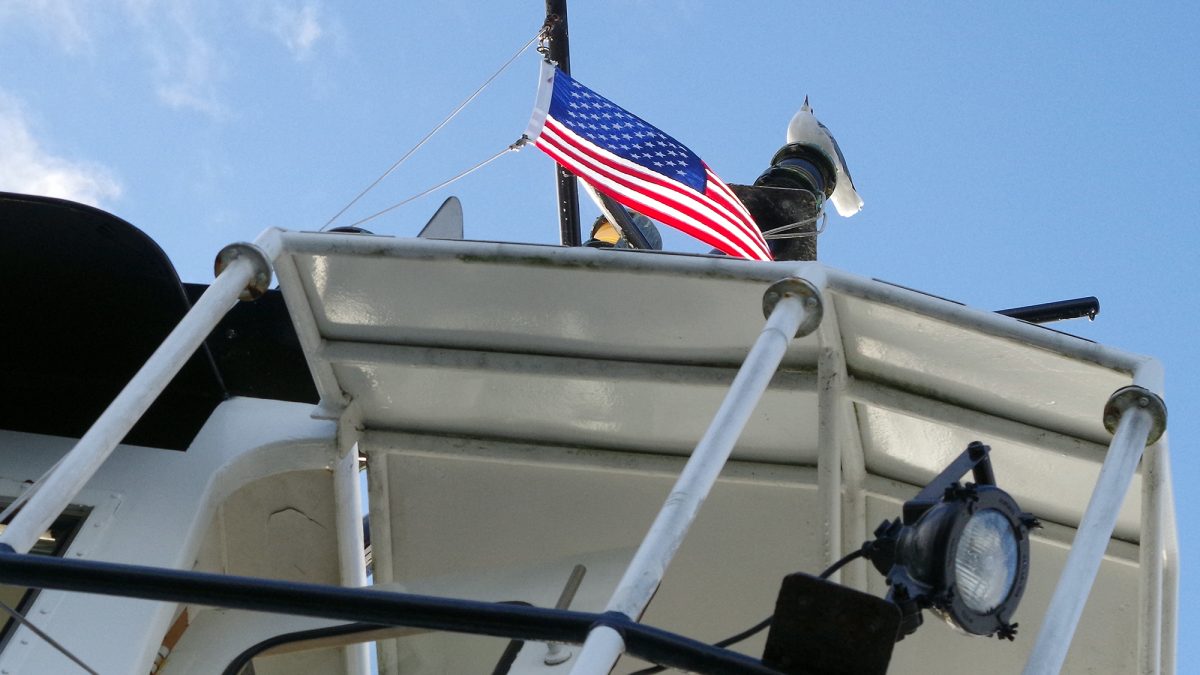
A gull keeps watch from atop the North Carolina Department of Transportation Ferry Division’s vehicle ferry Kinnakeet as it plies the Neuse River between Minnesott Beach and Cherry Branch. Photo: Mark Hibbs
Featured Photo
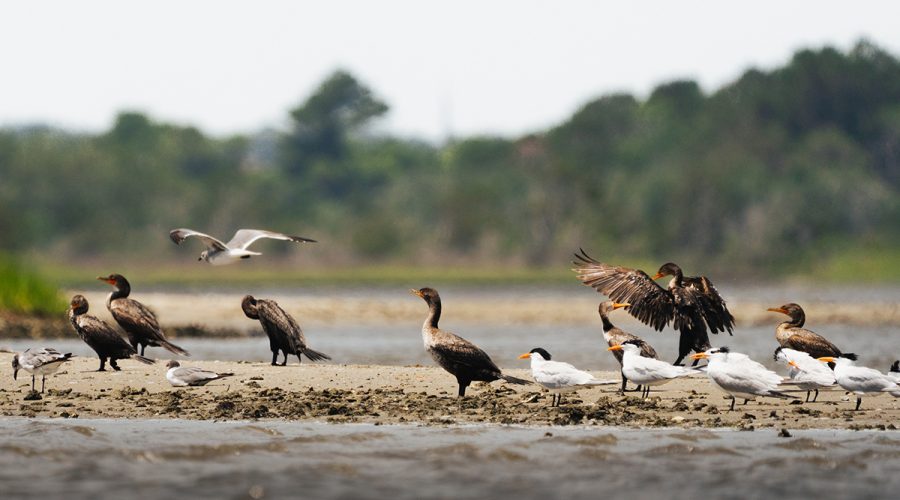
Shift change
Danielle Carey of Holly Ridge recently submitted this image of various shorebirds congregating on a sand bank in the Sneads Ferry area as if time for a shift change. “This was my first time taking this lens out on the water, and I felt like it was the one day I wasn’t seeing any birds out” Carey told us in her submission. “On our way back, I spotted this little sandbar with a whole variety of birds. I was so excited, and although I aim to capture birds in flight, I loved that I was able to capture a moment where one was taking off, and another was landing at the same time.”
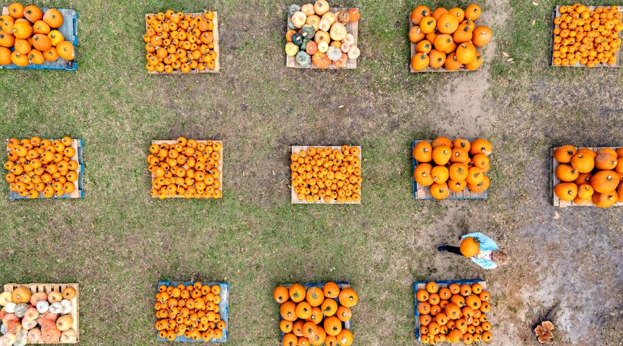
Pick of the pumpkin patch
Barbara Johnson of Morehead City carries a pumpkin Thursday across the grounds the First Presbyterian Church at 1604 Arendell St. Held every October, the fundraising event that benefits the children and youth ministry program is from 10 a.m. to 6 p.m. Monday through Saturday and noon to 6 p.m. on Sunday until Oct. 31. Photo: Dylan Ray.
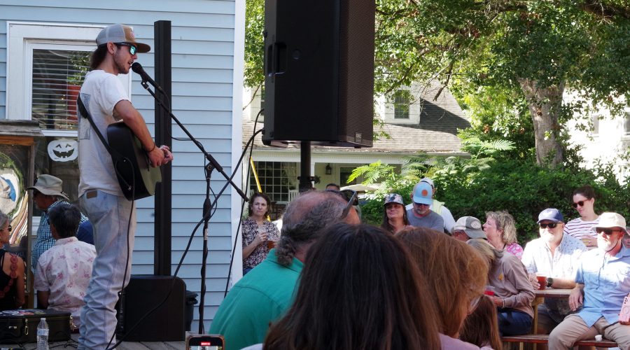
Free weekend concerts ring out in Oriental
Fingerstyle guitarist and vocalist Noah Cobb, 18, of Greenville, performs Saturday at the New Village Brewery in Oriental as part of the Pamlico County village’s two-day Ol’ Front Porch Music Festival, which was free to attend and brought together folk, Americana, bluegrass, country, gospel, blues and jazz performers on numerous stages sited within walking distance of one another. Photo: Mark Hibbs
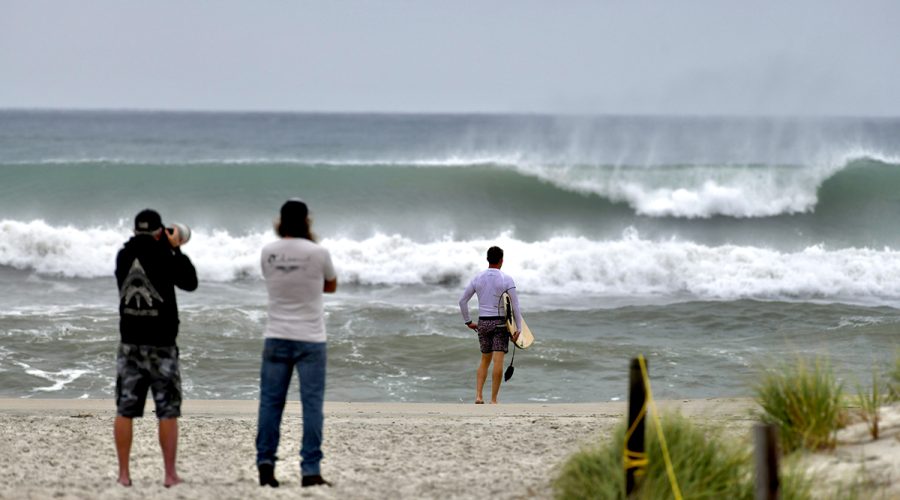
Distant storms churn up surf along NC coast
Storm swell associated with Hurricane Imelda and Hurricane Humberto breaks Tuesday along the Bogue Banks shore at Oceanana Fishing Pier in Atlantic Beach. The storm, while moving away from the U.S. Tuesday, still packed a potent punch, forecasters said, and could bring possible minor flooding in areas of onshore winds along the coast in the Southeast. At 11 a.m. Tuesday, the storm was moving to the northeast, toward near Bermuda, but swells and high surf from Imelda and Hurricane Humberto were expected to produce dangerous marine conditions and rip currents along much of the East Coast for several days. Farther north, the N.C. Department of Transportation on Tuesday closed N.C. 12 on the north end of Ocracoke Island between the National Park Service Pony Pens and the ferry terminal due to deteriorating travel conditions and five oceanfront houses collapsed on Hatteras Island. Photo: Dylan Ray
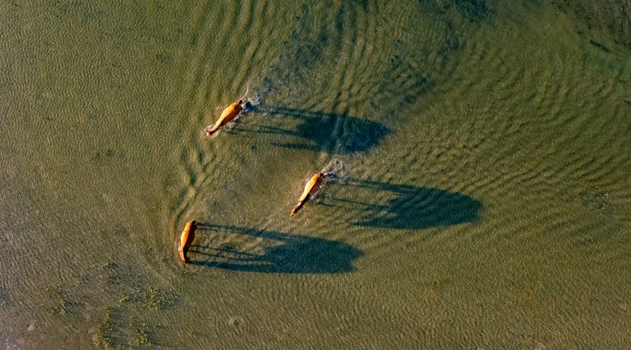
Wild herd, long shadows
Wild horses cross tidal waters from Town Marsh to Bird Shoal along Beaufort’s barrier islands, which are part of the Rachel Carson Reserve, in Carteret County. The cluster of islands includes Carrot Island, Town Marsh, Bird Shoal, and Horse Island, and the horses are descended from those brought to the islands by a Beaufort area resident in the 1940s, according to the North Carolina Department of Environmental Quality. The state manages the horse population for its health and for the health of the environment, but the herd is otherwise left to fend and forage for itself. Photo: Dylan Ray
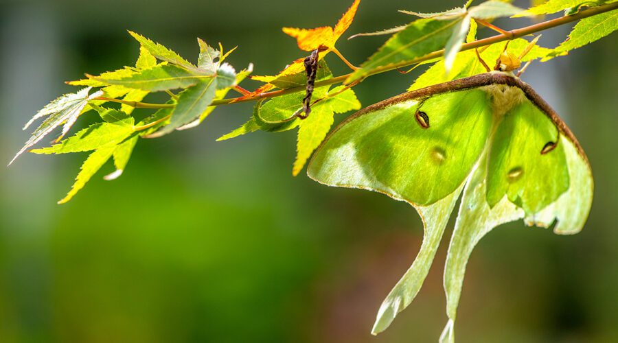
Night flyer out on a limb
A male luna moth, or Actias luna, finds a perch in the branches of a Japanese maple near Russell Creek in Beaufort. The easily identified species flies mostly at night and is found statewide this time of year in and near hardwood forests, wooded residential areas and, on North Carolina’s barrier islands, in maritime forests. Adult luna moths do not feed and live off food they consumed as caterpillars for the moths’ seven- to 10-day lifespan.
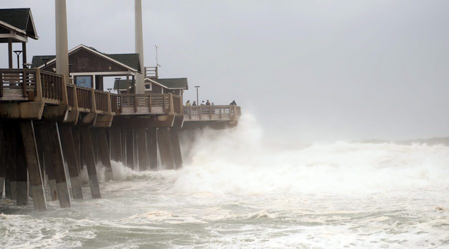
Angry Erin heads out to sea
People on Jennette’s Pier in Nags Head watch as waves generated by Hurricane Erin crash into the concrete structure that’s part of the North Carolina Aquariums system. The storm’s center was about 260 miles east of Cape Hatteras at midday Thursday and moving out to sea, but hurricane-force winds extended outward up to 105 miles and tropical-storm-force winds extended up to 320 miles from the sprawling but weakening storm’s eye. Life-threatening surf and rip current conditions will likely continue as storm surge and flood risks subside. The pier’s website provides information on current conditions and live webcam views.
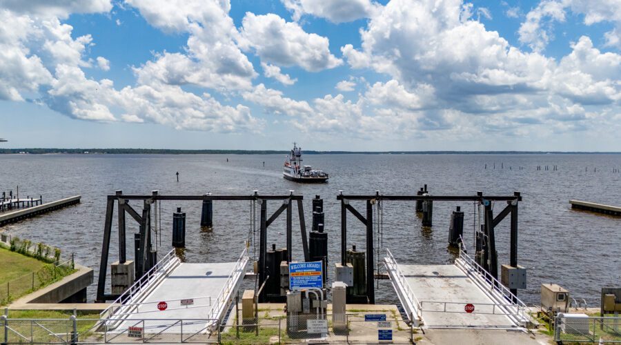
Avon inbound
The North Carolina Department of Transportation Ferry Division vehicle ferry Avon prepares to dock at the Minnesott Beach Ferry Terminal in Pamlico County, making one of the service’s numerous daily, 20-minute trips each way, back and forth between here and the Cherry Branch terminal across the Neuse River in Craven County. The Avon is one of 21 state ferries serving commuters and visitors on seven routes across the Neuse, Cape Fear and Pamlico rivers, and the Currituck and Pamlico sounds, and their schedules vary seasonally. Photo: Dylan Ray
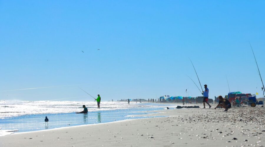
Blue skies over Bogue Banks
Fishing lines, sunshades and beachgoers crowd an Emerald Isle beach while two seagulls fly overhead, with another in the foreground searching for food. Photo: Robert Watkins
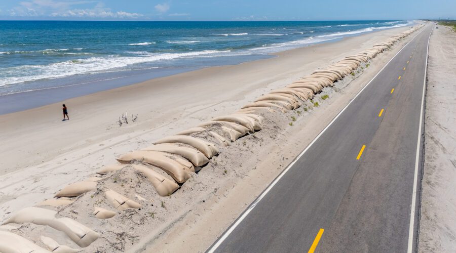
Shifting sands
A wall of sandbags extends along the roadside far into the distance aside N.C. Highway 12 on the north end of Ocracoke Island. This is where washouts and erosion from storm surge repeatedly chew away at the barrier island beach and roadway, part of the normal ocean dynamics that humans often try to control. Photo: Dylan Ray
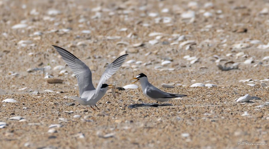
Wrong tern?
Least terns are excellent fish-catchers, and when feeding their young can deliver about two fish per hour. Males also catch and display fish during courting, which is what we assumed is going on here. There’s only one problem with that theory: After showing it to the female for a few seconds, when she finally showed interest, he flew away. Photo: William Birkemeier
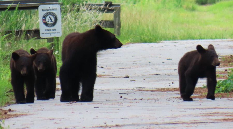
Mom, cubs out for a stroll
A mother black bear and three cubs stroll along Creef Cut Wildlife Trail in Alligator River National Wildlife Refuge, located on the Albemarle Peninsula in eastern North Carolina. The U.S. Fish and Wildlife Service in a press release featuring the photo recommends staying at least 1,000 yards away from bears. Use binoculars, scopes and telephoto lens to get a better look. Check out BearWise, an online resource that offers practical tips in the event of a bear encounter. Photo: Karen Lebing, U.S. Fish and Wildlife Service
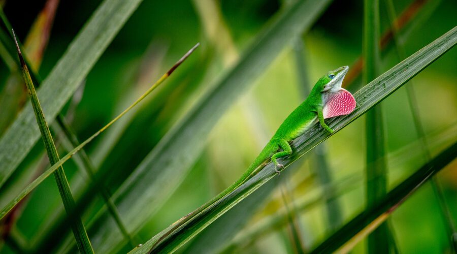
Sexy flex
An anole sends out a message to potential mates by flexing his throat to reveal a show of color in a Beaufort garden. Photo: Dylan Ray
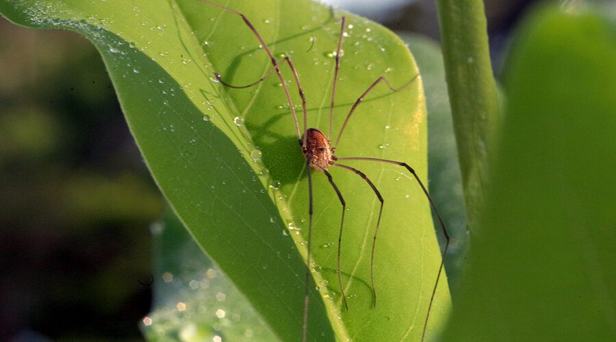
Morning stretch
Daddy longlegs, scientifically speaking, a member of the Leiobunum genus, stretches its legs recently on the leaf of a sweetbay magnolia, or Magnolia virginiana, a native species on the North Carolina coast. Often called harvestmen — there are at least 6,600 suborders of the species — and mistakenly identified as spiders, the insect is an arachnid that has been found everywhere on Earth except Antarctica. Photo: Mark Hibbs
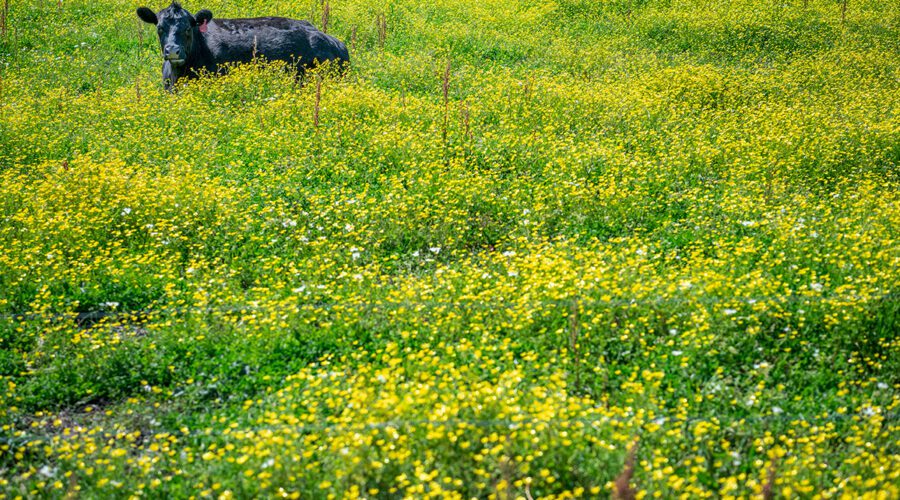
Coastal calf suns on a bed of flowers
A calf lies in a field of spring flowers near the Haystacks area of Morehead City in Carteret County. Photo: Dylan Ray