
Paint crews work high above the deck of the NC State Port of Morehead City Thursday as a new protective coating is applied to the water tower. Photo: Dylan Ray
Archives
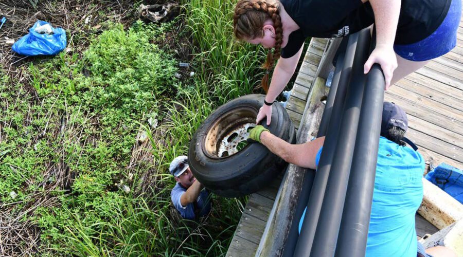
State’s fix for costly litter problem ‘not efficient or sufficient’
“It’s like you’re Band-Aiding over an artery,” says Rob Clark, of Cape Fear River Watch, a coauthor of a report that found that cleaning up more than 7,000 tons of litter in North Carolina cost more than $56 million in 2023.

Blue Economy Index, benchmarks reflect tariff tensions
The University of North Carolina Wilmington Blue Economy Index rose by 3.7% in February, beating the MSCI All World Index, the S&P 500, and the S&P Industrials.

Event to explore unsung African American gardening history
The North Carolina Botanical Garden is offering a virtual option for its daylong symposium on the “African American Legacy in Gardening and Horticulture” set for the last Saturday of March in Durham.
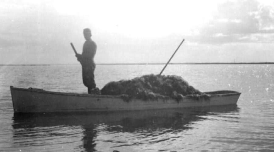
When fishermen harvested seaweed: Beaufort’s agar industry
The curiosity that sparked when historian David Cecelski came across photos taken in 1944 of fishermen harvesting seaweed near Beaufort inspired a “bit of a deep dive” into topics he never imagined studying: the history of agar, ecology of seaweed, the wartime crisis that led to seaweed harvesting and the construction of the Beaufort agar factory.
State officials: Burning trash against North Carolina law
Careless debris burning is the leading cause of wildfires in North Carolina, and the North Carolina Department of Environmental Quality’s Division of Air Quality has issued a reminder that, “If it doesn’t grow, don’t burn it.”
Link between greentails, green energy topic of next CSI talk
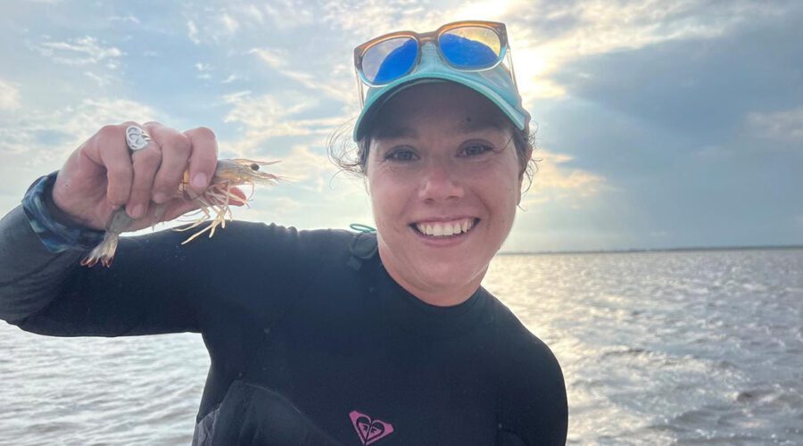
Dr. Lela Schlenker, fisheries liaison from Kitty Hawk Wind, will present, “What do greentails have to do with green energy? An update on the Kitty Hawk offshore wind project served with a side of shrimp” March 20 at the Coastal Studies Institute on the ECU Outer Banks Campus.
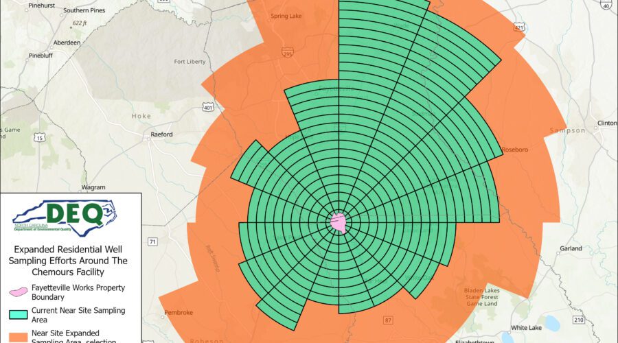
Chemours to expand well testing for PFAS contamination
About 150,000 additional private water drinking wells are eligible for PFAS testing after the state’s lead environmental agency directed Chemours’ to expand sampling in Harnett and Hoke counties.
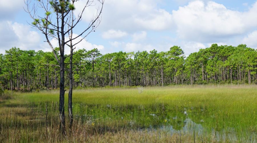
Commission set to further curb state wetlands protections
The Environmental Management Commission is to consider Thursday moving to public comment with a proposed amendment to align the state’s definition of wetlands with the federal definition, which was narrowed by a May 2023 Supreme Court decision.
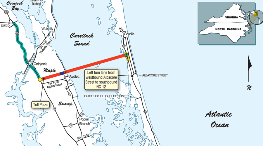
State to host hearing on mid-Currituck Bridge application
The state Division of Coastal Management has set a public hearing for March 18 on the Coastal Area Management Act application for the proposed Turnpike Authority project.
Mattamuskeet’s invasive carp boycott carp-removal effort
“What we found is we’re not finding the carp numbers in the lake that we thought were there,” Kendall Smith, refuge manager at Mattamuskeet National Wildlife Refuge, told the Lake Mattamuskeet Watershed Restoration Plan Core Stakeholder Team at a recent meeting.

Endowment to add $7.5 million for Fort Fisher aquarium work
The New Hanover County Community Endowment grant awarded this week to the North Carolina Aquarium at Fort Fisher will support its $56 million renovation, the details of which are to be announced this summer.
CAMA county governments may apply for resiliency funding
Local governments within the state’s 20 coastal counties and contractors may apply for the next round of funding for resiliency projects.

Public mixed on game land access pass plan during hearing
The Wildlife Resources Commission has proposed requiring paid passes for recreational uses of state game lands, a plan that could improve safety during hunting season but may make access out of reach for large user groups.
State seeks impaired watershed restoration project proposals
The Department of Environmental Quality expects to receive $1.5 million in federal grants to fund all or portions of eligible watershed restoration projects.
NC Trails Program announces grants for trail projects
Grants through the state’s Recreational Trails Program support greenways and trails for hikers, bikers, paddlers, equestrians and off-road vehicle operators.