Reprinted from Island Free Press
The long-planned effort to repair one of Buxton’s historic groins can now officially move forward after the final major federal permit required for the project was issued by the U.S. Army Corps of Engineers this week.
Supporter Spotlight
According to Dare County Assistant County Manager Dustin Peele, county officials received the Army Corps permit Tuesday, clearing the final regulatory hurdle for the project after approvals had already been secured from other stakeholder agencies, including the National Park Service and the North Carolina Department of Environmental Quality.
“We had a pre-construction meeting Monday for the groin project,” Peele said in an update Wednesday. “Bids are due back later this month. We intend to have a low bidder ready for Board approval during the June 9 meeting.”
The permit approval marks a major milestone for a project that has been in development for years and was intentionally fast-tracked to align with the county’s upcoming 2026 beach nourishment project in Buxton.
Officials have previously noted that obtaining permits for shoreline stabilization work can often take two years or longer due to the extensive environmental reviews and coordination required among multiple agencies. In this case, the process was streamlined as much as possible to coincide with the scheduled beach nourishment effort, which is now expected to begin in mid-June.
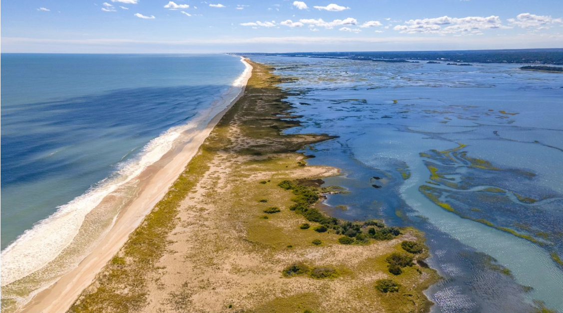
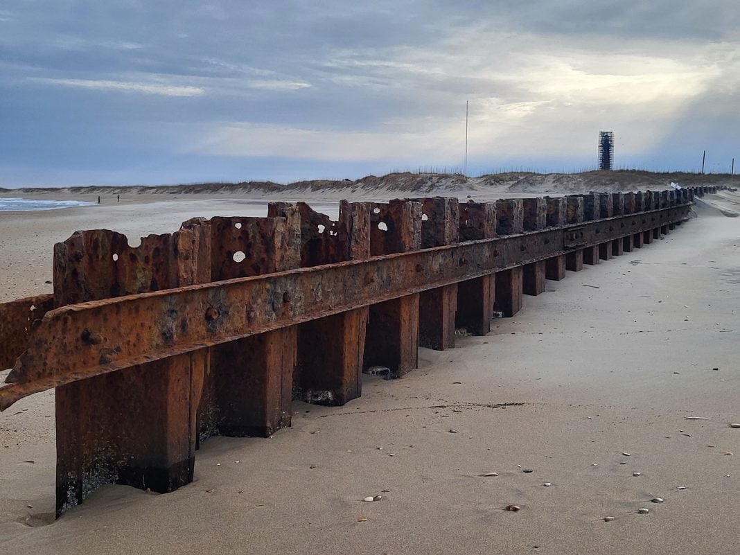
The repair project focuses on the southernmost of Buxton’s three groins, which are located along the shoreline near the end of Old Lighthouse Road.
Supporter Spotlight

The structures were originally constructed by the U.S. Navy in 1969 and 1970 near the former Naval Facility Cape Hatteras in an effort to slow shoreline erosion and help protect nearby infrastructure. However, maintenance of the groins largely ceased after the Cape Hatteras Lighthouse was relocated approximately 2,900 feet inland in 1999.
Over time, the groins deteriorated significantly under constant wave action and lack of maintenance.
Under current North Carolina coastal regulations, only the southernmost groin qualifies for repair. State officials determined that enough of the structure remained intact, at least 50%, for the project to be considered a repair rather than a reconstruction, allowing it to move forward under existing rules. The other two groins have deteriorated beyond that threshold and are not eligible for reconstruction under current regulations.
County officials and coastal engineers have emphasized that the repair project is not intended to stop erosion entirely, but rather to help retain sand placed during nourishment operations and slow the rate of shoreline loss in a small but vulnerable stretch of oceanfront.
Plans for the repair work include removing deteriorated materials, installing new steel sheet piles, and placing additional stone scour protection around the structure. The final repaired groin will follow the same footprint, extending 640 feet into the ocean.
The groin repairs are intended to work in conjunction with the 2026 Buxton beach nourishment project, which is now expected to place roughly 2 million cubic yards of sand along approximately 2.9 miles of shoreline extending from the Haulover Day Use Area to the groin area near the Cape Hatteras Lighthouse.
Dare County officials have repeatedly described the nourishment and groin repair efforts as complementary projects aimed at improving the resilience of Buxton’s shoreline and protecting N.C. Highway 12 from future erosion and storm impacts.
The Army Corps permit was issued through the agency’s Wilmington District under Section 10 of the Rivers and Harbors Act and Section 404 of the Clean Water Act, authorizing work within federally regulated waters and wetlands.
This story is provided courtesy of the Island Free Press, a digital newspaper covering Hatteras and Ocracoke islands. Coastal Review partners with Island Free Press to provide readers with more environmental and lifestyle stories of interest along our coast.