The below-normal activity predicted for the 2026 Atlantic hurricane season doesn’t give North Carolinians a pass on preparation this year.
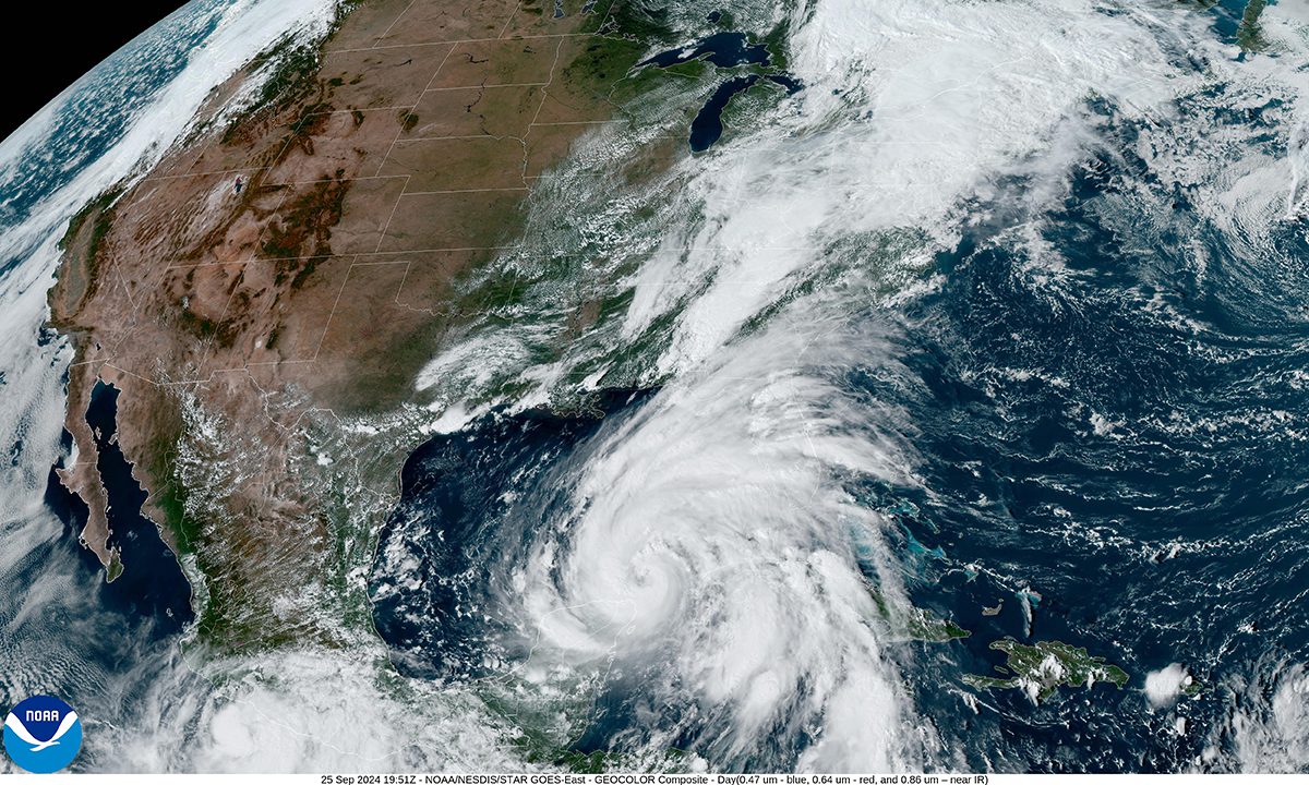
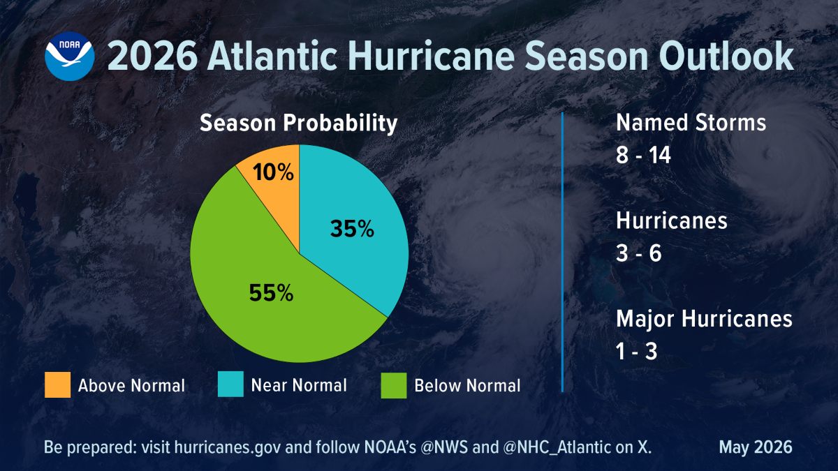
“For the Atlantic hurricane season, NOAA is predicting a below-normal season for 2026, with roughly a 55% chance of being below normal, a 35% chance of near normal, and a 10% chance of above normal,” National Oceanic and Atmospheric Association Administrator Dr. Neil Jacobs said during a media conference Thursday morning from NOAA’s Aircraft Operations Center at Lakeland Linder International Airport in Lakeland, Florida.
Supporter Spotlight
“This equates to eight to 14 named storms with winds at or above 39 miles an hour. Of these, three to six hurricanes with winds at or above 74 miles an hour, and one to three major hurricanes, that’s your Category 3 to 5 with winds at or above 111 miles an hour,” he added.
Jacobs is referring to the Saffir-Simpson hurricane wind scale, which categorizes maximum sustained wind speeds for tropical storms. Categories 1 and 2 are windspeeds between 74 and 110 mph, categories 3 to 5 are major hurricanes with speeds from 111 to 157 or higher, according to NOAA. Hurricane season begins Monday, June 1, and ends Nov. 30.
“Even though we’re expecting a below-average season in the Atlantic, it’s very important to understand that it only takes one,” Jacobs said, adding there have been Category 5s that made landfall in the past during below-average seasons.
During the news conference Thursday morning, Jacobs said that “what’s driving this forecast is largely an El Niño event. There’s a 98% chance of El Niño conditions occurring later this season, and an 80% chance that this El Niño will be moderate to strong.”
NOAA National Weather Service Director Ken Graham, who spoke after Jacobs, reiterated that “it just takes one,” and urged the public during the press conference not to “let words like ‘below average’” change the way you prepare.
Supporter Spotlight

“Now’s the time to start thinking about your hurricane preparedness,” Graham said. “Early preparedness is absolutely everything. Period. End of story. The actions that you take today really get you ready for the hurricane season.”
Especially a season like this, “there’ll never be a Hurricane Just-a. We’ll never make that a name. There’s no such thing as just a Cat 1, just a tropical storm, just a Cat 2. That is absolutely not the case,” Graham said. “It doesn’t matter what it is, you got to look at the size, the forward motion, little wiggles matter on the impacts. Even the smallest storm, if it’s slow enough and big enough, it’s going to create catastrophic flooding and storm surge.”
Graham said that the public needs to pay attention to every single one of the storm “systems, and the actual impacts, not the category, not the name, but the actual impacts associated with that storm, and that includes the tornadoes, heavy rain, damaging winds, even the high surf and rip currents, as well, including storm surge.”
Erik Heden, warning coordination meteorologist in the National Weather Service’s Newport office, said in an interview with Coastal Review that just because the forecast calls for a below-normal season, residents shouldn’t let their guard down.
“Just because the outlook says it’s going to be a low year doesn’t mean we won’t be impacted,” he said, adding “It just takes one storm. The graphic says a 55% chance below-normal year, but if we get one storm, it really doesn’t matter what the prediction was, it could be a big deal for us.”
Heden also warned in the interview against making decisions based on the category of the storm.
“Categories are only wind,” he said. Wind is to be respected, but the other storm impacts are more likely to be more frequent in terms of issues in our area.
“Water is what kills people. About 85% of people that die in hurricanes, it’s water related — nothing to do with the wind. but it’s, it’s things like rip currents, storm surge, and flooding. Those are the three things that would get us if we get a storm.”
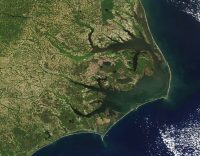
Two years ago, the Southeast faced a potential tropical cyclone that didn’t have a name. No. 8 resulted in almost 20 inches of rain in the Wilmington area, and last year Tropical Storm Chantal produced six to 10 inches of rain in Raleigh.
Steven Pfaff, meteorologist-in-charge for the National Weather Service’s Wilmington office, in an email to media partners Thursday morning, also expressed concern that the forecast for below-normal activity can cause messaging challenges because people may misinterpret what it means for any potential local impacts.
“All it takes is one storm to define a hurricane season regardless of the outlook,” his emphasis, “Given southeast NC’s and northeast SC’s hurricane history our communities must prepare the same way every year,” Pfaff continued. “Now is the time to prepare for hurricane season, and remain vigilant this summer and fall.”
Jacobs said during the press conference that for official forecast guidance, go to hurricanes.gov.
“June 1 is almost here. Be ready, have a plan, listen to your state and local emergency managers. Preparation is essential. You can learn more at ready.gov,” Jacobs added.
Heden told Coastal Review that the best way to stay informed in eastern North Carolina is to remember “if it’s the weather you love, it’s weather.gov,” where there’s up-to-date information, as well as on the office’s website, Facebook or X.
Coastal Review will not publish Monday in observation of Memorial Day.