The Virginia State Lottery was going to hold a drawing on April 25, 1827, for the benefit of the Dismal Swamp Canal Co.
Whole tickets were $4, half-tickets $2, and a quarter-ticket could be purchased for $1. The grand prize was $10,000 and more than $100,000 in prize money was going to be awarded.
Supporter Spotlight
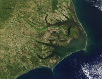
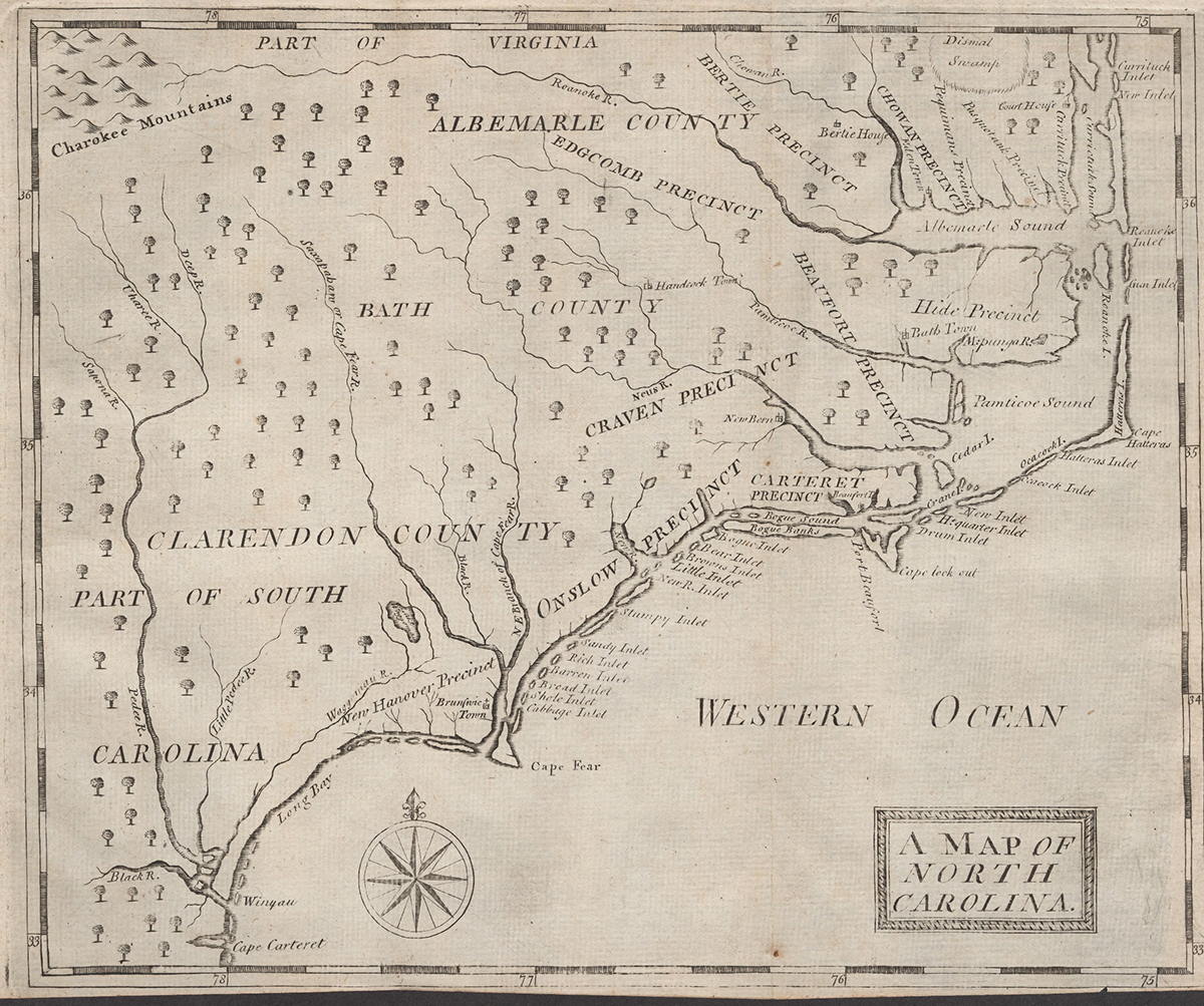
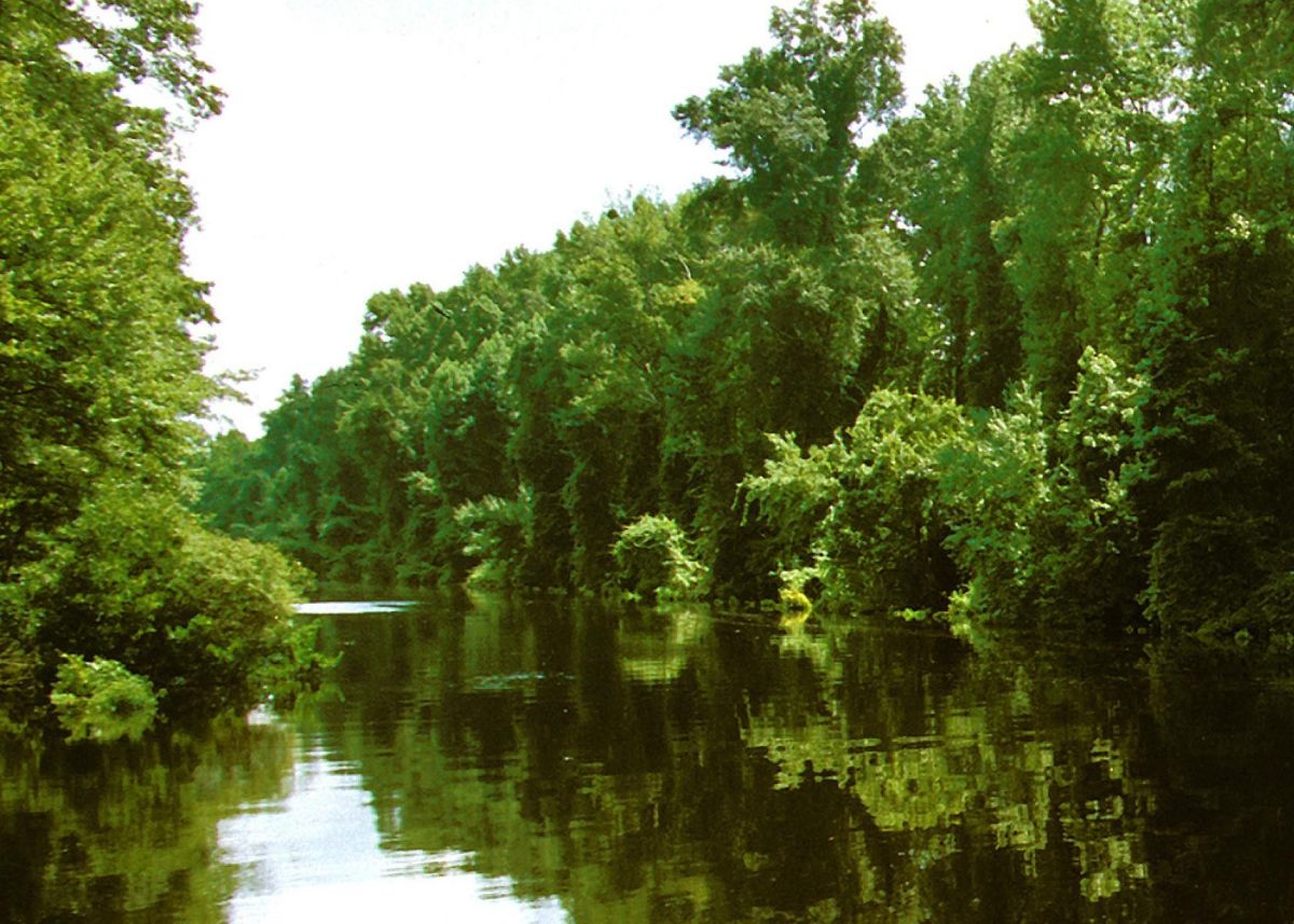
The lottery was part of an overall strategy by the company to raise funds to improve the then-22-mile-long Dismal Swamp Canal, a human-made waterway connecting the Albemarle Sound to the Chesapeake Bay that was completed in 1805.
Those improvements included creating the Northwest Canal, which was “built on the line of a waste ditch from the 1820s” and connected the Dismal Swamp Canal with the headwaters of the Northwest River. From there, the river empties into Currituck Sound on the coast, near the Virginia-North Carolina line, a 1973 report from the Canal Society noted.
Water to maintain the needed depth for navigation on the Dismal Swamp Canal and the Northwest River Canal was diverted from Lake Drummond in the Great Dismal Swamp. Those waters had traditionally drained though slow-moving creeks and rivers that emptied into Currituck Sound. That had been the case since opening in 1805.
The canal is often considered to be the oldest operating canal in the United States.
New Currituck Sound closed for the final time in 1828, changing the northern end of Currituck Sound from a saltwater to freshwater estuary, an event largely credited to the changes the Dismal Swamp Canal created in the flow of water.
Supporter Spotlight

“In 1828, the Atlantic inlets into the Currituck Sound closed due to the diversion of water in the Dismal Swamp and shifted the sound from salt-water to freshwater, upsetting the oyster and salt water fishing industries and changing commerce in the region,” Lago Mar on the Back Bay posted on their Facebook page on Dec. 31, 2025.
In a 1977 study “Coastal Processes and Resulting Forms of Sediment Accumulations Currituck Spit,” the authors note that “The completion of the Dismal Swamp Canal in 1805 undoubtedly also played a role in the closing of New Currituck Inlet.”
But coastal geologist Dr. Stan Riggs is skeptical that the Dismal Swamp Canal caused the inlet to close. The inlets of Currituck Sound are “ephemeral,” he said.
“They open in a storm, and they’re good for a while, and then they shoal back down,” he told Coastal Review. “It’s not the inside waters like down in the Pamlico. The inside waters there (in the Pamlico) play a big part in controlling the inlets and outlets, but up there (in Currituck Sound), there’s not enough water mass to build any kind of a storm surge on the inside.”
There are other factors arguing against the Dismal Swamp Canal closing the inlet that Riggs points to, as well.
With relatively little volume of water surging through the inlet, “it’s mostly the dynamics from outside that are driving that,” Riggs said. “One storm can move sand south, another storm will come along and move sand north. There’s a push and a pull that’s going on and up there. It’s mostly the dynamics of the ocean that are dictating what’s happening.”
And the ocean is getting sand from “a big sand pile off the mouth of Chesapeake Bay” Riggs said. “One of the reasons that we have so much sand up there in the first place is you have to have a source, and that source is the offshore (sand). That inlet closed because nor’easter storms were driving the Chesapeake sands to the northern barrier island.”
Neither the Old Currituck Inlet that would have been on the border of North Carolina and Virginia, nor the New Currituck Inlet just south of Knotts Island were especially useful for shipping.
There was some traffic through inlets for a short time, but William Byrd wrote in 1728 in his “History of the Dividing Line,” that “Navigation is a little difficult, and fit only for Vessels that draw no more than ten feet Water.”
Currituck County had a customs house to handle shipping arriving through New Currituck Inlet, but as author Meg Malvasi wrote in a 2010 “Historic and Architectural Resources of Currituck County 1790-1958” produced for the National Park Service, “One historian described the port as ‘of little consequence, for the few vessels which put in there were small, and the cargoes inconsiderable.’ Whenever one came to the port to unload goods, the port master would simply be there to greet the vessel.’”
The customs house closed in 1819 when Congress did not fund the location.
Even with either Currituck Inlet open, farmers and merchants in northeastern North Carolina lacked access to major seaports, and a canal linking the Outer Banks sounds with Norfolk, Virginia, had been discussed even before the American Revolution.
The earliest ventures were more concerned with draining the Great Dismal Swamp to create arable land than creating a canal. George Washington was a principal in the Dismal Swamp Co. formed in 1763 “for the purpose of taking up and draining a large Body of Land called the Dismal Swamp.”
The venture failed, but Washington held on to his shares.
After the American Revolution, he and the other shareholders made a second attempt at draining the Dismal Swamp. That, too, failed. But, now familiar with Lake Drummond and how the waters moved through the swamp, he wrote in 1784 to North Carolina politician Hugh Williamson that “I have been long satisfied of the practicability of opening a communication between the rivers which empty into Albemarle Sound (thro’ Drummonds Pond) & the waters of Elizabeth or Nansemund Rivers.”
A doctor and scientist, Williamson, after the British occupied Philadelphia in 1777, fled to Edenton where he was elected to the state legislature and eventually sent to the Constitutional Convention in 1787.
Edenton was an critical port of entry in the 18th century and, according to a 1969 National Register of Historic Places document, Williamson “owned ships that traded profitably between Edenton and the West Indies.” A canal connecting Elizabeth City on the Pasquotank River with Norfolk would draw trade away from Edenton to the much better ports of Virginia.
Nonetheless, Williamson was “the primary advocate of the canal in North Carolina,” historian Mathew Shaeffer wrote about the Dismal Swamp Canal for the North Carolina History Project.
His support was important. The Dismal Swamp Canal Co. needed permission from Virginia and North Carolina to move the project forward. Virginia chartered the company in 1787, and it took three years for North Carolina to follow suit, but in 1790, the state chartered the company allowing construction to begin.
It took a while.
Work did not begin until 1793 on the poorly funded project to create the canal connecting South Mills in North Carolina and Deep Creek, now part of Chesapeake, Virginia.
Most of the work to cut the canal by hand was almost all done by enslaved laborers.
The conditions to dig a ditch through the tangle of swamp vegetation were horrific: extreme heat, venomous snakes, constant danger of flooding, and ice and cold in the winter.
Because the labor force was predominantly enslaved individuals who were often rented from their owners, there are no known records of the deaths that occurred while the canal was being built.
Originally conceived to be 32 feet wide and 8 feet deep, engineering for the project was primitive, French noble Duke de la Rochefoucauld-Liancourt wrote after a visit to the canal.
“What must appear surprising, is that, for this canal which already seems in such a state of forwardness, no levels have been taken. It is not yet known what number of locks may be necessary, and even whether any will be requisite,” he observed.
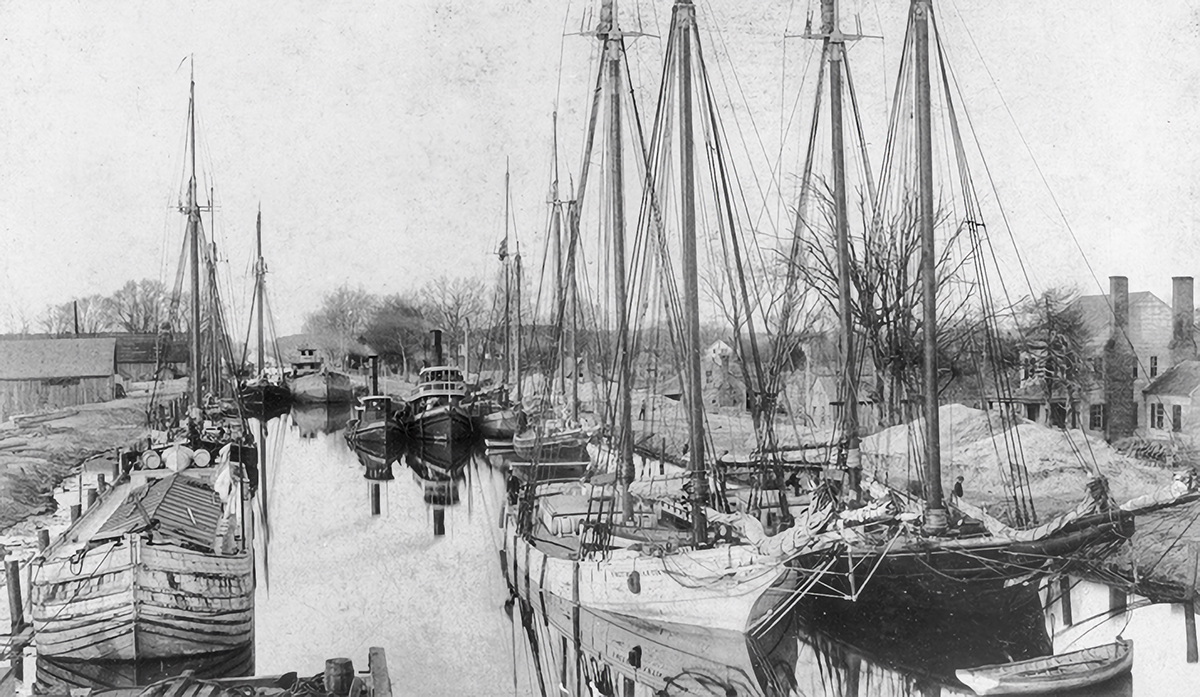
Even after opening to traffic in 1805, the canal did not match the original concept. When the canal was filled and the water was 8 feet deep, larger boats could not use it, although the water was sufficient for shallow-draft barges.
“That would be enough to let the residents of northeastern North Carolina get their produce and lumber to market,” David Walbert wrote for Anchor, a North Carolina online history resource.
Improvements were made, though. The War of 1812 “increased the desire to have a ‘back door’ shipping route between Virginia and North Carolina,” Shaeffer wrote, noting the canal “was not able to provide an adequate alternative route.”
Before the war ended in 1815, the “canal was expanded, and the first recorded passage of a vessel other than a flatboat occurred in June 1814,” Shaeffer continued.
Improvements continued to be made. On May 13, 1830, the Roanoke Advocate in Halifax wrote, “The interesting spectacle of the launching of a new boat, was exhibited on Saturday … in Portsmouth. Though small, being only about 65 feet length on deck, the plan and purpose of this boat render her an object no little importance; she is intended to ply between this place and Elizabeth City via the Dismal Swamp Canal, and to admit of her passing through the canal without injury to the banks she is to be propelled by paddles in the rear … The name of this handsome appendage to the navigation of our port is the Lady of the Lake.”
The Lady of the Lake was the first steam-powered boat to ply the waters of the canal.
The Dismal Swamp Canal, though, was facing increased competition. Railroads in North Carolina and Virginia offered faster transportation of goods. In 1859 the Albemarle and Chesapeake Canal, or A&C Canal, provided deeper water and a more direct route to Virginia ports for North Carolina goods.
Union and Confederate forces fought for control of the canal during the Civil War, and although the North wrested control from the Confederacy in 1862, the South “did benefit from extensive smuggling via the canal during the rest of the war,” according to the Virginia Places Dismal Swamp Canal webpage.
For a brief period beginning in the 1890s, following upgrades by Lake Drummond Canal & Water Co., which purchased the canal in 1892, the Dismal Swamp Canal carried more freight than the Albemarle and Chesapeake Canal. With the federal government purchasing the A&C to create the Atlantic Intracoastal Waterway, the fate of the Dismal Swamp Canal was sealed.
As with part of the Intracoastal, use of the A&C was free, and the Lake Drummond Canal & Water Co. did not have the resources to maintain its canal as well as the federal government could.
The federal government purchased the Dismal Swamp Canal in 1929 and it is currently maintained by the U.S. Army Corps of Engineers. Today, the canal is part of the Atlantic Intracoastal Waterway that stretches along the Atlantic and Gulf Coast states, and it measures 19 miles long, 60 feet wide and at a controlling depth of 9 feet, according to the North Carolina Department of Natural and Cultural Resources.