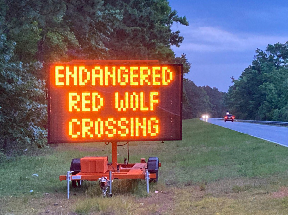
North Carolina’s Coastal Resources Commission is moving through the steps to update rules for building along high-hazard coastlines that are particularly vulnerable to erosion and flooding.
When the commission met April 16 in Ocean Isle Beach’s town hall, members voted unanimously to advance the rulemaking process to draft language amendments for ocean erodible areas and inlet hazard areas. Proposed changes include using the most recent data for erosion rates and maps for the two zones, which are classified as areas of environmental concern.
Supporter Spotlight
If approved, this will be the first time new inlet hazard boundaries have been updated since they were initiated in the late 1970s. The commission has been discussing revisions for decades, but the complicated process and public blowback have pushed talks of updates year to year.
Both inlet hazard and ocean erodible areas fall under the ocean hazard areas category of areas of environmental concern, which are the foundation for the Coastal Area Management Act permitting program. CAMA was enacted in 1974, along with the commission to adopt rules for legislation that protects the state’s coastal resources. The Division of Coastal Management, under the North Carolina Department of Environmental Quality, acts as staff to the commission.
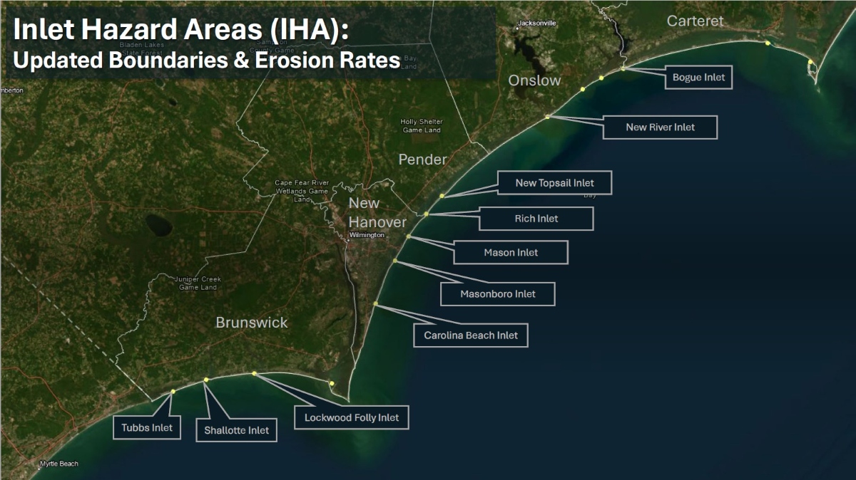
Inlet hazard areas, or IHAs, encompass land along the narrow body of water that allows for tidal exchange between the ocean and inland waters. These swaths of shoreline are susceptible to inlet migration, rapid and severe erosion, and flooding. Land within the boundaries is subject to the commission’s development rules.
Ken Richardson, the division’s shoreline management specialist, told Coastal Review that in addition to the proposed updates to inlet hazard area boundaries, one of the primary changes under consideration is that erosion rate setbacks within inlet hazard areas will be based on inlet-specific erosion rates detailed in a 2025 report rather than the adjacent ocean erodible area, or oceanfront, rates, which is currently the case.
Because of limited data and resources, erosion rate setback factors within inlet hazard areas have been based on the rates of adjacent ocean erodible areas, essentially treating the inlet shoreline as an extension of the oceanfront.
Supporter Spotlight

“Given the rapid changes that can occur at inlets, this method has often resulted in setback factors that underestimate the true erosion dynamics of these areas,” according to the division. Erosion rates are used to determine how far back new construction must be from the shoreline.
Richardson said that, “Additionally, the rules would effectively ‘hold the line’ of existing development by preventing seaward expansion of new development in inlet areas that have experienced natural accretion.”
He referenced the “Inlet Hazard Area Boundaries, 2025 Update: Science Panel Recommendations to the North Carolina Coastal Resources Commission,” presented in August 2025 to the commission that explains “any accretion at most inlets is temporary and likely to reverse over time; maintaining this line helps reduce future exposure to erosion hazards.”
The commission’s Science Panel on Coastal Hazards was directed in 2016 to update IHA boundaries. Rules were in the process of being updated in 2019, but the COVID-19 pandemic paused draft rules from moving forward.
The “Science Panel recommended updating IHAs on a five-year cycle alongside oceanfront erosion rates, by the time work resumed after the pandemic, the next oceanfront study (2025) was already approaching. As a result, some stakeholders asked the CRC to proceed with a coordinated update,” leading to the directive in 2023 to provide another five-year review, Richardson told Coastal Review.
Richardson explained during the meeting last week that the science panel analyzed for the 2025 update the state’s developed inlets, which are Bogue, New River, New Topsail, Rich, Mason, Masonboro, Carolina Beach, Lockwood Folly, Shallotte and Tubbs.
Panel Chair Dr. Laura Moore, professor of coastal geomorphology at the University of North Carolina Chapel Hill, presented the findings in the inlet hazard area boundaries report during the August 2025 meeting.
Last February, the Coastal Resources Advisory Council and a subcommittee reviewed the report and suggested deviating from the panel’s recommendation to measure setbacks from the hybrid-vegetation line because of concerns that existing structures would be nonconforming, and therefore harder to replace if something happened to the structure.
They decided to base the language on existing rules and continue to measure setbacks within inlet hazard areas from the actual vegetation line or pre-project line but not extend farther oceanward than the footprint of an existing structure, or, in the case with vacant lots, the landward-most adjacent neighboring structure, according to the division.
Richardson told the commission that another recommendation included amending the language for ocean erodible areas language citing the 2019 report to the “North Carolina 2025 Oceanfront Setback Factors & Long-Term Average Annual Erosion Rate Update Study: Methods Report report.”
Richardson noted that there are no boundary maps for ocean erodible areas because boundaries are measured from the vegetation line, which are dynamic and could change overnight, so the landward boundary is determined in the field.
Staff also proposes eliminating the distinction of residential or nonresidential for the type of structure, because “It doesn’t matter to erosion what the structure is being used for,” Richardson said.
Now, the proposed rule changes will go through the fiscal analysis. This step in the rulemaking process determines the financial impact of the proposed amendments. After the analysis is presented and voted on, the commission will decide to move on to the public comment period, then to final approval before sending it to the Rules Review Commission.
Septic tank update
Cameron Luck, a policy analyst for the division, briefed the commission on the work to develop rules for septic system siting, repair and replacement within ocean hazard areas.
He began by sharing what took place during a meeting March 30 in Buxton coordinated by the North Carolina Coastal Federation, with representatives from the North Carolina Home Builders Association, North Carolina Septic Tank Association, Outer Bank Association of Realtors, National Park Service, and from county health departments.
Attendees were brought up to speed on some of the issues surrounding failed septic tanks on the oceanfront, heard from Cape Hatteras National Seashore representatives about their policies and ongoing struggles and efforts to address both the threatened oceanfront structures and the failed septic tank systems and systems out on the beach
Department of Health and Human Services provided a quick synopsis of their process, focusing on the role within and alongside local health departments, with a discussion on how the department permits and cites septic tanks and how and failure enforcement.
Luck said that he and other division staff presented the most recently proposed rule language for discussion.
“We spent a good amount of time talking through the proposed language and some areas that could be improved,” Luck said.
Main points in the discussion focused on defining what type of repair would qualify for a permit.
“In other words,” Luck explained, would property owners be required to secure a permit if a filter or a section of pipe needs to be replaced, or does the rule need to be more focused on extreme failures.
Discussion also focused on whether the proposed rule changes should be applied coastwide or be more targeted to specific situations or locations.
“Perhaps, key takeaway from that meeting was a clear consensus among those attendees that some form of action is needed to limit the repair of failed septic systems on the ocean beach and to prevent them from remaining on the beach once they failed,” he said, adding that staff is working on those rule language updates.