The North Carolina Department of Transportation announced Wednesday that its officials are considering new design options for the Carolina Bays Parkway Extension project in Brunswick County after feedback from the public.
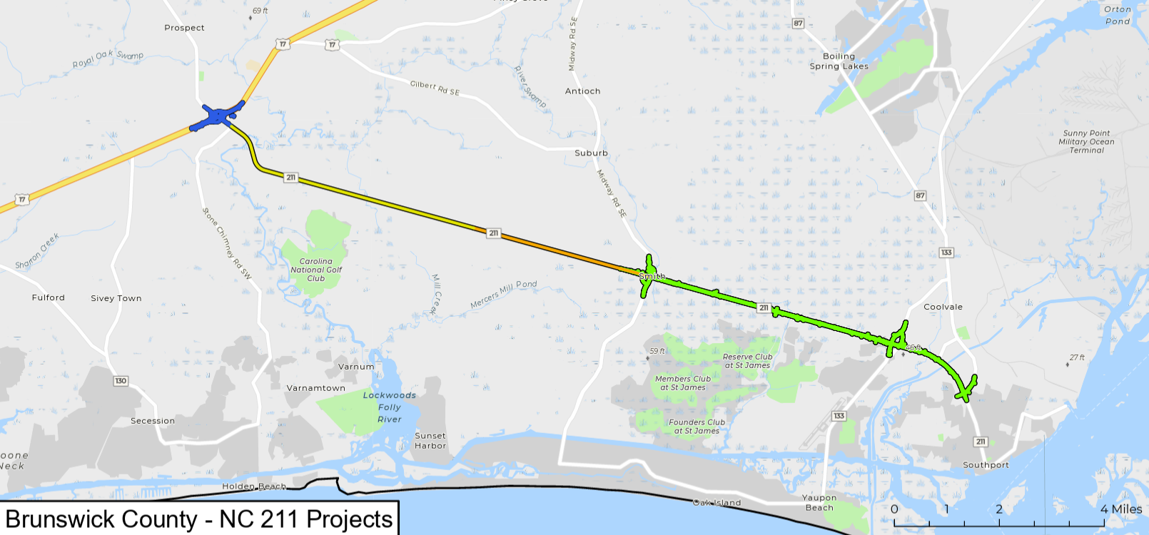
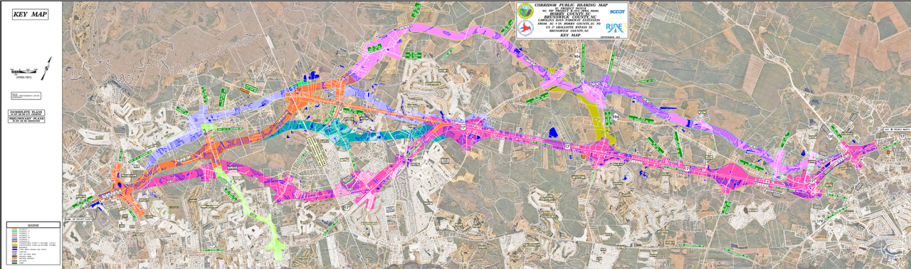
NCDOT, in collaboration with the South Carolina Department of Transportation, is planning to extend S.C. Highway 31, aka the Carolina Bays Parkway, from S.C. Highway 9 in Horry County across the state line to U.S. Highway 17 in Brunswick County.
Supporter Spotlight
Proposed is a multilane highway that would use portions of the existing road in addition to building roadway in new areas. The total anticipated cost for the project is $797 million. North Carolina’s share of the cost is estimated at $610.9 million. South Carolina anticipates construction commencing in 2029. North Carolina’s start date was listed as “TBD” on the project website.
In October 2025, the state highway departments jointly held two public hearings about the project. Seven different design alternatives were presented, including the departments’ preferred alternative known as Alternative 4.
NCDOT said Wednesday that, after reviewing public feedback and considering funding challenges, it’s not going to proceed with the North Carolina portion of Alternative 4, which builds on new location, tying in near the intersection of U.S. 17 and N.C. Highway 904.
Alternative 4 would also upgrade part of U.S. 17 to a fully controlled freeway from N.C. 904 to N.C. Highway 130 in Shallotte.
The two state agencies and the Federal Highway Administration continue to collaborate and explore other alternatives and modified routes to minimize impacts and meet the purpose and need of the project, according to NCDOT’s announcement.
Supporter Spotlight

“NCDOT deeply values the input from this community and our stakeholders. We want to provide the region with the best possible roadway designs. We’ve listened to the feedback, and we’re working hard to prepare a new alternative,” said Division 3 Engineer Trevor Carroll in a statement.
Alternative 4 was preferred because of factors such as requiring the lowest number of residential displacements, estimated at 39, and the lowest number of identified noise effects. The impacts to wetlands and streams were also deemed moderate relative to other alternatives, despite a large amount of designated High-Quality Waters impacted.
A new alternative must include connectivity through the transportation network, increased mobility for the region and reduced travel time through the project corridor, officials noted in the announcement.
Additional information regarding the new design is to be presented to the public at a later date.
NCDOT said it is “committed to transparency, innovative solutions and exploring community feedback regarding this project.” Its response to all comments received is available on the project webpage along with the most updated information regarding the project.
You can also follow NCDOT on social media for additional updates.