
Kevin Hardy of Wilmar, near Vanceboro, fishes along Cape Lookout National Seashore as a commercial fishing trawler offshore heads southwest. Photo: Dylan Ray
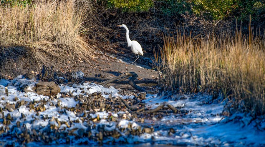
Icy conditions
An egret hunts along the shore of an icy marsh Thursday near Pelletier Creek in Morehead City. Don’t look for a quick thaw as much of coastal North Carolina is under a winter weather advisory from 4 p.m. Friday until 10 a.m. Saturday. The forecast calls for the potential for light accumulations of ice and snow, although little to none is expected from Hatteras Island to Ocracoke Island. Photo: Dylan Ray

Fine day for fishing
Visitors during a recent cloudy day carry fishing poles while strolling along the water’s edge at Cedar Street Park in downtown Beaufort, with the construction site of the 103-room Compass Hotel Beaufort by Margaritaville Resorts on Gallants Channel in the background. Photo: Dylan Ray
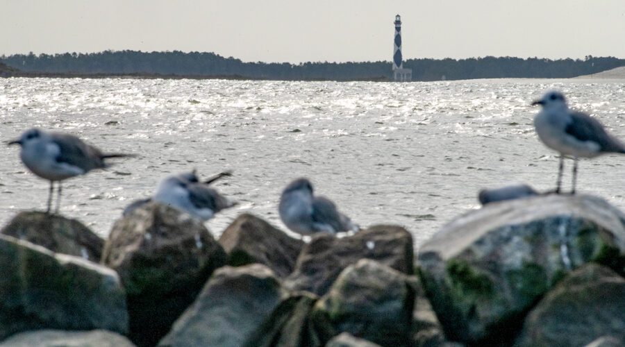
Beacon backdrop for the birds
The 1859 Cape Lookout Lighthouse reaches 163 feet skyward beyond shorebirds hunkered down recently on a jetty across the bay at the Cape Lookout National Seashore visitor center at Shell Point on Harkers Island. Photo: Dylan Ray

Sunset striations
Striations of clouds blanket the sky at sunset over North River in Carteret County recently. Photo: Dylan Ray

Tiny sunbather
An especially young green tree frog catches the morning sun from an agapanthus leaf in a Beaufort garden. Photo: Dylan Ray

Coastal flood advisory in effect
A vehicle creates a wake Tuesday while passing through floodwaters from the saltmarsh along Crow Hill Road near Otway in Down East Carteret County. Carteret County and coastal Onslow County were placed under a coastal flood advisory Tuesday effective until 5 p.m. Wednesday. Up to a foot of inundation above ground level is possible in low-lying areas near shorelines and tidal waterways. Officials urge people not to drive through waters of unknown depths. Photo: Dylan Ray

Fence-sitter in the rain
A green tree frog peers out at the rain from the safety of a fence railing near Russell Creek in Beaufort. Frogs all along the North Carolina coast may be in for more of the same with the potential tropical cyclone stalled about 185 miles south-southwest of Cape Lookout early Monday expected to move northward during the day, dumping very heavy rainfall, according to the National Weather Service Newport-Morehead City office. Photo: Dylan Ray
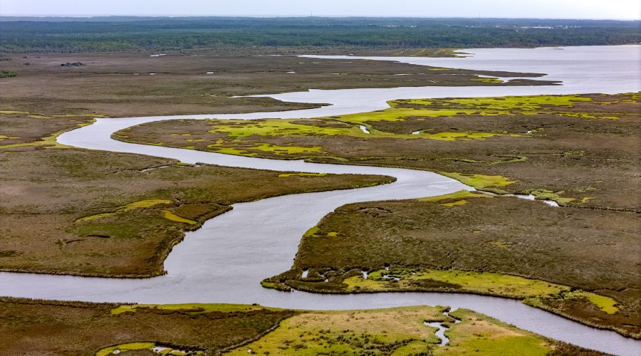
Gateway to Down East
A maze of creeks cuts through the salt marshes north of the Commissioner Jonathan Robinson Bridge and the gateway to Down East Carteret County. Photo: Dylan Ray
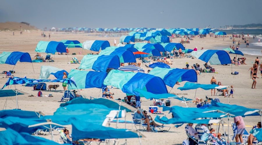
Full sun, fully shaded
A sea of sunshades hug the shoreline recently in Atlantic Beach on Bogue Banks. Photo: Dylan Ray
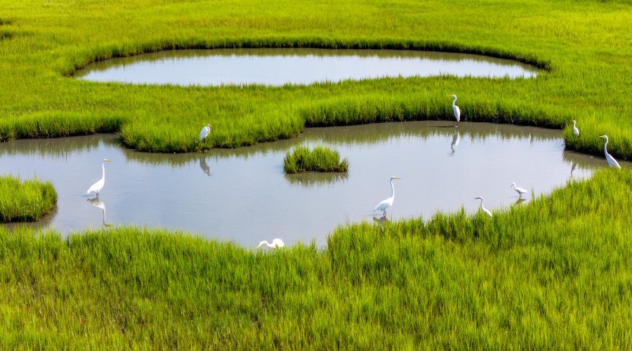
Salt marsh snacks
A wedge of egrets fish in a salt marsh along North River near Beaufort. Photo: Dylan Ray

Cooper attends wind energy event
Gov. Roy Cooper speaks to reporters about renewable energy, sidestepping questions about his possible selection as a vice presidential candidate, Wednesday at a turbine blade-signing event celebrating construction of the Timbermill Wind project by Apex Clean Energy in Chowan County. The 189-megawatt wind energy project is the state’s second and the first to be built since 2017. It is expected to generate up to $33 million in tax revenue over its lifetime and become the county’s largest taxpayer during its first year of operation. Photo: Dylan Ray
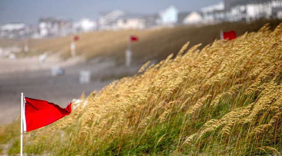
Red flags fly on most North Carolina beaches
Red warning flags whip against the wind Friday in Atlantic Beach, notifying swimmers to not enter the water. Life-threatening rip currents were likely and the surf zone dangerous for all levels of swimmers on all North Carolina beaches north of Cape Fear Friday, according to the National Weather Service’s experimental Beach Forecast webpage, which is color-coded to indicate the forecast rip current risk level. Yellow flags indicating moderate conditions flew on Brunswick County beaches Friday. Conditions had improved to moderate to low risk Monday. Photo: Dylan Ray
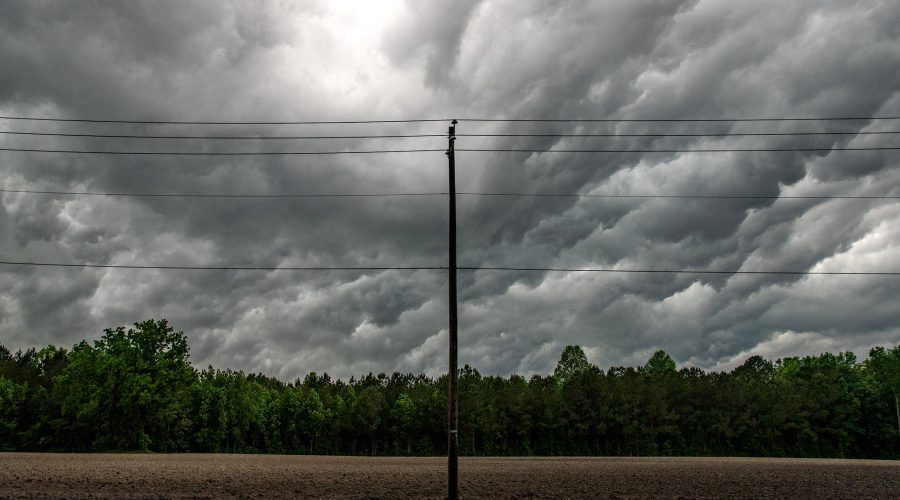
Overhead lines
Lines of clouds move over Askin near New Bern and the power lines overhead as part of a weekend weather front. Photo: Dylan Ray
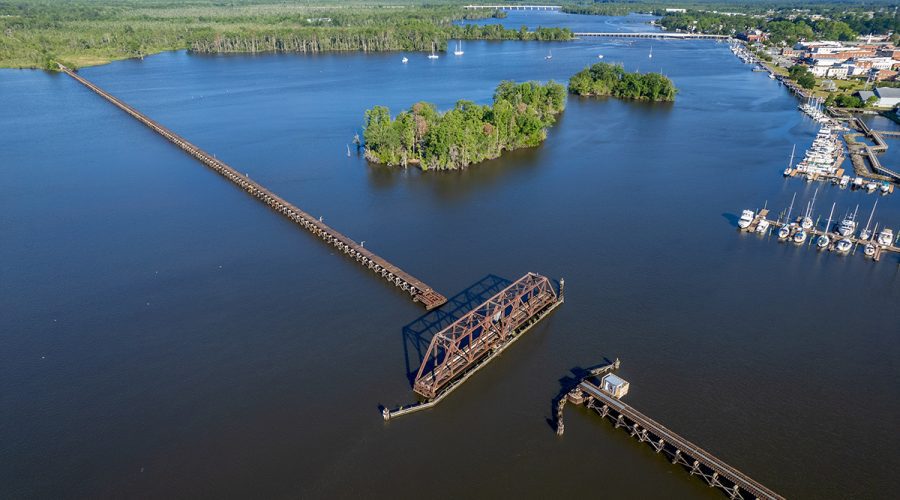
Pamlico passageways
The Coastal Railway Swing Bridge spans the Pamlico River in Washington, where the waterfront can be seen on the north bank at upper right in this recent image. Farther in the distance are the U.S. Highway 17 Business bridge into town and, beyond it, the U.S. 17 Bypass. Photo: Dylan Ray

Sunscreen season arrives
An anole, freshly shed of its skin except the still-peeling tip of the nose, suns in a Beaufort agapanthus bed. For us creatures who don’t normally peel, the Centers for Disease Control and Prevention advise that protection from the sun’s rays is important year-round, not just during the warmer months. Photo: Dylan Ray