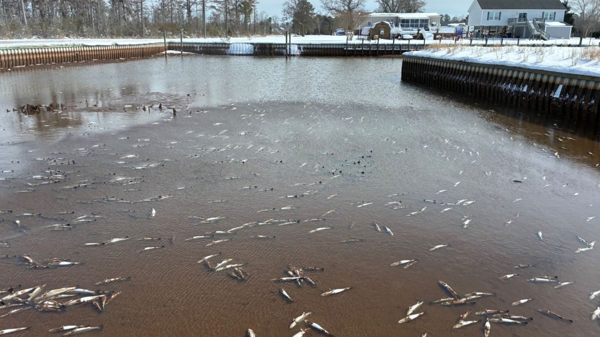
Season closures after cold-stun or cold-kill events, such as seen earlier this month on the North Carolina coast, are important to help fish stocks recover.
storms
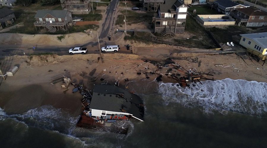
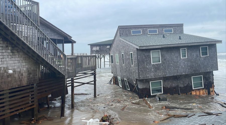
Causey urges council to help Outer Banks as more homes fall
“There’s some angry people out there,” Insurance Commissioner Mike Causey told members of the Council of State Tuesday, referring to the four houses that fell into the ocean last weekend, a total of 31 homes since 2020, and calls to end the ban on beach hardening.
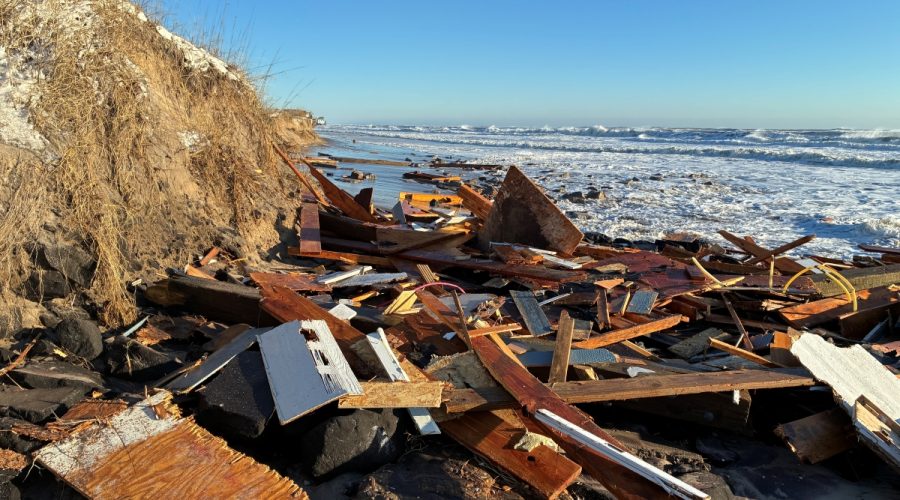
Winter storm takes 4 Buxton houses, leaves inches of snow
The weekend storm that covered North Carolina with more than a foot of snow in some places caused four unoccupied Buxton houses to collapse in about 24 hours on Cape Hatteras National Seashore beaches.
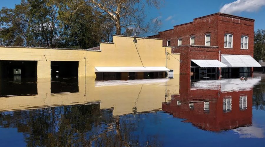
Despite judge’s order, communities in 20 states still waiting
Coastal communities in line for announced federal storm resilience funding, which the administration pulled last year and that a judge last month ordered immediately and, permanently restored, are still wondering when the money will come.
NOAA storm prediction modeling in midst of major update
National precipitation forecasting has for decades been hamstrung by static and inadequate climate models, but new tools are in development to provide more accurate rainfall predictions.
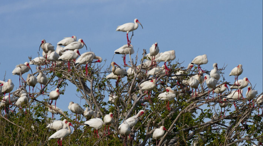
Partnership to test living shorelines on two Cape Fear islands
An effort to protect threatened wading bird colonies and their imperiled habitat on Battery and Shellbed islands, Audubon, Sandbar Oyster Co. and the North Carolina Coastal Federation have teamed up to design and install two pilot projects and test their effectiveness.
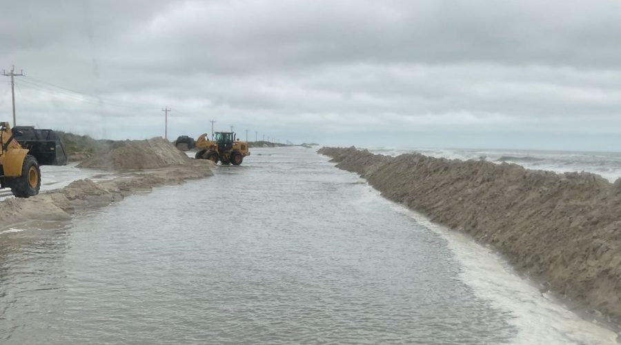
Coastal storm brings ocean overwash, erosion to NC beaches
The nor’easter that swept up the East Coast last weekend continues to cause headaches along areas of the Outer Banks, where road crews continue to work to reopen portions of N.C. 12.
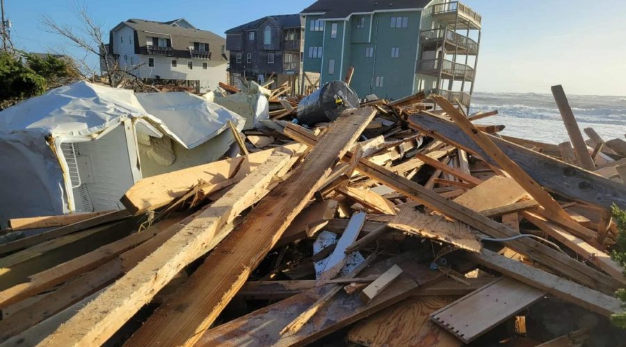
‘Messy situation’: Buxton beach closed after 8th house falls
The first home fell two weeks ago, but the spate of collapses this week has turned this Cape Hatteras National Seashore beach and the crashing surf into a hazardous, dynamic debris field.
Updated: 7th Buxton house collapses, officials advise caution
New: Another unoccupied house in Buxton collapsed Wednesday evening, bringing the total to seven this week, and the National Park Services warns visitors of potentially hazardous debris may spread for miles.
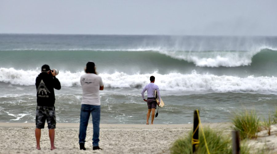
Distant storms churn up surf along NC coast
Storm swell associated with Hurricane Imelda and Hurricane Humberto breaks Tuesday along the Bogue Banks shore at Oceanana Fishing Pier in Atlantic Beach. The storm, while moving away from the U.S. Tuesday, still packed a potent punch, forecasters said, and could bring possible minor flooding in areas of onshore winds along the coast in the Southeast. At 11 a.m. Tuesday, the storm was moving to the northeast, toward near Bermuda, but swells and high surf from Imelda and Hurricane Humberto were expected to produce dangerous marine conditions and rip currents along much of the East Coast for several days. Farther north, the N.C. Department of Transportation on Tuesday closed N.C. 12 on the north end of Ocracoke Island between the National Park Service Pony Pens and the ferry terminal due to deteriorating travel conditions and five oceanfront houses collapsed on Hatteras Island. Photo: Dylan Ray
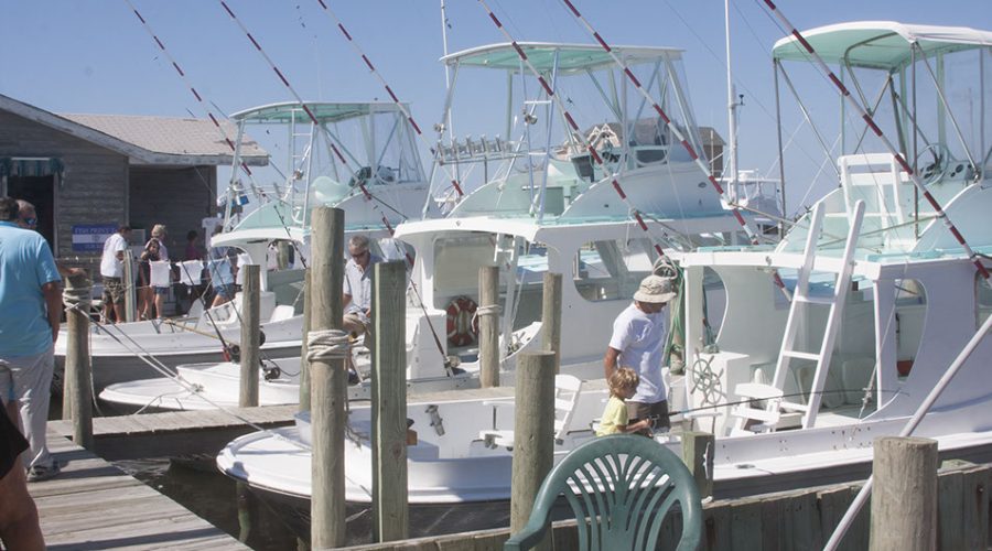
Docks event celebrates Hatteras Islanders’ spirit, watermen
The annual event set for Sept. 19-20 celebrates the heroes of Hurricane Isabel in 2003, the commercial fishing and charter operators who restarted the economy after the storm.
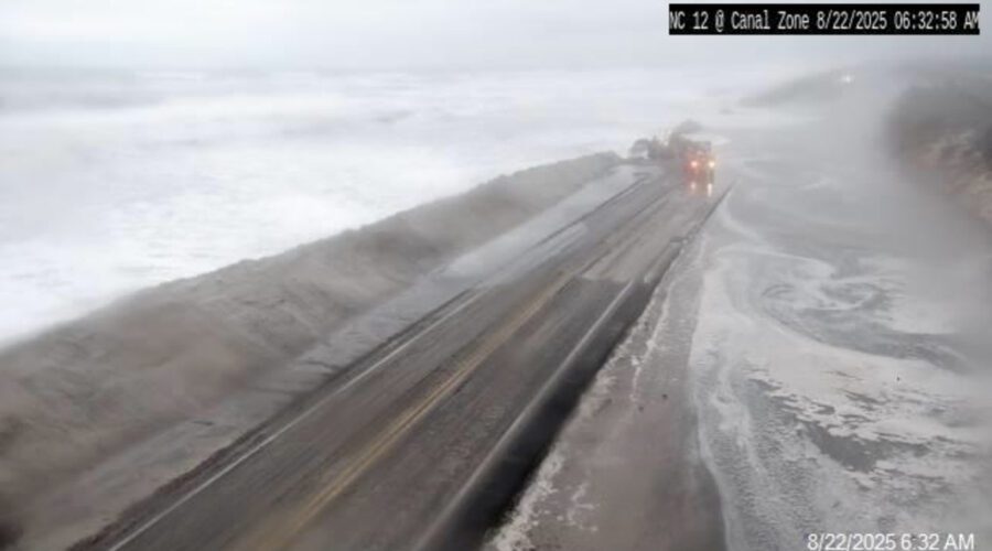
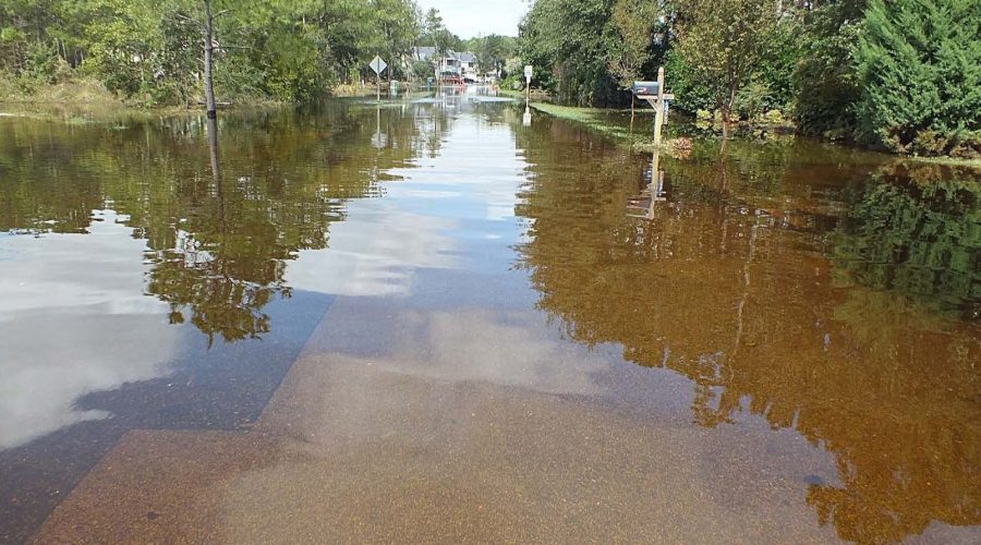
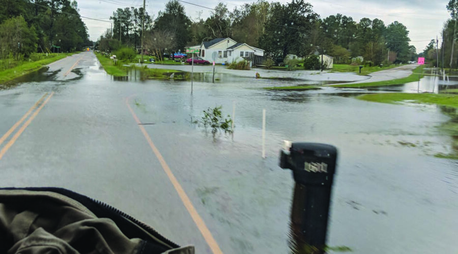
Flooding keeps NC 12 closed to traffic as Erin heads out to sea
State transportation crews were clearing N.C. Highway 12 and rebuilding dunes in the wake of Hurricane Erin’s pass offshore, as flooding conditions continued and the road remained closed Friday morning.
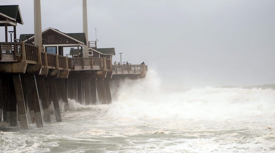
Angry Erin heads out to sea
People on Jennette’s Pier in Nags Head watch as waves generated by Hurricane Erin crash into the concrete structure that’s part of the North Carolina Aquariums system. The storm’s center was about 260 miles east of Cape Hatteras at midday Thursday and moving out to sea, but hurricane-force winds extended outward up to 105 miles and tropical-storm-force winds extended up to 320 miles from the sprawling but weakening storm’s eye. Life-threatening surf and rip current conditions will likely continue as storm surge and flood risks subside. The pier’s website provides information on current conditions and live webcam views.
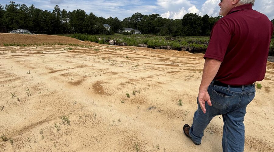
No easy fix for Boiling Spring Lakes’ ongoing dam troubles
Officials in the small Brunswick County city thought the structure damaged by Hurricane Florence had been repaired, but a June storm proved otherwise and residents’ anger and frustration are boiling.
Coastal counties seek regional hazard mitigation plan input
The federally mandated Southeastern N.C. Regional Hazard Mitigation Plan, which identifies natural hazard risks and ways to mitigate and respond to those risks, is under review as part of a five-year update.
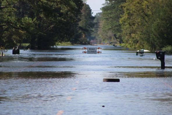
Proponents of Leland flood zone rules say it’s a moral issue
Advocates of the Brunswick County town’s proposal to strengthen and expand flood zone building rules say officials must ensure they are not putting property owners, emergency personnel in danger.