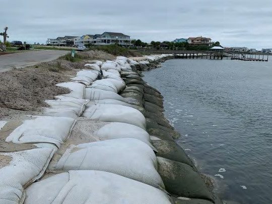
The homeowners association for a half-developed, rapidly eroding 10-lot subdivision on the east end of Sunset Beach now has approval to add on to an existing sandbag wall put in place two years ago to protect the only road in, after the state Division of Coastal Management had denied a permit.
During its online meeting Wednesday, the state Coastal Resources Commission approved the Palm Cove Homeowners Association’s request for a variance, reversing the division’s denial last year of a Coastal Area Management Act Major Permit.
Supporter Spotlight
The division in December denied a permit to add sandbags to make the wall 5 feet wider, or 25 feet wide, and 6 feet taller, or 12 feet above mean high water, because it would be larger than rules allow.
Commission Chair Renee Cahoon voted in favor of the variance, but said she worried that approval would lead to further development in the subdivision. A single private road built in 2005 bisects the 10 lots, four of which have houses with another house currently under construction.
“Are we then encouraging more development of the other five lots while they’re searching for an answer in an area that has a 29-foot erosion rate per year? Hopefully not.” she said.
Todd Roessler, the homeowners association’s attorney, responded, saying he hoped not too.
“With that water coming up against the sandbags. I would hope a prudent landowner would make an informed decision at this point,” he said.
Supporter Spotlight
He said that the association was considering a long-term solution, namely, realigning the channel to move it away from the shoreline.
The commission’s approval came with conditions recommended by division staff, including that if any long-term erosion-control measures were to be put into place, then all sandbags above grade and exceeding size limitations must be removed within six months. Also, rather than using mean high water as a measurement for the additional sandbags, the road bed must instead be used as the reference elevation, limiting the sandbag wall to a maximum height of 2.5 feet above the road surface.
The votes were unanimous for three of the four criteria for the variance, but commission members Craig Bromby and Lauren Salter, without comment, voted no on the fourth criteria, which included the conditions.
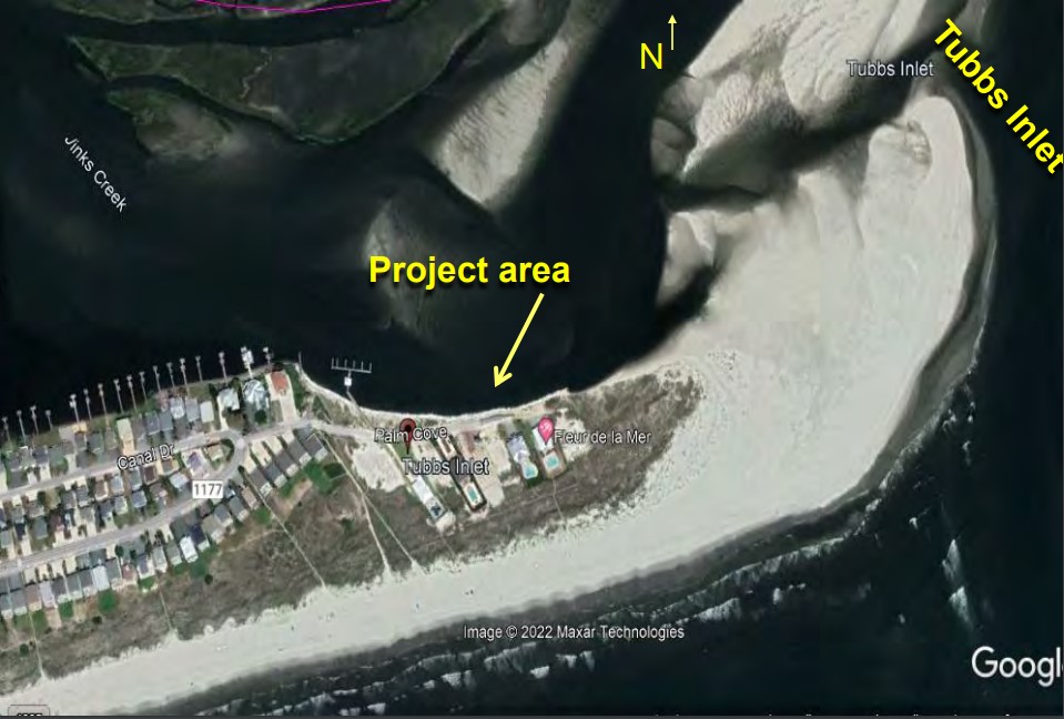
Palm Cove was subdivided in 2004 and is bordered by the Eastern Channel of Jinks Creek to the north, Tubbs Inlet to the east, the Atlantic Ocean to the south, and residential lots to the west.
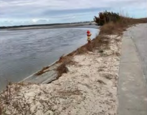
In December 2019, residents saw that erosion on the Jinks Creek shoreline was compromising a fire hydrant by the road. The county subsequently removed the hydrant, which the homeowners association claimed was improperly done and left a depression that made the area more vulnerable to erosion.
To protect the road, the association requested a permit in early 2020 to build the current sandbag wall. The 6-foot by 20-foot wall extends 1,000 feet east-west along Jinks Creek.
According to a report by an engineer contracted by the homeowners association, Coastal Planning & Engineering of Wilmington, the road and right-of-way continue to be imminently threatened by erosion.
The report also notes that erosion along the Palm Cove shoreline worsened between 2019 and 2020, with the estuarine shoreline receding by about 29 feet. That’s compared to the previous four years’ average of about 16 feet per year.


