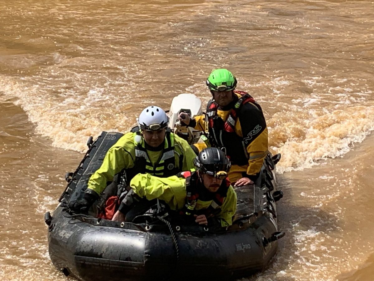
BUXTON — Surfers catching waves off a Hatteras Island beach last week had reported a sheen on the water, burning in their eyes and a noxious coating on their wetsuits. Numerous people noticed a powerful stench of diesel on the shoreline by the popular surfing spot in Cape Hatteras National Seashore.
Although a similar strong odor was evident after an October storm at the same beach in washed-up clumps of peat, the source of the pollutant is still a mystery.
Supporter Spotlight
“We cannot address contamination if we don’t know where the contamination is,” Carl Dokter, program manager of the Army Corps of Engineers Savannah District’s Formerly Used Defense Sites, or FUDS, told Coastal Review on Thursday. “And every attempt we’ve made to drill some holes and find it reveals no peat, no organic layers, no diesel — just clean samples.”
Back in the fall, Dokter said in an interview, that since there had been fuel spills at the nearby former Buxton Naval Base that FUDS has remediated, in addition to removing tanks and contaminated soil in the early 2000s, the office had agreed in recent months to remove any remaining petroleum contamination. But with the ever-changing conditions at the beach, and the intermittent recurrence of the diesel odor, its origin has so far evaded detection by the team’s instruments.
In fact, Dokter said, when his team had gone to Buxton to investigate, the only place that tested positive for petroleum was washed-up sediment on the beach.
“Then our geologists looked for the peat layer,” he recounted in the interview last week. “And they explained to me that the beach has eroded about 30 feet vertically and 150 feet horizontally over the decades. So the peat layer, which you can see at the base of the dunes, has long since eroded away.”
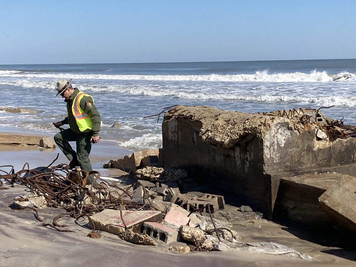
During a visit on Wednesday at the Buxton beach, Cape Hatteras National Seashore Superintendent Dave Hallac noted that the diesel odor was clearly most powerful in the vicinity of a slab of concrete debris exposed in the surf zone. Even with breezy conditions that day at the oceanfront, the smell was potent and offensive.
Supporter Spotlight
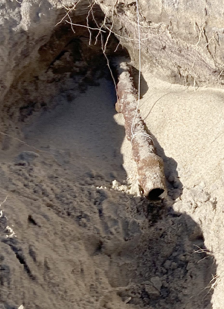
Pointing to a pipe protruding from a nearby eroded dune, Hallac said that the odor was also discernible from whatever had been in the pipe. He later added that results received on Friday from an independent laboratory indicate evidence of the fuel. The test, commissioned by the park, detected TPH (total petroleum hydrocarbons) and DRO (diesel range organics) above “state action” levels, Hallac said.
Soil samples the Coast Guard took in Buxton in September revealed weathered light fuel oil, a small amount of lubricating oil, petroleum hydrocarbons, and nonpetroleum contamination, according to a press release.
Looking back: Navy base’s wretched reminders not just petroleum in soils
Before the Cape Hatteras Lighthouse was relocated from the surf in 1999, the nation’s tallest brick tower had stood guard since 1870 from the same beach. From 1956 to 1982, just to the north, the Navy had operated a secret submarine surveillance base, which the Coast Guard acquired in 1986. When Group Cape Hatteras relocated in 2005 to Fort Macon in Carteret County, the Coast Guard was required to remove infrastructure on the base before returning the property to the National Park Service.
As has become more apparent as erosion increases and unpleasant surprises are unburied, lots of stuff was left behind: building debris, toxins from dumped pesticides, and contaminants from spilled and leaking fuel containers.
The Coast Guard was still in the process of responding to questions from Coastal Review about its current and past responsibilities and activities in Buxton, according to an email Thursday from Jonathan Lally, with Coast Guard 5th District public affairs.
Chunks of concrete with wires sticking through, various sizes of pipes and portions of concrete foundation from what was once the Driftwood Club, where sailors gathered to drink and socialize, and Building 19, the terminal “T” building where the listening cable was believed to be, now litter the beach. Just off the sand in the nearshore, surfers have to evade metal parts of several deteriorating jetties the Navy built that stick up in the water. And the Coast Guard and FUDS are still monitoring groundwater, conducting tests and/or working to remove contaminated soils related to operations at the bases.
“Every time there’s a storm, more stuff gets exposed,” said Russell Blackwood, a surfer and free diver who has lived by what is known locally as Lighthouse Beach for 50 years. “Then in a day or two or three after a storm, it covers it right back up.”
Blackwood also worked at the Navy base in the 1970s. He theorized in a recent interview that the military had redundant diesel tanks under the T building, and the fuel is pushed up during storms.
“It only comes out of the tanks when there’s ocean water over them,” he said. “You’d go there when there’s no swell, at low tide, and you’d barely smell it.”
But around Feb. 7, after heavy weather, in addition to the seawater-fuel mix looking “milky-gray” and the sheen on top of the water, he said, “you couldn’t even breathe.”
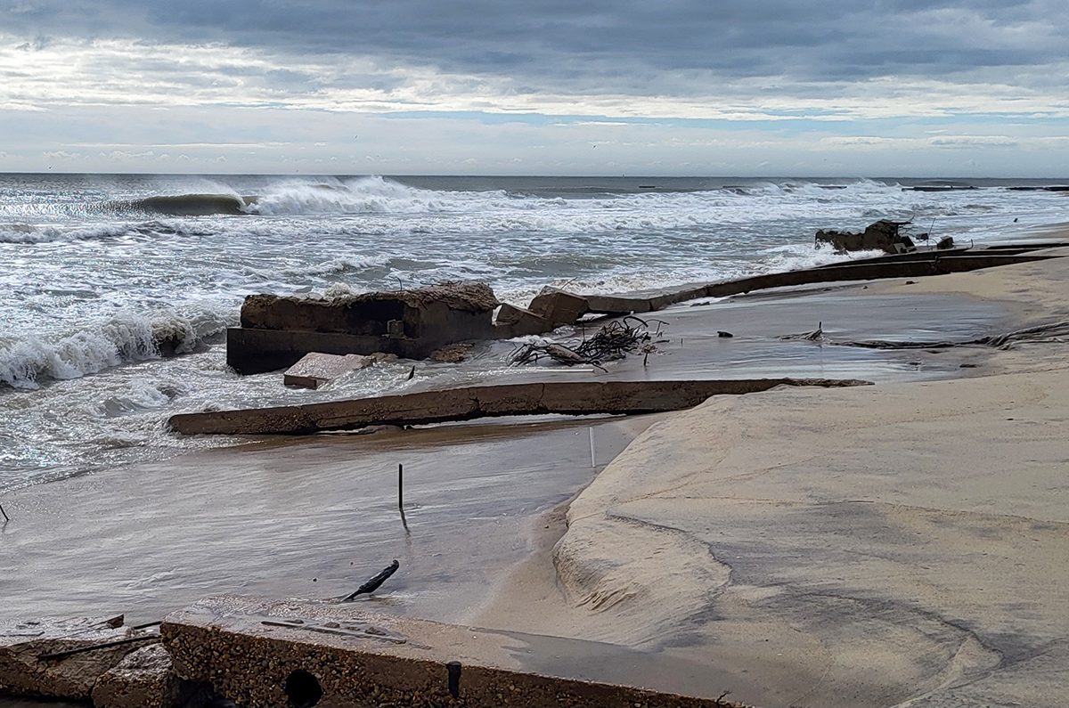
Despite beach nourishment projects in 2017 and 2022, Blackwood said, severe erosion in the last 18 months has undone much of it, especially by Lighthouse Beach.
“It’s gone,” he said. “There is no dune.”
According to the Corps’ December 2023 Buxton Naval Facility report and proposed soil survey map, seven above-ground storage tanks, 27 underground storage tanks, an oil change ramp, a pipeline between a building and a tank, and soil in several areas were removed in the 1990s and 2000s. In addition, groundwater had been sampled repeatedly and monitoring wells were installed.
The Corps’ FUDS offices are responsible for environmental liabilities at sites that were owned, operated or controlled by the U.S. Department of Defense before Oct. 17, 1986.
Dokter, with FUDS, said that his office is continuing to work with the National Park Service and the state Department of Environmental Quality on how to tackle the problem. A team went to the site last week, and a field report on the December work is due within weeks.
“We’re trying to look into every possible source for where this is coming from,” Dokter said. “But the dilemma I’m facing the most is, I can’t remove something I can’t find. And that’s where our big frustration lies right now.”
The Corps team is even considering whether the fuel is coming from prior spills offshore. If the problem continues, he added, “at that point, I have to sit down with my with my technical team and probably reach out to our center of expertise and discuss options.”
But Dokter said the pipe to which Hallac is referring is an unlikely source because it wouldn’t account for the volume of fuel that has been reported.
Hallac also said that the National Seashore is asking the Corps to follow through on the cleanup that was supposed to have been wrapped up years ago.
“And so the concern is that the project was not completed and we continue to request that the Army Corps of Engineers remove the building foundations consistent with the plans that were provided to us in 1985 and 1986,” he said.
Dokter, however, said his “hands are tied,” at least for now.
“Because our program and policy states that we address things that were a hazard at the time, hazards that arise after it was transferred out of Department of Defense control are not eligible for FUDS funding,” Dokter said. “And so each erosion creating that hazard over time, since it was transferred out of DOD control, I’m just legally not allowed to pay to fix that.”
Despite the challenges, Hallac said that he is confident that the situation will be addressed, preferably sooner rather than later.
No matter, as Blackwood sees it, the fuel will just keep coming back to remind everyone that nothing is being done.
“I guarantee you, next time we get a north swell, it’ll be back,” Blackwood said. “When the surf gets to 6 feet, that’s when they need to come here. They need to camp here.”


