This report was updated to include the swim advisory.
Water quality conditions along the North Carolina coast appear to be one of the most quickly identified problems resulting from rainfall associated with Tropical Storm Idalia. Officials on Thursday put in place immediate temporary closures of shellfish areas in much of the state’s coastal waters and advised against swimming.
Supporter Spotlight
State recreational water quality officials on Thursday advised the public to avoid swimming in North Carolina coastal waters from Wright Memorial Bridge in Kitty Hawk south to the South Carolina state line.
Division of Marine Fisheries Director Kathy Rawls, upon the recommendation of State Health Director Dr. Betsey Tilson with the Department of Health and Human Services, announced the closures early Thursday morning in a proclamation.
“These temporary closures are due to heavy rainfall and resultant runoff associated with Tropical Storm Idalia,” according to the proclamation.
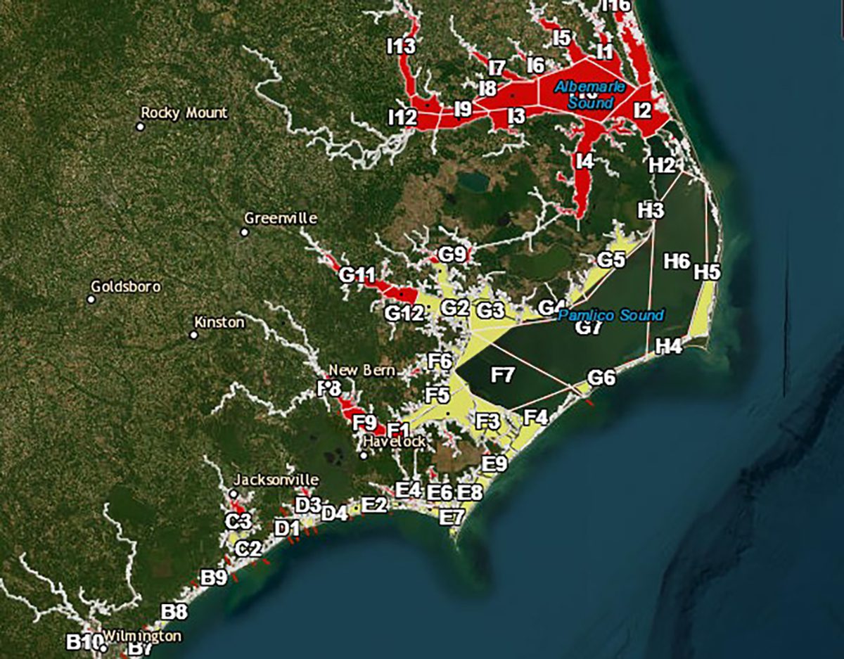
Areas in the northeastern part of the state are permanently closed to shellfishing.
It is unlawful for any person to take or attempt to take any oysters, clams or mussels or possess, sell or offer for sale any oysters, clams or mussels taken from the following polluted areas:
Supporter Spotlight
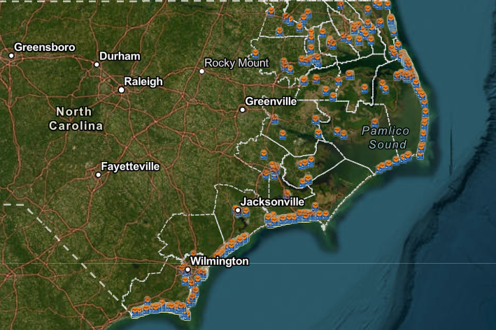
- All those waters bordered on the northeast by a line beginning at the Cedar Island Ferry Terminal, running southeasterly along the shore of Cedar Island to Camp Point; thence running southeasterly near Wainwright Island to a point on Core Banks at 34° 59.0185′ N – 76° 09.9344′ W; and bordered on the southwest by the South Carolina state line, to include all waters in Brunswick, New Hanover, Pender, and Onslow counties, as well as Bogue Sound, Newport River, North River, Ward Creek, Straits, Back Sound, Whitehurst Creek, Sleepy Creek, Jarrett Bay, Oyster Creek, Brett Bay, Nelson Bay, Thorofare Bay, Cedar Island Bay, and a portion of Core Sound.
- All those waters bordered in the east by a line beginning at Long Shoal Point, running southwesterly to the southern tip of Hog Island; thence running southwesterly to Bluff Point; thence running westerly to the southern tip of Great Island Marsh; thence running southwesterly to Maw Point, thence running southeasterly to Flashing Beacon “NR”, thence running southerly to Point of Marsh, thence running southeasterly to Point of Grass, thence following the shoreline of Cedar Island to the Cedar Island Ferry Terminal, to include Long Bay, West Bay, Turnagain Bay, Neuse River, South River, Adams Creek, Bay River, Jones Bay Pamlico River, Pungo River, Spencer Bay, Rose Bay, Swanquarter Bay, Juniper Bay, Wysocking Bay, and Long Shoal River.
- All those waters bordered on the north and west by a line beginning at a point 35° 28.2328′ N – 75° 29.0549′ W on the Outer Banks, running westerly to a point 35° 28.2938′ N – 75° 31.2790′ W on Gull Island; thence running southwesterly to Brooks Point.
- All those waters bordered on the north and west by a line beginning at Brooks Point, running southwesterly to the southern tip of DOT Island near Hatteras Inlet at 35° 12.1796′ N – 75° 45.6698′ W; thence running southwesterly to Channel Marker “6” off Ocracoke Village; thence running southwesterly to the northern tip of Beacon Island at 35° 05.9383′ N – 76° 02.8513′ W; thence running southeasterly to the southern tip of Ocracoke Island.
Shellfish Sanitation maintains an online temporary closure public viewer to help the public interpret written shellfish closure proclamations.
Swimming advisory
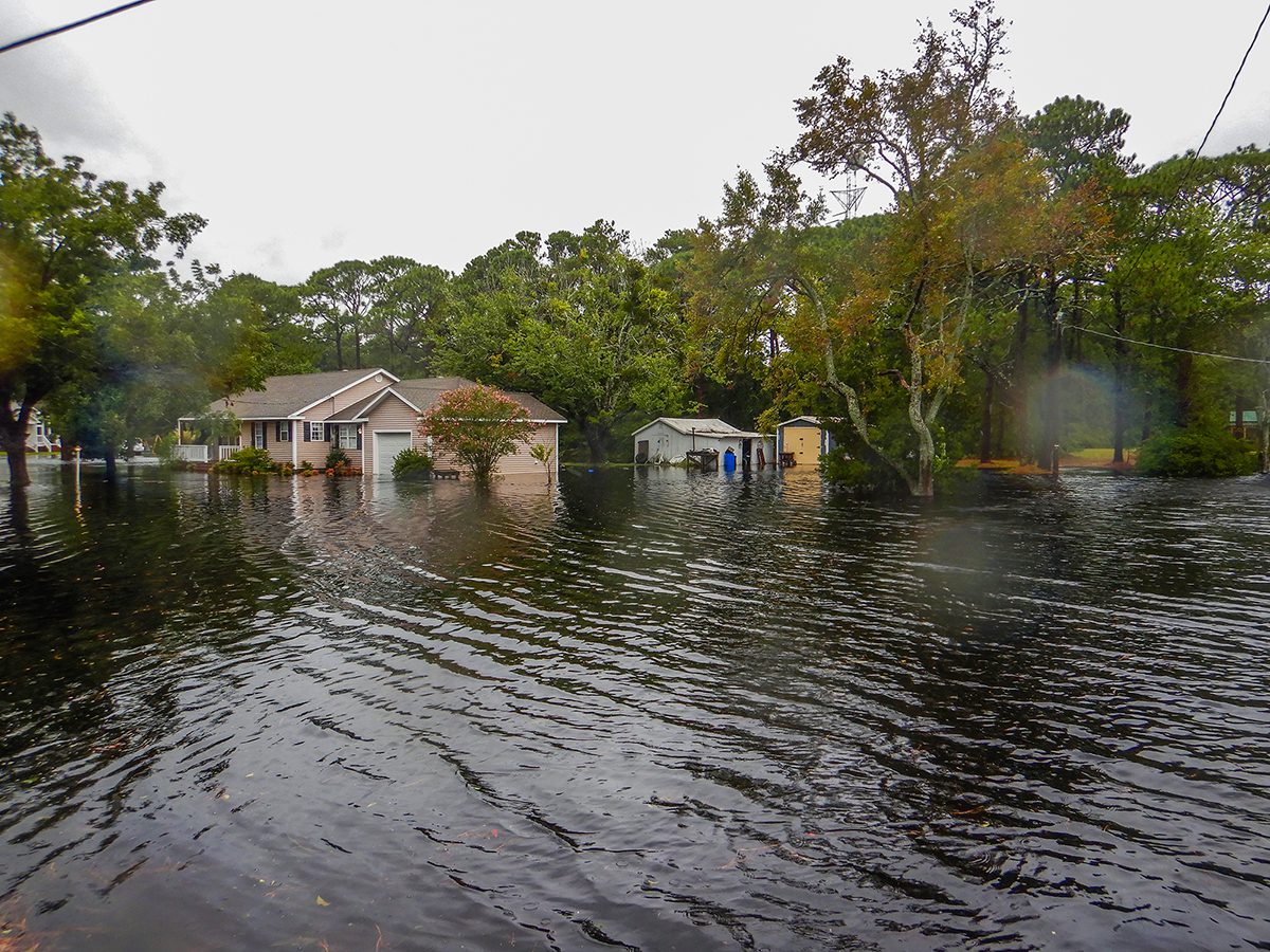
The storm caused flooding of streets, yards and housing that have resulted in some municipalities having to pump floodwaters into the ocean, state recreational water quality officials said. Avoid swimming near ocean outfalls, including the wet sand where the floodwater is pumped, even if no sign is posted.
“Severe weather events like tropical storms and hurricanes bring excessive amounts of rain, storm surge and cause extreme flooding. These conditions increase levels of harmful bacteria in our coastal waters that can cause illness,” said Erin Bryan-Millush, manager of the N.C. Recreational Water Quality Program. “The sources of bacteria can vary and include failing septic systems, sewer line breaks and overflowing manholes.”
While state officials do not have immediate laboratory confirmation that disease-causing organisms are in the water, storm impacts increase the chance that contamination is present thus increasing the risk of adverse health effects from swimming in these waters.
Residents and visitors should avoid swimming in these waters until bacteriological testing indicates sample results within the state’s and Environmental Protection Agency’s standards. Testing will begin as soon as conditions are safe and areas are accessible. The advisory will be lifted in part or in whole as test results become available.
Since the impacts are widespread, it is not possible to post signs in all areas.
Recreational water quality officials sample 215 sites throughout the coastal region, most of them on a weekly basis, from April to October. Testing continues on a reduced schedule during the rest of the year, when fewer people are in the water.


