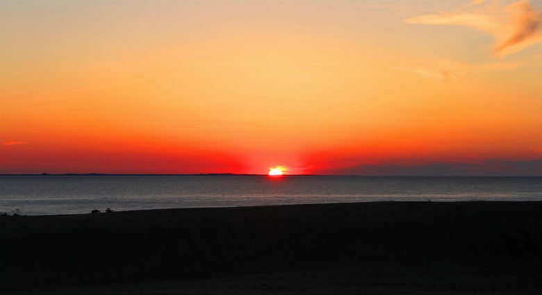
Like tens of thousands of tourists each year, Sam Bland hiked to the top of Jockey’s Ridge in Nags to capture the sun casting its dying light over Roanoke Sound.
Supporter Spotlight
 |
|
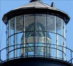 |
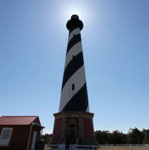
The Cape Hatteras Lighthouse was moved back from the ocean to a safer location. Visitors can climb to the top to see the Fresnel lens. |
The Outer Banks of North Carolina are one of my favorite places to spend some free time. I’m talking about Core Banks north to Corolla, the real Outer Banks. The rugged beauty, interesting culture, amazing history and diverse wildlife on this sandy ribbon of sand have always appealed to me.
So when my wife had a business trip scheduled for late March in the northern Outer Bank’s town of Duck in Currituck County, I begged to tag along. March is usually a great time to visit, tourists have yet to arrive and the daytime average temperature is 60 degrees.
Story & Photos
|
We departed for Duck under clear skies with a temperature of 50 degrees. Upon arrival we were greeted with snow showers, 34 degrees and blustery winds. No good for a couple of people with the thermoregulatory ability of a lizard.
The next morning, I headed south along N.C. 12, entering the Cape Hatteras National Seashore and into the area known as Bodie Island. When they say the word “Bodie,” most folks will hang onto the “o” and mispronounce the word. It’s pronounced “body,” which is how the island was originally spelled. It was named after the Body family that owned much of the island. It is not known why or when the name was changed to its current spelling. Local legend attributes that the name is actually a reference to the frequency of dead sailors that the washed ashore after shipwrecks.
Standing guard over the island is the black-and-white banded, freshly restored 170-foot-tall brick lighthouse. This is the third lighthouse serving the role as protector along this stretch of shoreline. The first, built in 1847, was so poorly constructed that it soon started sinking into the soft ground and began to list like the Tower of Pisa. It was eventually demolished and another guardian was built in 1859. This lighthouse was sound; however it was blown up by Confederate soldiers in 1861 to prevent invading Union troops from using it as a lookout post.
Supporter Spotlight
The existing lighthouse, completed 11 years later, stands proud and still contains the original Fresnel lens. Made up of hundreds of glass prisms, this lens can cut light through the darkest of nights for 19 miles.
The Park Service started a $2 million restoration effort in January of 2012. For the first time, visitors will be able to climb the 214 steps to the top of the lighthouse, starting April 19. The keeper’s duplex now serves as a visitor center, housing a great bookstore and displays about the lighthouse.
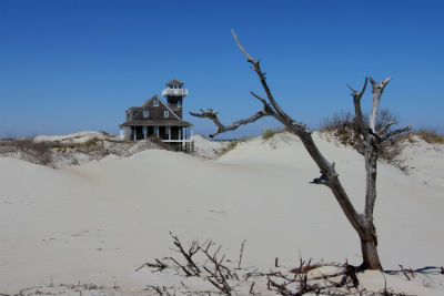 The old Oregon Inlet Lifesaving Station was abandoned more than 20 years ago and left to its fate. |
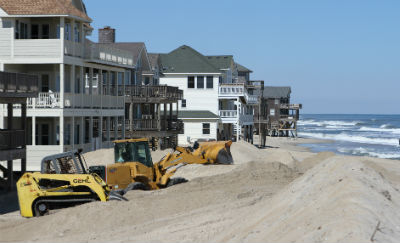 A few miles down N.C. 12 in Rodanthe, bulldozers and front-end loaders work feverishly to save houses from their fate. |
I continued south on N.C. and crossed over Oregon Inlet on the aging Herbert C. Bonner Bridge and landed on Hatteras Island and into the Pea Island National Wildlife Refuge. Off to the east, nestled among some sand dunes, I can see the lonely roof top of a building boasting the classic architecture of a Coast Guard lifesaving station. From a nearby parking lot, I follow a short trail through the dunes to this abandoned historic building. Built in 1897, the Oregon Inlet Lifesaving Station was one of 23 stations positioned along the Outer Banks where the cold Labrador currents clash with warm Gulf Stream waters creating fickle weather, unpredictable currents and expansive sandbars that baffled even the most experienced mariner. Lifesaving stations were a necessity to aid in the rescue of sailors that found themselves victimized by the harsh hand of the sea. This station stood at the ready near the inlet from 1897 until it closed in 1988.
According to local folklore, the name Oregon Inlet dates back to 1846 when the enormous storm surge of a hurricane pushed the steam vessel “Oregon” into the Pamlico Sound and cut open the inlet. The next day the Oregon made its way through the new inlet and continued on its voyage.
This section of N.C. 12 south to Rodanthe sits like a string of taffy placed on a bed of powder sugar. With the ocean just yards away, even the mildest of storms melts the sugar and twists the taffy creating uncertainty for the residents of Hatteras Island. Yellow excavators, front-end loaders and bulldozers are an almost permanent sight as they go about clearing the road of sand, creating makeshift dunes and tending to a temporary bridge that spans New Inlet, created by Hurricane Irene in 2011.
At the north end of Rodanthe, heavy equipment is still busy clearing away the debris and tons of sand deposited by Hurricane Sandy that hit in late October. As I pull into the debris covered entrance of an abandoned cottage, my wife excitedly utters an indiscernible plea, which I interpret as instructions to avoid the boards with nails. For the rest of the day, I call her Ms. Popatire.
Stepping out of the car, the rumbling sound of machinery and power tools fills the air. We walk out onto the beach and see that a soft wall of sand has been piled up as a last ditch effort to save the cottages for another vacation season. From here we can see three homes standing naked on their pilings in the surf and soon to be causality.
We then make our way to the Cape to see an old friend, the guardian of Diamond Shoals, the tallest of all brick lighthouses at 207 feet, the Cape Hatteras Lighthouse. Its candy striped black and white day markings looking a bit faded compared to the Bodie Island tower. We were on hand in 1999 to watch part of its glacial crawl as it was moved away from the threatening ocean to its current protected location. I walked the grounds and followed animal trails among the yaupon, wax myrtle and cedar. Eventually I stumbled upon on one of the freshwater wetlands that were full of great egrets preening in a cluster of the shrubs overhanging the water.
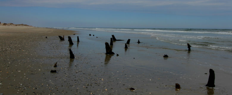
Stumps of old trees poke through the sand near Corolla. The stumps are remnants of trees that once grew on the soundside of the Currituck Banks. As the island moved back, the stumps ended up on the beach.
On our second morning I headed north of Duck, to Corolla and the Currituck Banks N.C. National Estuarine Research Reserve. It is here that I hoped to see the famous wild horses of Corolla. These animals have a history that goes back for centuries and their advocates worked long and hard to get the horses classified as registered wild Colonial Spanish Mustangs. Shipwrecks and explorers deposited these horses on our barrier islands and one time there were thousands of horses roaming the banks. Today there are a few hundred in herds at three sites: Shackleford Banks, Ocracoke Island and Corolla.
I parked my car in a small parking lot where N.C. 12 ends. From the lot, I see a boardwalk with a gate, on the gate a sign instructs visitors to make sure the gate is closed to prevent the escape of the horses. At onetime the horses wandered freely throughout the town but after a number were struck by vehicles, a non-profit support group, the Corolla Wild Horse Fund, built a fence that stretches from the sound and into the sea at the northern end of town. Another fence was built at the Virginia state line and the horses now have an eleven mile stretch of beach and 7,500 acres as their playground. These animals need to be protected; they are an iconic symbol of the rugged character needed to survive during earlier times on these harsh islands. They are such an important part of our cultural legacy that these noble mustangs have been designated as the official state horse of North Carolina.
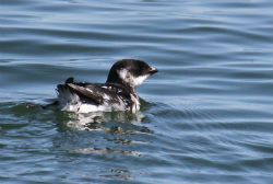 The dovekie spends the winter in the north Atlantic, but sometimes gets pushed south by storms and wind, as this one off Currituck Banks did. |
I stepped through the gate and closed it securely as I interpreted the message of the sign as an indication that finding the horses would be easy. Not far down the boardwalk, a side trail beckoned me into the maritime forest and away from the more sterile boardwalk. Even a placard warning of ticks, chiggers and snakes didn’t deter me; as cold as it was, I knew these critters were burrowed down somewhere trying to stay warm. The twisted shapes of the live oak trees throughout the trail were spiritual and almost daunting at the same time. Some of them seemed to be reaching out as I walked past.
This one way trail ended at the shore of the Currituck Sound where, unlike the other sounds in North Carolina, the water is almost fresh. Since the nearest inlet is nearly sixty miles south, there is little circulation of salt water in the northern reaches of the sound. This creates a peculiar habitat where flounder and red drum swim with the bass and catfish.
The maritime forest was so mesmerizing that I almost forgot about finding the horses. Since I hadn’t seen any in the forest I headed out onto the beach and could immediately see numerous dark objects on the horizon a couple of miles north. An outgoing tide created a flat firm surface suitable to be used as a roadway, which is exactly how the beach is used by anyone owning property north of Corolla. As I walked towards the horses a constant flow of four-wheel drive trucks and SUVs buzzed past. Seventy percent of the land from Corolla to the Virginia border is privately owned and a number of homes have been built among the dunes. It was apparent that low tide is the rush hour for the residents of this isolated community.
As I got closer, I notice that my objects on the beach were not moving at all. I pulled out my binoculars for a quick look and disappointment set in as I realized that my horses were actually old tree stumps. These stumps are great testimonials of the dynamic nature of the barrier islands. As these islands retreat, evidence of the sound side habitat will sometimes appear right on the beach.
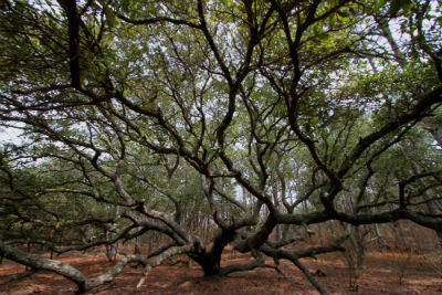 The twisting arms of giant live oak trees seem to reach out to visitors of the maritime forests of the Currituck Banks. |
Walking past the stumps I continued on my wild mustang quest. I hiked a few miles down the beach without seeing so much as a hoof print, and reluctantly, I dejectedly turned around for the long hike back. My mood turned brighter as I caught a glimpse of a small seabird floating just past the waves then disappearing under the water in search of food. This stocky black and white bird, is called a dovekie, or little auk, and has been making appearances up and down the N.C. coast this winter. Dovekies spend the winter in the north Atlantic, however strong storms or sustained winds can bring them down the East Coast, usually weak and starving. A large group of these weakened birds is called a “wreck,” and in the early 1930s a wreck of dovekies filled the streets of New York City and washed up as far as Florida. Fortunately, the dovekie I was watching appeared active and strong
I decided to spend my last evening on the Outer Banks watching the sun set at Jockey’s Ridge. That’s not a novel idea since hundreds of thousands of people makes a pilgrimage here every year to do just that. Their silhouettes look like shrubs in the fading light as groups gather together to share the experience. But because of the wind and cold, there was not a soul in sight; I had the ridge to myself. As the sun lowered, the sand glowed in a changing soft hue of orange, then red and finally pink. The waters of Roanoke Sound ran red while soaking up the last rays of the day before extinguishing the sun beneath its waters.
After the sun slipped away, I stayed on the ridge under the gathering darkness and was grateful that this pile of sand endures. I remembered the story of an amazing woman who 40 years ago this summer demonstrated great courage by standing in front of a bulldozer to protect the dune and another story of local islanders running off a group of biologists who wanted to plant kudzu to stabilize the dune.
I looked up and saw that the stars were like millions of lighthouses, each casting their own beacon. I realized that I have neglected my love of the night sky over the years and need to repair that relationship. Gazing deep into infinity, I didn’t feel small and insignificant at all. It made me realize that the footprints that we make and the paths that we create have a direction that is launched into its own infinity. All throughout the Outer Banks I saw the beauty of nature and the richness of culture that will endure for future generations to discover.
Then, like a child, I ran down the steep face of the dune into the cool darkness as my shoes filled with sand.

