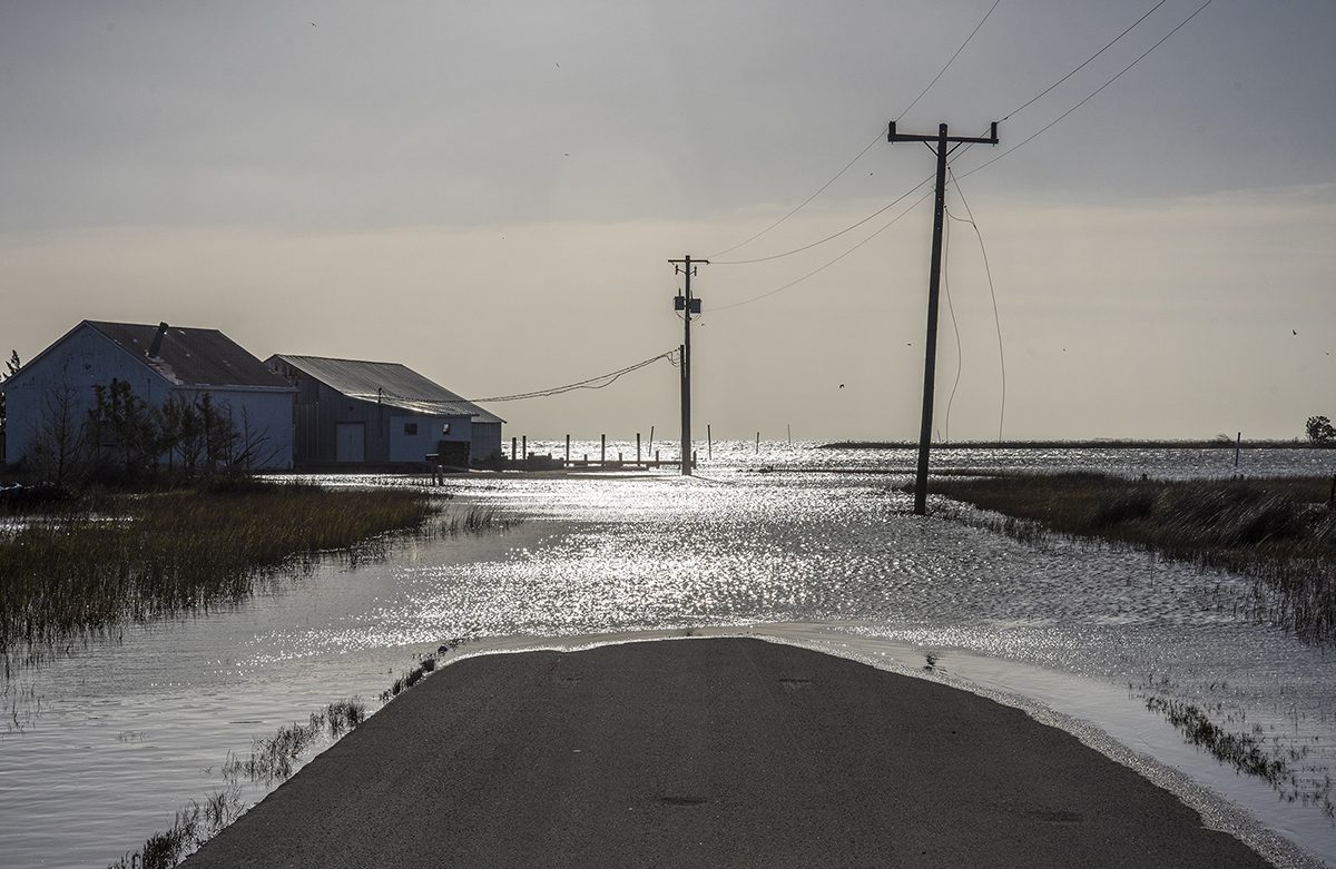
Coastal communities are inundated more often than previously believed, and floodwaters take longer to recede in rural areas than in urban areas, according to a new study.
The study, published Monday in the journal Communications Earth & Environment, also found that the way government agencies gather data used to predict floods fails to truly estimate how frequently water may get pushed over land.
Supporter Spotlight
“To capture the burden on coastal communities and to capture what people are really seeing on the ground, it’s so important to measure flooding on land,” said Dr. Miyuki Hino, a co-author of the study and assistant professor of city and regional planning at the University of North Carolina Chapel Hill.

What people living in Beaufort, Carolina Beach and Sea Level, an unincorporated area of Carteret County, told researchers they are seeing is that it floods “all the time,” said corresponding author Dr. Katherine Anarde, an assistant professor of coastal engineering at North Carolina State University.
“People know where it floods and a lot of people can put numbers to how frequently it floods, but as scientists, we just had no idea what ‘all the time’ meant,” she said.

To find that answer, researchers installed a network of in-house, custom-designed water level sensors in storm drains in Beaufort and Carolina Beach. Sensors were installed next to ditches cut along roads in Sea Level, a rural community about 28 miles northeast of Beaufort.
Each sensor measures when water rises and spills onto a nearby road.
Supporter Spotlight
The frequency at which that occurred during the course of the one-year study stunned researchers.
From May 2023 through April 2024, Beaufort experienced 26 days of flooding. Carolina Beach flooded 65 days.
And, “all the time” in Sea Level equated to 128 days of flooding. That’s one-third of the year, or once every three days.
“That was really shocking for me and I think for Miyuki too, just the sheer magnitude of flood days,” Anarde said.
It’s a reality in low-lying coastal areas where flooding is being driven more often by a combination of ingredients rather than large storm events.
The major ingredient, Hino said, is sea level rise. Rising seas strain storm drain systems and infrastructure designed decades ago when the ocean was much lower than it is today.
“And so while that highest tide 50 years ago, 100 years ago, might not have been high enough to get onto the road, now it is,” Hino said.
Sea level rise is exacerbating normal variations in water levels from tides and wind, which play a huge role in flood frequency.
If, for example, it rains on a day when a community’s storm drains are inundated with water from the tide, the rain that would normally drain into that system is pushed out across nearby roads.
But Mother Nature is not solely to blame.
Coastal areas have seen a population boom that has all but erased any semblance of what were once small fishing villages.
“Development definitely plays a role,” Anarde said. “Water has to have somewhere to go, and if the landscape is covered in impervious surfaces — roadways, buildings – then water is just going to sit on top of the road and on top of those impervious surfaces and create deeper, longer floods.”
Even in rural, low-lying areas that have fewer buildings and roads, water is not being absorbed into the ground at the rate it once was because sea level rise is elevating the groundwater table in the coastal plain.
One of the big motivations for installing the water level land sensors was to study how the different ingredients combine to cause flooding and, if you measure flooding from all of those sources, how the information gathered from those sensors compares to that taken from tide gauges.
Forecasters have widely relied on tide gauges to predict flood occurrences. The problem is, that is not what tide gauges are meant to do. And, there are many areas of the coast that are not close to a tide gauge, which are maintained by the National Oceanic and Atmospheric Administration.
“They do a great job at what they’re supposed to be doing, which is measuring water levels in oceans and bays,” Hino said. “But we knew that they’re not designed to measure flooding and that some of the other forces that influence flooding, like rain and local infrastructure, weren’t being captured there and so we wanted to know how accurate those tide gauge-based indicators are and how well they match up against what people living there are experiencing day to day and year to year.”
Over the course of the past five years, 11 land sensors have been installed in coastal areas of the state.
The information these sensors provide can help guide a community’s plan for a future expected to be only further impacted by sea level rise.
“We get asked a lot about how to fix this problem of more recurrent, chronic flooding in coastal areas,” Hino said. “There are solutions to the problem. They’re going to be different from place to place and many of them are going to involve difficult choices and so having more input from the affect people into what those choices are is really important.”
Jeremy Hardison, Carolina Beach’s director of Community Development, said in an interview last month that the study has “definitely” been a benefit to the town.
“We’ve kind of monitored how much water was in the street before, but not in the storm drains where the water is actually coming up during high tide events,” he said. “I don’t know that we would have come up with flooding sensors within our storm drains to monitor how much water is in our drains. We want to continue planning and we want to do some implementation and try to see what we can do to mitigate the problem so we’re working in that direction.”


