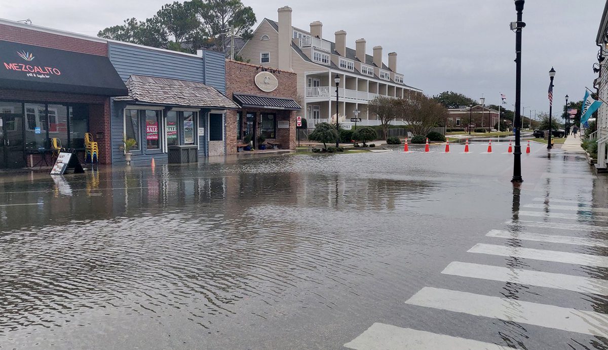
Beaufort’s historic Front Street is a bustling hub for local businesses, and strolling around the area is a must-do for tourists. But all this activity is disrupted when the town experiences flooding.
According to the National Oceanic and Atmospheric Administration, this has been happening more frequently over the past 20 years and will become increasingly common as sea levels continue to rise.
Supporter Spotlight
Thoroughly understanding flood dynamics is important for protecting people and property along the North Carolina coast.
A new study from University of North Carolina Chapel Hill and North Carolina State University researchers, led by former UNC Institute for the Environment researcher Adam Gold, has illuminated a hidden aspect of flooding not captured by NOAA’s flood observations. Gold currently is with the nonprofit Environmental Defense Fund.
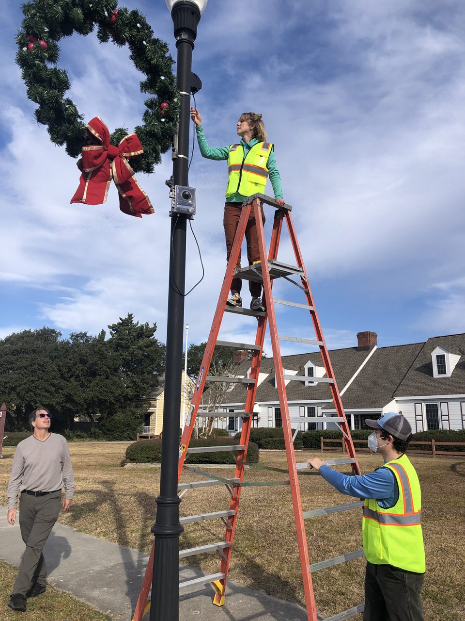
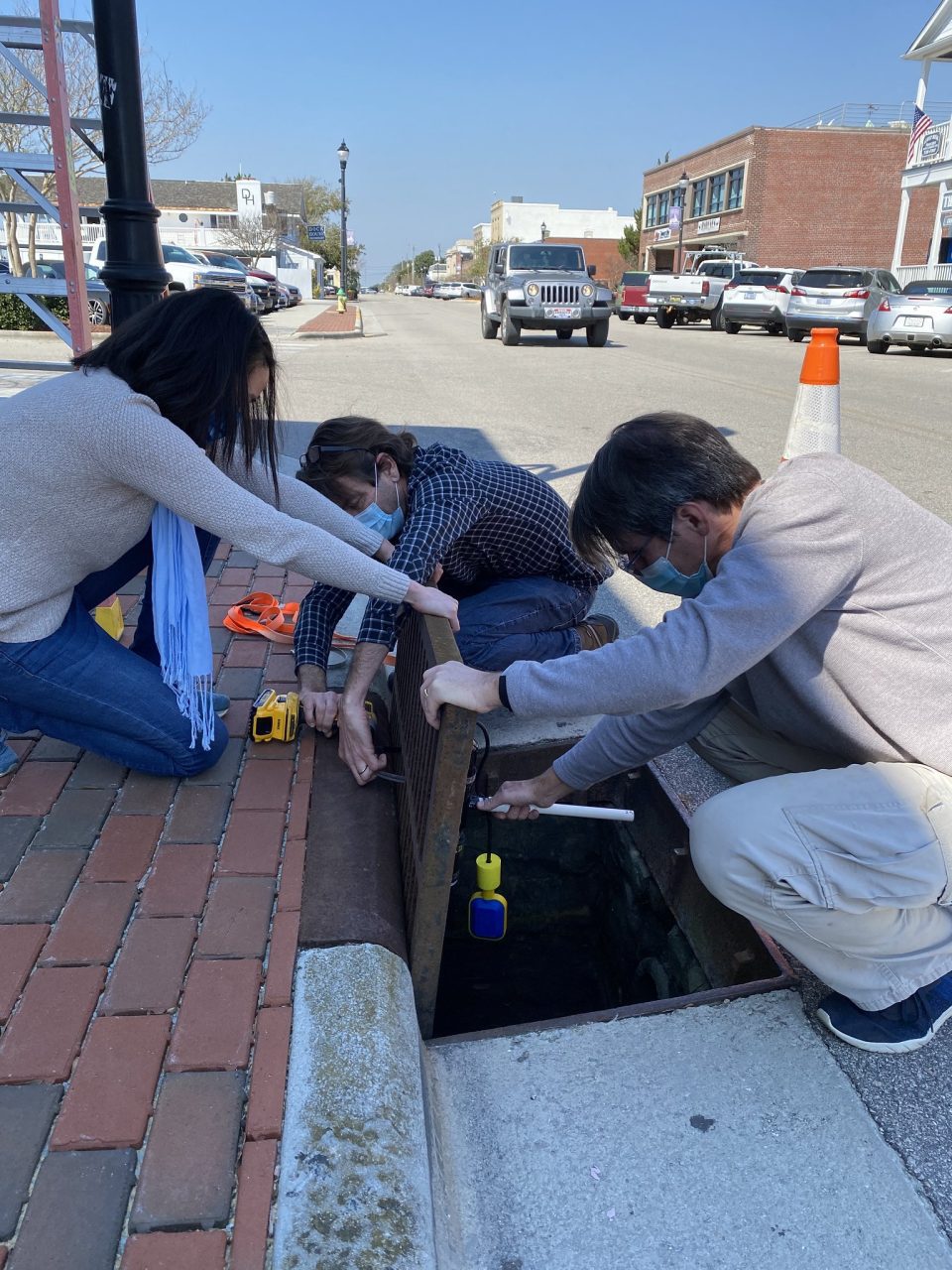
The researchers, who work together on the Sunny Day Flooding Project, used Beaufort’s Front Street as a case study to test a new, real-time sensor framework for detecting and measuring coastal flooding.
NOAA flood observations are based on data from tide gauges, which measure changes in water levels due to the tides, storm surge and river flow. But, the researchers found, they don’t capture flooding caused by rainfall, which accounted for 25% of the 24 flood events they observed in Beaufort during the five-month study period from June to November 2021.
These new measurements of rainfall-induced flooding begin to fill an important gap in flood records.
Supporter Spotlight
“It’s kind of an insidious problem,” Gold said. Because downtown Beaufort is so developed, rain can’t soak into the ground, and it runs into the underground drainage system instead.
“Ideally that would flow out to the sound or to Taylors Creek,” Gold explained. “But what we’re seeing is with these higher water levels in the tidal creek, that water is creeping up into the stormwater network.”
The drainage system eventually fills and water spills out onto streets and sidewalks.
“That’s the exact kind of flooding that future projections of coastal flooding don’t take into account,” Gold said.
This type of flooding, caused by the combined effect of sea level rise and rainfall, is called compound flooding. Colloquially, it is known as rainy-day flooding. Its counterpart, sunny-day flooding, occurs during exceptionally high tides in the absence of precipitation. Sunny-day flooding accounted for the remaining 75% of floods during the study period.
“Compound flooding is important to measure because flooding frequency is increasing with local sea level rise combined with heavy precipitation events,” said Molly Bost, an estuarine research scientist on contract with NOAA’s National Centers for Coastal Science Coastal Resilience, Restoration, and Assessment Branch in Beaufort and who was not involved with the research.
In addition to increasing scientific understanding of compound flooding in Beaufort, another benefit of the sensor framework the Sunny Day Flooding Project researchers developed is that it is linked to a publicly accessible web app. This means anyone with an internet connection can access the camera to see water levels on Front Street in real time. Headed to New Bern, Down East Carteret County, or Carolina Beach? Additional cameras extend the app’s reach to thoroughfares there, as well.
Bost said having real-time data and flood cameras can help mitigate risk. “Compound floods make roads impassable, hindering day-to-day operations across many industries at the coast,” she explained while pointing out that chronic flooding also degrades infrastructure.
The root cause of all this flooding — whether it occurs on sunny or rainy days — is sea level rise. Even on sunny days, during high tide, water can spill out onto roadways through stormwater drainage systems. The problem is magnified on rainy days. And it will only get worse: a 2022 report led by NOAA predicts sea levels along U.S. coasts will rise, on average, by 10-12 inches over the next 30 years.
Both Gold and Bost said quantifying the frequency and severity of compound flooding will help communities better adapt to sea level rise. Flooding can be hyperlocal depending on an area’s vegetation cover, distance to water bodies, topography, and even winds.
The sensor framework the Sunny Day Flooding Project team describes in their study published March 27, which is relatively inexpensive at just $650 for a pressure logger, subaerial camera and communications equipment, could be deployed elsewhere around Beaufort and other communities to see which locations are most susceptible to compound flooding.
This information could then inform adaptation planning. For example, on a street vulnerable to rainy day flooding, one-way valves in the stormwater drainage system are likely a better solution than higher sand dunes or waterfront bulkheads.
As towns up and down the North Carolina coast grapple with how they will adapt to flooding, one thing individuals can do is sign up for flood alerts through the Sunny Day Flooding Project’s web app. The system is still preliminary, but anyone can sign up to get an email when the sensor network detects likely flooding.


