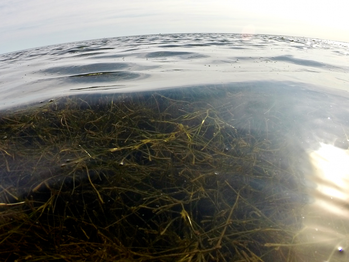
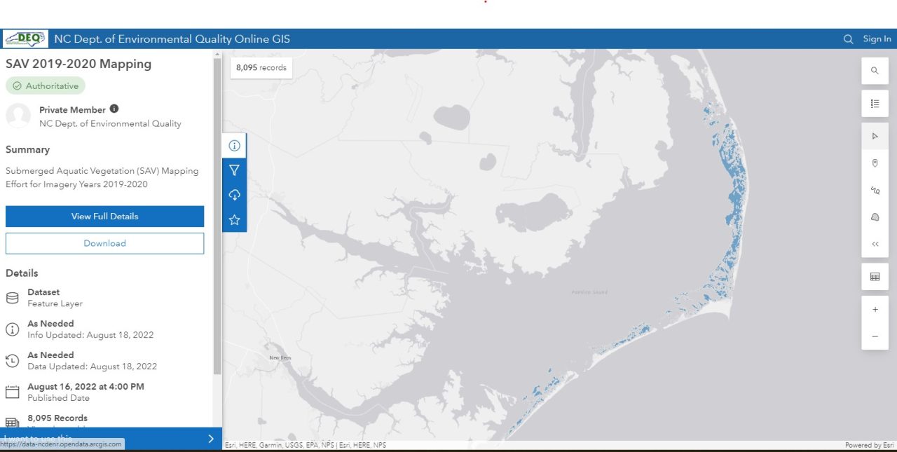
A map of underwater grasses in North Carolina sounds, an important tool in monitoring the coast’s environmental well-being, is newly updated.
The Albemarle-Pamlico National Estuary Partnership, or APNEP, worked with regional partners to create the updated map using data from 2020 that shows the amount and location of seagrasses, also called submerged aquatic vegetation, in the high-salinity areas of the Albemarle-Pamlico estuary.
Supporter Spotlight
“These mapping efforts are critical to understanding the locations and health of this important habitat within our sounds,” APNEP Director Dr. Bill Crowell said in a statement.
APNEP has been working for more than 30 years to identify, protect and restore resources in the Albemarle-Pamlico estuarine system, such as submerged aquatic vegetation.
Dr. Tim Ellis, APNEP’s quantitative ecologist, told Coastal Review that it’s important for the public to know about the health of submerged aquatic vegetation because it “is closely linked to many things people care about on the coast, including clean water, productive recreational and commercial fisheries, shoreline protection, and resiliency to major storms like hurricanes.”
Analysis of previous mapping efforts in 2006-08 and 2012-14 show that submerged aquatic vegetation resources are declining. The 2020 data will help researchers confirm whether and where seagrasses are continuing to decline, according to APNEP.
The 2020 data are being compared to previous maps, Ellis explained. While it is too early in the analysis to share even preliminary findings for specific regions, in general, for many of the areas examined so far, seagrass continues to decline.
Supporter Spotlight
“We attribute some of this decline to poor water clarity that limits the sunlight these underwater plants need to grow, particularly in the more developed regions; however, two recent major storm events — hurricanes Florence and Dorian — also certainly impacted SAV,” he said.
APNEP’s submerged aquatic vegetation team used a combination of aerial flights and ground truthing via boat-based surveys in 2020 to map the Albemarle-Pamlico estuary.
Ellis is a staff lead for the team that has members with various areas of expertise in long-term monitoring and assessment. Primary partners include the state Department of Transportation and the Division of Marine Fisheries.
Monitoring, which includes mapping, and assessment, or data analysis, are core components of APNEP’s efforts to develop and implement a protection strategy for the region, Ellis said.
“In 2021, we released a metric report on changes in the extent of high-salinity SAV. We are in the process of updating that change-detection analysis to include the new 2020 mapping information. We anticipate being able to provide this information to the public later this year,” Ellis said.
Ellis said that mapping submerged aquatic vegetation takes a lot of time and resources, as well as cooperation from the weather.
“For this mapping effort, aerial imagery was first acquired in June 2019,” he said, “but these images were deemed insufficient to reliably map SAV due to low-water clarity resulting from wind and rain in the days preceding the flights.”
The region was mapped again in May and June 2020 and that aerial imagery was largely sufficient.
“Given the vast amount of coastline and estuarine waters covered, as well as limited trained staff, delineating all of the visible SAV takes months to complete. That said, APNEP and its partners were able to produce this updated map of SAV much more quickly than our prior two mapping efforts, and we expect to continue to increase our mapping efficiency going forward depending on available resources and staff capacity,” Ellis continued. “APNEP is fortunate to be able to lead a large group of dedicated partners committed to monitoring and protecting SAV.”
Collaborative monitoring and assessment with partner organizations will continue annually as part of APNEP’s new regional strategy, with findings to be reported to the public as they become available, officials said.
Ellis explained that the new regional monitoring strategy is an effort to coordinate actions led by APNEP with regional partners.
“As being part of the EPA’s National Estuary Program, APNEP is required to have a monitoring plan for the region, and we’ve chosen to begin by formalizing our long-term strategy for SAV monitoring,” Ellis said.
“Briefly, rather than trying to fly and map the entire APNEP region for SAV every five years or so, we are now flying and mapping one different subregion each year,” he said. “This approach was designed to not only improve our mapping efficiency, but also to allow us to take an even closer look at the resource in each subregion to better understand seasonal variability in extent, abundance and species composition.”
In addition to the 2020 mapping data being used to determine where submerged aquatic vegetation is declining, the data is to help guide the development of protection and restoration strategies.
“These mapping efforts are a key component of North Carolina’s Coastal Habitat Protection Plan implementation,” APNEP Coastal Habitats Coordinator Jimmy Johnson said in a statement. “Protecting SAV habitat will increase the resilience of our coastal ecosystems overall.”
The Coastal Habitat Protection Plan, or CHPP, is a long-term effort developed by the state Division of Environmental Quality to improve coastal fisheries through habitat protection and enhancement. The state Marine Fisheries, Environmental Management and Coastal Resources commissions adopted the plan in 2004.
Johnson was part of the team that developed an amendment to the plan approved in 2021 that recommends actions to protect and restore submerged aquatic vegetation through water quality improvements.
APNEP is currently hosted by the state Department of Environmental Quality under a cooperative agreement with the Environmental Protection Agency and works closely with Virginia. The program area is from the headwaters in the Virginia mountains and North Carolina Piedmont, through the coastal plain and out to the string of barrier islands bordering the sounds, according to the website.
The EPA and NCDEQ provided APNEP with funding for this 2020 map update project, with field and technical support from the Division of Marine Fisheries and other partners.

