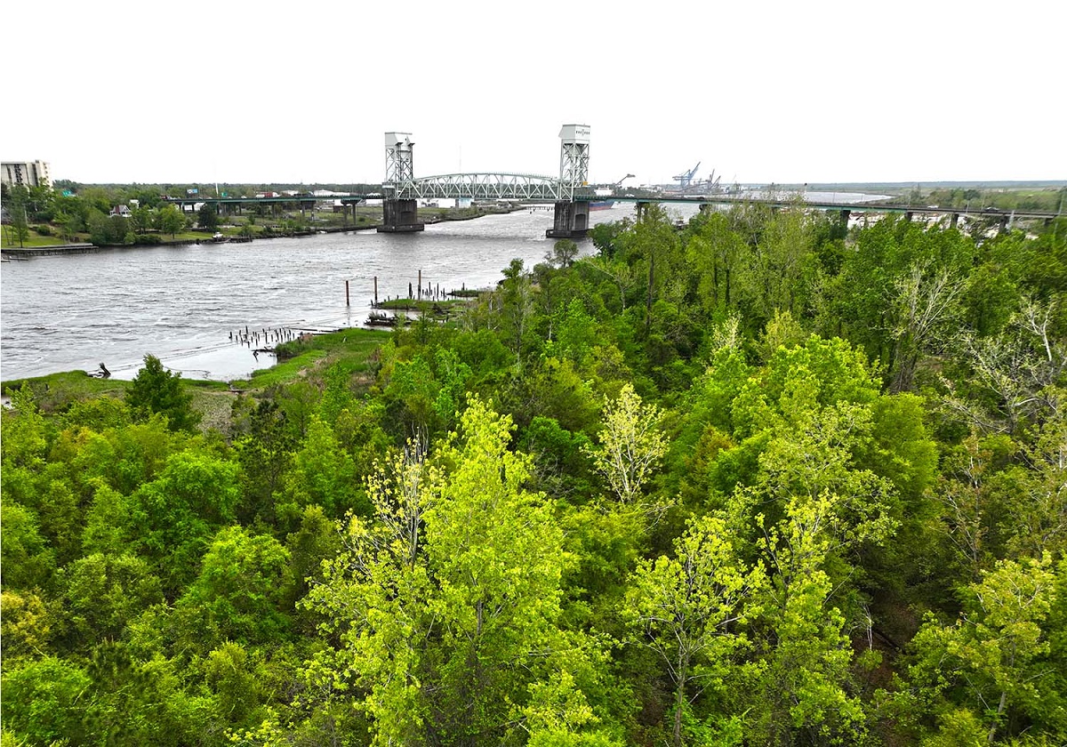
New Hanover commissioners want to know more about the land along the Cape Fear River’s west bank across from downtown Wilmington before determining any future rezoning of the property.
The board of commissioners last week instructed county staff to launch technical studies, including a hydrological study, so that they may better understand the types of development that may and may not be suitable on the land stretching between the Cape Fear Memorial Bridge and Isabel Holmes Bridge, and Eagles Island between the memorial bridge and the Thomas Rhodes Bridge on U.S. 421.
Supporter Spotlight
“Certainly that would bring some clarity to a number of these properties here,” Commissioner Rob Zapple said. “If we know there are going to be challenges up front, we really need to know what those challenges are. I’m definitely in favor of having more of these technical studies done so we really do understand the dynamic nature,” of the land.
Commissioners met Thursday for a second time this year to discuss the west bank’s future.
The meeting ended shortly after New Hanover County Manager Chris Coudriet informed board members they needed to address a request they tabled earlier this year to create a new zoning district and rezone an area known as Point Peter within that district.
Coudriet said the board will be presented again with KFJ Development Group’s request “likely with a recommendation to deny” in order for the county to further study the land.
KFJ Development Group is eyeing a little more than 8.5 acres for Battleship Point, a mixed-use development that would include a trio of 240 feet tall condominiums on Peter Point, a peninsula at the confluence of the Northeast Cape Fear and Cape Fear rivers.
Supporter Spotlight
Commissioners tabled the request in January, opting instead to look at the overall future development of the river bank, land projected to be significantly impacted by sea level rise.
KFJ took its request across the river to Leland, asking that town to annex the land and rezone it. The developers later withdrew that request.
Battleship Point is one of two major development proposals on the west bank.
A 6-acre plot on Eagles Island is the proposed site for a multi-story hotel and spa.
Much of the west bank, including Point Peter, is zoned industrial. Eagles Island is currently zoned commercial.
Chapel Hill-based conservation group Unique Places to Save is trying to raise $16 million by year’s end to buy 83 acres between the battleship and U.S. 17 on Eagles Island.
Diamondback Development LLC, which owns the land, recently entered into a purchase contract with the conservation group.
The nonprofit has indicated that if it raises the funds and purchases the land, the group will work with other local partners to improve the site for outdoor recreation, education and the conservation of natural resources.
Jay Shott, co-owner of Diamondback Development, told Coastal Review last month his group would “give conservation a chance” because of an outpouring of support to conserve the property.
Unique Places to Save Executive Director Clark Harris declined to disclose the amount of private, online donations the organization had so far received, saying in an email Friday that their focus is “getting initial momentum” from the $12 million grant the group applied for with the North Carolina Land and Water Fund.
“We received our initial scoring this week and believe it puts us in a competitive position for funding. We will be targeting larger private donors in parallel in the coming weeks, leading up to the decision period for the grant in late September.”
Online donations are being accepted at https://saveeaglesisland.org.
In April, commissioners held a workshop to discuss the land’s exposure to flooding, safety concerns, potential economic impacts and how stormwater runoff from the proposed developments might affect surrounding properties, including the National Historic Landmark USS North Carolina.
New Hanover County Planning Director Rebekah Roth presented commissioners last week with five different land use options within the area of the west bank the county will study. Those uses range from conservation, which would have the lowest impact on the land and likely the most restrictive, to urban scale mixed use, an option that would likely come with the highest price tag because it would require flood prevention and mitigation.
Moving forward, commissioners may consider refining the county’s vision for the western bank, create overlay zoning districts to put additional standards and mitigation measures in place, and, if mixed-use development is to be allowed on the land, update riverfront zoning to align with a comprehensive land use plan, Roth said.
Commissioners indicated studies of the properties should look at the future flooding potential of the land, risks of extending water and sewer lines to properties on the west bank that are likely to be impacted by sea level rise, and potential issues with emergency vehicles and residents being able to access the properties.
Roth said she believed the land within the county’s area of study is owned by at least seven different property owners, not including the battleship.
Roth said a more detailed assessment of flood vulnerability and a hydraulic assessment of the properties needs to be conducted before the county looks at traffic impacts.
Commissioner Deb Hayes said there is much that needs to be learned about the land before decisions about its future are made.
“I really feel strongly about those studies,” she said. “I think that will help inform us in order for us to really craft the best land use for that area.”


