This story has been updated to correct the proposed setback determinations within inlet hazard areas.
BEAUFORT – The state Division of Coastal Management has extended the public comment deadline on proposed redrawn inlet hazard area boundaries and building rules within them.
Supporter Spotlight
Public comments may be submitted through March 2, an additional month past the original Jan. 31 deadline.
Ken Richardson, a shoreline management specialist with the division, told members of the North Carolina Coastal Resources Advisory Council, or CRAC, on Wednesday that the division had received a hefty amount of comments about the proposed boundaries and rules.
Given the volume of comments the state had already received, Richardson said a staff summary of that public feedback would be presented to the Coastal Resources Commission, or CRC, which will likely discuss the proposed changes during its April meeting in Manteo.
“This is just kind of the start,” he said.
The CRC may discuss in April issues raised by the public, including proposed grandfathering dates related to rebuilding after storms, proposed limits on the size of structures built within the boundaries and whether the method established to draw the new boundaries accurately predicts erosion rates at the state’s developed inlets.
Supporter Spotlight
Spencer Rogers, a member of the Science Panel and CRAC, told fellow council members Wednesday that there are problems with some of the proposed changes.
The most serious, he said, is that erosion rates are severely underestimated at some of the inlets under the proposed rules.
Current Inlet Hazard Areas, or IHAs, were drawn based on the historic migration of the inlet shoreline.
Under the proposed changes, the vegetation line or static vegetation line, whichever is applicable, is used to establish setbacks within inlet hazard boundaries.
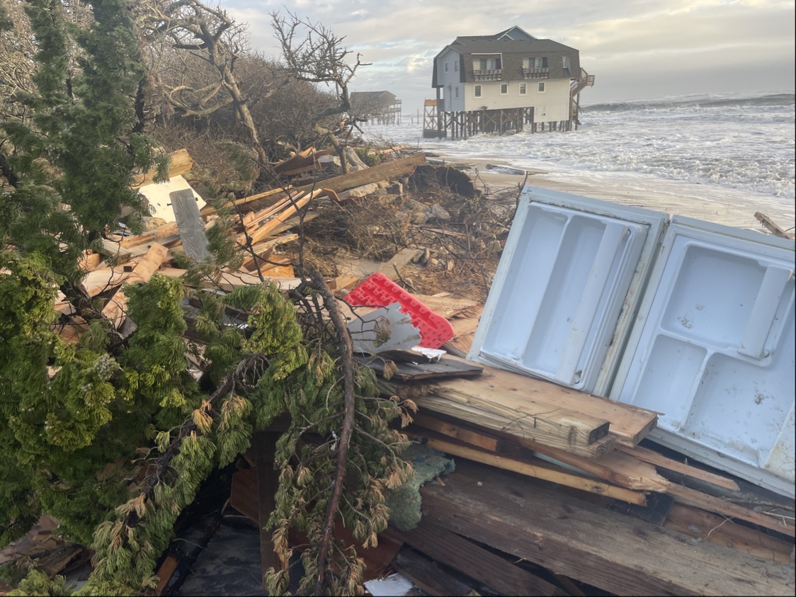
Inlet hazard areas are defined as shorelines especially vulnerable to erosion and flooding where inlets can shift suddenly and dramatically.
Erosion rates are more similar and evenly parallel along a straight shoreline. That’s not the case at inlet shores, which curve around.
Including the average oceanfront erosion shoreline rates with part or all of an inlet shoreline can distort the historical rate of change to an inlet’s shore, Rogers explained.
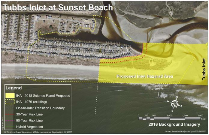
In a memo to the CRAC, Rogers points to Tubbs Inlet as an example of the disparity.
The Sunset Beach shoreline at Tubbs Inlet was “blocked” to have an erosion rate of 2 feet per year. That shoreline eroded about 1,000 feet between 2009 and 2014, a rate of about 200 feet a year, Rogers said.

Tubbs Inlet is one of 19 active inlets in the state. A little more than 2,900 acres at the state’s 10 developed inlets are designated as IHAs.
Those inlets include Tubbs, Shallotte and Lockwood Folly in Brunswick County; Carolina Beach, Masonboro, Mason and Rich in New Hanover County; New Topsail and New River in Pender County; and Bogue Inlet in Carteret County.
The proposed maps expand current IHAs collectively by a little more than 1,359 acres while removing about 470 acres from existing boundaries at the 10 developed inlets.
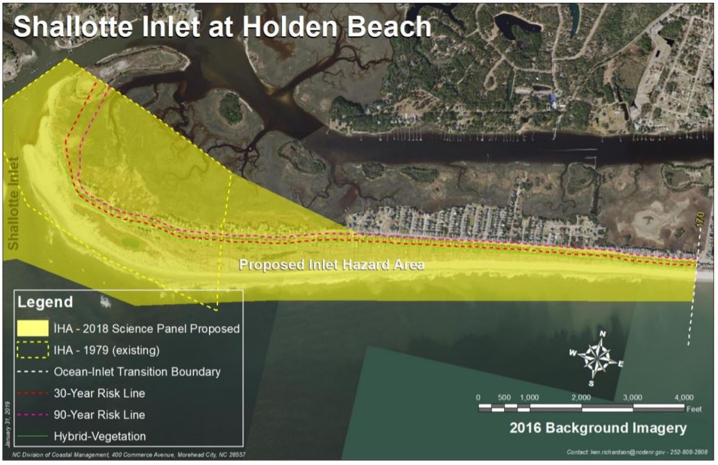
The greatest pushback on the proposed boundaries comes from Holden Beach in Brunswick County and North Topsail Beach in Onslow County.
During a series of public meetings DCM hosted late last year and into this year, beach property owners and town officials from Holden Beach expressed their concerns about the proposed expansion of the IHA at Shallotte Inlet eastward for about 2 miles from the end of the island, which is accreting.
The preliminary boundary encompasses a little more than 200 structures, nearly four times the 51 structures in the current IHA.
People have also criticized the proposed structure size limit within IHAs. New construction is limited to structures no larger than 5,000 square feet.
Rogers said the CRC needs to clarify whether that limit is strictly meant for buildings or all structures, including parking lots, roads and bridges.
He also suggested that the CRC consider changing the proposed grandfathering date of August 2009 to the date the new rules are adopted.
Currently, buildings in IHAs that are larger than 5,000 square feet and built before Aug. 11, 2009, may be rebuilt after a storm. Those buildings could not be rebuilt under the proposed rules.
Other changes to existing rules, including overturning the prohibition of dune construction near inlets, and changing the general permitting rule to allow bulldozing in IHAs may also be considered.
The Science Panel recommends that the IHA boundaries be updated every five years.
Submit comments
- Written comments may be sent to Braxton Davis at braxton.davis@ncdenr.gov or Ken Richardson at ken.richardson@ncdenr.gov.


