This is the first of two parts. The story is reprinted with permission from Bit + Grain, a new website devoted to telling the story of North Carolina – its people, places and culture.
Photos by Daniel Pullen
Supporter Spotlight
Baxter Benjamin Miller stood 6-feet, 8-inches tall with hands the size of a dinner plate. Almost every story I can recall about him begins this way, describing his physical stature, the size of his hands, his strength, fearlessness and stubbornness compared to that of an ox. He used every ounce of it he had. Stormy day after stormy night, he led his Lifesaving crew into the deep, dark, violent unknown risking their lives in the service of saving passengers from vessels wrecked helplessly upon angry shoals, beaten weak by bitter currents.
Like so many who call Hatteras Island home, the weather shaped my great-grandfather. His pensive nature, his blistered, calloused hands, his courageousness, by all accounts, mirrored the petulant storms that have brewed for centuries over the Diamond Shoals. The weather defined his life, his character, his purpose. For the better part of my life, because of him, I’ve been on a mission to understand how the forces of nature shape a place and a people and to understand what a storm feels like on the edge of the earth.
This is a story about a few of the men and women whose home is a fleeting sandbar; whose lives are dictated by the wind and the water; whose resolves are unshakable. These are the men and women who have weathered the storm.
Heading South
The moment you turn right onto N.C. 12 South at Whalebone Junction, one of North Carolina’s most scenic byways, you feel as if you’re leaving a world behind. The breeze gently tugs at your car, and egrets flank the pristine marshlands to your right. At golden hour, Bodie Island Lighthouse pierces through a radiant sunset.
One last curve of highway, and she appears: the criticized, condemned, celebrated and soon-to-be-replaced Bonner Bridge, your ticket across one of the most tumultuous and dynamic inlets on the East Coast, Oregon Inlet. At the bridge’s crest, the curve of the earth extends in all directions. The world ahead, Hatteras Island, seems boundless, filled with possibility, adventure and freedom.
Supporter Spotlight
Stretching 48 miles from Oregon Inlet to Hatteras Inlet, Hatteras Island makes up almost the entire southern half of North Carolina’s Outer Banks; it’s the heart of the Cape Hatteras National Seashore and home to seven villages: Rodanthe, Waves, Salvo, Avon, Buxton, Frisco and Hatteras. It is miraculous, really: a simple sandbar, three miles wide at its widest point, poised between two mighty bodies of water – the Atlantic Ocean and the Pamlico Sound. This thin, sliver of sand stands sentry to the mainland against an often destructive and angry sea. Resolute, yet adaptive, the island is ever-shifting with the wind and tide, breaching periodically to cut new inlets that can close just as quickly as they open.
Hatteras Island is home to what may be North Carolina’s most recognizable feature on a map: the protruding elbow that reaches far east into the Atlantic. The late David Stick, the premier Outer Banks historian, wrote that at the Cape, more familiarly known as The Point, “The Banks jut out so far into the Atlantic that the Gulf Stream currents caress the shoals, warming the atmosphere… Here the northbound Gulf Stream swerves out to sea as it encounters the cold waters coming down from the Labrador Current, and at the junction of the two is Diamond Shoals, the Graveyard of the Atlantic, a point of constant turbulence and of countless shipwrecks.”
This convergence creates an ecosystem of marine life from southern and northern latitudes, representing one of the few places in the world where such different species, like warm-water dolphin and cold-water tuna, can cohabitate. It also produces unpredictable wind patterns that forecasters for the Navy in Norfolk, who are responsible for routing ships safely through the Atlantic, often underestimate.
The Wind
Jan DeBlieu, longtime Outer Banker and author of Wind: How the Flow of Air Has Shaped Life, Myth and The Land, reports, “”Something happens out there, some local phenomenon that we’re just missing,’ one meteorologist told me. ‘The wind speeds we predict will be off by 10 or 15 miles per hour, sometimes more. It’s got to have something to do with the temperature difference between the Gulf Stream and the cooler water along the coast. But in terms of sea conditions, it makes a huge difference.”
You can see the wind everywhere here. You can see it in the intensity of the weather: in the storm that moves in from miles offshore in minutes, engulfing you in its rapture. You can read it on people’s faces: a light breeze has the ability to heal, while a strong northeast blow is a humbling reminder of mankind’s insignificance. And when you can’t see it, you can feel it in the sand biting at your ankles, and you can hear it in the yaupon trees hugging the sound, themselves bent and shaped by a powerful, persistent force. This island was formed by and revolves around the wind–its direction, its strength, its mood, its relationship with the ocean determines life here.
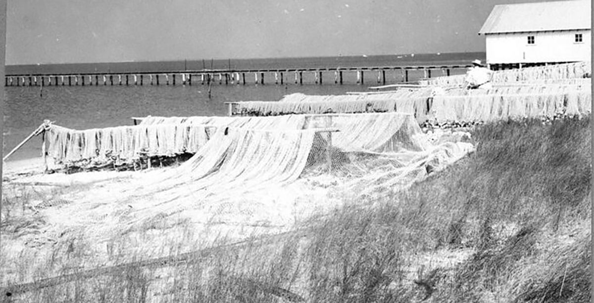
The day before I pulled up to Todd Ballance’s house in Hatteras Village, gray skies had engulfed the Island and intermittent bands of rain moved in across the horizon with a steady wind from the northeast. I walked under the stilted house, where Ballance, who is a commercial fisherman and the chief of Hatteras Village’s Volunteer Fire Department, was repairing pound nets strung between two wooden posts.
“How about this weather?” I asked him.
Pausing to shake my hand, “Bad for me and good for you,” he replied. “If I could get out to set my nets, I wouldn’t be able to meet you. No nets means no money. And, it looks like this low’s going to hang around for a while, too.”
As a commercial pound net fisherman, his livelihood depends on the weather. Like so many watermen on Hatteras Island, predicting the weather comes as naturally as hauling in the day’s catch. Throughout history and prior to modern technology, mariners have relied on observations of the wind, sea swells and currents, clouds, celestial signs, atmospheric colors, smells and animal behavior to forecast weather. Learned, genetic, or a product of patient observation, the ability of many Hatteras Island natives to read and understand the weather is almost a surreal phenomenon.
Ballance, a descendant of a multi-generational Hatteras family, was raised on reading weather patterns that, today, help inform how he and his family prepare for storms. “We make decisions about when and how we’re going to prepare [for storms] from past experience and looking at the weather to see what size the storm is going to be,” he says. “And when I say weather, I don’t mean the forecast. I’m looking at barometric pressure to see where the lows are going to be – the lows coming off of Florida – and ‘Is there a high pressure that’s going to come down off the jet stream and suck it right up to us?’ I’m reading all of that and the water temperature, air temperature, wind direction, the wind shear – all that stuff makes a big difference.
Storm preparation across the villages is no less of an art form than storm prediction. It’s always been this way.
Ballance and his wife, Mary Ellon, explain, “When there’s a late season storm coming, we have to start deciding: ‘Are we going to pull (the pound nets)? It’s a three-day commitment to pick everything up out of the water and loss of income, (but) if you leave them out and a storm comes, too bad. You’re probably going to get wiped out.”
“We took a chance one year and left them out in a small storm with just 60-miles per hour winds, and we got destroyed,” Mary Ellon remembers. “We found three sets of stairs that were racked up in one of the leads and tore it all to pieces. It’s your livelihood, so there’s a lot you have to think about and prepare for.”
Riding the Storm
This is one of many calculations Bankers make for a storm. They choose how to prepare their homes, whether to close up business and the ultimate choice – whether or not to evacuate. Each storm brings different variables to consider and Islanders have balanced these choices for generations.
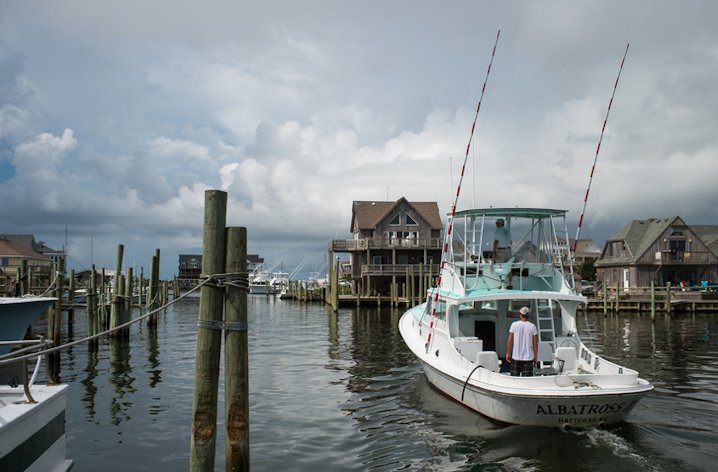
“What you see from those who have experienced it before, is a very focused preparation,” says Ernie Foster, Captain and owner of the Albatross Fleet, which gave birth to the charter fishing industry in the Outer Banks. “You get ready, you tie everything down, you batten down all the hatches. You do all the prep work with great focus, and then you’re ready. When the storm hits you go inside and stay inside until the worst of it’s over.”
Because of sage experience and calculated preparation, Islanders live with and experience storms in a rational and pragmatic manner. Foster’s childhood home had two stoppers under the interior steps. “The purpose of the stoppers was literally to let the water in so (the house) wouldn’t float,” he explains, “It was a very practical, pragmatic thing to do. The tide would come up and the tide would come down; the worry was when to start cleaning. But what I remember is when you got six inches to a foot of water in the house, it didn’t shake as bad – and that was good.”
Everyone on Hatteras Island abides by a similar routine when preparing for a hurricane: take care of your business, then tend to your home; start outside and work your way in. There’s no time to think about the big picture or what might happen over the next few days – there’s too much work to be done.
Natalie Perry Kavanaugh, co-owner of Frisco Rod and Gun, echos this sentiment, “Preparing for a storm is pretty methodical. You calmly go through each step and mark it off the list. You get your insurance papers together. You put family photos in a plastic bag that you can grab in a hurry if you need to. Get your business settled and then get your house settled. And then you wait. A whole lot of waiting.”

