Reprinted from the Island Free Press
RODANTHE– A project to widen the beach to protect beleaguered and battered N.C. 12 on the north end of this town on Hatteras Island will not be ready for construction for months, despite some public perception that it would be completed before hurricane season.
Supporter Spotlight
“It was misinformation that we were going to be pumping this spring,” said Bob Keistler, project manager for the Corps of Engineers. “We’re working with all the resource agencies. It’s going to be more like a late summer/early fall placement.”
Meanwhile, the state Department of Transportation will be keeping a close eye on the vulnerable area of road between S-curves at the south end of Pea Island and the Rodanthe pier.
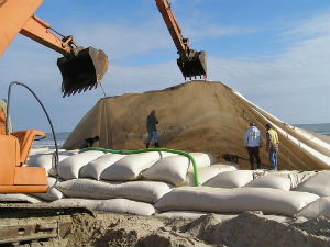
“We will do the best we can to clear the sand and water off the road if we do have overwash,” said Jerry Jennings, a DOT division engineer. “There’s really nothing else we can do. We do have that significant sandbag system that was put in place to protect the highway.”
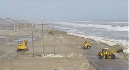
 Department of Transportation crews work to clear N.C. 12 near Rodanthe after a storm in March. Photo: NCDOT |
Engineers are providing bi-weekly updates to state leadership in several departments, he said.
On March 19, Gov. Pat McCrory declared a state of emergency for the Rodanthe area and ordered all state and local government agencies to cooperate in implementing short- and long-term measures to protect the road. A similar federal declaration was issued on April 8.
Supporter Spotlight
Some islanders said that statements sent out after a meeting in Manteo with the governor and the Transportation Secretary led them to believe that the work would be done before June 1.
“To begin this process after the hurricane season is well under way is pathetic to say the least,” said Jett Ferebee, owner of Camp Hatteras, in an e-mail to Jennings. “One marginal storm will destroy all of your work. This then opens us all up to the criticism that we are wasting money rebuilding this road.
“We truly are wasting money if we are not going to protect the road.”
The nourishment is intended as a temporary measure until the long-term alternative in Rodanthe is completed.
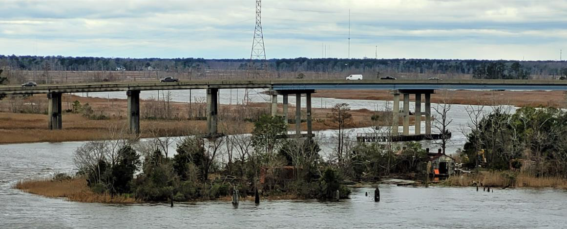
Beth Smyre, DOT project engineer for the Bonner Bridge replacement project, said that three public hearings planned for input on the environmental assessment detailing two proposed long-term alternatives at the Rodanthe breach have been moved back to August, when the document is expected to be released. The department, she said, has had to turn more of its focus on the Pea Island bridge that will be constructed to replace the temporary bridge now in place.
Despite the fact that the Pea Island Inlet is currently dry beach under the bridge, she said that the project is still considered necessary because of the vulnerability at that hot spot.
“It’s an area that has obviously been breached before,” she said. “If it happens there again, we’ve already covered it.”
A bridge contract is expected to be awarded in July, when DOT will apply for necessary contracts. Barring any delays from weather or legal challenges, Smyre said, construction will start in the fall and be completed in 2 to 2.5 years.
The Army Corps and the DOT have an agreement for the Corps to design and construct a beach-widening project at S-curves that would last three years. The 60- to 90-day project would be about two miles long. The proposed width has not been determined.
 Crews bury huge sandbags to protect N.C. 12. Photo: Outer Banks Voice |
Keistler said that contractors are in the process of surveying the beach profile and the offshore bar area to identify the amount and type of sand available.
“The question we have,” he said, “is we have to have a borrow source that has enough sand and the right quality and quantity of sand.”
Three areas are being targeted for the approximate two million cubic yards of sand that will be needed, he said. Two are at or near Wimble Shoals, located between 2 miles and 3.5 miles offshore. Area A is about 1 mile by 2 miles in size. Area B is about ½ mile by 2 miles in size.
The other potential dredge site is Oregon Inlet, which would necessitate pumping the sand through 12 to 15 miles of pipeline, which – in an effort to avoid effects to the beach and protected species – would likely run along the highway in the right of way.
Both locations have their pluses and minuses, Keistler said. Wimble Shoals sand, analyzed years ago by the U.S. Geological Survey, could be suitable, although some of the data is 20 years old. There is also the concern that offshore cultural or historic resources could be affected.
“It’s the Graveyard of the Atlantic, so the chances of finding something are pretty good,” he said.
Oregon Inlet, as the Corps knows all too well, has plenty of sand, and it is would be good match in quality. The stickler is cost and engineering challenges.
“The further you pump,” Keistler said, “the more expensive it is.”
Dredging and pumping sand 15 miles down the road is conceivable, Keistler said, yet it’s beyond the distance contractors usually deal with in such projects. The department is about to put out an industry inquiry to gauge the feasibility, he said.
But another advantage, he said, is that because the Corps already has so much data about the sand, the Oregon Inlet option would allow pumping to begin as soon as July.
“If we have to get a permit to go offshore,” he said, “we have a lot more boxes to check.”
A state Coastal Area Management Act permit for the project has been obtained, according to DOT. The department has also applied for a special use permit from the National Park Service and from the U.S Fish and Wildlife Service and is awaiting final approval.
Once the sand sample surveys are completed, the DOT will apply for permits from the state Division of Water Quality. When the environmental assessment is completed, the document will be sent to the Federal Highways Administration for approval. At that point, the Corps will be able to issue its final permit, which would be followed by artifact data submitted by the state Department of Cultural Resources. Then a contractor can be hired and the project construction can begin.
According to Corps estimates, about 1.7 million cubic yards of sand –equal to 170,000 dump truck loads – will be needed.
The DOT is expected to decide on the sand source for the project by mid-month.


