With the shoreline surveys of three state-owned lands complete, North Carolina Office of State Archaeology officials are waiting for the contractor’s draft assessment of storm-related impacts before they can develop a plan to protect these vulnerable cultural sites.
When that data is delivered in the coming months about Hammocks Beach State Park in the Swansboro area, and Alligator River Game Land and the Scuppernong River section of Pettigrew State Park, both in Tyrrell County, Historic Preservation Archaeology Specialist Allyson Ropp said recently that her office intends to look at ways to protect the cultural sites on land, underwater and in the tidal zone.
Supporter Spotlight
Called North Carolina Shorescape Survey, this project and the Historic Cemetery Survey, which documented how cemeteries had been affected by hurricanes and identified unmarked cemeteries, are being funded through the Emergency Supplemental Historic Preservation Fund, administered by the National Park Service.
The state’s archaeology office was awarded $1 million of the $17 million North Carolina received following the storm surges, rain and high winds from hurricanes Florence and Michael in 2018. Those storms threatened coastal historic structures and archaeological sites, according to an October 2023 update on the project. Both projects have been in the planning stages since 2020. Fieldwork for the shore survey wrapped up in late 2023.
Scott Seibel, associate vice president of multinational infrastructure consulting firm AECOM, told Coastal Review last week that his team worked on the three sites this past fall and are producing the draft report now. The plan is to deliver the draft by early March.
If there’s anything of interest in the data, they will explore it further, and if not, Ropp said her office will complete its report and then hold public meetings, most likely in April.
The three sites were chosen using a model that ranked the state-owned and -managed lands by environmental and historical significance.
Supporter Spotlight
Ropp said she designed the model by combining known data on storm surge and sediment movement, historic maps and existing archaeological information to prioritize all of the state lands in the 12 counties. Those counties are Beaufort, Bertie, Brunswick, Carteret, Craven, Dare, Hyde, New Hanover, Onslow, Pamlico, Pender and Tyrrell.
The shoreline is the focus because, as Acting State Archaeologist and Deputy State Archaeologist Chris Southerly said, there was a lot of activity at the shoreline environment, such as fishing or wading out into the water to collect shellfish.
“I’d say almost the majority of the cultural interface that we have maritime dealings with in water happens in that 60 meters (about 197 feet) one way to 60 meters the other from the shoreline,” Southerly said.
Because that interface can be difficult to reach, land-based archaeologists may not go all the way to shore and in-water archaeologists will stop where the boat stops.
Shorelines are where “a lot of cultural material could be lost,” Southerly continued. For example, an American Indian could have dropped something into the muck while getting out of his dugout canoe, or English settlers from their vessels, or by soldiers during war time.
The project in the Swansboro area is looking at archaeological sites within the shoreline environment – about 60 meters inland from the low-tide mark and about 60 meters offshore the low-tide mark – “to see how archaeological resources in those areas are being impacted by shoreline erosion, hurricanes, storm surge, inundation in general,” Ropp said.
Hammocks Beach is one of the more vulnerable sites, Ropp said, because the state-managed park is part of a barrier island, has a lot of known resources, and has a high potential for more to be discovered. The land also has a rich African American maritime history, which is another reason the park topped the list.
There are 27 known sites on two of the protected islands and the mainland. “Most of those, I believe, are prehistoric shell middens,” she said.
A midden is a mound of refuse that may include shells, fish and deer bones and plant remains — things Indigenous peoples harvested from the landscapes around them.
Southerly noted that shell middens are extensive in Carteret County and parts of Onslow County and are usually indicative of long-term habitation by American Indians. This means there’s a higher probability of finding an intact Native American site nearby.
“Shell middens are one of the key markers to look for along the coastal area for pre-contact American Indians,” he said, and built-up shell middens are a good indication of repeated settlement or habitation.
Both sites in Tyrrell County have a high potential for plantation-related resources, canal building, shipwrecks, and general marine infrastructure.
AECOM, a cultural resource management firm with offices all over the East Coast, performed this fall the land and in-water surveys with a field crew of about 15 and around 10 in the office working on artifact analysis and geographic information system, or GIS data.
The area for each of the three projects was 60 meters landward of the shoreline and 200 meters, or 656 feet, into the water.
The fieldwork at Hammocks Beach State Park included both terrestrial and underwater archaeology, Seibel said. “We surveyed the entire shoreline area of the mainland portion of the park, all of the shoreline area of Huggins Island, and the sound-side shoreline of Bear Island.”
For the terrestrial archaeology, which took place from early October to early December 2023, most of the work involved shovel-digging test pits at 100- and 50-foot intervals within the project area. The pits were about 12 to 16 inches in diameter and about 3.3 feet in depth.
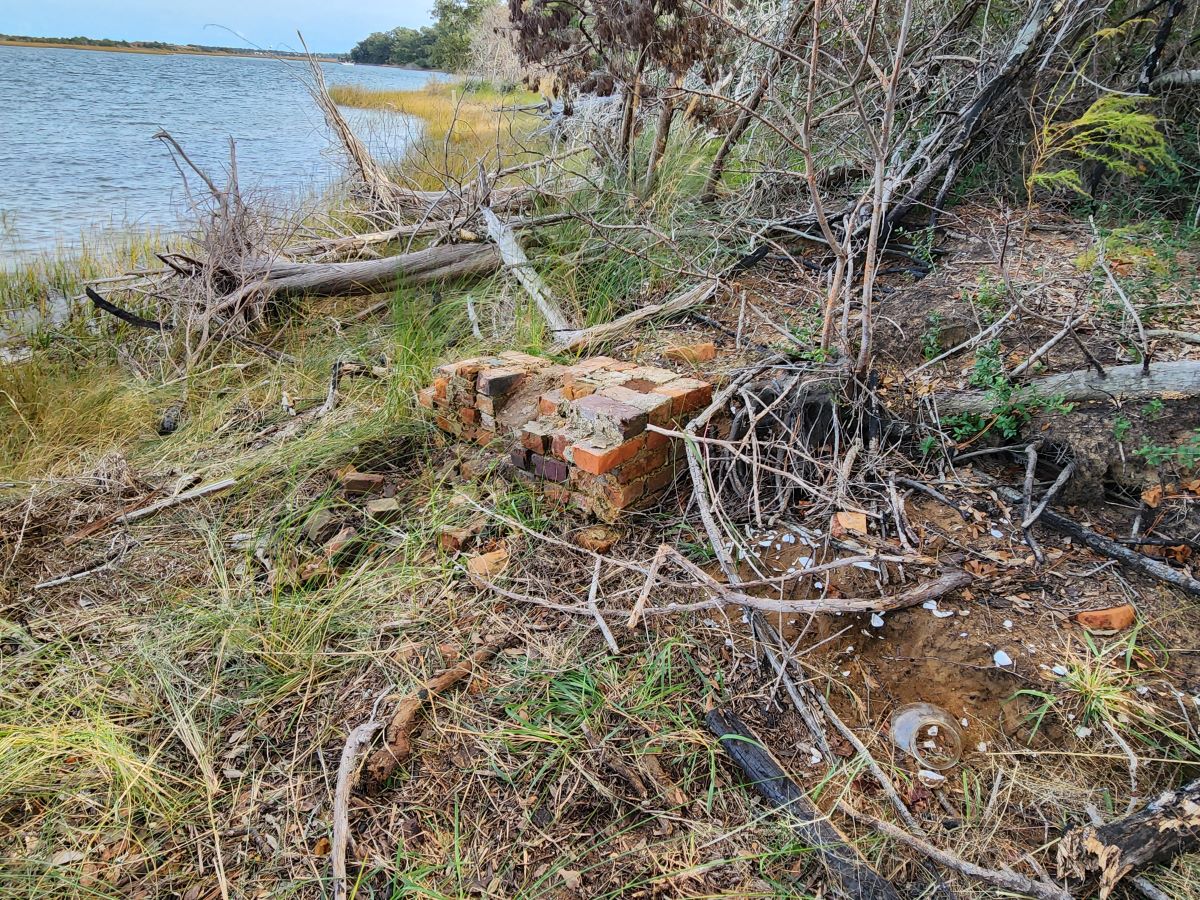
The sediments were screened through 0.25-inch wire mesh to collect artifacts such as ceramic sherds, stone flakes and oyster shell from the pre-contact middens. They found brick and glass, too.
“We also inspected the ground surface for artifacts and features, such as brick foundations from former houses,” Southerly said. “All of our shovel test pits and any features that we found were mapped using a GPS system. Along the shorelines, we used an electronic data form to record information about the condition of the shoreline and the possible threats to archaeological sites from things like waves, tree fall, and looting.”
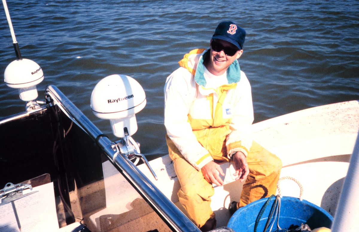
The underwater survey, which took about a week to complete, included using remote sensing equipment towed behind a boat including a side-scan sonar, magnetometer and sub-bottom profiler, Seibel continued.
“A side-scan sonar uses sound waves to produce images of the seafloor. A magnetometer records anomalies in the Earth’s magnetic field and is useful for identifying shipwrecks that contain iron, like nails,” he explained. “A sub-bottom profiler is similar to a side-scan sonar, except that it provides information about sediment layers below the seafloor and can be used to identify old and buried streams and terrestrial landforms from when sea levels were much lower than today.”
The terrestrial archaeology work was different at the two project locations in Tyrrell County, Seibel said.
“Along the Scuppernong River, since it was all cypress or cedar swamp, all we were able to do was slowly run a boat along the river’s edge to see if there were any signs of piers, docks, or other similar features or small areas that could be shovel tested,” he explained. “At the other project area along the Little Alligator River and fronting Albemarle Sound, most of the project area was also swamp, but often thick with phragmites, an invasive reedy plant. We were able to walk over the small beach areas looking for artifacts and dig shovel test pits in scattered areas.”
The underwater survey took about a week to complete for each of the areas, while the terrestrial survey work for all three areas totaled over three months last fall.
“As we expected, the mainland and Huggins Island portions of Hammocks Beach State Park have been used by people for thousands of years. Archaeological site types include large pre-contact shell middens and even a pre-contact village as well as the remains of historic home sites and a Confederate earthwork from the Civil War,” he said.
At the sites along the Little Alligator River and Albemarle Sound, remains of fishing pound nets in the water were found as well as small scatters of artifacts from 19th and early 20th century houses and farms that used to line the shoreline of Albemarle Sound. Remains of a sunken ship were found during the underwater survey.
“Regrettably, there were no finds of any kind within our survey area in the Scuppernong River,” he said.
Seibel explained that this kind of work is important to North Carolina because it can help the state understand the types of archaeological resources present at Hammocks Beach.
“The more important aspect of the work is determining which of the archaeological sites along the shorelines of the park are under the most environmental threat and providing recommendations about how the state can prioritize preservation actions to help protect the most vulnerable archaeological sites and help preserve them for future generations,” he said.
In addition to the archaeological survey work, Seibel said they’re including a shoreline assessment to let the state know the types of environmental threats the archaeological sites at the park are under.
The assessment includes looking at historic and present-day data to determine the level of shoreline erosion that has taken place over the past 100 years or more, as well as projections for future erosion and other threats. This information is being used to help assess which archaeological sites are at the most risk and provide recommendations to the state for preservation efforts.
Ropp said the survey is not only going to be the baseline to gather the data of what’s at these locations and what they look like, but also testing out the methodology.
Coming out of this work will be foundational data for these areas as well as a way to perform this work, and come up with a methodology that can be adjusted as needed.
Combining AECOM’s management strategy suggestions plus boots on the ground, “we can come up with a means to manage and mitigate and adjust to these coming changes,” Ropp said.
Southerly said this work is going to be valuable in the long term because the methodology can be further developed to collect data about the different types of shorelines that “you would assume would probably be very similar” but are different, like the Alligator River and Hammocks Beach.
“You’re still coastal, you’re on the sounds, but putting tools in the toolbox so to speak, and having a methodology, having techniques, knowing what works, knowing what doesn’t work, lets us and lets other archaeologists once these reports are published, look at it and adapt and evolve the sites and that alone — other than figuring out what we’ve got here in North Carolina — that methodology, those techniques that can go into the field that someone else can use can help sites elsewhere, help someone else manage the sites collect the data before the sites become inundated,” he said.
Within this project, Ropp explained they plan to look at known sites across the coastal counties to see where they are in relation to some of these climate projections, particularly with sea level rise. “There’ll be a lot coming out of this project beyond the survey that we’re doing on the shoreline.”
Ropp and Southerly are encouraging the public to share any history or information about Hammocks Beach and the sites in Tyrrell County. Email the team at archaeology@ncdcr.gov.


