Heavy shoaling has created a challenging water course for ferries that carry tens of thousands of visitors to Cape Lookout National Seashore where iconic structures, including the lighthouse, are being threatened by erosion.
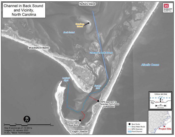
Now, for the first time in more than a decade, the National Park Service hopes to unclog two channels — Lighthouse Channel and U.S. Coast Guard Channel — that passenger ferries and private boaters use to access the park and place the material that is dredged onto the soundside beach in front of the lighthouse compound. The public has until June 8 to comment on the plan.
Supporter Spotlight

“The shoaling is not anything new,” Cape Lookout Superintendent Jeff West said. “It’s just part of life out here.”
But not since March 2006 have sand borrow areas within Barden Inlet been dredged and that sand placed on the beach at the historic lighthouse. Erosion has stripped that sand away, leaving the iconic structures vulnerable.
The federally maintained channel from Back Sound to Lookout Bight has not been dredged since 1997.
Boat strandings have become commonplace as a result of the heavy shoaling.
Many fishing and trawling boats cannot pass through Barden Inlet, which runs into Lookout Bight to the Atlantic Ocean, leaving the sole alternative of traveling nearly 9 miles west to Beaufort Inlet according to a draft environmental impact statement, or EIS, of the proposed project.
Supporter Spotlight
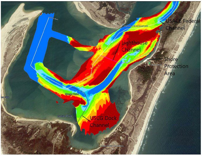
There is no record of when the two park service channels, which access the dock to the lighthouse compound and a dock to the old Cape Lookout U.S. Coast Guard Station, were last dredged, according to the permit application.
The Coast Guard pulled navigation buoys from Barden Inlet back in 2017.
West said a number of local boaters have gone out and marked the channels, but constantly shifting sand moved at the will of currents, storms and extreme lunar tides makes those efforts fruitless.
“Low tide out there is terribly difficult to navigate,” he said in a recent telephone interview. “If you’re not running it all the time, it’s even more difficult. Even our ferry service, and those guys make multiple trips every day, have had some problems. They are able to make most of the runs most of the time. It’s just that they may have to be a little bit more careful when they run what we call locally the ‘S’ turns.”
Each year some 110,000 passengers use passenger ferry service from Harkers Island to Cape Lookout, where a 200-foot docking facility leads to the 1859 lighthouse, lighthouse keeper’s quarters, a series of smaller structures and picnic areas.
Cape Lookout also can be accessed by passenger ferry service from Beaufort.
The park is home to the old Coast Guard station and a former residential village. The NPS plans in the future to use the now-dilapidated station dock for maintenance operations.
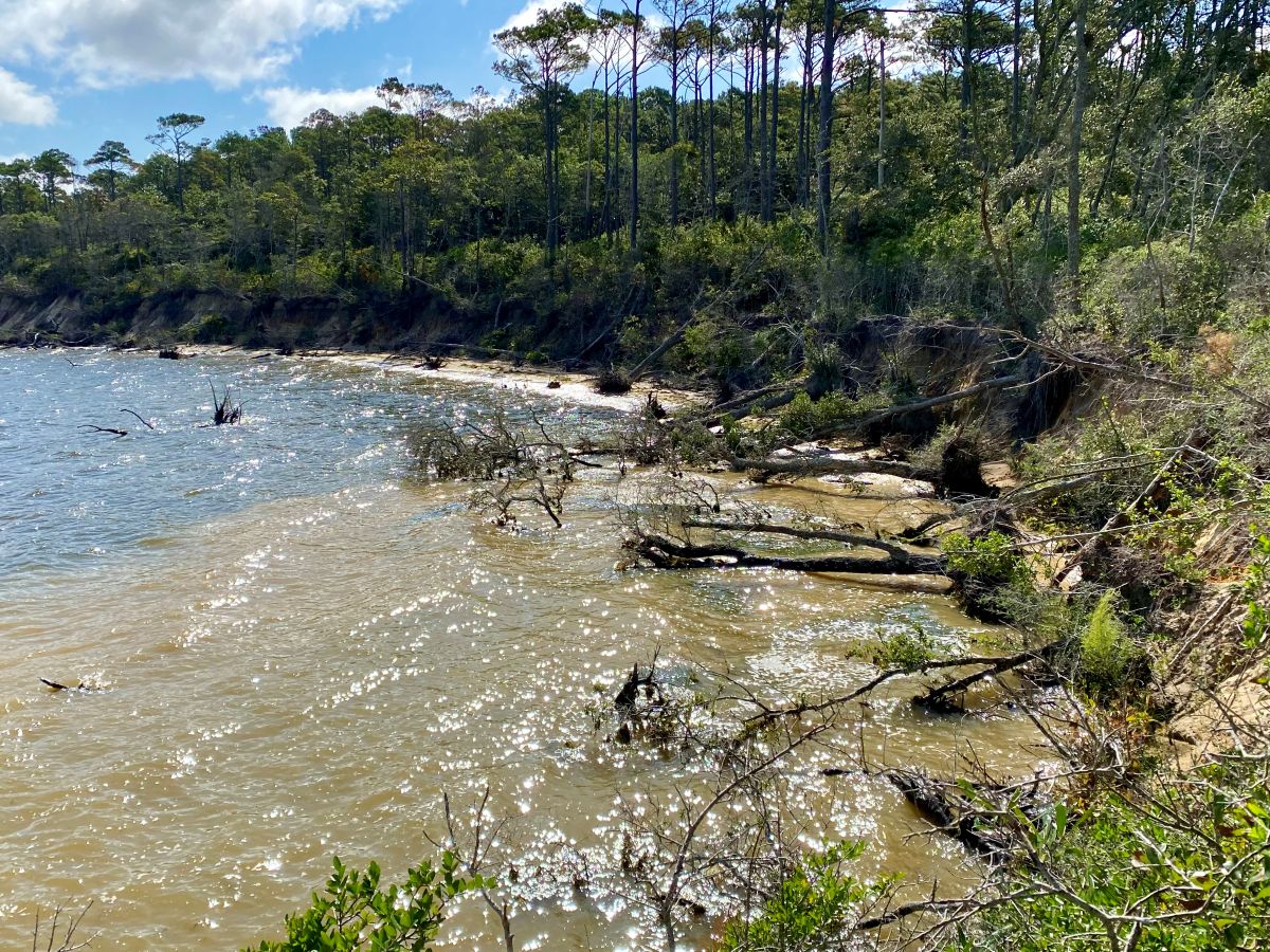
Erosion now threatens the 1873 lighthouse keeper’s quarters and summer kitchen.
“There’s a critical issue there,” West said.
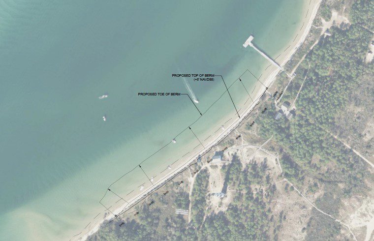
The 2006 nourishment project injected 74,000 cubic yards of material over a three-quarter-mile stretch of the soundside beach in front of the lighthouse compound.
An estimated 38,000 cubic yards of sand is anticipated to be placed on about 450 feet of beach if this next round of nourishment is approved, West said.
“Ultimately what we’re trying to do is keep direct ocean impact from striking those buildings and taking those out,” he said. “Anything there man-made over there on the banks is subject to be destroyed.”
The hope is to kick off the project – $6.5 million by rough estimates – on Nov. 1.
“We’ve still got to answer concerns that were raised during the environmental assessment process,” West said. “I don’t foresee anything major coming out of that.”
More than 150,000 cubic yards of material is anticipated to be dredged from the federal channel in Back Sound and placed onto Sandbag Island.
According to the draft EIS, which assessed three project alternatives, neither essential fish habitat nor related species in the proposed project area is expected to be adversely affected under the park service’s preferred alternative.
The preferred dredging locations are not likely to adversely affect sea turtles, sturgeon or manta rays, according to the study, but placement of dredged material may affect and will likely adversely affect sea turtles, piping plover, red knot and seabeach amaranth.
The National Park Service is seeking a 10-year permit to cover maintenance dredging and material placement two or three times within that time frame.
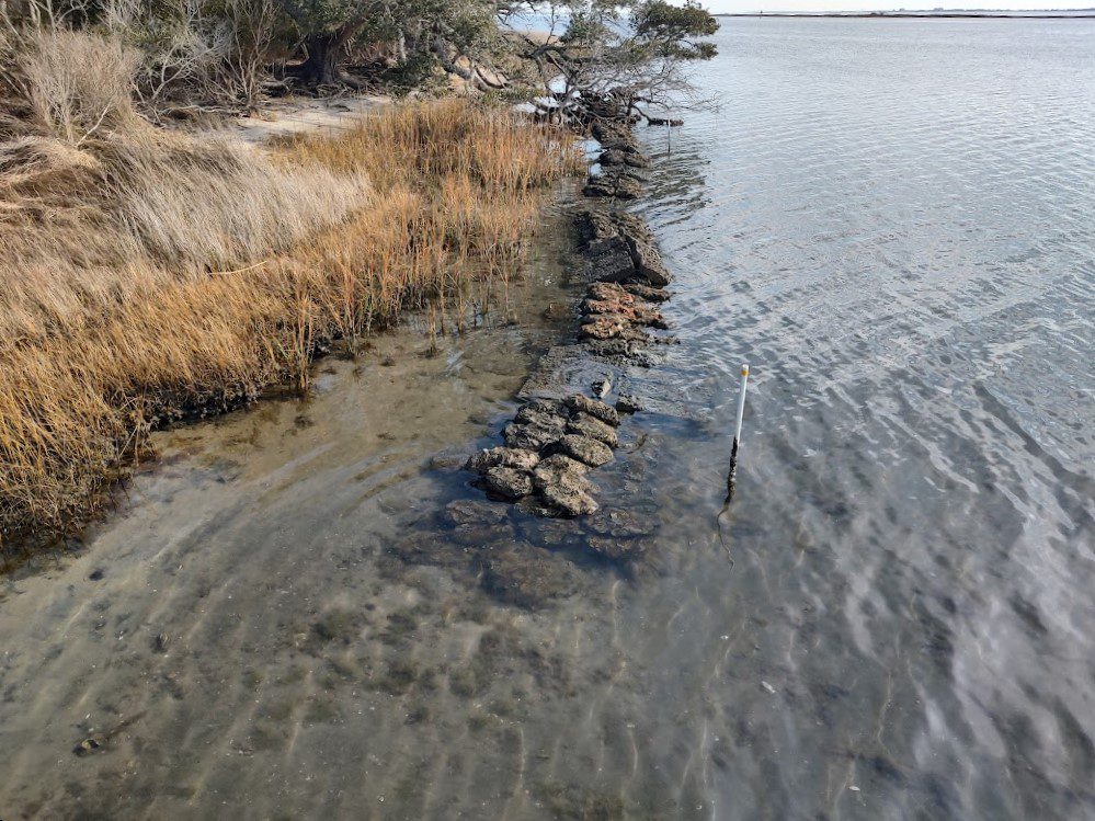
West said that, ultimately, the service’s goal is to install a living shoreline along the soundside beach to curb erosion.
The U.S. Army Corps of Engineers is accepting written public comments on the park service’s May 1 permit application until 5 p.m. June 8. Comments may be submitted to Emily Hughes, Wilmington Regulatory Field Office, 69 Darlington Ave. Wilmington, NC 28403, or by email at emily.b.hughes@usace.army.mil.


