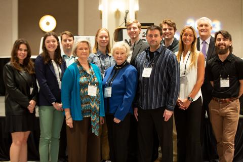
Five of the 13 college students who recently received the G. Herbert Stout Award for Innovative Student Papers attend coastal universities or their projects were on coastal and environmental issues.
The award presented during the North Carolina Geographic Information Systems Conference recognizes students that have completed an “outstanding project using geographic data to analyze or solve a problem regarding an issue of their choosing,” according to the North Carolina Department of Information Technology.
Supporter Spotlight
The NCGIS Conference, held every two years, offers opportunities for professionals and students of geographic information systems and computer mapping technology to network and learn about advancements and new applications for GIS software.
“College and university students represent the next generation of GIS professionals that will be future leaders in both the public and private sectors. Rewarding their academic achievement not only benefits the individual students but ultimately the GIS community as a whole,” Tim Johnson, conference chair and N.C. geographic information officer, said in a statement.
Colleges were able to submit one undergraduate and one graduate student for the award. Winners presented their papers at the NCGIS Conference. Each student received free registration to the conference, recognition at the awards luncheon ceremony and a cash award of $200.
The handful of projects related to the coast or could impact coastal residents looked at environmental justice, sustainability, climate change and the COVID-19 pandemic.
NCDIT provided the following information on the projects.
Supporter Spotlight
Cate Arnold, University of North Carolina Wilmington undergraduate student, was awarded for “Analyzing Impacts from Hurricane Florence on Gentrification in New Hanover County, North Carolina.” Arnold conducted research to determine a correlation between the gentrification process in New Hanover County and the flood impacts of Hurricane Florence. The project aims to identify natural disaster impacts, community resilience and environmental justice issues and will be presented to local policymakers.
Elijah Dalton, UNCW graduate student, was awarded for “Leveraging the Power of Google Earth Engine and Earth Observation Data to Create a Green Infrastructure Suitability Index for the Wilmington Metropolitan Urban Area.” Dalton’s research aimed to assess the benefits of green infrastructure as a strategy for enhancing sustainability and resiliency and the vulnerability of coastal resources. The project uses satellite data to develop a methodology for the effectiveness of green infrastructure in southeastern North Carolina.
Mike Wallace, North Carolina Central University graduate student, was awarded for his work, “COVID-19 Rates and Proximity to Meat and Poultry Processing Plants in North Carolina.” Wallace’s project examines the impact of economic inequalities and population distribution for rural and urban areas on the rate of COVID-19 cases. Wallace used data from the NC COVID-19 dashboard, created by the North Carolina Department of Health and Human Services.
Eliza Merrit, Appalachian State University graduate student, was awarded for “Using Interactive Maps to Understand the Content of Second-order Climate Change Beliefs.” Merrit’s study used public opinion maps to examine why people have certain beliefs about climate change. The study used an interactive map of N.C. climate change opinions to evaluate how GIS can be used for effective communication regarding climate change policy.
Caroline Fehlman, Appalachian State University undergraduate student, was awarded for “Exploring Characteristics of Community Resilience Using a Logistic Regression Model.” Fehlman examined the ability of communities to withstand or adapt from disturbances using data on climate variables, socioeconomic damages and community resilience. The study used maps to help communities determine what they need to do to prepare for and prevent damage.
Statewide awards
- Madison Eaton, Elon University undergraduate student, “The Impact of Soil Compaction and Land Cover on Soil Carbon Sequestration at Elon University.”
- Sarah Followill, UNC-Chapel Hill, undergraduate student, “Geovisualizing Urban Sprawl in the Atlanta Metro Area.”
- Ross Jensen, Fayetteville State University undergraduate student, “War Impacts on Landscape Change in Mariupol, Ukraine.”
- Andrea Saravitz, N.C. State University undergraduate student, “Modeling the Invasion of the Spongy Moth.”
- Neylan Visnius, Warren Wilson College undergraduate student, “Intersections of Food Insecurity, Medicare Spending, and Non-Health Interventions in Western North Carolina.”
- Cambria White, N.C. Central University undergraduate student, “Identifying Sources of Methane Leaks in the Bountiful/North Salt Lake Area.”
- Jeremy Davis, N.C. State University graduate student, “Town of Matthews, N.C.: Tree Canopy Assessment Tool.”
- Grey Shipman, UNC-Chapel Hill graduate student, “Transportation Equity in Chapel Hill.”
The conference is sponsored by the North Carolina Center for Geographic Information and Analysis, the N.C. Geographic Coordinating Council, and Carolina Chapter of the Urban and Regional Information Systems Association. The NCCGIA is part of the N.C. Department of Information Technology. Its mission is to advance the use of GIS technology as a tool for better decision-making in the state.


