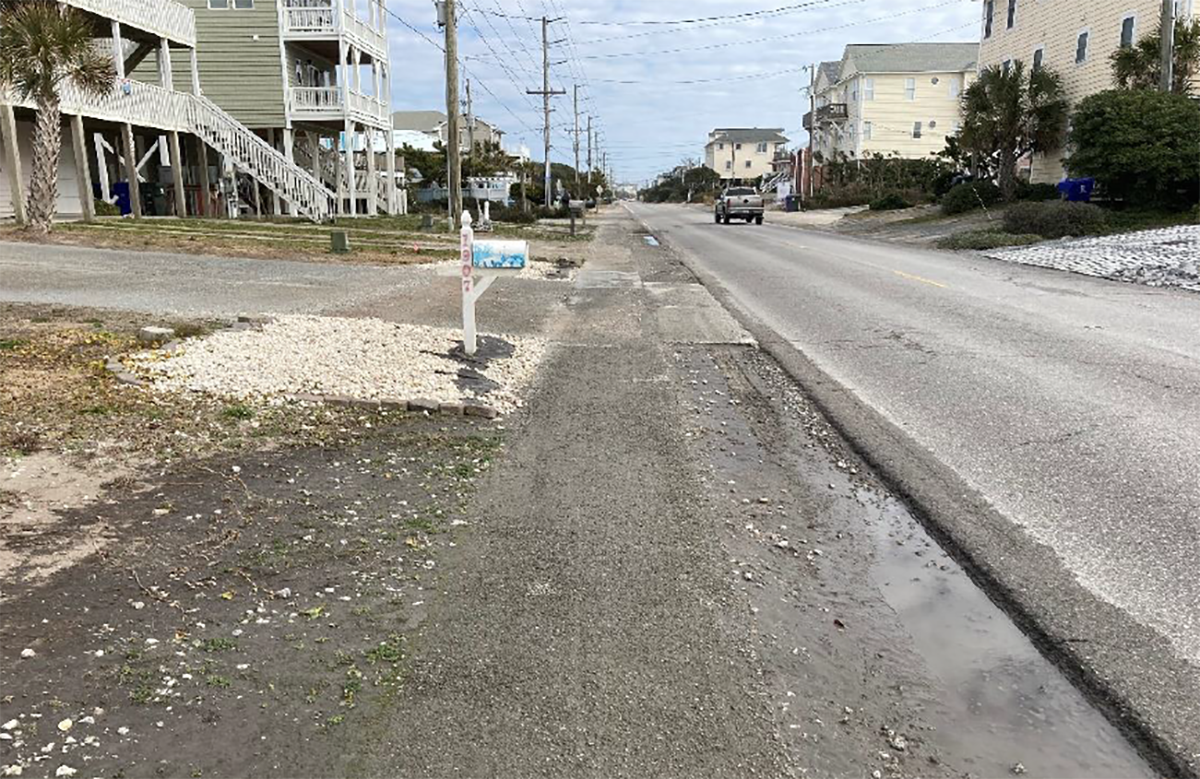
One of Surf City’s most traveled roads on Topsail Island is also one of the most flood-plagued after a good rain.
Heavy showers leave pools of water on a stretch of South Shore Drive, also N.C. 50, blocking motorists driving along the main thoroughfare from Surf City to Topsail Beach from safely passing through.
Supporter Spotlight
The town was recently awarded two grants totaling nearly $800,000 to move forward with a multiphase, nature-based project to divert floodwaters off the road and into the ground.
Efforts to get the project underway go back about two years, when Surf City and the North Carolina Department of Transportation, or DOT, began working together to figure out how to address the flooding.
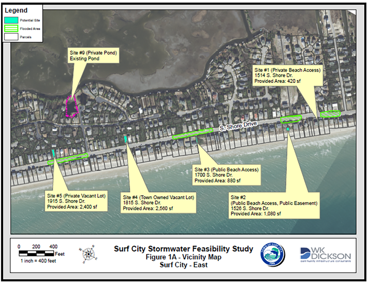
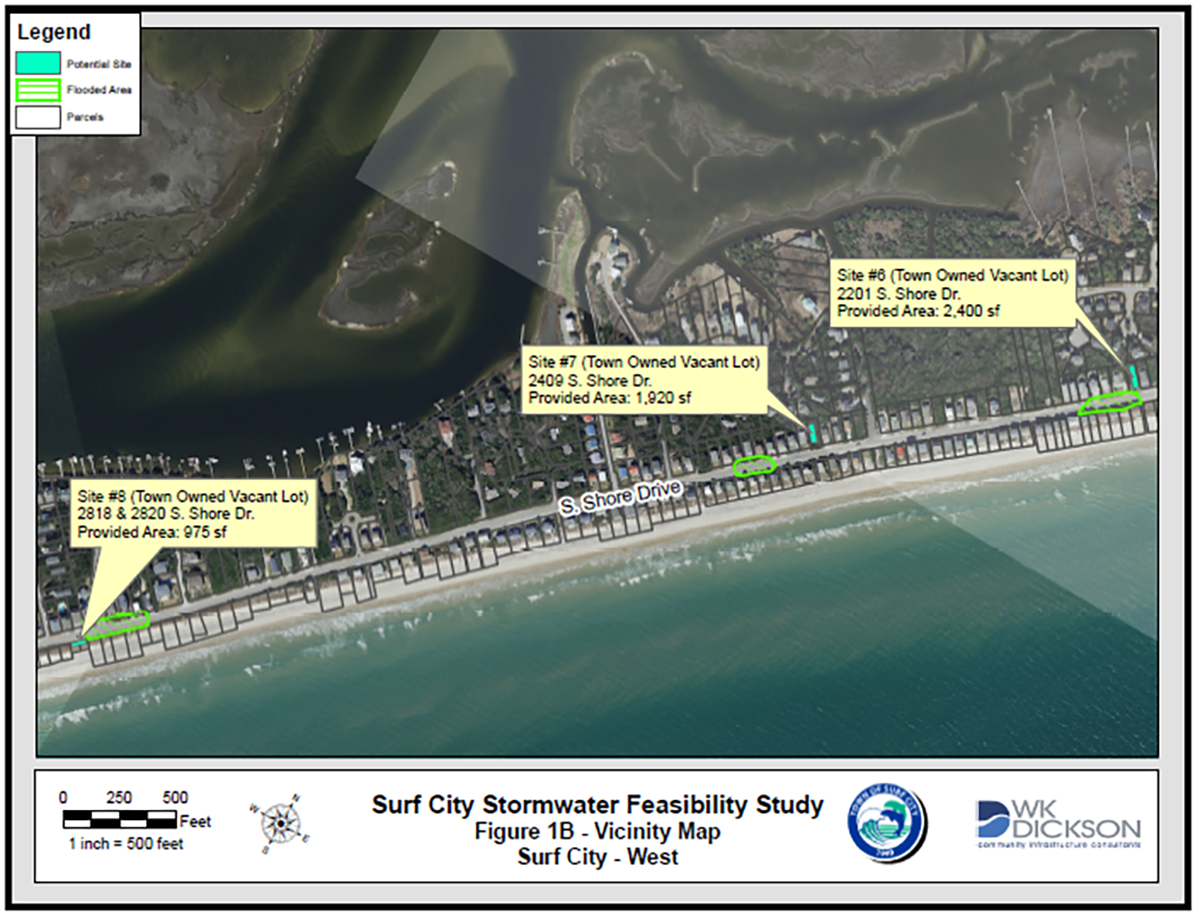
The town hired Charlotte-based engineer consulting firm W.K Dickson & Co. Inc. to study how to divert water from seven critical flooding areas along South Shore Drive to potential infiltration areas or existing stormwater management ponds.
The company released a final feasibility study a year ago identifying nine flooding hot spots and options for drainage and infiltration of those sites between the 1500 and 2800 blocks of South Shore Drive.
“All of these nine sites contribute to each other,” said David Price, Surf City public utilities director. “As the rain starts to fall and it starts to flood you get a lot of little puddles.”
Supporter Spotlight
Those puddles expand as it continues to rain, eventually overlapping and covering the road – the main corridor that runs from Topsail Beach to the bridge to the mainland – with several inches of water, rendering the stretch of road unsafe for vehicles.
This has resulted over the years in calls to emergency services from drivers whose vehicles have stalled in the road after trying to pass through too-deep floodwaters.
“We’ve had water coming in dashboards of vehicles in certain isolated, more extreme incidents,” said James Horne, Surf City’s emergency management director.
Driving a half-million-dollar firetruck through several inches of floodwater is not ideal, he said.
“To this point we’ve never had to forgo answering an emergency call for service (because of flooding), but it is certainly a real possibility,” Horne said. “It’s always a thought that sits in the back of your mind.”
As the island’s population has grown, so too have the concerns about access being restricted from the southern end of the island to the bridge because of floodwaters.
With each phase of the project that gets complete, Horne said that’s “a couple of pounds of weight off our shoulders.”
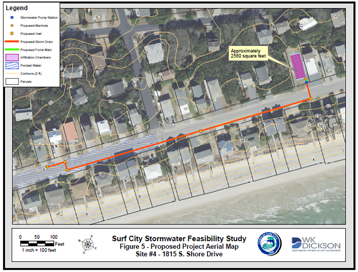
The initial phase of the project focuses on two areas, 1815 South Shore Drive and 2201 South Shore Drive.
The town has received a $250,000 Golden LEAF Foundation grant and a $520,100 N.C. Emergency Management grant, which will cover the cost of installing catch basins at each site.
Stormwater will flow off the road, into the catch basin and routed to underground infiltration chamber systems designed to hold the water, which will then percolate into the ground.
Surf City Town Manager Kyle Breuer said town and DOT officials are meeting in the coming weeks to discuss the state taking over the project since the road is maintained by the state.
This initial phase of the project is expected to be completed no later than two years.
Breuer said the town would like to set up a monitoring program so officials can gauge the effectiveness of the project. What works for one area may not work at them all, he said.
“Different areas have unique challenges, which will require unique solutions,” he said.
The project is just one piece of resiliency strategies the town is looking into.
Last December, Surf City, Topsail Beach and North Topsail Beach officials held the first public meeting about an island-wide resiliency project.
The three beach towns are among 26 coastal communities, including eight counties and 18 municipalities, in the state that received grants last year on behalf of the North Carolina Division of Coastal Management’s N.C. Resilient Coastal Communities Program, or NC-RCCP.
NC-RCCP is a product of the state’s 2020 Climate Risk Assessment and Resilience Plan, which was the result of Executive Order 80 signed by Gov. Roy Cooper in October 2018.
The program aims to boost resilience efforts in the state’s 20 coastal counties and encourages those who live and work along the coast to participate in finding solutions and prioritizing projects designed to help their communities bounce back from flooding and storms.
“During any sort of rainfall event we want to be able to not skip a beat,” Breuer said. “Being about to move this water into infiltration chambers and putting it back into the ground allows us as an island to not be impacted by certain events.”


