MOREHEAD CITY – The state Coastal Resources Commission is giving its science advisory panel the option to look at sea level rise predictions beyond 30 years in its 2020 update to an assessment that was previously limited in scope.
The report first published in 2010 and updated in 2015 is a way for the CRC to provide understandable sea level projections specific to the state to help inform planning and decision making, Tancred Miller, coastal and ocean policy manager for the Department of Environmental Quality’s Division of Coastal Management told Coastal Review Online. The information is available to anyone who needs to use it.
“We have seen it used in online tools, vulnerability assessments, and for educational purposes. It has been referenced by academic institutions, local governments, and nonprofit organizations. Ultimately, we hope that it is useful for long-term planning,” he said.
Supporter Spotlight
The CRC tasked its science panel to prepare the first report in 2010, and the panel recommended the report be updated every five years “to stay up to date with scientific understanding,” Miller explained. An April 2012 addendum to the 2010 report was prepared to answer questions CRC members had, and in 2013, the CRC asked for the first five-year update using the most recent science at the time to estimate future sea levels.
But the CRC directed the panel to limit the scope to 2015-2045, or 30 years out, rather than the 90-year time frame used in the original report, which was the first of its kind.
“Sea level rise compounds coastal hazards like flooding, storm surge, and coastal erosion. Global and regional sea level rise projections have been available, as well as historic trends for North Carolina, but state-specific projections had never been done,” Miller said.
Since the last update, attitudes about sea level rise appear to have shifted.
During its July meeting in Beaufort, the CRC decided that the science panel should have the ability to report projections for 30 years and beyond. “Uncertainty increases with longer projections, and that would be explained for all periods included in the report,” Miller said.
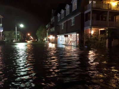
Miller said there had been growing recognition, driven primarily by recent storms, that conditions are changing and the state needed to adapt.
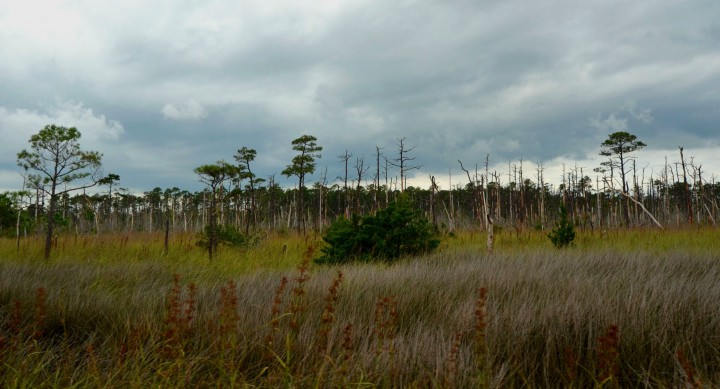
“We are flooding in more places, more often, and for longer periods of time than we have in recent memory. Forests are being drowned, wetlands lost, roads and yards flooded, storm drains are flowing backwards. People are seeing changes and want to find solutions,” he said.
The CRC is expected to give during its Sept. 18-19 meeting the science panel the go-ahead to begin the 2020 update process. The meeting will be at New Hanover County Government Center, 230 Government Center Drive, Wilmington.
Relative change
The original 2010 sea level rise report, which forecast up to a 39-inch rise by 2100, was rejected by the General Assembly, which passed the following year a bill restricting coastal policymaking based on sea level rise predictions. Development interests contended the forecast was flawed and that rates of sea level rise differed on different parts of the coast.

The 2015 update gives a high-low range, and a mean, for each of the five tide stations that on the coast, Miller said.
The National Oceanic and Atmospheric Administration tide gauge stations are located in the Army Corps of Engineers’ Field Research Facility in Duck, Oregon Inlet Marina, Duke University Marine Lab dock in Beaufort, Army Corps of Engineers’ maintenance yard and docks at Eagle Island and the Southport Fishing Pier, which is no longer active, according to the 2015 report.
Science panel member Greg “Rudi” Rudolph, with the Carteret County Shoreline Protection Office, told Coastal Review Online that during the 2015 update the panel focused on vertical land motion, or the sinking or rising of the Earth’s surface, and how that affects relative sea level rise. The panel also focused on what was causing different land movement on the coastal plain, which was integrated with absolute sea level rise projections.
“I thought that was really important, he added.
Relative sea level change is how the height of the ocean rises or falls relative to the land at a specific location. Absolute sea level change refers to the height of the ocean surface above the center of the Earth, without regard to whether nearby land is rising or falling, according to the Environmental Protection Agency.
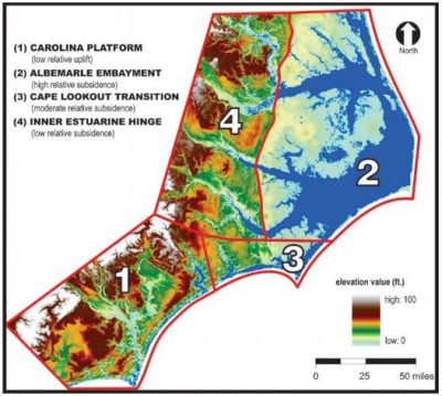
In the report, the North Carolina coastal plain was segmented based upon vertical land motion and a range of relative sea level rise was provided for each zone, Rudolph said. By having that component in their back pocket, the panel can look at other things that impact sea level rise for the 2020 report.
Miller added that the 2020 update “will look at any new peer-reviewed studies that have been published since the 2015 report, and updated numbers from the tide stations. The new projections will go at least through 2050.”
As of Tuesday, the CRC had yet to finalize the charge for the science panel expected to be given during the September meeting. Miller explained that a “charge” is the CRC’s mechanism to formally ask the science panel to undertake a task and includes specifics on the task, timeline, process and deliverables.
During the CRC meeting in July, Miller presented a proposed timeline for the 2020 update process, which may be adjusted, depending on if the science panel is comfortable with the timeline.


