As massive Category 5 Hurricane Irma grows in intensity on its track toward the U.S. coast, a North Carolina coastal scientist is warning that the Saffir-Simpson Scale used to measure storm strength reveals very little about any given cyclone’s storm surge potential.
Nor does the scale provide an indication of a storm’s precipitation potential, said Rob Young, professor of coastal geology at Western Carolina University and director of the Program for the Study of Developed Shorelines.
Supporter Spotlight
Young said better ways to communicate storm surge information to the public are needed.

In 2012, Young and his colleagues published a paper in the Journal of Coastal Research showing that there is no statistical relationship between the Saffir-Simpson Scale rating of a tropical storm and the resulting storm surge, but it’s still widely believed that you can determine whether or not a storm is likely to be catastrophic utilizing a simple, five-category ranking based only on wind speed.
Young said it’s difficult to find a statistical relationship between the surge of a given storm and any single factor that might control storm surge heights.
“As with so many natural phenomena, it is complex,” Young said.
It’s the interaction between the storm’s conditions and track and the natural features of the affected shoreline that matters, Young said. “In general, larger diameter storms have an opportunity to push more water.”
Supporter Spotlight
Hurricane Sandy in 2012, for example, was a monster although its 80 mph wind speed at landfall may seem low. It is likely that the diameter of the storm is at least as important, if not more important than the wind speed.
Also, a tropical storm that spends many days heading over open water directly toward landfall can push a significant amount of water in front of it, Young said.
On the other hand, if a storm crosses islands on its approach, then its storm surge can be significantly limited. Hurricane Andrew in 1992 was a Category 5 storm at landfall, but generated only around 8 feet of storm surge because its path crossed the Bahamas.
Storm tracks that approach perpendicular to shore are of greatest concern, Young said.
“They can push water in front of them for many days and then finish the job as they cross the shoreline perpendicularly,” he added.
This makes it difficult for water to escape. Hurricanes Hugo, in 1989, Hazel in 1954, and Katrina, in 2005, are good examples.
Storms that move along the coast or cross obliquely, such as Hurricane Matthew in 2016, cannot generate the same degree of storm surge.
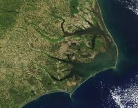
Finally, the shape of the coast and the width of the continental shelf make a big difference. The same storm approaching a concave shoreline like the middle of the Georgia Bight will generate a higher storm surge than a storm that is approaching a convex shoreline like Cape Hatteras. The water gets pushed towards the middle in the case of a concave coast. A wide, shallow continental shelf also tends to build a larger surge than a shelf that is narrow with deep water just offshore.
Surge heights in the Caribbean can never match those of the mainland U.S. shoreline for this reason.
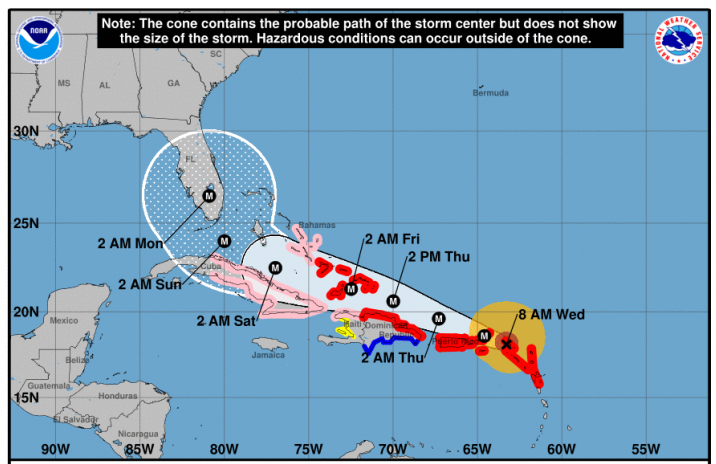
Regarding Hurricane Irma’s potential for destructive storm surge, Young said don’t worry about the Saffir-Simpson category of the storm; instead focus on the storm’s track, diameter and the location of landfall.
Irma’s expected crossing of or interaction with the Leeward Isles, Greater Antilles and Bahamas before reaching the U.S. should limit the storm surge for southeastern Florida. But if, on the other hand, if the storm crosses into the Gulf of Mexico before turning to the north, there would be potential for generating significant surge along the northern Gulf Coast.


