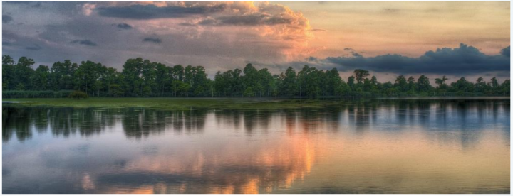
SWAN QUARTER – On the surface, Lake Mattamuskeet, the centerpiece of Mattamuskeet National Wildlife Refuge, looks serene and resplendent. But beneath the calm appearance, there is a churn of concerning questions about the loss of submerged grasses, worsening water quality and changing lake levels.
After years of disparate efforts to improve conditions at the state’s largest natural lake, a panel of government and private stakeholders is now united in development of a plan to restore Mattamuskeet’s watershed.
Supporter Spotlight

“We’re very much in the informative stage right now,” North Carolina Coastal Federation coastal scientist Erin Fleckenstein told the 30 or so attendees at the group’s first meeting earlier this month in Hyde County.
A partnership between Hyde County, the U.S. Fish and Wildlife Service and the North Carolina Wildlife Resources Commission, the Lake Mattamuskeet Watershed Restoration Plan will be guided by a stakeholders group of no more than 11 members who represent different interests in the community, including farming, hospitality and duck impoundments.
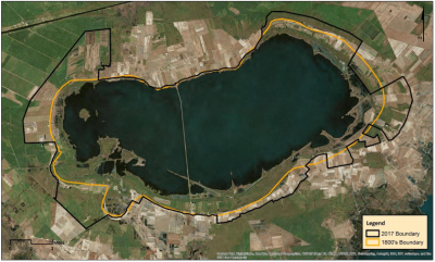
Fleckenstein, who is helping to coordinate the restoration plan, explained that they will be digging deep to find solutions. Historic changes in the watershed’s boundaries going back to the 1800s are being explored. Concerns, experiences and opinions of residents surrounding the lake are being queried. Water impairment and lake levels are being measured and compared with available historic data. Stormwater runoff causes and potential reduction strategies are being calculated. Land use changes will be tracked.
“Another thing we’re doing is identifying where flooding concerns have been taking place,” she said.
The watershed management plan, to be completed by fall 2018, is to provide information, based on scientific studies and local knowledge, on the lake’s function and its current condition and health. Management options to address water quality and flooding issues will be identified.
Supporter Spotlight
Fleckenstein has administered another complicated watershed restoration project for the Coastal Federation at a Hyde County farm collective where polluted drainage in the 42,500-acre Mattamuskeet Drainage District has been redirected from estuarine waters and managed instead on the land to allow the nutrients to seep harmlessly into the soil.
Lake Mattamuskeet, 6 miles wide, 18 miles long and averaging just 2 feet in depth, has its own set of challenges. In recent decades, nutrients from animal waste and fertilizers have fed algae growth that may have diminished submerged aquatic vegetation, or SAV. Record levels of rainfall in recent years has also challenged functioning of gates that control water levels and prevent the briny Pamlico Sound waters from mixing with the fresh lake waters.
To add to the complexity of the current situation, the 40,000-acre lake serves as the cultural hub of mainland Hyde County’s hunting, fishing and farming lifestyle and livelihoods. Located on the Atlantic Flyway, Mattamuskeet attracts more than 200,000 ducks, swans and geese in the winter. The lake has also been known for its bass and crab fishing. But residents are worrying that the numbers of waterfowl and fish using the lake are diminishing.
The U.S. Fish and Wildlife Service has recently partnered with the state Wildlife Resources Commission to share management of the refuge.

“We realize that the majority of the problem with the disappearance of SAVs is a combination of nutrients as well as suspended solids,” said Pete Campbell, refuge manager of the 50,000-acre Mattamuskeet National Wildlife Refuge, in a later interview. “As of last year’s survey, we had lost all but 10 percent of the vegetation in the lake … We realized we had to look at it on a watershed scale.”
The county, the wildlife commission and the refuge had collectively agreed to share the $75,000 cost of the 18-month restoration plan process and selected the Coastal Federation to oversee it, Campbell said. The goal is to develop strategies that will reverse the lake’s degradation.
According to an article published in the November/December 2016 edition of Wildlife in North Carolina, “Where Has the Grass Gone?” the submerged grass in the lake – an important habitat and food to both fish and waterfowl – began declining on the west side in the 1990s. The west side was plagued by phytoplankton, while the east side had healthy grass beds.
But data collected since 2012, according to the article, has found that there is no longer any difference in water quality between the sides, and decline of lake grasses has increased rapidly since 2013.
Campbell said there is an ongoing study to determine where the sources of nutrients, primarily nitrogen and phosphorous, are coming from. Phytoplankton feeds on the nutrients, eventually covering the lake surface and blocking light from the grasses.
“Right now, within the watershed, you have residential areas, agricultural areas, and public and private waterfowl impoundments,” he said.
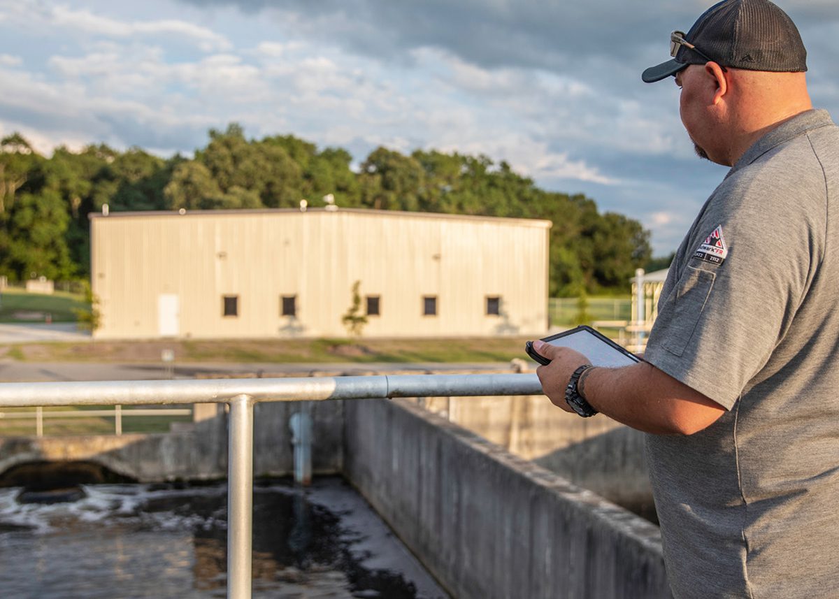
For the last four years or so, two water quality monitoring stations in the refuge have been collecting data on temperature, salinity, depth, chlorophyll and phosphorus. The refuge is also looking at strategies to reduce the numbers of carp in the lake, “which is very difficult to do,” Campbell said. The fish are voracious consumers of the grass.
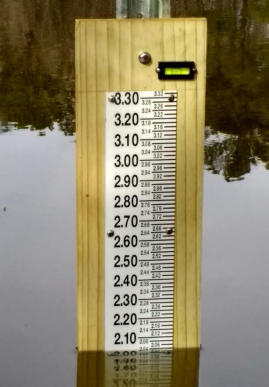
Campbell said that the lake levels are not as high as they were in the prior two years, when record rainfall filled the lake and saturated the surrounding land. In addition to the levels being tracked by the two monitors, the lake’s edge is measured every 16 days by satellite. Researchers are also asking people to volunteer to submit their measurements of the lake to help scientists understand how the lake responds to weather conditions and other factors.
Although there were not many people from the community in attendance at the first meeting, Campbell said that he has heard positive feedback about the restoration planning, and expects that more people will attend future meetings.
“I think we’re on the right track,” Campbell said. “We’re working together to solve a difficult problem.”
Besides the complexity of Mattamuskeet’s environmental issues, there are overlapping concerns of the stakeholders and the residents, many of whom have multiple interests that may conflict in finding solutions. For instance, farming and waterfowl both contribute nutrients to water that drains into the lake. Not only has the number of private waterfowl impoundments increased dramatically over the years, but some farmers also are involved in cultivating the corn that is grown on the impoundments.
Daniel Brinn is the Tar-Pamlico technician for the Hyde County Soil & Water Conservation District and he represents Hyde drainage on the stakeholders’ group. Brinn said it is premature to say what exactly is creating the nutrient overloads at the lake. But he said that between 1991 and 2016, farmers in Hyde County, abiding by a 1991 rule to cut nitrogen levels by 30 percent, have reduced the level of nitrogen going into the Tar-Pamlico river basin by 58 percent.
“Agriculture is doing its part in Hyde County to address the environmental concerns,” he said.
Brinn said it is a “dynamic” relationship between traditional agriculture and duck impoundments. Even on the stakeholders group, some members may represent one interest, but still have a stake in the other.
“It struck me as very complex,” he said. “There’s so many different stakeholders and so many different landowners. A functional solution is going to be difficult to come up with and put into place.”
But Brinn said the success with the Tar-Pamlico river basin, which also involved complex relationships, sets an encouraging precedent.
“There was plan a adopted that was put in place,” he said. “In that situation, the solutions were not necessarily regulatory – they were incentives.”
Joey Ben Williams, a stakeholder in the group who represents impoundments, said that it will be a while before enough data is collected to understand what is going on with Lake Mattamuskeet.
“It didn’t happen overnight, and I really don’t think we’re going to fix it overnight,” he said. “We want to make sure that whatever research money we have that we’re studying the right thing.”
Additional public meetings for the Lake Mattamuskeet Watershed Restoration Plan are set for 7 p.m. at the Hyde County Government Complex in Swan Quarter on Nov. 7; Feb. 6, 2018; May 8, 2018; July 10, 2018; and Sept. 18, 2018.


