NORTH TOPSAIL BEACH — The ocean was calm here Monday and although the wind was chilly, the sun shone brightly as couples walked their dogs along the strand and anglers cast their lines into the gently rolling surf. Also on the beach, a team from the Federal Emergency Management Agency had returned for a second visit in five days to assess damage to the shoreline and dune system caused by the coastal storm that thrashed the barrier island earlier this month.

The storm was the result of the combined forces of Hurricane Joaquin passing far off the East Coast during the first weekend of October and a nor’easter-type system that moved up the coast from Florida. Although the storm caused no major structural damage to the buildings and homes in North Topsail Beach, the shoreline and dunes were “significantly” damaged, according to town officials, who have requested federal assistance in repairing that damage. Local officials estimate the work will cost about $15.6 million, based on a preliminary assessment from the town’s contracted coastal engineer, Coastal Planning and Engineering, of Wilmington.
Supporter Spotlight
FEMA officials had visited town late last week but high tides, with waves breaking on sandbags put in place previously to protect homes already precariously close to falling in the ocean, prevented them from completing their planned visual inspection.
“They didn’t have chance to get on beach when they came last Friday,” Carin Faulkner, the assistant town manager, said Tuesday.
The process is becoming somewhat routine for the beach town. The past 25 years have seen millions of dollars in damage from hurricanes, tropical storms and nor’easters that have wracked beachfront homes and town infrastructure and chewed away at the narrow ribbon of sand that separates those structures from the Atlantic Ocean. The recent FEMA visits were standard procedure.
“It was the same as everything we do after every storm when we ask for assistance,” Faulkner said.
The process is defined by the Robert T. Stafford Disaster Relief and Emergency Assistance Act. The Stafford Act requires that all requests for a major disaster declaration by the president must come from the governor of the affected state. The preliminary damage assessment is the first step in that process.
Supporter Spotlight
“It’s an information collection, looking at the damages. Without it, we don’t have an accurate picture of the damage from the storm event,” said Danon Lucas, a FEMA spokesman at the agency’s regional office in Atlanta, which serves the area that includes North Carolina.
The state uses the results of the preliminary damage assessments to determine if the situation is beyond the combined capabilities of the state and local resources and to verify the need for federal assistance.
“The state and FEMA will work with local officials there to get an up-close view of the damages. Then they’ll compile a report to the state emergency management office and from that the state EM makes a recommendation and counsels the governor on whether or not to make a request (for federal assistance),” Lucas explained. “If we do receive a request from the state, it’s processed through the FEMA regional office and passed on to headquarters (in Washington, D.C.). It really is hard to put a timeframe on how long that could take.”
The factors involved include the estimated cost of assistance, localized effects, insurance coverage in force, recent multiple disasters and other federal assistance programs that could come into play, Lucas said.
“FEMA cannot duplicate any other federal assistance,” he said.
Another federal agency may already be a factor in that decision.
“With Topsail, FEMA has solicited help from the Army Corps of Engineers,” Julia Jarema, a spokesman for N.C. Emergency Management, said yesterday.
State financial assistance may be a possibility, she said, adding that state officials must first finish crunching the numbers to determine whether the town’s damage meets the threshold for assistance.
“Once we have all the information in, not just from Pender (County) and Topsail because there are other areas affected, then we’ll be able to see if we qualify for federal financial assistance,” Jarema said, adding that a rough estimate is expected by early next week.
An ‘Engineered Beach’
Days before the storm, on Sept. 24, Coastal Planning and Engineering provided the town a summary of its coastal management plan. The report announced that the town had completed its fifth phase in a beach-restoration project in which about 1.25 million cubic yards of sand from offshore were used to rebuild about 3.5 miles of shoreline on the south end of North Topsail Beach.
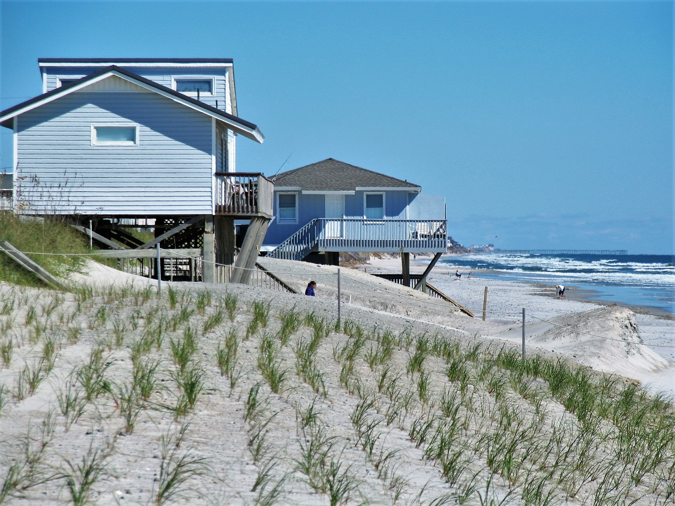
The $16.8 million project began Dec. 18 and was wrapped up on June 30. The project was financed through an 11-year U.S. Department of Agriculture Rural Development loan. Money from the town’s 15-cent ad valorem tax and a 3 percent accommodation tax will go to pay back the loan in future years. It was the first shoreline protection project constructed at Topsail Island using an offshore source for sand and its completion brought the town into compliance with FEMA’s requirements for an “engineered beach.” That makes the town eligible for FEMA’s public assistance program.
“This assistance may be provided to replace material lost from the beach during a presidentially declared disaster,” according to the town’s announcement.
The report also noted the General Assembly’s recent action to allow for two additional terminal groins in the state, increasing the total currently allowed to six terminal groins. North Topsail will benefit from the legislation, according to the firm’s summary. It remains unclear how the town may pay for a groin project.
Mayor Daniel Tuman said the work was the largest capital project undertaken by the town, and despite some unexpected problems, such as rocks in the borrow area that wound up on town beaches and poor weather, visitors would be pleased with the results.
“We now have a wider beach which is a great recreational asset. The additional sand also improves wildlife habitat and provides shoreline protection which will mitigate potential storm damage,” Tuman said in the announcement.
Town officials said after the storm that nearly all dune damage was in areas that had not been re-nourished in the shoreline-restoration project completed in June. But town officials also said there were several dune breaches and significant dune loss along the town’s entire 11 miles of shoreline. Evidence of that damage was still visible Monday, with deep scarps carved into the sand and damaged wooden crossovers along much of the beach. However, plantings intended to stabilize the dune appeared to be in good shape.
Meanwhile, the town has set a public hearing for 6:30 p.m. Nov. 5 at town hall regarding its recently completed preliminary assessment of the beach erosion and flood and hurricane protection works at the north end of the island, otherwise known as the north end sandbag revetment project. The revetment is intended to provide erosion protection for residential oceanfront structures north of Topsail Reef Drive and some flood protection to a portion of New River Inlet Road north of Port Drive.
A History of Vulnerability
The history of North Topsail Beach’s exposure to storm damage was included in 2009 in the Geological Society of America’s paper, “America’s Most Vulnerable Coastal Communities,” edited by Joseph T. Kelley, Orrin H. Pilkey and J.A.G. Cooper.
The town, which had a population of 743 in the 2010 census – 100 fewer residents than in 2000, was incorporated in 1990. Six years later, the town bore the brunt of Hurricane Bertha, a Category 2 storm that caused $135 million in insured damage mainly along the N.C. coast. Three homes in North Topsail Beach washed away as an estimated storm surge of six to nine feet above mean sea level inundated the island, also washing out a bridge and downing power lines. Later in 1996 Hurricane Fran, a Category 3 storm, damaged 80 percent of the 3,500 homes in North Topsail Beach, including 145 destroyed. The town hall and police station were destroyed and water service wasn’t restored until five months later. Half of the roads in town were wiped out and about a dozen miles of dune line were washed away, according to the Geological Society’s paper.
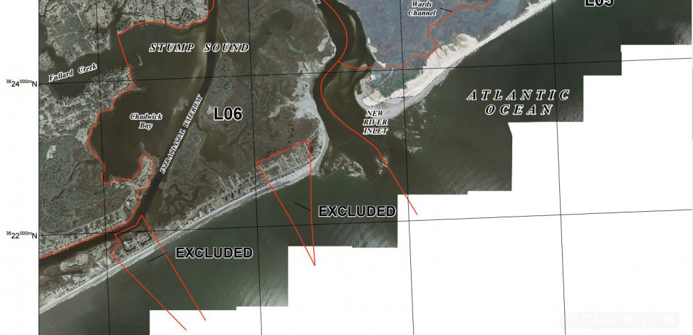
North Topsail Beach received $1.6 million in FEMA assistance after Hurricane Fran in 1996. FEMA allocated another $14 million the following year for public works projects here, amid criticism that the area was ineligible to receive the federal assistance because of a federal law passed to discourage development in hazardous coastal zones.
About 70 percent of North Topsail Beach’s land mass is included in a zone regulated by the Coastal Barrier Resources Act, or CBRA (pronounced “cobra”) enacted in 1982 to encourage conservation of hurricane-prone, biologically rich coastal barriers. The act restricts federal expenditures that encourage development.
Lucas and Jarema each declined to say how the CBRA designation might ultimately affect the town’s eligibility for FEMA assistance.
Under the CBRA provisions, FEMA may reimburse or conduct emergency work such as debris removal and emergency protective measures to eliminate immediate threats to lives, public health, safety and property. FEMA may reimburse permanent work on certain types of publicly owned facilities that may be eligible for permanent repair assistance such as existing roads, structures or facilities that are deemed consistent with the purposes of CBRA.
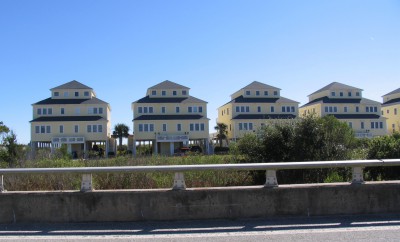
Following Fran, development continued in North Topsail Beach and storms continued to pummel the town. Hurricane Floyd, a Category 2 storm, made landfall here in 1999 with a 10-foot storm surge that washed away most of the artificial frontal dune line and reopened a trio of temporary inlets that earlier Hurricane Fan had opened. Those little inlets were spanned by bridges along New River Inlet Road, which connects the oceanfront neighborhoods to the highway, N.C. 210, that runs the length of Topsail Island. Now homes occupy the land where the breaches occurred.
In 2005, a Category 1 storm, Hurricane Ophelia, passed off the N.C. coast, causing overwash and erosion that ate away up to 60 feet of the beach at North Topsail Beach, breaching dunes and leading to the town’s condemnation of eight duplexes severely damaged during the storm.
Don Roberts of Stow, Ohio, near Akron, has been a regular visitor to North Topsail Beach for about 40 years. He spent a recent Monday morning surfcasting from the narrow strip of dry sand at the Green Street access on the south end of the beach.
“I’ve seen the beach come and go over the years. Some seasons, it was all washed away. Other years, it was newly re-nourished,” Roberts said, adding that a healthy strand is important to the economy for the entire region.
Roberts said federal assistance to rebuild the beach here would be worthwhile. He related the project to the federal Works Progress Administration efforts, using Civilian Conservation Corps workers to improve the shoreline on Outer Banks beaches in the 1930s and 40s.
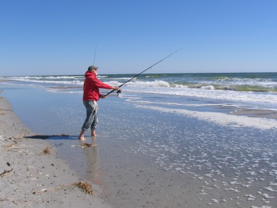
“That was a good project and I’d rather spend the money here than in somewhere like Afghanistan,” Roberts said.
Later that morning, another angler, Joe Sullivan of Fayetteville, was trying his luck fishing from the narrower beach near the first curve along New River Inlet Road. Sullivan said saving the beach at the north end of the island appeared futile.
“Looks to me like a losing battle,” Sullivan said as he pulled his hook from the mouth of a black drum too small to keep.
No stranger to coastal storms and the damage they inflict, Sullivan said he had been coming to Topsail Island to vacation since 1986. He owned a property in nearby Surf City until 1996, when Hurricane Fran caused enough damage to prompt him to sell. Now he owns a place on Virginia Creek, on the mainland in neighboring Pender County. The economics of beach real estate didn’t make sense, he said.
“We kind of anticipated prices would go up and we would not be able to afford a place on the island,” he said.
Likewise, the economics of the erosion problem on North Topsail Beach make little sense, Sullivan said. Federal funding to benefit the relatively few people with homes at risk on the north end of the island, “It’s just not a good situation,” he said. “It’s a shame to see it go but it’s a shame to spend all that money. If you’re one of the people who live out there you want to see it. If not, it’s a waste of money.”
As he spoke, a Blackhawk helicopter from a nearby military base hovered for a moment above the ocean’s edge, where waves broke against the wall of sandbags that continue to provide some protection of the homes battered by the recent storms. The chopper then cut a wide circle seaward, gaining altitude before looping back around and flying off toward Jacksonville.
“We should listen to the scientists,” Sullivan said as he baited his hook again. “The reason people build here is because they can get insurance but who am I to say they shouldn’t do it?”
Insurance, especially flood insurance, is a costly matter for many island residents because of CBRA. The act’s restrictions on federal expenditures include federally subsidized flood insurance through the National Flood Insurance Program. CBRA is called a “free-market approach to conservation.” CBRA zones may be developed, but federal taxpayers are not on the hook for the investments.
The National Flood Insurance Program cannot provide flood insurance coverage for structures built or substantially improved after the area is designated under CBRA. Initial designations went into effect Oct. 1, 1983. North Topsail Beach officials have long maintained that the town had existing infrastructure in place when the CBRA designation was made here.
The U.S. Fish and Wildlife Service is responsible for maintaining CBRA maps and consulting with federal agencies to determine if funds can be spent within designated areas. CBRA determinations can take several months.


