PINE KNOLL SHORES – A group of area residents are helping out with a university study that researchers hope will provide better understanding of the relationship between sea-level rise and the groundwater table on Bogue Banks.
The study is also intended to gauge the volunteers’ perceptions and understanding in regard to environmental concerns.
Supporter Spotlight
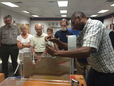
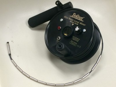
Study organizers and about 10 volunteer “citizen scientists” met last week at the Pine Knoll Shores Town Hall for an orientation and training session on how to collect data on groundwater levels using a simple electronic device. Measurements will be taken at about 25 shallow monitoring wells researchers placed at various locations between Atlantic Beach and Emerald Isle. The wells, which were drilled – with approval – on mainly public properties and on a few private homeowners’ lots, range from about seven to 22 feet in depth, or just deep enough to reach the water table below.
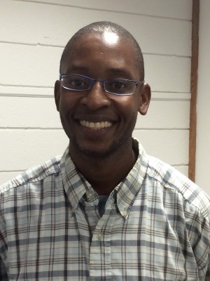
Alex Manda of the East Carolina University Department of Geological Sciences presided over the orientation. He said the research project was inspired by a previous, similar study in Emerald Isle at the western end of Bogue Banks.
“This time around we said, ‘Let’s look at the entire island and then see what’s happening to the water table. And with all this news about sea-level rise and climate change occurring, what would be the consequences of sea-level rise and climate change on the water table?’ ” Manda explained.
He and others involved hope the information acquired from the project will be useful in showing the major causes and extent of flooding on the coastal barrier island and to develop strategies to deal with flooding and environmental change.
“The previous study in Emerald Isle shows that if the water table was really high and then it rains, that water table goes above the land surface and then you might have flooding. And so with the data that we are going to collect, we are going to test that hypothesis across the entire island,” Manda said.
Supporter Spotlight
A key to the study is that participants agree to take their measurements at the same time on the same days of the week. The simultaneous recording is needed for an accurate depiction of what’s going on with groundwater levels across the entire barrier island. Levels may vary based on numerous conditions, such as rainfall, pumping of groundwater, barometric pressure and the same gravitational forces that affect the tides.
In addition to the data collected by volunteers, automated recording devices are also being used to provide quality control. Also, a handful of additional wells not so easily accessed are to be monitored exclusively by the automatic devices.
So why not use auto-recording meters at every well? Because they cost about $500 each, Manda said. Getting people to record the data would be more cost-effective and also actively engage the public.
“An additional piece to that proposal was that we wanted to involve the people, citizens, such that perhaps some of the people living here will be the ones facing the consequences (of sea-level rise), whatever they are,” Manda said.
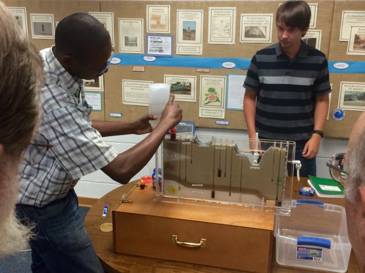
During the orientation, Manda used models depicting the flow of groundwater, with representations of surface waters, wells of varying depths and the different layers of soil and rock types, to illustrate for volunteers the interactions between wells and also between ground and surface waters. He injected colored dyes into the simulators to show how plumes of contamination travel below ground.
Participants also signed a number of documents during the orientation, including a consent form acknowledging their understanding of participation in the study and two surveys to gauge their knowledge and perceptions related to stormwater flooding and how officials in their communities respond. Later, a focus group will be convened to try and understand the participants’ perceptions. The before and after questionnaires and focus groups are to be facilitated by ECU researchers and qualified staff at the N.C. Coastal Federation, which is a partner in the study.
‘Mutual Benefit’
“The project will have mutual benefit to university and the community,” according to study documents. ECU researchers will use the data collected to determine the extent of flooding on the barrier island and to develop future grant proposals. Information collected will also be provided to the state Division of Water Resources. The community may also use the project to inform decisions about the best ways and strategies to address coastal flooding.
“By involving community members in active research, the project will improve the environmental literacy of community members,” the researchers said.
Caitlin Lauback is an Emerald Isle resident participating in the study and a former geology student at ECU who earned her master’s degree in December 2014. She was excited to get back into scientific research, especially with the opportunity to help the community where she lives.
“I’ve been very involved, in my research and just personal interest, in coastal preservation and looking into the future with sea-level rise and climate change and how this beautiful place that we live in right now is going to react to those things,” she explained. “I think it’s a wonderful opportunity for people to be involved firsthand in the science. I’ve been involved in this kind of thing before only from the science side and it’s really fun to come out and see all these other people who are just here because they’re interested in it and want to be involved. I think it’s just wonderful to see that.”
Walt Zaenker of Pine Knoll Shores became involved as a way of better understanding the history of Pine Knoll Shores and the way it was developed.
“I’m involved with the History Committee of Pine Knoll Shores and one of the things that has always interested me is the building of the canals and the creating of the land that Pine Knoll Shores is on. The whole effect of them building the canals on the water table is kind of what got me into the whole thing.”
Zaenker has written for the committee’s history blog about the man-made waterway that was built between late 1960s and the early 1970s. The canals were not only a marketing tool designed to entice prospective property buyers with easy boating access to Bogue Sound, the were also ways to intentionally lower the water table and reduce standing water to curb the then-rampant mosquito population, improve septic system functioning and drain stormwater without the need for roadside ditches.
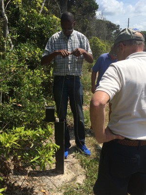
The data collection for the study was initially set to run about 10 weeks. Then, using that information, modeling and simulations would be employed to make predictions about changes in groundwater levels, with work wrapping up sometime in 2016. Manda said he hopes to go longer.
The research team used a Geoprobe technical drilling machine to drill the wells. Because of the time and money invested in drilling, Manda plans to seek permission to keep some of the wells open for at least three years in order to get long-term records. A few wells may remain in place beyond three years, if property owners agree.
The project started out as the basis for a thesis by James Owers, a graduate student at ECU. Owers’ research plan was to model what would happen to the water table under different climate-change scenarios, using the data collected as a baseline, but the project then grew in its scope. North Carolina Sea Grant, which provided about $40,000 for the study, requested the inclusion of citizen scientists to assess the perceptions of the public volunteers and how participating in the research improved their understanding of the environment.
“This strategy aligns with the mission of East Carolina University to be a national model for public service through the ‘discovery of new knowledge and innovations to support a thriving future for eastern North Carolina and beyond’. Additionally, this project aligns with East Carolina University’s strategic priority to develop a school of the coast,” according to documents related to the study.
The federation’s involvement in the groundwater study sprang from Manda’s awareness of the organization and its goals.
“Dr. Manda had become aware of the federation and knew we were a citizen-based organization working to protect and restore the coast so he saw us as good potential partners to help with the volunteer or ‘citizen scientist’ component of this,” said Lauren Kolodij, the federation’s deputy director.
Kolodij then contacted Randy Newman, superintendent at Fort Macon State Park in Atlantic Beach, who also agreed to allow a monitoring well at the park and have a ranger participate in the data collection.
More volunteers are needed. Those interested may contact Kolodij at the federation at 252-393-8185.
