First of two parts
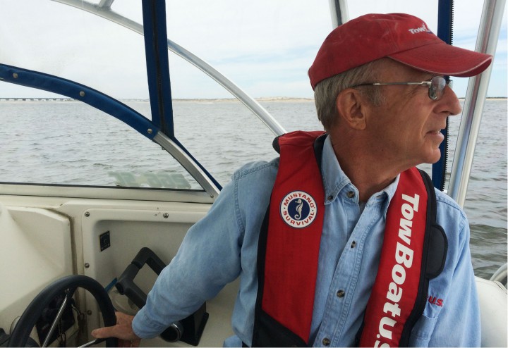
NAGS HEAD — Conditions were pleasantly calm and overcast on a recent spring morning in Oregon Inlet, one of waterway’s better days after a stormy winter rendered it nearly impassable and clogged with sand. The navigational channel under the Herbert C. Bonner Bridge had been freshly dredged, deep enough for charter boats to transit safely. Mother Nature had helped the effort by shifting the late April winds to the southwest, a seasonal change that scours sand out of the channel.
Supporter Spotlight
Still, as he steered his 26-foot World Cat out of Wanchese Harbor, Harry Schiffman kept a keen eye on his depth finder and the red and green channel markers as he made a right turn into Roanoke Sound Channel, heading to the bridge. Navigating in Oregon Inlet has been tricky business for decades; in recent years boaters say shoaling has worsened, making it too challenging for anyone but locals to chance.
So far, the boat has been running nicely in 12 feet of water, said Schiffman, owner of Salty Dawg Marine Towing, a subsidiary of TowBoat USA.
“But,” he added, “the channel is no better than the minimum depth.”
Even for an Oregon Inlet old-timer like Schiffman, transiting the waterway is akin to a city dweller walking through the rough part of town – you have to be hyper-vigilant and agile.
Moving along at about 27 mph, the boat passed Duck Island, its handsome hunt club peeking over the tree line, and continued past the turn to Pamlico Sound.
Supporter Spotlight
About four miles out, the channel splits. Walter Slough on the left leads to the Oregon Inlet Coast Guard Station, to the right is Oregon Inlet Channel. The boat turns right.
It’s about here where boats coming from the south would make a choice to go to Manteo or Wanchese for the night, or head to Albemarle Sound toward Coinjock and the Intracoastal Waterway.
Straight ahead, the Café Petron, a 50-plus-foot cruising vessel, sat in the water, spurring Schiffman to wonder aloud if it was caught on a shoal. He radioed the captain, who said he was just considering his options where to fuel up before heading to Atlantic City.
“I just kind of peeled off here to get a little breathing room,” he said.
Responding, Schiffman told him to proceed under the bridge cautiously, watch his depth closely and don’t rely on the channel markers, which had not been updated.
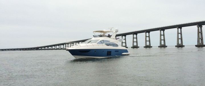
There was a long pause, and then the captain laughed. “Okaaay!” he said. “That sounds interesting. I know when I headed outbound, I’ve had a few little bumps.”
Here is an illustration of what tourism officials and marine businesses hate: the reputation Oregon Inlet has gained with out-of-towners as an unnavigable waterway, making recreational and commercial fishermen avoid the inlet, and by extension, the Outer Banks. According to a recent economic analysis, the inlet has an overall economic effect of $550 million, and could nearly double that if the inlet is maintained properly.
Schiffman volunteered to escort the vessel through the navigational channel, and while the captain regrouped, Schiffman resumed heading toward the bridge. He gestured toward a large patch of smooth water as he approached the span – a shoal, lurking just beneath the shimmering surface.
Under the lovely blue-green inlet waters, that shoal has created havoc for watermen, spreading northward toward the equally insidious Bodie Island Spit on the north end of the inlet that was inching southward. For three days in March, they had joined up and choked off the navigational channel.
“That’s a massive shoal,” he said. “It goes from deep to no water at all. It’s grown larger and longer.”
In March, the water in the federal navigational channel, which is supposed to be maintained at 14 feet deep and 400 feet wide, was just 3- to 4-feet deep and very narrow. When the two migrating shoals joined and pinched the channel, the Coast Guard closed inlet traffic in the vicinity of the bridge to all but the smallest boats, an action that infuriated local charter captains who had been managing to get out in alternate channels.
The Army Corps of Engineers soon sent dredges out, and by the end of April, the main channel had been widened to a manageable 100 feet and deepened to 8 feet. Further dredging was promised to carve it out even more.
Closer to the bridge, the powerful current runs parallel to the bridge, creating a river of swift water. Some of the force spins off into wild swirls that encircles bridge pilings, funneling an energy so fierce that even large boats have to gun their motors so as not to be sucked toward the pilings.
As he moved west of the span, Schiffman alternated between looking at the depth finder and looking in front and behind him.
“That current, running like does, it can grab you unsuspectedly and take you off course,” Schiffman explained, counting out as the water went from 8 feet to 15 feet. “We’re out in good water now, but we had to come about 1,000 feet from the bridge.”
For months, until the main channel was dredged, highly motivated fishermen used an alternate channel about 1,000 feet to the south that went between bridge bents, or pilings, with lower vertical space and no protective fenders around the structure. It wasn’t until recently that any of the bents were numbered, making finding the unmarked channel an even more remarkable feat.
If a boat had to come through in bad weather, or at night, the risk of straying out of the channel, bumping bottom or hitting the bridge increased. In recent months, at least two vessels bounced into the bridge, creating little or no damage to the bridge but alarming the Coast Guard and the state Department of Transportation about the impact on the structure, not to mention the safety of the boater.
Opened during a hurricane in 1846, Oregon Inlet has since been moving inexorably south – about two miles so far. With its powerful currents and propensity for shoaling, it is widely considered one of the most volatile and treacherous waterways on the East Coast. But it is also a critical passage for commercial and recreational fishermen, and habitat for birds and fish.
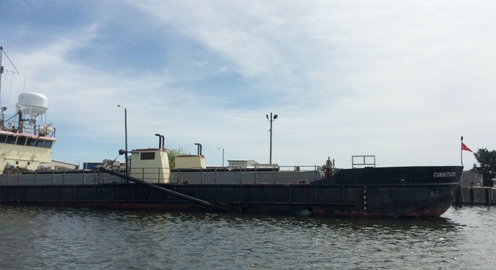
Trouble with navigating the inlet, the only ocean-to-sound passage between Virginia and the south tip of Hatteras, has been unceasing since the 1960s, when trawlers and other large vessels started having difficulties getting through the navigational channel under the new Bonner Bridge, built in 1963. It wasn’t long before smaller-draft recreational boaters also were affected by shifting shoals, especially after storms.
Boaters say that recent hurricanes, in particular Isabel, Irene and Sandy, have altered the Outer Banks and made shoaling far worse, most noticeably in Oregon and Hatteras inlets. The storms coincided with steep decreases in federal funding for coastal and waterway management projects.
Schiffman, who is the vice chairman of the Oregon Inlet Task Force, an advisory panel established by Dare County to advocate for Oregon Inlet, said that the Army Corps is working on an agreement with the county and the state to provide 340 days of dredging for $7.3 million a year, with costs divided between the county and state.
Although conditions are not as severe as they’ve gotten at Oregon Inlet, the shoaling problem in Hatteras Inlet has forced the state Ferry Division to use a longer route because the Hatteras-Ocracoke short ferry channel had become impassable.
But Robert Dolan, professor emeritus at the University of Virginia’s Department of Environmental Sciences, said that from his perspective, Oregon Inlet is “pretty stable.”
Dolan, a coastal scientist who has done extensive study of Oregon Inlet, including a current study at Pea Island, said that overall, there has been a fairly calm period for the sand transport process, although nor’easters can dramatically alter the system. What is important, he said, is the balance of the “sand budget,” that is, how much sand is going in the southerly direction, and how much is going in a northerly direction.
Too much in either direction will upset the balance, Dolan said. And then the difficulty is determining what is creating the surplus. For instance, he said, Oregon Inlet is “snuggled up to” Wimble Shoals, a vast offshore deposit of sand, but he is puzzled why there has not been research on its sand budget.
“It’s spotty research – a little bit here, a little bit there,” he said. “That’s what needs to be done.”
Otherwise, what’s going on lately with coastal shoaling may remain speculative.
“The point is,” Dolan said, “we don’t really have all the data we need.”
Whatever the cause of Oregon Inlet’s latest challenges, Outer Banks watermen and local and state officials are determined to find a solution.
Thursday: Is there a fix?


