NAGS HEAD — For at least a decade, numerous North Carolina scientists have been warning with increasing stridency about the state’s vulnerability to impending sea-level rise, but policymakers have yet to take heed.
Two reports released this month by a group of independent researchers, however, have only reinforced the dire predictions about the effects of a rising Atlantic on the state’s coast.
Supporter Spotlight
 Ben Strauss |
“Our hope is, really, to provide useful information and help people prepare,” said Ben Strauss, an author of “Surging Seas,” and director of the program on sea-level rise with Climate Central, a nonprofit journalism and research organization based in Princeton, N.J. “The problem is very real. In the scientific community, the only real debate is how fast and how much.”
North Carolina, the report said, has the third-highest amount of land area in the nation that would be inundated by one meter (39 inches) or less of water. It ranks sixth in the number of houses affected and eighth in the population affected.
Of the counties in the state with the largest total population exposed to the risk, Dare County ranks No. 1.
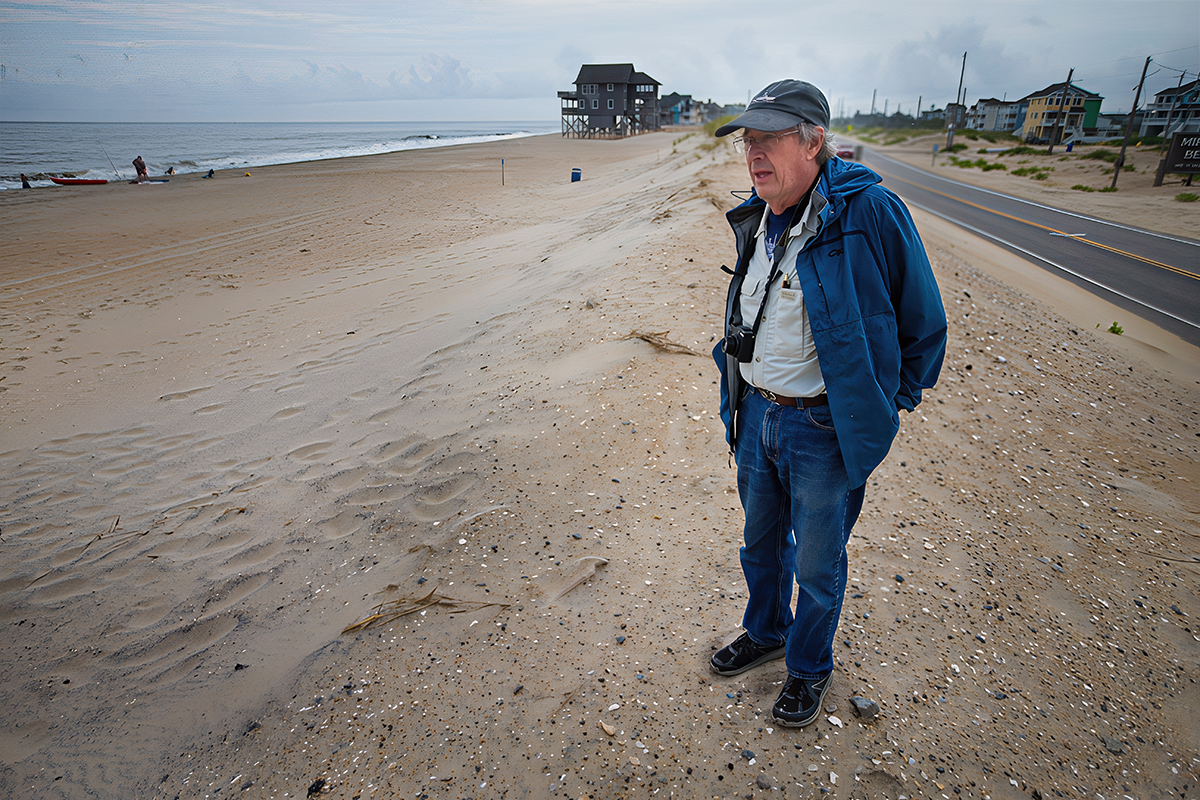
That is hardly a surprise to Stan Riggs, an East Carolina University coastal geologist who has been studying the Outer Banks since the 1970s.
“The bottom line with sea-level rise, this has been going on for 18,000 years now,” said Riggs, whose book The Battle for North Carolina’s Coast, was also released recently.
Supporter Spotlight
As he has told anyone who will listen, storm damage on the Outer Banks that leaves roads torn up and houses stranded in the water is only going to increase.
“They’re in the ocean because sea level is still rising,” Riggs said. “This is fact. There’s a train coming down the tracks and it’s getting closer and closer.”
According to “Surging Seas” and a related report by the Environmental Research Letters, the best estimate for the average level of sea rise by 2030 on the Atlantic coast is six inches; by 2050, it’s 13 inches.
The Rising Sea
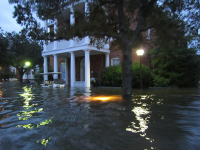 Hurricane Irene flooded downtown Manteo. |
In North Carolina, there is a one in six chance that combined sea-level rise, storm surge and tide will exceed three feet by 2020, flooding 3.5 percent of the state’s acreage and 0.9 percent of the state’s homes.
By contrast, the chances are equal that that same amount of water would flood 65.8 percent of Dare County land, impacting 23.1 percent of the homes. In Nags Head, it would amount to 16 percent of the land and 13.7 percent of the homes; in Kitty Hawk, it would be 53.9 percent and 21.7 percent, respectively; in Hatteras, 71.6 percent and 74.6 percent; and in Ocracoke, 45.4 percent and 80.8 percent.
Dennis Stewart, a biologist with Pea Island National Wildlife Refuge and Alligator River National Wildlife Refuge, said he has already seen the effects of rising seas in Alligator River, which is about two feet above sea level. Saltwater intrusion has been gradually killing off trees, he said, and canals running through refuge lands on the Dare County mainland allow salt water to “jet” farther into the interior system. Over the years, he has seen swaths of land transitioning from pond pine pocosin to salt marsh.
Stewart said that the refuge is working with The Nature Conservancy on ways to adapt and manage for sea-level rise in Alligator River, including planting salt-tolerant trees.
In Pea Island on the north end of Hatteras Island, Stewart said he has observed “tremendous” beach erosion, even on the sound side. Left to nature, the island would be migrating west and widening the sound beach. But maintenance of N.C. 12 and dunes along the ocean side prevents that process.
“So the island is getting narrower and narrower and will continue to do that,” Stewart said. “Our game plan is to manage Pea Island pretty much as we are now.”
But it is clear that one day the ocean will blow out the dikes of each of the refuge’s three bird impoundments, he said. When that happens, whatever is left will be managed as sand flats and marsh.
Hurricane Irene in August tore an inlet through the refuge and breached N.C. 12 at the so-called “S-Curves” on the south end of the refuge. The state Department of Transportation has since restored the road and is working on long-term solutions.
Although Stewart won’t venture to guess what rate seas will rise, he doesn’t question the validity of the science.
 Dennis Stewart |
“I accept it,” he said. “Only time is going to tell who’s right and who’s wrong about sea-level rise. I want to err on the side of conservation.”
Riggs, on the other hand, expresses no doubt that N.C 12 does not have much of a future on Pea Island.
“Even if you hold Pea Island, the state of North Carolina does not have the money to hold those weak spots,” he said. “No matter what you do there, you’re going to have problems.”
When it comes to fighting geology and the rising ocean, Riggs is confident that sooner or later, the Outer Banks will throw in the towel on N.C.12. In fact, if another storm like Irene came right now, he said, “we’d already be there.”
But Riggs believes the state should be proactive and plan innovative transportation systems, including high-speed ferries that would preserve the coastal economy.
“These are the most spectacular waters in the world,” he said. “People would come from all over the world to see this place. We have to figure out ways to make that happen.”
An Alternate Vision
Even if N.C. 12 was under water on Pea Island and other weak spots on Hatteras Island — areas he called “wimpy” barrier island — Riggs said the villages are less vulnerable because they’re built on higher, more stable ground.
If the road was allowed to go away, he predicted, the barrier islands would naturally rebuild — by moving like “a tank tread” — and the pollutants in Pamlico Sound would be flushed. The healthy nutrient balance would be restored, the water would become saltier, habitats for threatened species would be renewed and fishing would improve. In essence, the equilibrium of the natural system would be restored.
And if the system was left alone, the Hatteras Flats on the soundside, old flood tide deltas, would help the islands to regenerate.
“I like to think of them as the barrier island retirement system,” Riggs said.
 Stan Riggs |
The Outer Banks has the potential to be like Core Banks, “a very happy set of barrier islands,” that have been allowed to grow laterally.
Eventually, Riggs wrote in his book, the barrier islands could become “eight Ocracoke-style destination villages, situated like a string of pearls on a vast network of inlet and shoal environments.”
Riggs said that he has received very positive feedback from the public during his recent book tours, but he has seldom heard from any politician.
“It’s like they don’t want to know too much,” he said. “The politicians are thinking short term.”
State Report
A sea-level rise report submitted recently by a state-appointed panel of scientists to the N.C. Coastal Resources Commission has been pulled to allow time for the division to respond to critiques of the report, said Tancred Miller, the coastal policy analyst for the state Division of Coastal Management.
Much of the feedback on the report, which had projected sea-level rise between 39 to 54 inches by 2100, Miller said, came from NC-20, a lobbying group for home builders and some coastal counties. The division has posted a much watered-down draft of the report that reflects changes requested by the lobbying group.
Miller said that North Carolina has not yet established any official policy to address climate change or sea-level rise. But, he said, it is a priority with the commission, which had asked for the sea-level rise report.
“It’s a place to start,” he said, “just to get an understanding if there is a problem that we need to understand and prepare to react to.”
Other states, including Rhode Island, Maryland, Delaware, Florida, California and New York, he said, have some sort of sea-level policy or response plan.
“I think that there are a lot of states that we can look to that are taking it seriously,” Miller said.


