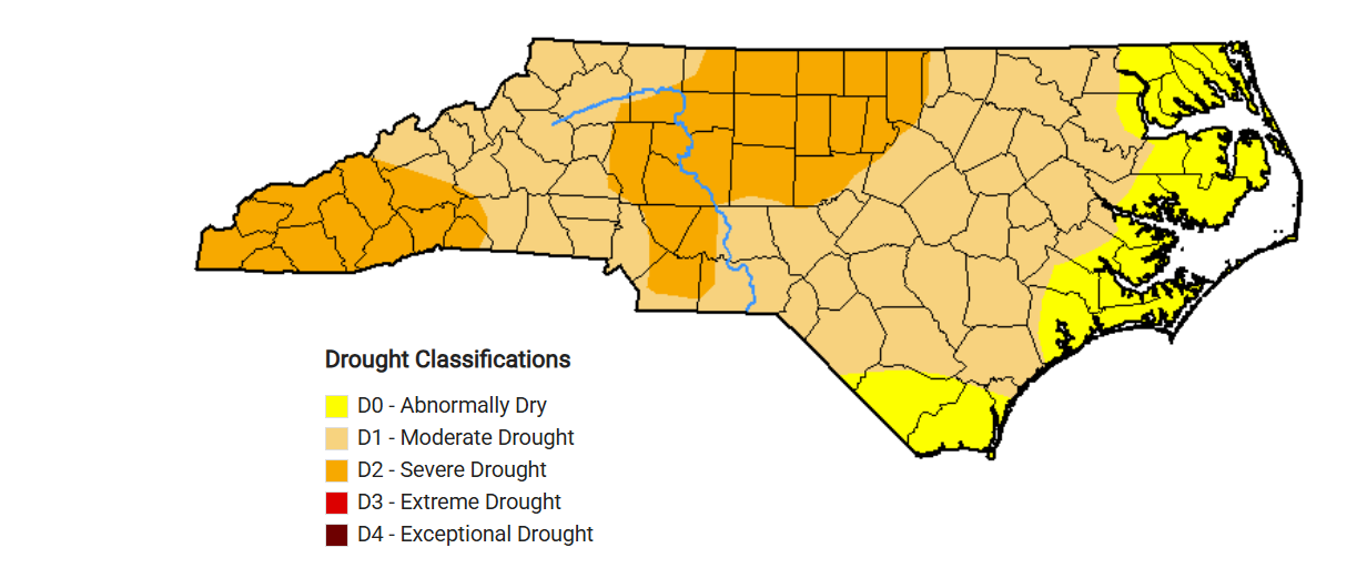
North Carolina is experiencing widespread dry conditions, with 15 of the state’s 20 coastal counties being classified as abnormally dry, according to the latest update of the state Drought Management Advisory Council.
Counties in central and western part of the state are experiencing the driest conditions, with 32 of them considered to be in severe drought, and 53 in drought conditions, according to the council’s Thursday update.
Supporter Spotlight

“The state has been drying out since the middle of August,” council Chair Klaus Albertin said in a release. “The region is seeing a La Niña pattern, which often results in lower-than-average rainfall. We hope to see some relief towards the spring, with forecasts predicting this pattern to weaken over the next few months.”
The council recommends water systems in counties experiencing severe drought implement their water shortage response plans, participate in regional and local coordination to manage water resources, reexamine water delivery systems to minimize water loss and eliminate nonessential users of water, according to the release.
Systems in counties under drought should asses their drought readiness and consider voluntary water conservation.
While negative impacts from these conditions are expected to be limited in the cooler months because of lower water demand, water reservoir levels “are continuing to drop,” according to the release.
“For water recreators, stream flow averages statewide are falling below normal. Average streamflows recorded at U.S. Geological Survey ga(u)ges at many locations in central and western North Carolina have fallen below the 10th percentile,” the release states.
Supporter Spotlight

Council members meet weekly and submit drought condition recommendations to the National Oceanic and Atmospheric Administration, U.S. Department of Agriculture, and the National Drought Mitigation Center.
The council consists of drought experts from various government agencies in North Carolina, South Carolina, and Virginia and is organized by the N.C. Department of Environmental Quality’s Division of Water Resources.
The drought map is updated weekly on Thursdays, based on conditions through the previous Tuesday.