Effects of Hurricane Erin, including flooding, storm surge and overwash have already begun on the coast, and will worsen overnight, National Weather Service meteorologists said late Wednesday morning.
“Despite the path of Erin forecast to remain offshore, the threat for life-threatening rip currents, damaging beach erosion, major coastal flooding and overwash, and extremely dangerous surf continues as expected,” forecasters said. “Erin is expected to increase in storm size, and tropical storm force winds will reach the coast, especially the Outer Banks.”
Supporter Spotlight

Gov. Josh Stein and state emergency management and transportation officials reiterated during a press briefing Wednesday that the coast will feel the effects event though the storm will pass a few hundred miles offshore.
“Based on the current forecast, we are anticipating coastal flooding from massive waves, tropical storm force winds, and tidal and storm surge for much of the state shoreline, especially the Outer Banks, from this evening through Thursday,” as well as life threatening rip currents, and extensive beach erosion along much of the coast, Stein said.
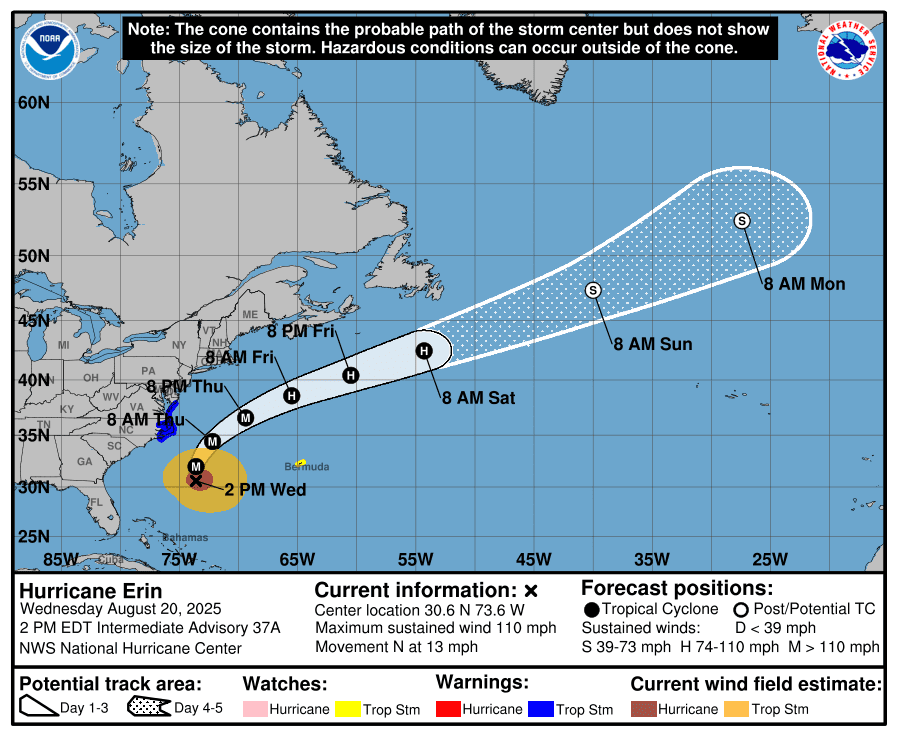
As of 2 p.m. Wednesday, Hurricane Erin was about 335 miles south-southeast of Cape Hatteras with maximum sustained winds at 110 mph. The storm was moving north at 13 mph and is forecast to move northwest, and then northeast through midweek.
Storm surge warnings and tropical storm warnings were in effect Wednesday for Cape Lookout to Duck. A tropical storm warning is in effect for Beaufort Inlet to Chincoteague, Virginia, including Pamlico and Albemarle sounds. Moderate to significant storm surge inundation of 2 to 4 feet above ground level is expected along the oceanside north of Cape Lookout, and the worst impacts will likely be felt along the Outer Banks on Ocracoke and Hatteras islands, forecasters said.
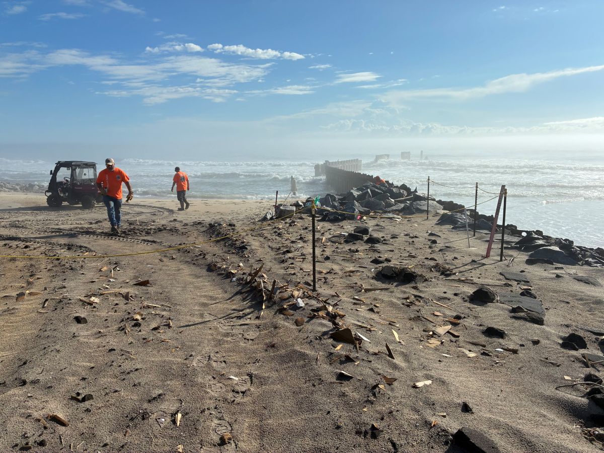
Strong rip currents are expected through the remainder of the week, and extensive beach erosion is likely. Waves could reach 20 feet in height with wave periods of 15 or more seconds, with the highest on the Outer Banks.
Supporter Spotlight

Warning Coordination Meteorologist Erik Heden with the National Weather Service’s Newport office said during his midday briefing Wednesday that, in terms of impacts, the forecast hadn’t changed since Sunday.
A borderline Category 3 storm on the Saffir-Simpson scale, Hurricane Erin was starting to turn to the north, Heden said, and his office has “high confidence” the storm was going to turn to the northeast. Category 3 winds are from 111 to 129 mph.
Heden urged those along the coast to keep in mind that if Erin gets a little stronger or weakens in terms of just wind speed overnight, that “doesn’t matter for us. We’re still going to have high impacts along our coast,” Heden said. “No matter what happens to the strength, please know that our impacts have not changed.”
Stein, during his briefing, reminded listeners that states of emergency had been declared for Currituck, Dare and Hyde counties. Mandatory evacuations were put in place for visitors and residents earlier this week for Ocracoke and Hatteras islands.
“Yesterday, I declared a state of emergency across North Carolina to facilitate our emergency response and to keep you safe,” which enables the state government “to send critical resources from across the state and around the country to respond,” he said.
Stein said he wanted to emphasize “the importance of taking this storm seriously, because it’s a serious storm and conditions can deteriorate quickly, please take these steps to ensure your safety,” which include staying informed by following reputable sources like the National Weather Service and local media, having a disaster kit ready, and an evacuation plan set.
“And finally, do not drive through floodwaters. Too many people have died driving into flooded roadways. Don’t do it. You do not know how deep the water is or how fast it is running, so please don’t drown. Turn around. We do not want you to become a casualty of Hurricane Erin,” he said.
State Emergency Management Director Will Ray said he wanted to remind everyone, that “regardless of the track of the center of the storm, dangerous conditions can be felt far from the eye, especially with the system as large as Erin.”
Wave action and storm surges of 2 to 4 feet will likely erode dunes along portions of the coast, especially east- and southeast-facing beaches and the Outer Banks, and cause numerous roadways to become impassable, especially N.C. Highway 12.
Ray said no significant federal resources were expected to be needed to support response, but the agency would continue to reassess throughout the storm.
He said coordination around problems such as abandoned or derelict vessels, or anything that could create hazardous debris in waterways, “those are conversations we’ve been having over the course of this week with the various federal agencies.” Those include the Environmental Protection Agency, U.S. Army Corps of Engineers and Coast Guard providing support, “on how we, one, support life safety missions in those impacted areas, but also have the right federal resources postured should they be needed to deal with some of the infrastructure impacts there.”
When asked about long-term plans to preserve N.C. 12, Stein said officials will have to wait and see what the extent of the damage is from this storm.
“Look, people love our Outer Banks. It’s a national treasure, and you need to be able to get to them. We have ferries that take us to the islands, but this is an important road for North Carolina,” Stein said. “So many people live there. There’s so much tourism dollars that goes on that road. It is an important asset to the state. And then we need to do everything we can to protect and preserve it.”
North Carolina Department of Transportation officials in a press release shortly after Stein spoke advised people on the coast to avoid traveling starting Wednesday night because the rain and winds from the western edge of the storm could flood and damage coastal bridges and roads, including N.C. 12.