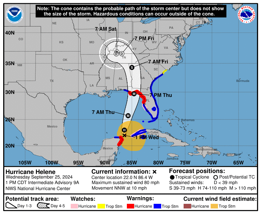
As Hurricane Helene moved Wednesday through the Gulf of Mexico, heading for the Florida panhandle, officials here reminded residents to prepare for the storm’s effects.
“Helene is expected to become a major hurricane by Thursday. While significant impacts will remain west of our area, some impacts are still possible for Eastern North Carolina,” forecasters with the National Weather Service said at its 11 a.m. Wednesday briefing.
Supporter Spotlight
Because of the storm’s size, forecasters expect that effects will be felt far away from the storm center, especially to its east. “Local impacts will include gusty winds, some areas of flooding, isolated tornadoes, and dangerous surf conditions,” they said at the noon briefing.
Also on Wednesday, Gov. Roy Cooper declared a state of emergency ahead of the powerful storm expected to cause flash flooding, numerous landslides, damaging debris flows, slope failures across steep terrain, and riverine flooding across portions of western and central North Carolina. Flooding may occur in areas that do not typically flood, according to Cooper’s office.
“Helene threatens heavy rain, flash flooding, landslides, and damaging winds to the mountains and Piedmont areas of our state,” Cooper said. “Now is the time for North Carolinians to prepare, make sure emergency kits are up-to-date and pay attention to the weather alerts in your area.”
Effects could be felt as early as Thursday night, but Friday will bring the storm’s worst to this area.
“A few tornadoes are possible which may produce enhanced areas of damage,” and there’s an enhanced threat for rip currents, a chance of coastal flooding, especially in areas still with elevated water levels, and strong winds, especially over the coastal waters south of Cape Hatteras,” forecasters said.
Supporter Spotlight
The state of emergency gears up certain state emergency operations and allows for the North Carolina departments of Transportation and Public Safety to act to ensure the quick movement of utility vehicles and those carrying essential supplies such as food, medicine and fuel or transporting livestock, poultry and crops.
State officials provided the following tips to prepare:
- Have multiple ways to receive emergency information, including watches and warnings. Make sure emergency alerts are enabled on your cell phone and monitor local new outlets and the National Weather Service.
- Ensure that you have multiple ways to receive warnings, especially with the potential for severe storms to be moving through during nighttime hours.
- Have an emergency plan. Know where you would go if you need to evacuate, especially if you live in a flood prone area.
- Gather emergency supplies or refresh your emergency kit. Visit ReadyNC.gov for info on how to build an emergency kit.
- Never drive through flooded roadways or around barricades. Turn around. Don’t drown.
- Make sure you know where to seek shelter if a tornado warning is issued for your area.
- Check to see if your local emergency management office offers emergency alert services for its residents. You can visit your county government website for more information.
- Avoid unnecessary travel. If you do not need to drive, stay home. You can find current roadway conditions by visiting DriveNC.Gov.


