The First Colony Foundation has published a book tracing what the nonprofit group has learned since forming in April 2003 about the fate of Sir Walter Raleigh’s Lost Colony.
Edited by the foundation’s Vice President of Research, Dr. Eric Klingelhofer, “Excavating the Lost Colony Mystery: The Map, the Search, the Discovery” is a compilation of essays and writings intended to bring the significance of the “La Virginea Pars” map and Site X into perspective. Klingelhofer is professor emeritus of history at Mercer University in Macon, Georgia.
Supporter Spotlight
Published by the foundation and the University of North Carolina Press, the book that includes contributions by historians, archaeologists and other experts is an exploration of science, research and history.
By design, “Excavating the Lost Colony Mystery” is intended to be read by everyone, Klingelhofer told Coastal Review.
“(The book) is not a collection of symposium papers for an audience of scholars,” he wrote in an email. “I chose those papers that most fit the story of what we did, why, and how, and the context of that story. I told each author about this, and that I would be editing all for the general public to follow. No footnotes to be used.”
For Sir Walter Raleigh, the New World represented economic opportunity and an opportunity for scientific discovery. Thomas Harriot, a mathematician and scientist, and artist John White were part of the scientific exploration of the new lands, and the pair created the Pars map, more properly Virginea Pars map, in 1585 during the second expedition to the North Carolina coast.
In 2012, a request by the foundation to the British Museum where the map is housed was made to examine two paper patches on the map. What researchers found was the symbol for a fort under one of the patches — what has now become known as Site X.
Supporter Spotlight
Located at the confluence of Salmon Creek and Chowan River in Bertie County, the Site X finding has led to a series of discoveries and new information about the more than 100 English men, women and children who disappeared from Roanoke Island sometime between 1587 and 1590, when the long overdue relief ship returned to find the site abandoned.
The only clue to their disappearance was the word “CROATOAN” carved into a tree.
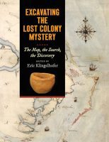
In “Excavating the Lost Colony Mystery,” Klingelhofer takes the reader on a well-organized journey of discovery, beginning with Phillip Evans’ contribution, “The search for Raleigh’s Colony,” which gives an overview of known factual information, the false starts, pseudohistory and hucksters who have laid claim to certain knowledge of the fate of the Lost Colony.
The reader hears from the British Museum’s Curator of British Drawings and Watercolours Kim Sloan about when she realized how important what was hiding beneath that patch of paper could be, and foundation member, archaeologist Nicholas Lucketti in “The Prima Facie Case for Site X” chapter that details why there is good reason to think some, but not all, of the Colonists settled on the bluffs at Salmon Creek.
What adds to the story is the very human reaction even the most dedicated scientists and researchers share in the book.
Here is Sloan on realizing the significance of what she found beneath that patch of paper.
“I could see that the marking resembled what I thought to be the symbol for a fort. I said to Alice (Alice Rugheimer, a paper conservator at the British Museum), ‘I think we just discovered the intended site for the ‘Cittie of Ralegh’, the colony that John White was sent to Virginia to found.’ And then I think I swore,” she wrote.
In Lucketti’s introduction for “The Prima Facie Case for Site X,” he highlights the sensationalism of the press.
“Bold headlines and excited press reports in 2016 told the public about the First Colony Foundation’s amazing discoveries at Site X — equal to finding the Ark of the Covenant or Jimmy Hoffa’s body,” he wrote.
Like the Ark of the Covenant or Hoffa, the union activist who disappeared in the mid-1970s, what ultimately happened to the Lost Colony may remain unsolved, something Klingelhofer acknowledged, while also noting that the research may yet hold the answer.
“And yet the story of Raleigh’s colony continued to stir the public’s imagination. National Geographic Magazine had recently published (2013) One Hundred Greatest Mysteries, listing the Lost Colony among them. Site X and Mettaquem (the Native American village adjacent to Site X) would prove to hold important new clues toward a resolution of that mystery,” Klingelhofer wrote in his chapter “Science in the Search,” introducing the science behind the hunt for the fate of the Colonists of Roanoke Island.
The book does not provide definitive answers, and the writers go to some length to make it clear nothing conclusive has been discovered.
“We do not have a smoking gun — no artifacts undeniably of sixteenth-century European origin,” Luccketti wrote. “No features from English buildings, no burials. We did not find a fort. Nor did we claim that we had found the site of the main group’s relocation …”
What researchers did find suggests that the colonists left in small groups and coexisted with Native residents, especially the Chowanoke Nation who occupied much of what is now Gates, Hertford, Bertie, and Chowan counties. Site X is well within the boundaries of what would have been the Chowanoke Nation.
Asked in an email if it is reasonable to conclude that the Roanoke settlement broke up into small group, Klingelhofer answered, “Yes, that is exactly what we think, though do remember that the book only covers Site X. We are not ones for puerile speculation.”
“Excavating the Lost Colony Mystery” is a detailed chronology of how the conclusion that the Colonists left in small groups was reached and the discoveries along the way.
For example, the reproductions of White’s paintings are depicted as dull, almost two-tone images. But originally, the paintings were not dull at all, Sloan writes while describing the research British Museum Department of Conservation and Scientific Research Janet Ayers uncovered.
The point Janet Ayers made in her article was about John White’s use of gold and silver in his work. “Fish, for example when they are alive are iridescent, and in order to capture this, John White used these precious pigments,” Sloan wrote.
The historical research that the writers recount brings the men who explored the Albemarle region of what they had designated Virginia into focus.
Capt. Ralph Lane served as governor for the first attempt at a colony in 1586. Soldiers under his command beheaded King Wingina, the ruler of the Algonquian Indians on Roanoke Island. That action is often seen as a primary reason the closest Native nation to the colony would not help the colonists.
“Roanoke Colonies Illuminated” in East Carolina University’s Digital Collection, notes that although Lane returned to England in 1586, his actions impacted the 1587 attempt to settle Roanoke Island.
“It is likely that the bad blood fostered by Lane did not work much in the favor of Raleigh’s subsequent Roanoke expeditions,” the website points out.
But, James Horn, in his chapter, “Into the Maine: Why They Went West,” seems to question if Lane had complete control of the soldiers under his command in 1585-86, citing Lane’s description of them as ‘wylde men … whose unrulynes (was) suche as not to gyve leasure to the goovenour.’”
And according to Horn, who is president of the Jamestown Rediscovery Foundation and on the board of directors for the First Colony Foundation, Harriot confirmed that observation.
“They killed Indians, he wrote, ‘upon causes that on our part, might easily enough have been borne,’” Horn recorded Harriot as writing.
Yet for all the detail there is a feeling as though the book has barely scratched the surface of what has been learned and is still to come.
It is, as Sloan writes at the end of her “Paper Patches” recounting of how Site X was identified, “the best kind of historical quest, one that just keeps asking us to try to find further truths about the past in order to learn from it for the future.”


