Rules on the size and location of buildings allowed at many of North Carolina’s inlets will once again be up for discussion by the state Coastal Resources Commission after state officials withdrew amendments approved by the commission last month.
Following years of discussion, debate and multiple public hearings, the Coastal Resources Commission, or CRC, unanimously approved rule amendments for Inlet Hazard Areas, or IHAs, and redrawn boundaries of those areas during its Sept. 15 quarterly meeting.
Supporter Spotlight
The amended rules were filed Sept. 23 with the state Rules Review Commission to be reviewed during that commission’s November meeting. Staff with the state Division of Coastal Management, or DCM, withdrew the updated rules Sept. 29 from the Rules Review Commission, which is tasked with reviewing and approving rules adopted by state agencies.
“The 2019 Fiscal Analysis for IHA rules was correct at the time it was written and approved by the CRC, but subsequent changes to other CRC rules removed a specific provision while the IHA rules were still being considered that would have provided certain exceptions in situations where erosion rates increased within newly designated IHAs to the point that this would ‘preclude the placement of permanent buildings,’” division spokesperson Christy Simmons said in a Sept. 30 email.
The proposed rule amendments are to be presented to the CRC at its November meeting.
“Depending on the Commission’s direction, this could result in additional amendments that would require further rulemaking procedures, including an updated Fiscal Analysis and the opportunity for public comments/public hearings,” Simmons said.
The CRC Science Panel, an advisory board to the commission, identified a need to update the state’s IHAs when it was initially formed in the late 1990s. Since then, the Science Panel has discussed how to best predict inlet erosion and accretion rates at IHAs and recommended updated boundaries.
Supporter Spotlight
Updates were proposed in 2010, but discussions on those were sidelined by a state-implemented terminal groin study and a study of oceanfront erosion rates, according to Ken Richardson, DCM shoreline management specialist.
“We know that inlets are kind of where the action is,” CRC board member Bob Emory said during the commission’s Sept. 15 meeting in Wilmington. “We’ve been studying it off and on pretty doggone thoroughly for 20 years. The science panel and their methodology is science-based and with each iteration it has improved over the years. I believe we’ve been thoughtful about the regulations that we’ve adopted to apply in these proposed inlet hazard areas. I think we’ve really arrived at a very good place having watched the evolution of this over the last few years.”
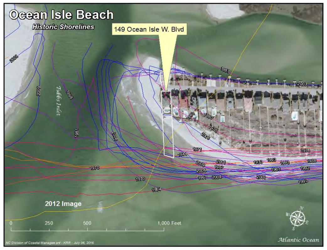
IHAs are shorelines especially vulnerable to erosion and flooding where inlets can shift suddenly and dramatically.
Erosion rates are more similar and evenly parallel along a straight shoreline. That’s not the case at inlet shores, which curve around.
“As a result, the CRC has adopted inlet setback requirements based on calculated inlet erosion rates rather than continuing to apply the adjacent (Ocean Erodible Area) erosion rates to IHAs. The CRC is continuing to implement limits on structure size and density within the IHAs,” Richardson said in an email responding to questions.
Ten of North Carolina’s 19 active inlets are developed, including Tubbs, Shallotte and Lockwood Folly in Brunswick County; Carolina Beach, Masonboro, Mason and Rich in New Hanover County; New Topsail and New River in Pender County; and Bogue Inlet in Carteret County.
Hundreds of acres of land at those inlets are designated IHAs.
The proposed size of IHAs has been reduced at some inlets but, overall, updated boundaries would include more acreage, Richardson explained in the email.
“Collectively, IHAs are reduced by approximately 470 acres at Tubbs, Mason and New Topsail Inlets; and increased by approximately 1,800 acres for all others combined,” he said.
Under the proposed boundaries, about 4,778 acres will be included in IHAs. A little more than 150 acres of that does not fall within existing Ocean Hazard Areas, or beaches, frontal dunes, inlet lands, and other areas susceptible to excessive erosion or flood damage.
“In other words, approximately 97% of the land area inside the proposed IHAs is already part of one of three existing (areas of environmental concern) that make up the current Ocean Hazard Area, and already within the CRC’s jurisdiction,” Richardson said.
The amended rules would only apply to new development.
Proposed amendments would allow structures built in an IHA prior to the updated boundaries to be grandfathered in, a move that addresses concerns voiced by property owners who have structures larger than 5,000 square feet.
Newly constructed buildings in IHAs cannot exceed 5,000 square feet.
Richardson told the commission that the plan is to review IHA erosion rates and boundaries on a similar schedule with oceanfront erosion rate updates, which occur about every five years.
That review process will include studying new methodologies for predicting erosion rates.


