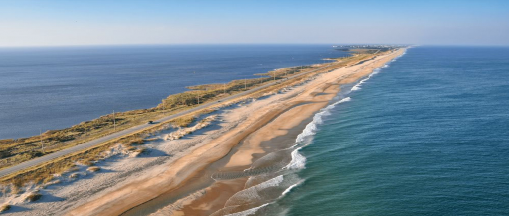
The National Park Service has selected a plan that provides a streamlined framework for Cape Hatteras National Seashore to manage over the next 20 years activities such as including beach nourishment, dune rebuilding, habitat restoration and emergency breach fill, with conditions.
National Park Service South Atlantic-Gulf Regional Director Stan Austin and U.S. Fish and Wildlife Service Southeast Regional Director Leopoldo Miranda-Castro signed Wednesday a record of decision for a sediment management framework environmental impact statement at Cape Hatteras National Seashore.
Supporter Spotlight
The National Park Service’s selected alternative B. Under this alternative, the park service could permit other agencies and municipalities to conduct, with conditions, sediment management in the form of oceanside and soundside beach nourishment, filling island breaches, and dune restoration, according to documents. This alternative would also recognize that park service and others may independently or in partnership restore beach habitats or periodically protect specific facilities or resources through sediment placement in areas that have been affected by erosion.
A sediment management framework helps park partners who want to nourish beaches in the face of increased storm events and projected sea level rise. The framework is to include when, where, and how sediment management actions may be permitted at the seashore.
A special use permit application and approval process detailing how the seashore will review, issue and manage special use permits for larger-scale sediment management activities was developed as part of the framework as well.
Sediment management activities will usually not be permitted along the 13 noncontiguous miles of beach set aside for monitoring where beach width and lack of vulnerable infrastructure indicate a low potential for requests to manage sediment.
David Hallac, superintendent for National Parks of Eastern North Carolina thanked U.S. Army Corps of Engineers Wilmington District Regulatory and Planning divisions, U.S. Fish and Wildlife Service Pea Island National Wildlife Refuge and Raleigh Ecological Services Field Office, the Bureau of Ocean Energy Management, the North Carolina Department of Transportation Ferry and Highway divisions, the North Carolina Wildlife Resources Commission, Dare County and Hyde County.
Supporter Spotlight
“Their assistance in developing this plan will allow our partners to protect important community infrastructure while avoiding and minimizing impacts to the resources of Cape Hatteras National Seashore. We also appreciate the time that many individuals and organizations took to review the plan and provide helpful comments and recommendations,” he said in a statement.
The record of decision explains the decision, describes the selected alternative and documents public and agency involvement in the decision-making process. The issuance of the record of decision is the final step in the National Environmental Policy Act process.
To view all documents, visit parkplanning.nps.gov/CAHAsediment.


