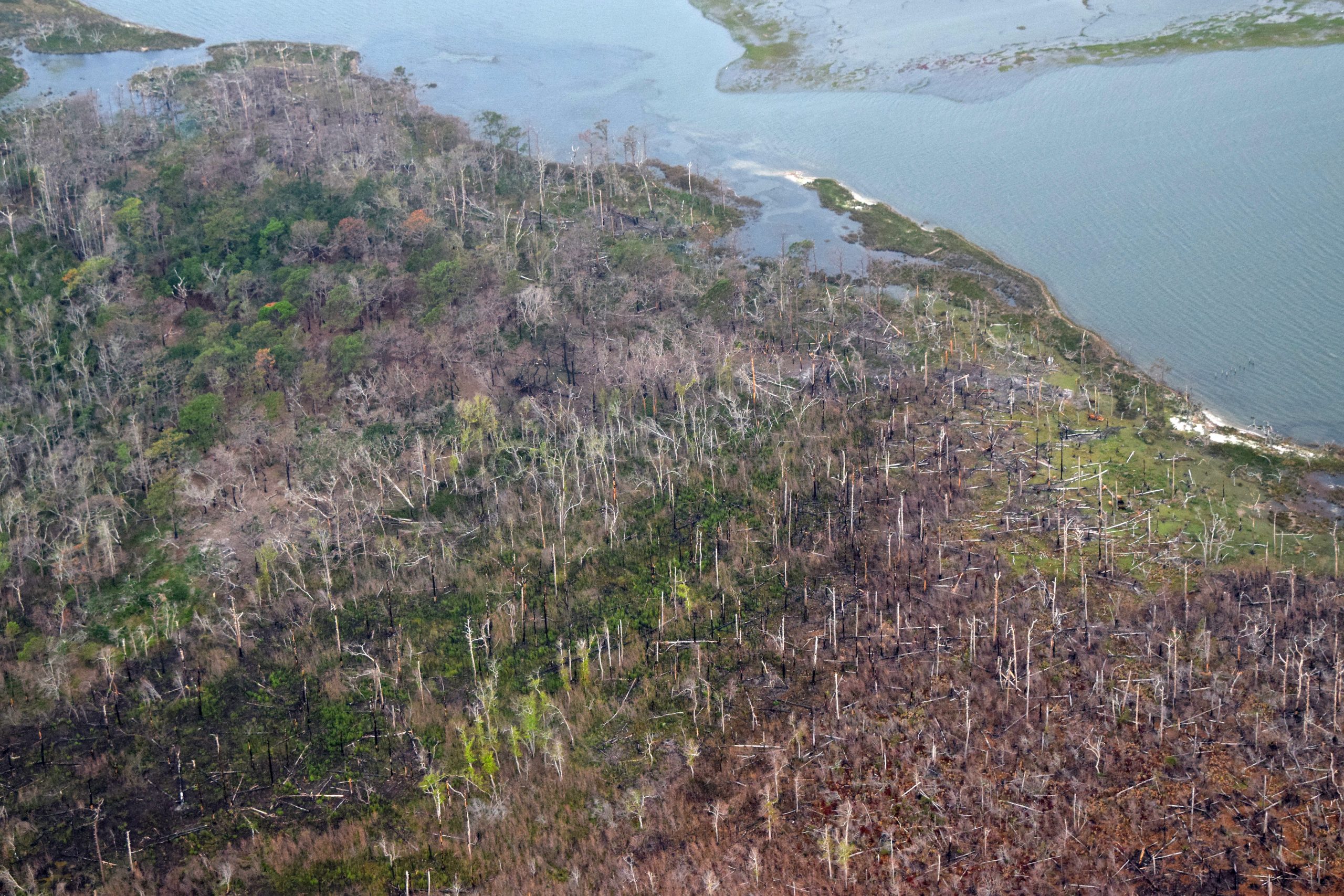
Encountering a ghost forest is a decidedly eerie experience. Tall, stripped tree skeletons remain standing long after they have died on the inside. The other deeply visceral part of the image is the sheer expanse of the ghost forests along the North Carolina coast, says Dr. Emily Ury, an ecologist at Duke University who studies ecosystem responses to rapid environmental change.
“Not just one or two dead trees, but hundreds of dead trees in one area,” Ury said. “You know just by looking at it that it’s not normal.”
Supporter Spotlight
Ury is the lead author of a study published this month in the journal Ecological Applications called “Rapid Deforestation of a Coastal Landscape Driven By Sea Level Rise and Extreme Events.” The purpose of the study was to map rates of vegetation change in the Alligator River National Wildlife Refuge on the Outer Banks using remote sensing techniques. Ury and her team analyzed data to measure the change in these coastal forests over a period of 35 years. They found that more and more coastal forestland is transitioning away from freshwater forest cover –and it is doing so quickly.
“The rate at which this is happening is fast, even for me, someone who studies climate change and ecological change,” Ury said.
“The rate at which this is happening is fast, even for me, someone who studies climate change and ecological change.”
Emily Ury, study author
Ury and her team found that 32% of the refuge had changed land cover classification over the last 35 years, whether that be through land loss, forest loss or shrubland expansion. This is happening despite the study area’s protected status as a National Wildlife Refuge.
About 19,300 hectares, or nearly 47,000 acres, was converted to marsh or shrubland, while 1,151 hectares was lost to the sea completely. What’s more, approximately 11% of forest cover transitioned into what has commonly become known as a “ghost forest.”
Ghost forests are not a random phenomenon. Most scientists accept the assumption that they are caused by increased exposure to salinity. Too much salt can cause widespread tree death, ultimately changing the ecosystem entirely. This results in habitat loss for wildlife and is capable of wiping out entire coastal forests.
Supporter Spotlight
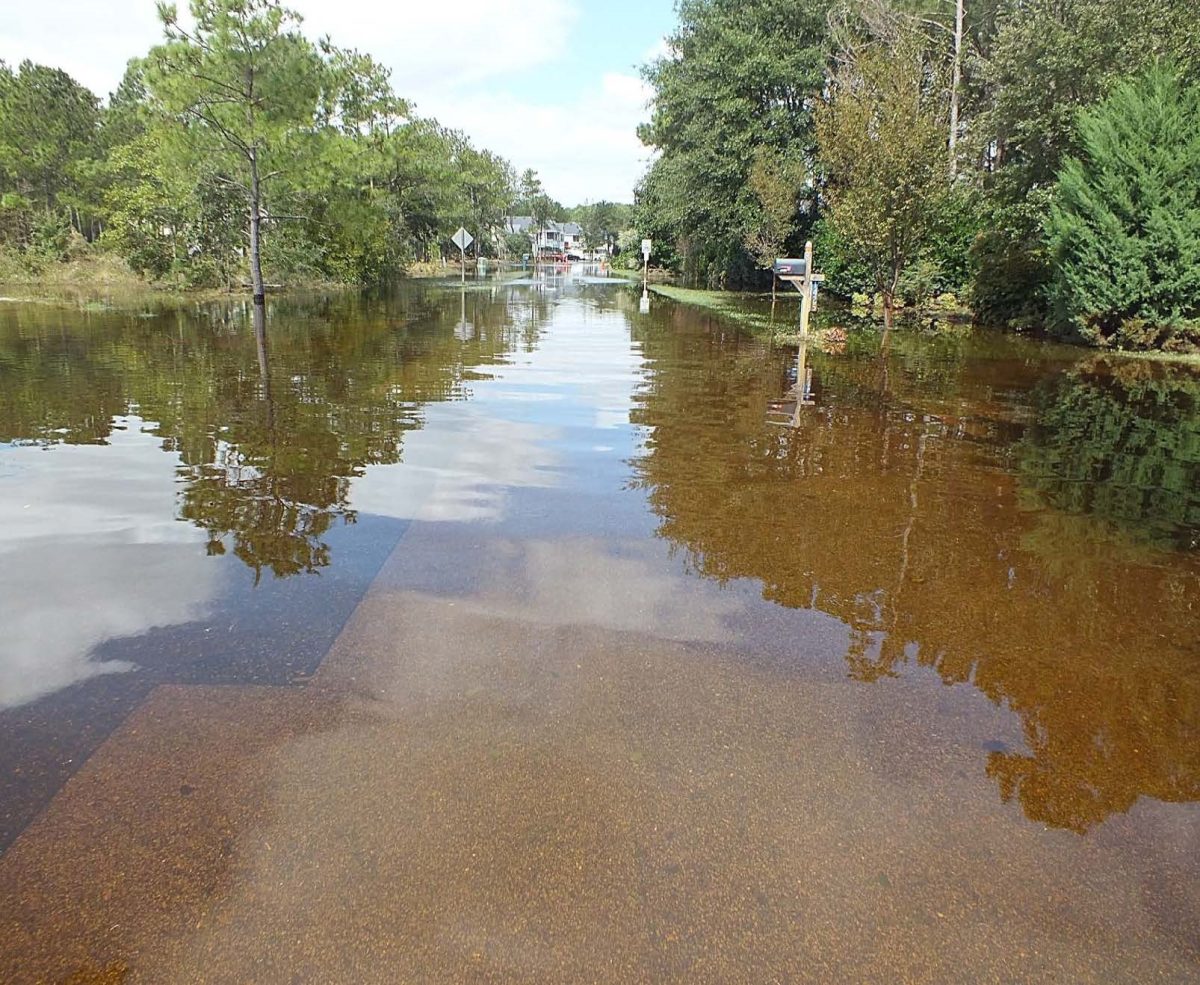
Rising sea levels are one cause of the infiltration of salinated water into coastal forests. Data compiled by the Virginia Institute of Marine Science show that the sea level has been rising every year along the North Carolina coast for decades. While sea level follows a linear curve, Ury’s study shows that ghost forests aren’t following quite the same pattern. Instead, ghost forests seem to expand largely after extreme weather events. For example, the refuge saw 4,500 — plus or minus 990 — hectares of ghost forest form between 2011 and 2012. Ury attributes this high point in conversion to be caused by the end of a five-year drought and the impact of Hurricane Irene that hit the coast in late August 2011.
But either way, said Ury, both the rising tide and extreme weather events are climate change-related things. What’s more, ghost forests are also an indicator of other environmental consequences.
Coastal forests are known for sequestering carbon in high rates in both their soil and in their plant life, particularly trees. When these areas begin to convert, some of that carbon is released into the atmosphere.
Dr. Lindsey Smart of North Carolina State University published a study in 2020 about ghost forest mapping across the Carolina coast. Her study focused specifically on aboveground carbon loss as habitats convert. According to Smart, Ury’s study supports what she and her team of interdisciplinary scientists also found.
“The Duke study identified the potential role of severe storms and droughts in the proliferation of ghost forests, which gives us a better understanding of why these ghost forests can appear in a much shorter timeframe than previously anticipated or expected,” Smart said.
Ury’s study was the first mapping effort to use completely remote sensing data, like NASA’s 430-mile-high Landsat satellite images. Smart’s work also used this technology in part. According to Smart, the technological abilities to make these measurements have expanded exponentially in the last decade, as has access to that technology.
“With the increase in the availability of remote sensing technologies and access to big data, like this volunteer geographic info and drone imagery, we’re really able to piece together the stories of the landscape in time and space more completely,” Smart said.
This evolving technology will allow for additional research to take place in order to more fully understand why ghost forests appear and what they mean for coastal communities. In addition, Smart said some research is needed to determine how people along the coast perceive ghost forests and what steps they are willing to take in order to adapt to them. The coast is a mix of public and private land, and any further conversations about ghost forests should account for the communities affected by them.
“Different landowners have different values for their landscapes,” Smart said. “And it just shows how critical it is to bring landowners into the conversation.”
This information would allow for a fuller picture of the issue and its consequences, as well as help scientists like Ury and Smart piece together the stories of these coastal forests more completely.


