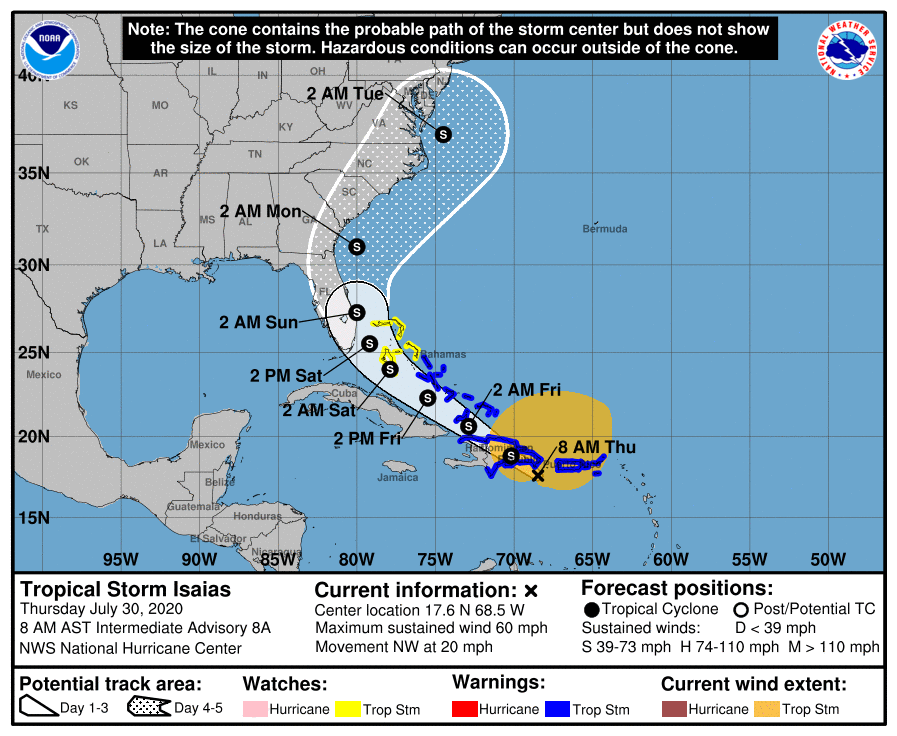
Coastal North Carolina could see rip currents from the newly formed Tropical Storm Isaias as early as Friday afternoon and tropical storm conditions could be felt as early as Sunday night, but most likely sometime Monday, according to a briefing Thursday morning from the National Weather Service office in Newport.
While the threat for tropical storm force winds is increasing, especially along the coast, track and intensity forecast and impacts beyond rip current risk remain uncertain as Tropical Storm Isaias, which formed overnight, is still organizing and expected to pass over Hispaniola.
Supporter Spotlight
There is the possibility of storm surge inundation along the coast and in sounds and rivers, and depending on the final track, localized heavy rain and elevated threat for tornadoes.
As the coast enters the most active portion of hurricane season, officials advise checking hurricane plans and supplies.
Latest update on #Isaias. For many more details click: https://t.co/CAZ6pXICRr Remember that dangerous rip currents are likely ahead of #Isaias as early as Friday afternoon! pic.twitter.com/7Raa7fmlnl
— NWS Newport/Morehead (@NWSMoreheadCity) July 30, 2020


