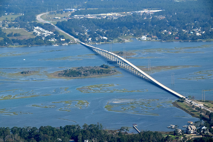
Bogue Banks is accessible via two bridges, one on N.C. 58 at the west end and the other connecting Morehead City and Atlantic Beach at the east end. Image: Google Maps
Supporter Spotlight
MOREHEAD CITY – Carteret County officials have asked the North Carolina Department of Transportation to expedite design work for a proposed third bridge, possibly a toll bridge, to Bogue Banks to help relieve congestion and improve hurricane evacuation.
The proposed project was discussed Wednesday during the Carteret County Transportation Committee’s meeting at the Crystal Coast Civic Center. The committee advises county commissioners on transportation issues and acts as a liaison to regional transportation planning organizations, or RPOs, and NCDOT.
Don Kirkman, director of the county’s economic development department, said NCDOT was asked to add the project to its queue for express design, a process that’s essentially an abbreviated feasibility study that estimates costs and environmental effects.
Diane Hampton, corridor development engineer for NCDOT Division 2, said the project is now in the queue but behind other proposed projects and subject to budget constraints and other considerations.
“Getting it into the queue for study is the first step.” Hampton said during the meeting.
Supporter Spotlight
Hibbs Road, a roughly 3-mile, two-lane stretch between U.S. 70 and N.C. 24, was discussed as a possible mainland connection for the bridge. Where the bridge would connect to N.C. 58 on the Bogue Banks side of Bogue Sound has town officials in both Indian Beach and Pine Knoll Shores worried.
Tim White is town manager in Indian Beach. He told Coastal Review Online that the town board had expressed numerous concerns, including the effects the project would have on property owners in town.
“Our concern is where is it going to locate? It’s going to come in our back door,” White said Thursday. “What’s it going to do to property owners here?”
Pine Knoll Shores Town Manager Brian Kramer said his community’s concerns are the same ones expressed a decade ago when a third bridge was proposed during creation of a countywide comprehensive transportation plan.
“The feeling 10 years ago among island towns was opposition to a third bridge and widening 58,” Kramer said Thursday. “At the time, the widening of 58 was connected to adding that third bridge. With the traffic impacts and the commercial development in Indian Beach, Salter Path and Pine Knoll Shores, it would be a pretty significant game changer in the central part of the island.”
White echoed the concerns.
“Does 58 need to be widened? I don’t know if 58 can handle another bridge. And a toll bridge? That’s not going to go over well.”
Hampton, with NCDOT, noted that the long process of planning and public discussion was just beginning, but now is the time to prepare for an expected doubling of traffic volumes in the area over the next 25 years.
The project was submitted a few weeks ago for express design, a process that usually takes less than a year once work begins. The timeline for construction, assuming the project gets approval and funding, is harder to estimate, but the earliest would be seven to 10 years, Hampton said.
“Right now, it’s just an idea. There’s no funding, no plans,” she said. “But we need to start thinking about it because of the traffic growth in the area and evacuation routes are very important.”
For the project to move to the construction phase, it would first have to be evaluated and scored according to the state’s prioritization process, which weighs factors such as traffic volumes, safety and local support as well as cost.
“Right now, it’s just an idea. There’s no funding, no plans.”
Diane Hampton, NCDOT
“If it’s not scored it will just sit there on the back burner,” Hampton said.
The idea for making the bridge a toll route was “tossed around” as a way to potentially speed the process, she said.
“Tolls are controversial but the benefit to cost ratio is great and makes it more likely to get scored higher, get funding and more likely to get built,” she said.
The process would look at both toll and nontoll alternatives, with each scored and treated separately as two different projects, as well as various siting and design alternatives, and then “let local input drive the decision making,” she said.
The process would also entail a lengthy environmental review as required by the National Environmental Policy Act, or NEPA.
“A project of this magnitude might need an environmental impact statement, which is quite an ordeal,” Hampton said.
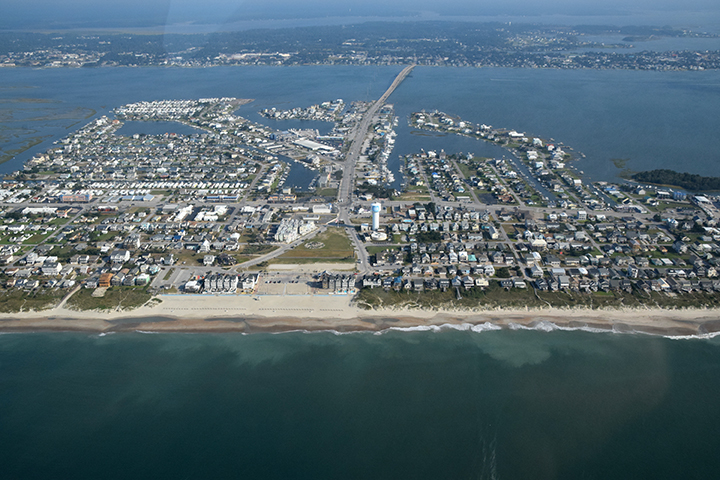
One of the biggest challenges with the project is that the central part of Bogue Banks is across the widest part of Bogue Sound.
“That’s another reason environmental issues will be looked at very closely,” Hampton said.
She noted that one suggestion for the project would be making the bridge a three-lane span with one lane dedicated for pedestrians and cyclists and protected with a removable barrier. Removing the barrier could allow all three lanes to be used to get people off the island rapidly, such as during a hurricane evacuation.
“I think that would be a big help,” she said.
Limiting traffic to two lanes during normal times could also allay concerns about N.C. 58’s capacity on Bogue Banks. The portion of the highway on Bogue Banks is mostly two lanes, except for turn lanes.
Kramer, with Pine Knoll Shores, said the discussions never got to the point of capacity when the third bridge was proposed a decade ago.
“We never got there as to what they were going to widen it to or how would you do that. We’re concerned again and will be keeping an eye on it,” he said.

