Second of two parts. Read Part 1.
“Seagrasses are like ‘Canaries in the coal mine,’” Jud Kenworthy, a research biologist, said. “The status of seagrasses can warn us about the health of our coastal ecosystem.”
Supporter Spotlight
The Albemarle-Pamlico National Estuary Partnership and its partners are working to better understand the status of the submerged aquatic vegetation or SAV along the coast of North Carolina and have been mapping the extent and density of SAV, which Kenworthy said will “help tell the story in space and time” of the seagrasses.
APNEP in September published a map of imagery years 2012-2014 that updates the higher salinity areas of the 2006-2008 SAV map, the first effort to record the location of underwater grasses along the North Carolina and southern Virginia estuarine coastlines. The update will allow APNEP and its partners to study if the region’s SAVs are growing, declining or stable, according to APNEP.
Kenworthy, who also serves as team co-lead, said that the maps developed for the period between 2006 and 2013 indicate that the high salinity seagrass beds are in much better condition than what is being documented in many other coastal ecosystems around the world that are experiencing severe declines.
“While it appears that widespread declines are not evident in North Carolina, there are some local declines that deserve attention by resource managers, especially in areas experiencing the most coastal development,” he said. “We need to focus on the conservation and protection of this resource because restoration is difficult, uncertain, less than the probability of a coin toss, and very expensive.”
Mapping SAV in the Albemarle-Pamlico estuary was done through a combination of aerial flights and ground truthing with boat-based surveys, conducted by APNEP SAV team members, which includes federal and state agencies, academic institutions and nongovernment organizations, according to APNEP.
Supporter Spotlight
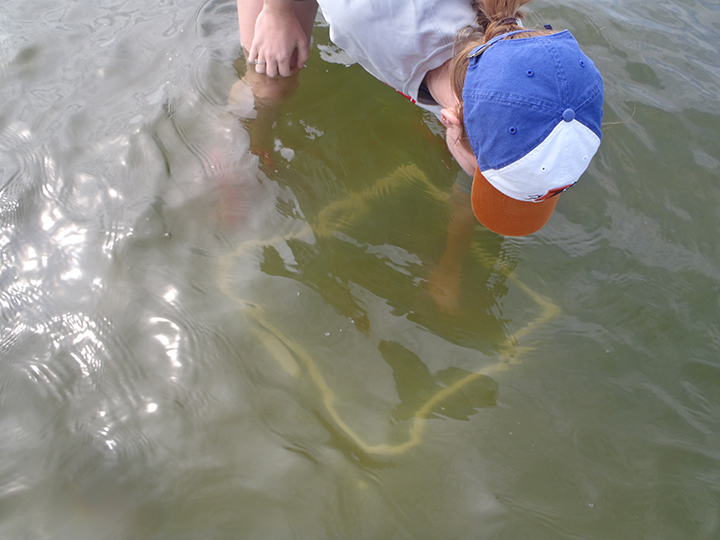
Kenworthy explained that using the seagrass maps for the two different years enables them to assess the geographic distribution of the SAV resource and determine its status. “Basically, where it is and how much there is growing in the estuary,” he said. They can also assess any changes in the abundance SAV between the two years.
“For the spatial extent of the SAV resource we are monitoring, the maps provide us with information at a scale, which is appropriate to the enormous size of the resource,” Kenworthy continued. “The maps are a large-scale picture of the resource and ‘a picture is worth a thousand words’ when you place it into the context of the entire APNEP region.”
APNEP plans to follow the release of the 2013 map with a more extensive analysis of the extent and density of the region’s underwater grasses later this year. A set of aerial flights and boat-based surveys took place this summer that will be used for a third SAV map to provide a more complete picture of the state of submerged aquatic vegetation in the Albemarle-Pamlico region, according to APNEP.
Kenworthy said he’s inspected the aerial photography from this summer and commented that if you had expected to see changes associated with Hurricane Florence, it appears that your expectations were met in some areas of the coastline.
“Storms can have substantial effects on benthic habitats like SAV. Truthfully, I did expect to see some changes. But I am also impressed by the resilience, given the large amount of wind and rain we experienced,” he said. “It will also be interesting to see how the cumulative effects of Florence and Dorian impacted the seagrass beds, given that many of the climate change forecasts suggest increased ‘storminess’ in the future. For this, the maps will be extremely useful.”
SAV mapping involves three major tasks: aerial image acquisition, boat-based surveys and photo interpretation,” explained Dean E. Carpenter, program scientist with APNEP. “All tasks require the coordination and collaboration of multiple APNEP partners.”
APNEP contracted with partner, North Carolina Department of Transportation’s photogrammetry team, for aerial images from White Oak River north along the Outer Banks to Highway 64 near Manteo and Nags Head.
Carpenter said they target the May-June time period, when the overlap in the distribution of the three high-salinity species is greatest.
“Because of the strict environmental requirements, such as water clarity, sun angle, cloud cover and low tide, and a narrow optimal biological window coupled with the extensive target area, the flights occur over multiple days and if necessary, multiple years,” he explained.
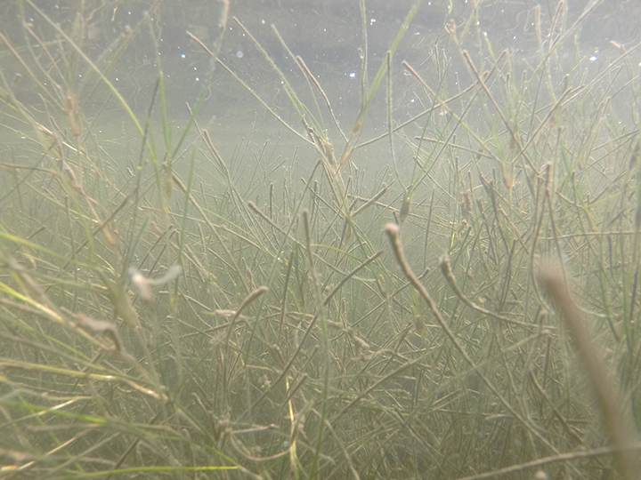
While SAV beds occur in many other parts of the Albemarle-Pamlico estuarine system, SAV cannot be detected from aircraft in those waters because of generally poor water clarity.
“Even within the target flight areas, water clarity can be impaired by sediment runoff from heavy precipitation events on previous days. Thus, APNEP established a network of volunteers along the coast who provided daily water clarity readings,” Carpenter said.

The days where the weather forecast and water clarity readings are favorable, the actual weather encountered may feature unfavorable conditions. “One example is the phenomenon of ‘popcorn clouds’ that prevented the acquisition of interpretable imagery over Core Sound during 2013 and a revisit flight in 2014,” he added.
In concert with the aerial mission, APNEP coordinated boat-based SAV surveys with partners, primarily the state Division of Marine Fisheries and the National Oceanic and Atmospheric Administration Beaufort Laboratory.
“Over 650 stations were surveyed in the target area. The resulting ‘ground truth’ data is important to support photo interpretation,” Carpenter explained in an email. With access to the aerial images and boat-based data, an APNEP photo interpreter worked over 150 hours to delineate SAV beds of differing spatial cover classes (e.g., continuous or patchy beds). A NOAA remote sensing specialist provided additional time in providing quality assurance on the interpretation.”
The Environmental Protection Agency provided APNEP funding and the Division of Marine Fisheries, the NOAA Beaufort Lab and numerous volunteers provided field and technical support.


