MANTEO — Ditches, swales and culverts, once the dullest of public topics, have become of urgent interest on Roanoke Island, where last summer’s epic rainstorm spurred Dare County to consider construction of its first engineered stormwater management project.
A new study of drainage infrastructure in the most affected neighborhoods on the island’s north end reveals that long-term fixes would not be easily, cheaply or quickly addressed.
Supporter Spotlight
Recommendations proposed in a three-phase project by Raleigh-based firm Moffatt & Nichol would cost about $2.6 million, not including engineering and easement acquisitions.
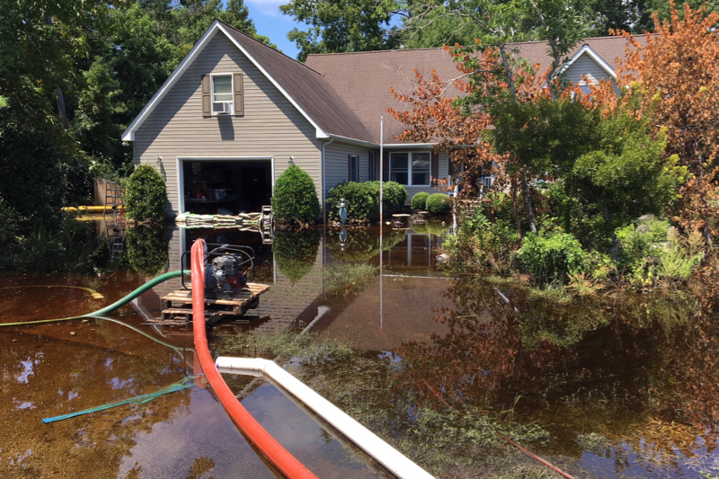
More than 15 inches of rain fell during a 10-day stretch in July 2018 on the north end of the island, flooding yards, homes and roads with increasingly wretched water for weeks, even months.
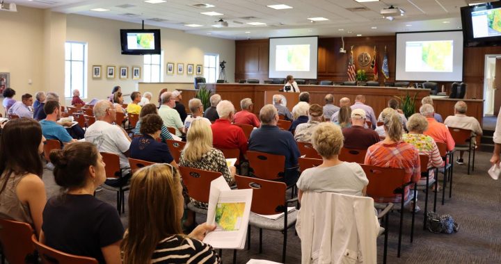
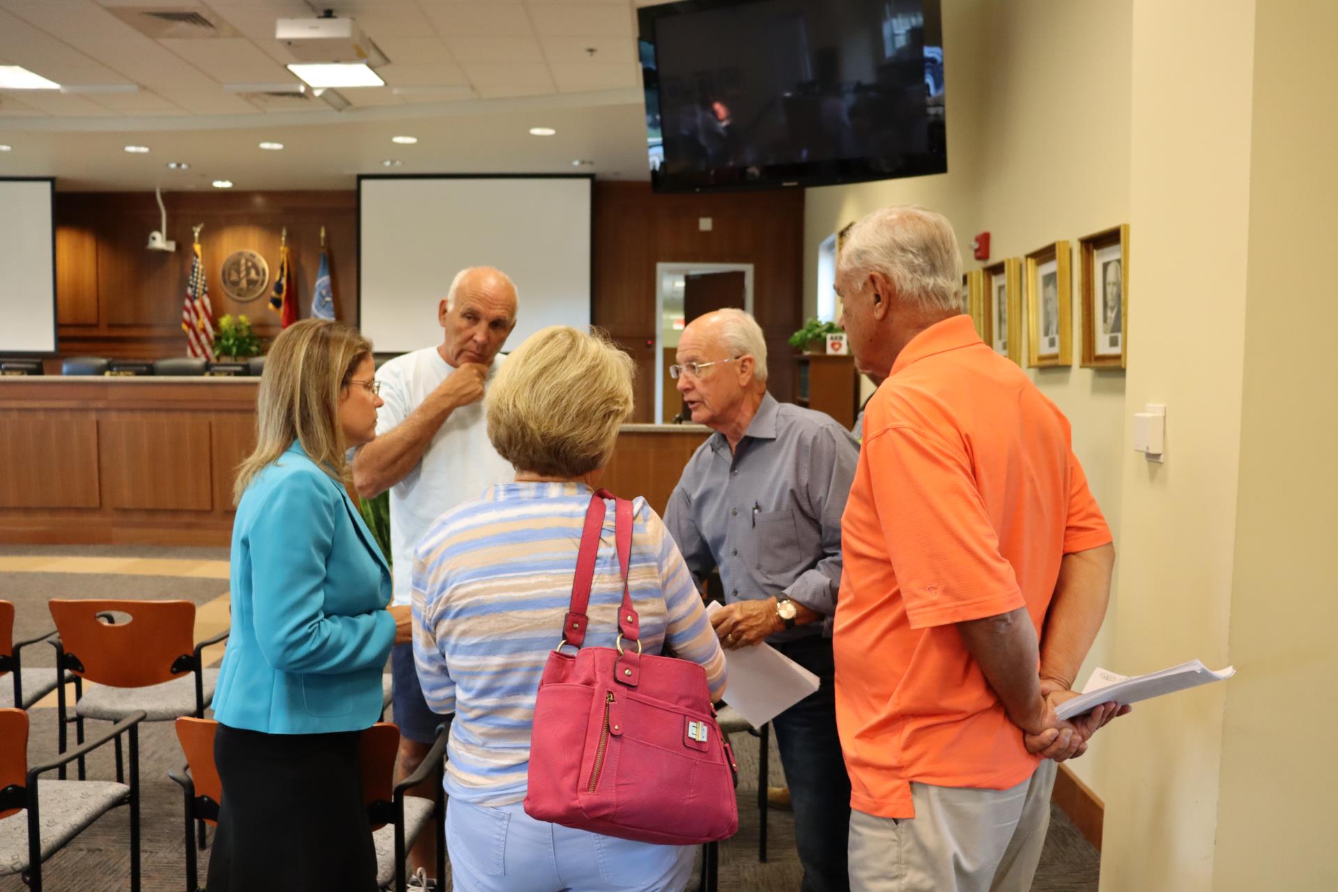
“The water didn’t have anywhere to go,” Ryan Smith, an engineer with Raleigh-based firm Moffatt & Nichol, said to 50 or so residents at a community meeting held last month in Manteo. “So it’s not just about depth; it’s about duration.”
Although Dare County has not yet done such comprehensive drainage improvements in its unincorporated communities, the increased flooding on the Outer Banks likely ensures that stormwater management projects will be a budget item for years to come.
Other flood-prone areas the county identified include Fernando, California and Scarborough streets on the west side of Roanoke Island; Tower Lane and Colington Road on Colington Island; Old Lighthouse Road in Buxton; and the mainland communities of East Lake and Stumpy Point.
Supporter Spotlight
But with most roads, roadside ditches and culverts under the jurisdiction of the North Carolina Department of Transportation, it has been difficult for the county to address drainage issues, county manager Bobby Outten said in an interview.
Outten said that if the county goes forward with the Roanoke Island work, it will require commitment from property owners, who will be expected to chip in a share of costs.
“We’ve got to sort through all of this stuff,” he said. “This is the first step in what is going to be a complicated process.”
With color-coded maps showing before-and-after water depths displayed on screens, Smith said the firm’s analysis, prepared for the state Department of Transportation at the request of Dare County, found that much of the drainage infrastructure in the approximately 1,000-acre, or 1.5-square-mile, study area was inadequate: too old, too small, too clogged or too shallow to handle the estimated 50 million cubic feet of rain that fell.
Some water drained into neighbors’ yards from more elevated homes and property. Some water spilled over from creeks and ditches. Some water just sat several feet deep on top of waterlogged land.
“We were prepared for the rain event, and we sandbagged our garage,” said Kimberly Head, who lives with her husband and four children in the Brakewood subdivision. “But then the water came through our vents. The water was almost up to our hips in some places.”
Responding to an outcry from residents after the storm, the county pumped 1.5 million gallons of water from affected areas, at a cost of $50,000. The North Carolina Forest Service pumped an additional 1.4 million gallons. The county has split the cost of the study – about $50,000 – with NCDOT.
According to data from the National Oceanic Administration, 15 inches of rain fell on Roanoke Island in July 2018. Of that, 14 inches fell during the last 10 days of the month. As far as categorizing that volume of rain – an estimated 50 million cubic feet – it would be considered midway between a 50-year and a 100-year storm, Smith said in a later interview.
Modeling in the report, however, was calculated for 10-year and 25-year storms. The different span of years is based on data that represents the likelihood of a storm of a certain magnitude to occur within the specified time period. For instance, a 10-year event has a 10% chance of occurring in any single year. It does not mean that it happens every 10 years.
But to the confusion of many, so-called 50- and even 100-year storms seem to be coming every few years.
“They certainly have been happening more often lately,” Smith said of the large rain events. “Whether they’ll continue to happen more often is something that people debate.”
NCDOT chose the study area around the Airport Road and Brakewood neighborhoods based on where the most flooding had been observed, Smith said.
Recommendations in the report include replacing existing pipes and culverts – pipes under roads or driveways – with larger ones; adding roadside and surface ditches, grading or excavating high spots, which will prevent water from being trapped and allow it drain to an outlet; installing erosion-control blankets – a degradable or removable covering – to stabilize grass growth over newly graded areas.
Another option would be to create a natural sand bed, freshwater creek with habitat features and a riparian buffer or flood plain. Although this option requires more area, it would also need minimal maintenance and would be environmentally friendly. The bonus of constructing a natural channel, Smith added, is that it would be more likely to qualify for grants from the state Clean Water Management Trust Fund or the National Fish and Wildlife Foundation.
“It would not reduce the drainage going into the sound, but it would improve water quality,” he said.
Engineering costs would be expected to be about 10% of the estimated construction costs, Smith said. There would also be additional costs to acquire easements from property owners, which are based on tax value.
Elevation in the study area ranged from below sea level at the downstream end of the creek to as high as 78 feet on the north end of U.S. 64, Smith said. The water table is generally high, and more so in low-lying areas.
Despite widespread flooding in the Roanoke Island neighborhoods, combined with the potential of more intense rainstorms, Smith said the data and engineering indicate that flooding can be managed.
“This is just a study-level analysis,” Smith said. “But the modeling that took place to come up with these systems is very sophisticated.”
By improving the capacity of the infrastructure and the storage in the soil, drainage flow can be restored.
“I think it can be and I think the type of solutions we address in the study would help,” he said. “It won’t flood and sit there 2 feet deep.”
Still, some areas present tougher challenges. For instance, Head said that even though her home’s property is like a bowl, it is not in a flood zone. No houses in her neighborhood are built on pilings.
“We’re an island that should be prepared,” she said. “I don’t think proper planning (for flooding) did occur. But my husband and I didn’t think about that. We looked at the ‘X’ flood zone.”
Flood Zone X on newer National Flood Insurance rate maps indicate a minimal to moderate flood risk, whereas on older maps it was understood to mean not a flood zone.
When the couple purchased the three-bedroom, two-bath house in 2015, Head recalled, flooding was not mentioned. But by the following year, their home had been inundated by 17 inches of rain during Hurricane Matthew and has also been flooded in subsequent storms.
Neighbors have since told her that her house had flooded several times before they bought it, she said.
“There is no way for us to drain our property,” said Head, a military retiree. “It would have to be pumped, or we’d have to move the house.”
Even before last year’s rainstorm, the Heads had applied to a Federal Emergency Management Agency program to have their home elevated 4 feet. Meanwhile, Head said the family is still dealing with effects from flooding, including mold damage, while coping with serious health issues for herself and her daughter.
“I would like to sell my home, but I won’t lie,” she said. “Trees are dying. All the bushes died. During (Hurricane) Dorian, five trees came down.”
But she’s keeping the house listed in hopes that another buyer could find a solution.
“I can’t take the anxiety of it,” she said of the flooding. “I am determined to enjoy life. I am an upbeat person, but every time it rains, or there’s a hurricane out there, it’s very stressful.”
Although Head said the report is “great,” she knows that the process will take time – and work near her property would be at the end of line.
“I hope that the county embraces this and moves forward quickly,” she said. “But I have my doubts. Phase III is a long ways away.”


