LONGMONT, Colo. – After walking only a few hundred feet into the forest of lodgepole pine, spruce and fir trees, I turned off my headlamp. Darkness closed in around me and the earthy smell of evergreen dominated my senses. As I looked up into the darkness, my eyes slowly dilated to reveal the outline of towering trees dancing in the wind against a blanket of shiny stars draped across the night sky.
The gusty breeze rushed through the tree branches creating a roar that reminded me of ocean waves crashing onto the beach. I then couldn’t help but think about family and friends back home along the coast of North Carolina, busy preparing for yet another hurricane less than a year after the devastation caused by Hurricane Florence. Two thousand miles away, I could feel their sense of dread, anxiety and apprehension created by this cyclone named Dorian that was just hours away.
Supporter Spotlight
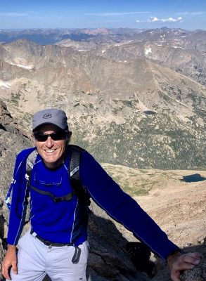
I stared up at the stars and took in a long deep breath, slowly exhaled, turned my headlamp back on and began the long hike up. Underneath my feet was a rugged trail that would lead me to my destination, Longs Peak in Rocky Mountain National Park.
This mountain at 14,259 feet above sea level, is easily visible from my adopted summer home in Longmont. In the distance, Longs Peak beckoned me like one of Homer’s Sirens, I cautiously lusted for it every day, like I would a freshly baked chocolate chip cookie.
Attempting to reach the summit was not a spur-of-the-moment irrational decision, it was unfinished business.
After living at close to 5,000 feet for three months, acclimation hikes up to 12,000 feet and watching weather reports for weeks, I was ready. Longs Peak and I had already a history, we tangled a number of years ago in an unsuccessful summit attempt with my brother-in-law. We became statistics of the over 50 % failure rate, driven off the mountain by high winds and the inability to find the trail markers. I was back, solo this time, to reach the summit. Motivated purely by the beauty of these mountains and the sensational views from the top, I hiked on.
Other hikers attempting to summit were well ahead of me, nowhere in sight. My research revealed that most Longs Peak hikers will start their hike at 3 a.m., knowing this, I started out at 5 a.m. in search of solitude, meditation with movement.
Supporter Spotlight
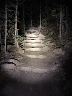
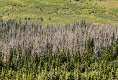
As I pushed up countless stone and log steps, my headlamp became less and less useful as a more powerful beam began to illuminate my surroundings. I walked alone through the forest and beside and over small streams fed by melting snowpack high on the mountain slopes. Throughout the forest, skeletons of ghost trees stood out among the healthy lush green trees. Some were still standing while others had crashed onto the ground, victims of the mountain pine beetle. Most of the dead trees are lodgepole pines, infested with beetles that had chewed deep enough into their trunk to kill them.
For many years now, milder winter temperatures allow more beetles to survive the cold winters and to also multiply more frequently, resulting in more beetles.
Throughout the park and the state of Colorado, these beetles have wreaked havoc on the pines leading to a cascade of potential environmental issues. The dead trees are no longer able to sequester carbon and are now actually releasing carbon into the atmosphere as they decay. This carbon becomes part of the cycle that fuels warmer global temperatures and a changing climate. The dead trees also increase the risk of wildfires, soil erosion and loss of habitat and food sources for wildlife.
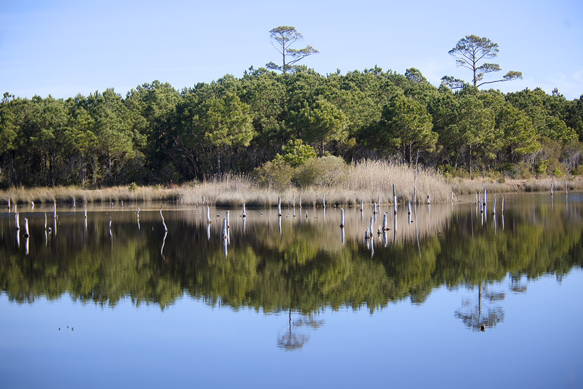
This reminds me of the loss of pine forests in North Carolina adjacent to coastal water bodies that are slowly dying due to the incremental rising of sea level. Salty water infiltrates low lying areas or is pushed in by storms raising the salinity to the point where the trees can no longer survive. The bare, gray trees become a tombstone to themselves and eventually a salt marsh will follow. Saltwater intrusion is especially problematic when adjacent agricultural fields become barren and livelihoods are at stake.
The higher I hiked, the trees became much smaller as I entered the subalpine zone.
Gradually, my pace brought me above the tree line. Here, temperature and wind extremes team up to create conditions so severe that trees cannot survive at these altitudes. The alpine tundra is not, however, devoid of life. This fragile landscape is full of specially adapted plants that cling low to the ground anywhere there is a patch of soil among the exposed rock. The surrounding slopes along the trail were covered with boulders of various sizes. Among the nooks and crannies of the boulders I could frequently hear the sharp warning call of the American pika pierce the crisp morning air.
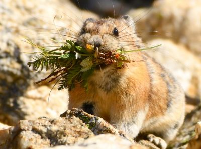
I pretended that they were cheering me on. A few weeks prior, I had spent hours photographing these adorable little furballs as they darted in and out of boulder piles.
They reminded me of ghost crabs on the beach that would quickly disappear into a burrow, only to pop up somewhere else. The pikas were busy making hay, harvesting mouthfuls of grasses and creating “haystacks” deep within the boulder piles. Since they don’t hibernate, they must store enough plant material to see them through the long, cold winter.
Looking like a miniature rabbit, pikas are not rodents but are actually closely related to rabbits. The pika thrives in the harsh cold, wet, windy alpine environment, but changing alpine conditions threaten their survival. Pikas are disappearing in much of their historic ranges and climate change is the culprit.
Warmer mountain temperatures, the amount of snowpack, drought, and vegetation growth all play a role in their survival. Numerous research studies have documented the vulnerabilities pikas face due to climate change and their future is bleak. However, recent research has shown that the pika is quite resilient and is showing signs of adapting in some areas.
Researchers are also considering a controversial idea called “assisted migration” to relocate populations of pikas to areas where conditions are more agreeable.
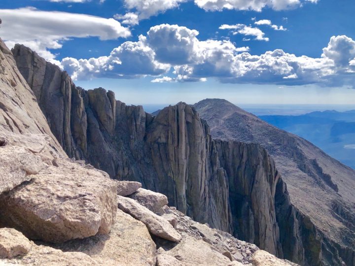
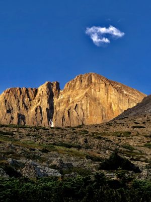
Above the tree line, with the trail rising higher, I was now starting to get views of the mountain. The sun was now peeking over the horizon and splashing a soft, golden glow on the east side of Longs Peak. This east facing wall of Longs Peak is a 900-foot sheer cliff known as “The Diamond,” a world-class alpine rock-climbing destination.
Sitting on top of the Diamond is the summit, the objective, my destination. I have neither the skill, experience, training or lack of common sense to attempt a summit climbing the vertical wall of The Diamond. My attack will be to sneak up from behind the Diamond along what is called the Keyhole Route on the west side of the mountain. But to get there I must finish hiking up 7 miles to what is called the Boulder Field.
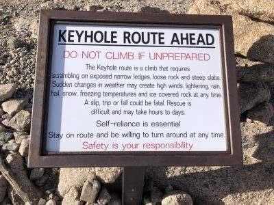
The visible trail etched into the mountain eventually grew fainter as the rocks and boulders became larger and larger. Here, a large, sobering sign was strategically placed as a warning for all to consider.
“DO NOT CLIMB IF UNPREPARED” in red letters. “The Keyhole route is a climb that requires scrambling on exposed narrow ledges, loose rock and steep slabs. Sudden changes in weather may create high winds, lightening, rain, hail, snow, freezing temperatures and ice-covered rock at any time. A slip, trip or fall could be fatal. Rescue is difficult and may take hours to days. Self-reliance is essential. Stay on route and be willing to turn around at any time.” The sign finished with “Safety is your responsibility” in all red letters.
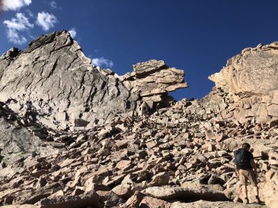
I took a long, deep breath and continued to the Boulder Field, a large talus pile where large rocks have weathered off of the side of the mountain. The Keyhole entrance at the top of this pile was now fully within reach. Getting there now required a dangerous game of hopscotch over boulders the size of a VW Beetle and tilted at various angles while going up a steep slope.
As the boulders became larger, the angle of repose became steeper, requiring climbing onto and over the boulders to reach the Keyhole. Throughout most of the Boulder Field, rock cairns were placed every so often to give the assumption of the easiest route, but it was only a suggestion.
I had now caught up with other climbers and passed a few as I climbed up to the Keyhole. Two young men that I assumed to be college students sat resting on boulders just inside of the Keyhole formation. As I stepped through the Keyhole, it was like walking through a portal into the grandeur of unimaginable beauty. Even the most jaded mountaineer would pause for a moment of reflection. I found a comfortable spot to sit and soaked in the view for about 10 minutes. Other climbers had now also reached the Keyhole, and after a quick glimpse of the start of the trail they decided to turn back down the mountain.
After 7 miles of serious uphill hiking, boulder hopping and rock scrambling, it was now time to evaluate continuing to the top. The Keyhole trail is all business, the trail is broken up into sections named The Ledges, The Trough, The Narrows, The Homestretch and The Summit. Each section has its own obstacles to scare the bejeebies out of you. The “trail” is now sporadically marked with red and yellow bull’s-eyes painted on some of the rocks.
With the markers in sight, I and the college kids started the Keyhole trail.
We soon came to our first ledge and the kid in the lead stopped and stared at the ledge. It was narrow, about 15 feet long, with a high wall on the left and the abyss on the right. He turned and looked at me.
“Are you turning around” I asked.
“No sir” he said, “I need a bathroom break.”
As he shuffled past me to take care of business, I stepped up to the ledge to walk across. I paused, not sure if I could continue. The kid was now back and he said, “let me take a look,”and then quickly moved across it with ease, like he was walking down the beach.
Following his lead, I stepped in his footfalls and knew that this adventure had really only just begun. The three of us took turns leading, and making our way across the side of the cliff we slowly made it to the base of the Trough. We had already been through enough ledges, troughs and narrows that I thought we were at the Homestretch. I asked a descending climber if this was the Homestretch, he just laughed and said “no.”
A bit dejected, but not discouraged, I looked up this wide gully of boulders of various sizes and could see the round trail markers rising steeply 600 feet up to the Narrows. While the Trough didn’t have any sheer drop-offs it was fairly steep in some sections requiring scrambling and reaching for handholds in the rock. You couldn’t stand upright and climb, you need a sturdy foot placement among sections of loose rock and good handholds. I played a game of connect the dots and gradually made it to the top and a ledge at the start of the Narrows. I had climbed ahead of my two companions and was now in the company of three jovial men that looked to be in their 30s.
The Narrows are just that, narrow. It is a long ribbon of a ledge etched into a sheer rock face on the south side of the peak. With other climbers returning from the top, the four of us had to wait our turn until the ledge was free of oncoming traffic. We moved slowly across the Narrows as a team, pointing out foot placement and handholds. I was so focused on foot and hand placement that I really didn’t notice the drop-off into oblivion.
After making it across the Narrows, we were now at the Homestretch, a steep, 300-foot climb up slick granite. Looking up to the top of this pitch, for the first time, I really thought I was going to reach the summit. But first, I had to get there. This section had a number of cracks and notches in the granite allowing for plentiful foot and handholds on the otherwise slippery and polished rock. Suffering from summit fever, I now powered up the last few hundred feet without stopping. After close to 5,000 feet of vertical elevation gain, I stood on the summit. It is wide and flat with views as vast as the oceans in all directions, the mountains and valleys, products of glaciers that carved out their shape millions of years ago.
The view from the summit is so astounding that it defies definition. Beauty is, indeed, in the eye of the beholder and I have trouble expressing it. As I stood on top of the highest boulder on the summit, a bronze U.S. Geological Survey benchmark was under my feet, it read 14,255 feet. While standing on the rock, it dawned on me that the wind was completely still. This was a rarity on this high mountain where winds rival that of a hurricane and are routinely over 100 mph and have gusted to over 200 mph. A ranger friend that had worked for years on North Carolina’s highest peak, Mount Mitchell, once told me a great analogy for mountain weather: “A hurricane,” he said, “is nothing but a warm blizzard.” But today it was calm on Longs Peak, and I was grateful.
As the other hikers trickled up, there was a group of about seven of us on the summit. There were no victory yelps, just silent, exhausted elation. We spoke in hushed tones, with reverence as if we were in a church, and for me, it was indeed, a spiritual experience.
We lingered at the top congratulating each other and shaking hands but we all knew that we were only at the halfway point. With clouds brewing and a dark rain cloud in the distance, I said farewell and began the tricky descent. With great caution and patience, I gradually made my way back through all the trail sections and just as I arrived back at the Keyhole the sky began to rumble. Large, fat raindrops began to splatter on the boulders. Large clouds were now developing behind me on the west side of the mountain. I needed to get down below tree line as fast as possible. I picked my way through the Boulder Field and was soon back on the trail that leads to the trailhead parking lot, 7 miles away.
The fast-moving clouds quickly caught me out in the open as the rain turned into sleet and hail. Small rocks of hail began to stab my ears like icepick projectiles. My ears started to become numb, forcing me to cup my hands over them for protection. After about an hour, the raining and hailing stopped, and the sun popped out just as I was descending back into the tree line. Parts of the trail were now wet with standing water and water-bars diverted gullies of rainwater toward the now-rushing streams.
Colorado is one of the driest states in the nation and any type of precipitation is a precious commodity. Their main source of water comes from annual winter snows that produces a thick snowpack. Each spring, the melting snow flows down the mountain providing 70% of the water to fill up reservoirs for municipal and agricultural uses. One of the fastest-warming states, Colorado has seen the average temperature jump 2 degrees over the past 30 years. The spring melt now arrives 15 to 30 days earlier, with less available for thirsty farm fields later in the summer. Past snowfall records indicate a downward trend in annual snowpack accumulation that will be available. For the winter sports industry, snow is money, with fewer days for people on the slopes, revenues are down and jobs are fewer.
Climate change is occurring globally, but we experience these changes locally.
Along the coast of North Carolina, sea level rise, coastal flooding and more frequent and more powerful hurricanes are two of the biggest issues. In Colorado, snowpack, water availability and pests top the list. Some people feel it is arrogant to think human activity can cause these changes, I feel it is arrogant to think that we don’t.
Can we stop the warming of the earth? Are we too late for meaningful actions that will make a difference? Remember when the hole in the ozone layer was discovered in the 1980s and found to be due to the gases, chlorofluorocarbons, spewing out of aerosol cans? Over 30 years ago, countries agreed to limit and stop using these gases that thinned the ozone layer.
Scientists are now reporting that the ozone layer is on the mend and that the hole is closing. Can we do the same to reverse climate change or have we passed the tipping point while the politicians were pondering, bickering and denying?
Any serious mitigation efforts to confront climate change will require a serious reduction of greenhouse gas emissions. Politics will not allow this to happen quickly, in the meantime we can change behaviors and practices individually and as a community.
Something as simple as planting C02-absorbing trees will help. We must also adapt to the realities of climate change and be prepared for what the future may bring.
Almost 12 hours after I started, I was back at the trailhead, bone-weary.
The following morning, I looked west toward Longs Peak, and the mountain was shrouded in a cloak of mist and fog. I teased my wife that the peak was embarrassed to show itself after being conquered by an old guy that has lived his life at sea level. But I knew I was fortunate to climb on a day where the mountain had the sky all to itself.
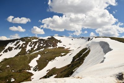
When I was on the top of Longs Peak, I could see patches of white snowpack scattered throughout the Rockies like whitecaps dancing on a troubled sea.


