SOUTHEAST N.C. — Narrowed down from a dozen, the six options, or alternatives, for a proposed large-scale transportation project intended to improve traffic in the Wilmington area will be presented next week.
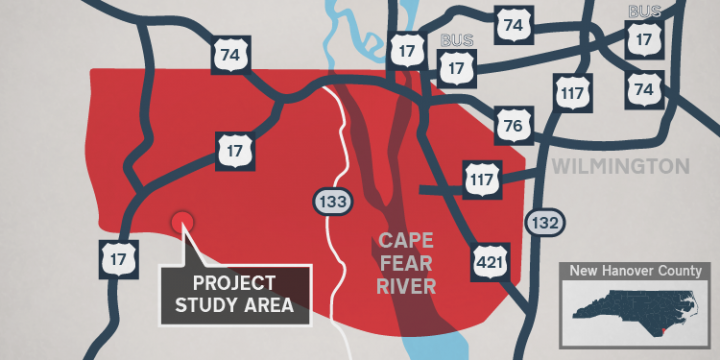
North Carolina Department of Transportation will hold open houses and public hearings Monday and Tuesday about Cape Fear Crossing, a 9.5-mile proposed road and high-level bridge over the Cape Fear River that officials say would help improve traffic flow and enhance freight movements from U.S. 17 and Interstate 140 in Brunswick County to U.S. 421 near the North Carolina Port of Wilmington in southern New Hanover County, according to an announcement Monday from NCDOT.
Supporter Spotlight
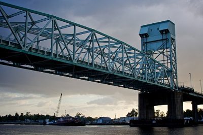
NCDOT Communications Officer Lauren Haviland told Coastal Review Online that the project, in addition to easing congestion on the Cape Fear Memorial Bridge, would serve as another way to evacuate in the event of a hurricane or other emergency.
The public can drop by between 5 and 6:30 p.m. Monday for the open house, which will be followed at 7 p.m. by a public hearing, both in John T. Hoggard High School cafeteria, 4305 Shipyard Blvd., Wilmington. The second open house is 5 to 6:30 p.m. Tuesday with the hearing to follow at 7 p.m. at North Brunswick High School Gym, 114 Scorpion Drive, Leland. Comments also can be submitted online until May 16.
Community members will be able to ask questions, submit comments and discuss the proposed project with NCDOT representatives during the open house. The public hearing will include formal presentations explaining the six alternatives, right of way and relocation requirements and procedures. The same information will be presented at both meetings, which will be recorded and a written transcript will be prepared.
Detailed Study Alternative Maps are online, and more information is on the project website and at NCDOT public meetings website.
Haviland said that that the public’s involvement in this process is vital and comments will aid in NCDOT’s decision.
Supporter Spotlight
“NCDOT will balance that against other factors, such as: safety, traffic service, human and natural environmental impacts and costs, to name a few,” she explained, adding that the location and selection of an alternative is not based on any one single comment because it does not reflect popular or majority preference.
The estimated cost of the project is $620 million to $995 million. The final cost will be determined during the design process. The NCDOT’s 2018-2027 State Transportation Improvement Program funded the planning and environmental studies for this project. Once funding for construction is secured, the project is expected to take about five years to complete, according to NCDOT.
In addition, the formal review is underway of the Cape Fear Crossing Draft Environmental Impact Statement, or DEIS, that was approved March 25 by NCDOT, in cooperation with the Federal Highway Administration, according to the release. A requirement of the National Environmental Policy Act, the purpose of DEIS is to detail how the transportation project was developed, alternatives that were considered and shows compliance with other applicable environmental laws and executive orders. The DEIS also explains how different alternatives will change communities, and impacts to environmental justice areas.
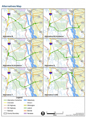
During the open houses and hearings next week, formal comments can be submitted regarding the DEIS to be included in the project record. The 1,009-page DEIS and maps with the six detailed study alternatives are available for review online and until May 16 at several locations in the region and in Raleigh. Comments will be accepted until May 16.
The U.S. Army Corps of Engineers, Wilmington District, will issue a public notice explaining the ongoing process in choosing the Least Environmentally Damaging Practicable Alternative, or LEDPA, for the subject project, under Section 404 of the Clean Water Act.
Haviland said that the project is not expected to have a substantial impact on ground or surface water quality.
“The US Army Corps of Engineers has jurisdiction over wetlands and streams within the study area, and any impacts to these resources will be avoided, minimized and mitigated to the extent practicable,” she explained.
“Fragmentation and loss of wildlife habitat would be an unavoidable consequence of all the detailed study alternatives. During construction, impacts resulting from erosion and sedimentation will be kept to a minimum by employing Best Management Practices such as revegetating or covering disturbed areas,” Haviland added. “Traffic noise impacts will be abated where feasible and reasonable in accordance with applicable federal and state policies.”
Ramona McGee, attorney based at the Chapel Hill office of the Southern Environmental Law Center told Coastal Review Online that they are monitoring the project and reviewing the recent environmental analyses.
“We are concerned about the extensive direct and indirect environmental impacts for such a costly project—including severe impacts to local communities, natural areas and wetlands, and imperiled wildlife,” she added. “The project appears poised to cause such environmental destruction with little benefit to local residents. That said, the project is not currently funded, so its future seems murky at best. We plan to attend the public hearings next week.”
Following the comment period that ends May 16 for both the six detailed study alternatives and DEIS, public input will be summarized and considered when choosing a preferred corridor, or the preferred alternative, which is not a final decision. Public comment will also be taken into account when developing the final design of the project, according to NCDOT.
After the public comment period and review by local, state and federal agencies, NCDOT will prepare a Final Environmental Impact Statement, expected to be complete in Spring 2020, that will identify the preferred alternative and address comments regarding the draft environmental impact statement.
The environmental study process will wrap up with a record of decision in the summer of 2020 that will include the approved corridor, or selected alternative, detail why that alternative was chosen and how to minimize and compensate for human and environmental impacts. The selected alternative is a final decision.
Since at least 1999, the Cape Fear Crossing project, though under different names, has been considered in local and regional plans, according to the DEIS.
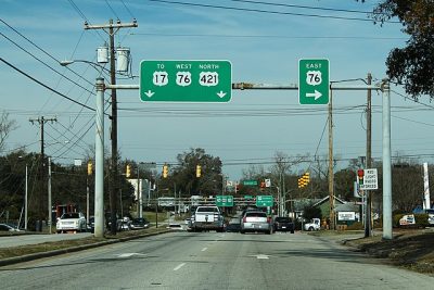
The Wilmington Urban Area Metropolitan Planning Organization, a transportation planning agency for the lower Cape Fear region, determined that because U.S. 17 is a key entry point into the town from the west, an additional crossing would alleviate congestion on the Cape Fear Memorial Bridge, according to the release.
Mike Kozlosky, executive director of the Wilmington Urban Area Metropolitan Planning Organization, told Coastal Review Online that the federally-mandated and federally-funded entity is “tasked with providing a regional and cooperative transportation planning process that serves as the basis for the expenditure of all federal transportation funds in the greater Wilmington area” and is required to prepare long-range transportation plans for the area with a minimum of a 20-year horizon.
The project, initially known as the Southern Bridge, was first proposed as a highway from Independence Boulevard and U.S. 421 travelling west across Cape Fear River.
“The project described as ‘Southern Bridge’ was identified in Greater Wilmington Urban Area Transportation Plan 1999-2025,” he said.
The project was renamed by 2005 the Cape Fear Skyway. The Wilmington Urban Area Metropolitan Planning Organization’s 2030 Long Range Transportation Plan, or LRTP, proposed that the project shift to the south of Leland and Belville and was considered a priority, according to the DEIS.
“The 2030 Transportation Plan described a project that extends east from U.S. 17 at the proposed I-140 (Wilmington Bypass) interchange, across the Cape Fear River, to Independence Boulevard at US 421. This project has been carried forward in Cape Fear Commutes 2035 and Cape Fear Transportation 2040,” Kozlosky said.
A merger team made up of local, state, and federal agency representatives is developing the Cape Fear Crossing project following the National Environmental Policy Act (NEPA)/Section 404 Merger Process. The team met several times, including in August 2017 to review and eliminate some of the 12 alternatives because of residential and business relocations and impacts to historic and natural resources.
In December 2017, it was announced that half of the 12 proposed project alternatives were eliminated and the six detailed study alternatives that were selected will be the focus next week of the open houses and public hearings, when the public is encouraged to give feedback.
Learn More
- Contact Jamille Robbins, NCDOT public involvement, community studies and visualization group leader, at 1-800-233-6315 or at capefear@ncdot.gov to comment on any aspect of the project or make arrangements for auxiliary aids and services under the Americans with Disabilities Act.
- Those who speak Spanish or have a limited ability to read, speak or understand English, may receive interpretive services upon request before the hearing by calling 1-800-481-6494.
- NCDOT will live-stream the public hearing on Facebook though questions and comments submitted through the social media platform during the event will not be answered or be recorded.

