OUTER BANKS — With more than 50,000 people on the move, the evacuation of Hatteras Island is slow but steady and – for now – N.C. 12, the island’s lifeline, is still open.
Dare County ordered the mandatory evacuation of the island first, with the rest of Dare County to follow, and Tuesday Gov. Roy Cooper reaffirmed moving all residents and visitors off through a first-ever statewide evacuation of all barrier islands.
Supporter Spotlight
N.C. Department of Transportation officials said Tuesday that despite a few over-washes they had been able to keep the road open.
“Obviously for now the focus is on the evacuation and we’re doing what we can to assist with that effort,” said Jerry Jennings, North Carolina Department of Transportation’s chief engineer for Division 1, which spans the state’s northern coast. “Really no problems to speak of, a couple of locations where we’re receiving a little over-wash, but nothing affecting traffic. We have crews on site trying to address those areas.”
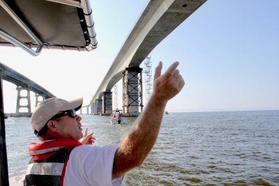
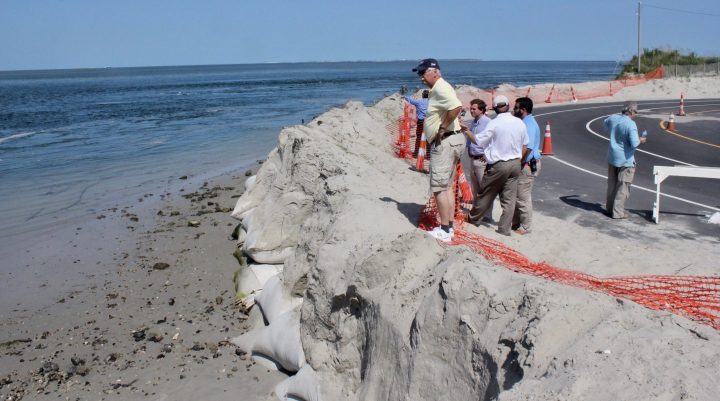
Two weeks ago, Jennings led a group of legislators with the House Select Committee on Strategic Transportation Planning and Long Term Funding Solutions on a tour of the iconic thin ribbon of asphalt that runs through Pea and Hatteras islands. In places, the road is separated from the ocean only by a windswept dune that’s over-washed enough that no plants will root in it. The sand there is constantly spilling into the road and crews have to clear the area regularly.
“It’s like dealing with a snowstorm 365 days a year,” Jennings told legislators on the tour.
Keeping track of the hot spots along Hatteras Island has been somewhat easier since the department started using drones to map the ever-shifting shoreline and its proximity to the highway. This will be the first major use of the drones in hurricane response.
Supporter Spotlight
“We had them out yesterday and did a pre-storm flight of some of the problem areas just to have that documentation,” Jennings said Tuesday. “After the storm, once conditions are such that we can get it back in the air it’ll be a good way to do surveillance of any damage.”
With the track through North Carolina still uncertain, Jennings is reluctant to speculate on how Hurricane Florence will affect Highway 12. Yet, he expects an over-wash on Pea Island and the “S Curve” region near Mirlo Beach, where last week contractors set the first piling for the so-called “jug-handle bridge” that shifts the road further into the sound and away from the oceanside dunes.

The highway through both islands were hit hard during Hurricane Irene and closed the road for weeks, cutting off most of the inhabitants of the island from their link with the rest of Dare County.
Then, supplies, repair crews and emergency aid got to the island southern part of Hatteras Island via an emergency ferry crossing from Stumpy Point to Hatteras.
Jennings said that whether N.C. 12 closes again will depend on the severity of the storm.
“If it’s just sand on the road and it can be cleared in a day or so then, that can be opened up before the temporary ferry route could be operational,” he said.
If the road is impassable, traffic would likely be stopped north of the Bonner Bridge. Jennings said crews working on the new bridge over Oregon Inlet have been securing the site ahead of the hurricane.
“The contractor implemented his hurricane plan, demobilizing equipment and mooring it for the storm, removing any loose materials and making the site as storm-worthy as possible,” he said.
Another zone NCDOT crews are keeping watch on is across Hatteras Inlet at the northern end of Ocracoke Island. Last winter, part of the roadway loop at the end of the island used to que up ferry traffic collapsed due to heavy erosion at the inlet.
NCDOT rebuilt the road and has installed a sandbag wall to protect it, but the inlet continues to eat away at the northern end of the island.
Sound Future
The impending arrival of Hurricane Florence underlines the fragility of N.C. 12, Kym Hunter, of the Southern Environmental Law Center, said Tuesday.

Hunter, who has served as one of the lead attorneys in several cases involving N.C. 12, said planning a long-term future of the road is a challenge, given the dynamics of the North Carolina coast and fast-rising seas along the state’s northern region.
Hunter said she also expected damage to likely show first at the S-turns and Pea Island hotspots along the Outer Banks highway.
She said the new jug-handle bridge will be a benefit because it solve the problems with the road in that area by shifting it along a bridge farther out on the sound. She said SELC and the groups it represents will continue to push for sections of N.C. 12 to be redesigned in a similar way.
“We have consistently advocated for taking much of that highway off the island into the sound side so its protected,” Hunter said. “If you keep the road on the island it’s eventually going to be in the ocean.”
Jennings said the new bridge will make a difference for access to the area. “Certainly, it will make a tremendous improvement,” he said.
The jug-handle bridge wasn’t popular with some property owners in the area and SELC, which in the past has sued the state most famously over the design of the new bridge, has joined with the NCDOT to defend the bridge in court. Plaintiffs lost the case to stop the bridge in federal district court and are now appealing the case. Hunter said briefs in the case, like the first winds of Hurricane Florence, were due Wednesday.


