Imagine data could be plugged into a computer to show exactly how much human presence and interaction the delicate ecology of a popular coastal area could handle before being severely affected.
Would it help with managing national seashores or state parks along the coast?
Supporter Spotlight
According to Pat Kenney, superintendent of Cape Lookout National Seashore, yes.
“One of the things – and I’ve been in this business for a long time – that we’re always trying to figure out is: Where is that line, or that sweet spot so to say, that the resources can be preserved for future generations while allowing this level of public use?” Kenney said.
“That is very difficult to determine, but any sort of tools that help us with that would be useful.”
New research out of the University of North Carolina-Chapel Hill seeks to do just that – help find the “sweet spot” in sustaining ecotourism.
The research is taking place at the school’s Center for Galapagos Studies in the Galapagos Islands, where tourism is booming and the residential population is growing as people flock to the island for higher wages in the ecotourism economy.
Supporter Spotlight
The islands are a province of Ecuador more than 600 miles from the mainland. Officials in Ecuador were looking for scenarios of change reflecting the number of tourists and residents the islands could accommodate before they start to lose their luster, according to a press release about the study.
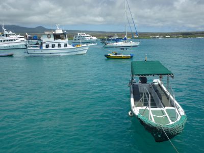
“The Ecuadorian government and the Galapagos National Park are asking the exact right questions,” said Dr. Stephen Walsh, geography professor at UNC-CH and director of the Center for Galapagos Studies. “No one wants a boom-and-bust situation. We want wise, managed growth within the concept of sustainability.”
And while the research is focused on the Galapagos, it can be applied to other locations, Walsh said.
“(Models) could be developed to examine the conflicts between resource conservation and economic development and the impact of tourism, nearby residents, transportation and visitation on the ecological sustainability of special places in North Carolina,” he said.
Such research could be helpful in managing places like the national seashores along the state’s coast.
“Yes, this is the type of information we would find useful,” Kenney with Cape Lookout National Seashore said. “The National Park Service has a preservation mandate first and foremost, and obviously our mission also calls for the use of public enjoyment.

“However, that being said, our main mandate is the preservation of these places for future generations. So any sort of information that would look at managing human use relative to preservation would be useful.”
Kenney noted there are challenges in managing land for public use.
“There’s the political challenges of putting limitations on public use – it’s always a challenge because parks become economic engines for local communities,” he said. “People want to be able to access their parks. So, having good information that can show correlations between too much use resulting in degradation of resources would be important. Having good science to support decisions is really important.”
Dave Hallac, Outer Banks Group superintendent, agreed.
“I would anticipate that that type of science is, yes, something that the park service is very interested in,” he said. “But it’s also something we have been studying and working on I think for many, many years.”
Hallac, who oversees Cape Hatteras National Seashore, Wright Brothers National Memorial and Fort Raleigh National Historic Site, explained that the park service does a lot of research on parks’ carrying capacity, which takes into account things like the visitor experience, the effects on natural and cultural resources and what it takes to manage the park and the flow of visitors.
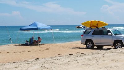
He used the beach driving regulations for Cape Hatteras National Seashore as an example.
“We actually built a carrying capacity element into our Off Road Vehicle Managament Plan … it’s called vehicle carrying capacity and it’s the maximum number of vehicles allowed on a route at one time (equal to) the length of the route divided by 20 feet,” Hallac said.
“Now whether or not that’s the right statistic – maybe it should be 30 feet or 50 feet or 10 feet – those are the types of things we seek more information on, where we have an incredible opportunity to collect more scientific data.”
Hallac said the park service has traditionally done a good job of collecting data on natural and cultural resources but could use more information about visitors.
“We have a lot of information about the productivity of shorebirds and sea turtles, but we don’t have a lot of information – we don’t collect as much data – on the visitors that come to the park and what their preferences are and what their attitudes and perceptions of the types of experiences that they desire,” Hallac said. “So I think we seek to gain a lot more of that information.”
The research from Walsh’s study could also be a tool for how natural areas are promoted, said Carol Lohr, executive director of the Carteret County Tourism Development Authority.

“The Cape Lookout National Seashore and the horses on Shackleford Banks are … probably the top areas of interest that people – once they’re here – come to see,” Lohr said, noting that protecting the area’s natural resources is important so that visitors have such areas to enjoy.
“I think we are so blessed to have not only the Cape Lookout National Seashore that includes Shackleford Banks and Portsmouth Island, but also the Croatan National Forest, along with Fort Macon State Park, the Rachel Carson Reserve – all that have been basically set aside for recreational use,” Lohr said. “And I think all the administrative branches of all of these areas are looking closely at visitation and the use.”
Walsh’s research could be another tool for local government and land management agencies, she said.
“It appears to be a great resource that we could take a look at and plug our local data in, but the key would be making sure we have accurate local data” on visitation, Lohr said.


